The North Pole-Columbia Lode is a silver, copper, and gold mine located in Baker county, Oregon at an elevation of 5,899 feet.
About the MRDS Data:
All mine locations were obtained from the USGS Mineral Resources Data System. The locations and other information in this database have not been verified for accuracy. It should be assumed that all mines are on private property.
Mine Info
Elevation: 5,899 Feet (1,798 Meters)
Commodity: Silver, Copper, Gold
Lat, Long: 44.825, -118.21583
Map: View on Google Maps
Satelite View
MRDS mine locations are often very general, and in some cases are incorrect. Some mine remains have been covered or removed by modern industrial activity or by development of things like housing. The satellite view offers a quick glimpse as to whether the MRDS location corresponds to visible mine remains.
North Pole-Columbia Lode MRDS details
Site Name
Primary: North Pole-Columbia Lode
Secondary: From Ne To Sw South Pole
Secondary: North Pole
Secondary: E & E
Secondary: Taber Fraction
Secondary: Columbia
Secondary: Golconda
Secondary: Mountain Belle
Secondary: Amazon
Secondary: Analulu
Secondary: Bunker Hill
Secondary: Eureka & Excelsior
Commodity
Primary: Silver
Primary: Copper
Primary: Gold
Tertiary: Arsenic
Tertiary: Antimony
Tertiary: Tellurium
Tertiary: Mercury
Location
State: Oregon
County: Baker
District: Cracker Creek
Land Status
Land ownership: Private
Note: the land ownership field only identifies whether the area the mine is in is generally on public lands like Forest Service or BLM land, or if it is in an area that is generally private property. It does not definitively identify property status, nor does it indicate claim status or whether an area is open to prospecting. Always respect private property.
Administrative Organization: Wallowa-Whitman National Forest
Holdings
Not available
Workings
Type: Underground
Ownership
Owner Name: Brooks Minerals Inc
Years: 1980 -
Production
Not available
Deposit
Record Type: Site
Operation Category: Producer
Operation Type: Unknown
Discovery Year: 1887
Discovery Method: Unknown
Years of Production:
Organization:
Significant: N
Deposit Size: S
Physiography
General Physiographic Area: Intermontane Plateaus
Physiographic Province: Columbia Plateau
Physiographic Section: Blue Mountain Section
Physiographic Detail: Elkhorn Mountains
Mineral Deposit Model
Not available
Orebody
Form: TABULAR
Structure
Type: R
Description: Blue Mountain Uplift Trends N 30 Deg E. Major Thrust Fault Trends East-West
Type: L
Description: Shear Zone
Alterations
Alteration Type: L
Alteration Text: Silicification
Rocks
Name: Diorite
Role: Associated
Age Type: Associated Rock
Age Young: Late Cretaceous
Name: Diorite
Role: Associated
Age Type: Associated Rock Unit
Age Young: Late Cretaceous
Analytical Data
Not available
Materials
Ore: Sphalerite
Ore: Chalcopyrite
Ore: Pyrite
Gangue: Quartz
Comments
Comment (Location): LODE RUNS CONTINUOUSLY THROUGH TEN CLAIMS
Comment (Reserve-Resource): OMEGA MINES (1968) REPORTED AN AVERAGE OF 0.086 OZ/TON AU AND 0.30 OZ/TON AG OVER A SAMPLE WIDTH OF 17.5 FEET ALONG 1357 FEET OF STRIKE ON THE NORTH POLE 5600 FOOT LEVEL. THEIR DIAMOND DRILLING INDICATES THAT THE LODE CONTINUES TO AT LEAST 200 FEET BELOW THIS LEVEL.
Comment (Production): PRODUCTION RECORDS FOR THE SOUTH POLE, MOUNTAIN BELLE, AMAZON, ANALULU, AND BUNKER HILL MINES NOT AVAILABLE.
Comment (Development): THE NORTHERN PART OF THE LODE IS NOW BEING DEVELOPED BY BROOKS MINERALS INC. (1981)
Comment (Deposit): THE NORTH POLE, COLUMBIA, EUREKA AND EXCELSIOR, AND TABER FRACTION ARE OWNED BY THE CRACKER CREEK MINING COMPANY. THE GOLCONDA IS UNDER SEPARATE OWNERSHIP
Comment (Workings): LODE IS A COMPOSITE IMBRICATE SELVAGE VEIN SYSTEM. AVG. WIDTH ABOUT 25 FT. 2100 FT. VERTICAL INTERVAL MINED. STOPES UP TO 2500 FT. LONG & AVG. 4 FT. WIDE. NO PRODUCTION RECORDS FOR THE SOUTH POLE,MOUNTAIN BELLE,AMAZON,ANALULU, & BUNKER HILL MINES
Comment (Geology): THE LODE FILLS A HIGH ANGLE FAULT WHICH CUTS THRUST FAULT CONTACTS BETWEEN ARGILLITE AND METAGABBRO. BOTH UNITS ARE HORNFELSED BY THE PRE-MINERALIZATION EMPLACEMENT OF THE BALD MOUNTAIN BATHOLITH.
Comment (Deposit): A HIGHLY ALTERED PORPHYRY DIKE IS FOUND DISCONTINUOUSLY WITHIN THE LODE
References
Reference (Deposit): BROOKS, H. C., AND RAMP, L., 1968, GOLD AND SILVER IN OREGON: OREGON DEPT. OF GEOLOGY AND MINERAL INDUSTRIES BULL. 61, P. 59-62
Reference (Deposit): PARDEE, J. T., 1909, FAULTING AND VEIN STRUCTURE IN THE CRACKER CREEK GOLD DISTRICT, BAKER CO., OREGON: USGS BULL. 380, P. 85-93
Reference (Deposit): PARDEE, J. T., AND HEWETT, D. F., 1914, GEOLOGY AND MINERAL RESOURCES OF THE SUMPTER QUADRANGLE: OREGON BUREAU OF MINES AND GEOLOGY, MIN. RES. OF ORE. 1(8): 92
Reference (Deposit): LORAIN, S. H., 1938, GOLD MINING AND MILLING IN EASTERN OREGON: U.S.B.M. INFO. CIRC. 7015 & 5) LINDGREN, W., 1901, THE GOLD BELT OF THE BLUE MOUNTAINS OF EASTERN OREGON; USGS ANN. REPT. NO.
Reference (Deposit): 1909 PARDEE, J.T.; BULL. 380
Reference (Deposit): 1914 GEOLMAP ORE. BUREAU OF MINES AND GEOLOGY
Reference (Deposit): 1916 COMPILE ORE. BUREAU OF MINES AND GEOLOGY
Reference (Deposit): 1980 GEOLMAP ODGMI REFERENCE 8
Oregon Gold

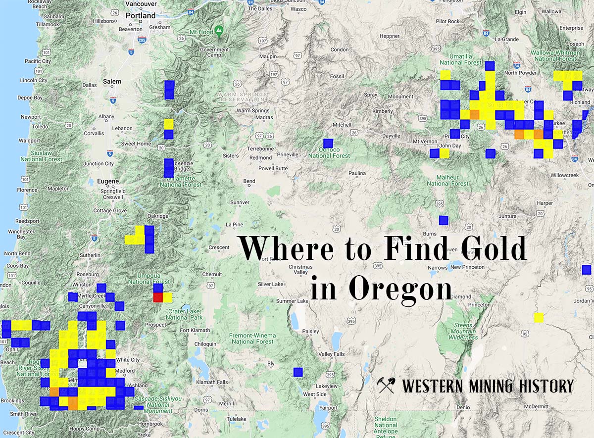
"Where to Find Gold in Oregon" looks at the density of modern placer mining claims along with historical gold mining locations and mining district descriptions to determine areas of high gold discovery potential in Oregon. Read more: Where to Find Gold in Oregon.