The Lovitt is a gold mine located in Chelan county, Washington at an elevation of 1,201 feet.
About the MRDS Data:
All mine locations were obtained from the USGS Mineral Resources Data System. The locations and other information in this database have not been verified for accuracy. It should be assumed that all mines are on private property.
Mine Info
Elevation: 1,201 Feet (366 Meters)
Commodity: Gold
Lat, Long: 47.38194, -120.31528
Map: View on Google Maps
Satelite View
MRDS mine locations are often very general, and in some cases are incorrect. Some mine remains have been covered or removed by modern industrial activity or by development of things like housing. The satellite view offers a quick glimpse as to whether the MRDS location corresponds to visible mine remains.
Lovitt MRDS details
Site Name
Primary: Lovitt
Secondary: L-D Gold Mine
Secondary: Golden King
Secondary: Wenatchee
Secondary: Squillchuck
Secondary: Gold King Mine
Commodity
Primary: Gold
Secondary: Silver
Tertiary: Copper
Tertiary: Antimony
Tertiary: Zinc
Tertiary: Arsenic
Tertiary: Lead
Location
State: Washington
County: Chelan
District: Wenatchee District
Land Status
Land ownership: Private
Note: the land ownership field only identifies whether the area the mine is in is generally on public lands like Forest Service or BLM land, or if it is in an area that is generally private property. It does not definitively identify property status, nor does it indicate claim status or whether an area is open to prospecting. Always respect private property.
Holdings
Not available
Workings
Type: Surface/Underground
Ownership
Owner Name: Asamera Minerals (U. S.), Inc., And Breakwater Resources, Ltd.
Years: 1990 -
Production
Year: 1967
Time Period: 1949-1967
Material type: ORE
Description: Cp_Grade: ^0.396 Oz/Ton Au, 0.607 Oz/Ton Ag
Year: 1946
Time Period: 1944-1946
Material type: ORE
Description: Cp_Grade: ^0.42 Oz/Ton Au, 0.49 Oz/Ton Ag
Deposit
Record Type: Site
Operation Category: Past Producer
Operation Type: Unknown
Year First Production: 1894
Discovery Year: 1885
Discovery Method: Ore-Mineral In Place
Years of Production:
Organization:
Significant: N
Deposit Size: M
Physiography
General Physiographic Area: Pacific Mountain System
Physiographic Province: Cascade-Sierra Mountains
Physiographic Section: Northern Cascade Mountains
Mineral Deposit Model
Model Name: Epithermal vein, Comstock
Orebody
Form: IRREGULAR STOCKWORK, VEINS, DISSEMINATED, BONANZA BODIES
Structure
Type: R
Description: Nw Trending Chiwakum Graben Bounded By Entiat And Leavenworth Faults
Type: L
Description: Zone Of Northerly Trending Steep Faults And Imbricate Thrust Faults.
Alterations
Alteration Type: L
Alteration Text: 3 Stages Of Hydrothermal Alteration: Sericitization; Silicification And Brecciation; Resilicification. Also Argillic, Potassic, And Chloritic Alteration
Rocks
Not available
Analytical Data
Analytical Data: AVERAGE OF ORE PRODUCED FROM 1949 TO 1967 IS 0.396 OZ/TON AU AND 0.607 OZ/TON AG.
Materials
Ore: Acanthite
Ore: Pyrargyrite
Ore: Pyrite
Ore: Chalcopyrite
Ore: Gold
Ore: Hessite
Ore: Galena
Ore: Marcasite
Ore: Arsenopyrite
Ore: Sphalerite
Ore: Electrum
Ore: Naumannite
Ore: Tetrahedrite
Ore: Stibnite
Gangue: Siderite
Gangue: Chalcedony
Gangue: Quartz
Gangue: Calcite
Comments
Comment (Production): HUNTTING (1956) REPORTED 240 TONS IN 1894, 170 TONS IN 1910, 20,000 TONS 1938-1939, AND 6,216 TONS IN 1944-46
Comment (Development): LONG HOLE DRILLING WAS ACCEPTED METHOD FOR EXPLORING EXTENSIONS OF KNOWN ORE BODIES IN 1960'S. ORE IS VERY FINE-GRAINED AND EARLY MILLING OPERATIONS MADE POOR RECOVERY. CYANIDATION HAS BEEN SUCCESSFUL.
Comment (Reserve-Resource): SILICIFIED "REEFS" THAT EXTEND NW FROM GOLD KING MINE ARE LOCALLY MINERALIZED AND PROBABLY REPRESENT A MODERATE SIZED GOLD RESOURCE - ALBEIT TOO LOW GRADE TO MINE AT PRESENT-DAY (MID 1970'S) PRICES.
Comment (Workings): QUARRY, 2 ADITS, INCLINED SHAFT
Comment (Deposit): QUARTZ VEINS COVER A 2 MI X 300 FT AREA. MAIN ORE ZONE IS 300 X 200 X 50 FT. MINERALIZATION IS IN AND NEAR A THRUST ZONE WITH WHICH AREA ASSOCIATED HYPABYSSAL INTRUSIONS. SEDIMENTARY ROCKS IN AREA HAVE A STEEP DIP
Comment (Location): ON WEST SIDE OF SQUILLCHUCK CREEK
Comment (Deposit): NW-TRENDING SILICIFIED ZONES - LOCALLY CALLED REEFS EXTEND NORTHWEST FROM GOLD KING MINE AND APPARENTLY MARK ZONE OF GOLD MINERALIZATION. DEPOSIT ZONE EXTENDS 1 MI NW TO THE B-REEF MINE WHICH CONTAINS LOWER GRADE ORE BUT WITH SIMILAR CHARACTERISTICS. ; INFO.SRC : 1 PUB LIT
Comment (Deposit): MRDS RECORDS W017903, US53037 HAVE BEEN MERGED WITH THIS RECORD AND DELETED
Comment (Geology): COLUMBIA RIVER BASALT (YAKIMA) OVERLIES SEDIMENTARY ROCKS IN AREA
Comment (Commodity): BOTH VEINS AND COUNTRY ROCK CONTAIN SIGNIFICANT QUANTITIES OF GOLD.
References
Reference (Deposit): DERKEY, R.E., JOSEPH, N.L., AND LASMANIS, RAYMOND, 1990, METAL MINES OF WASHINGTON - PRELIMINARY REPORT: WASHINGTON DIVISION OF GEOLOGY AND EARTH RESOURCES OPEN-FILE REPORT 90-18, P. 14-15.
Reference (Production): PATTON AND CHENEY, 1972; HUNTTING, 1956; LOVITT AND SKERL, 1958
Reference (Deposit): HUNTTING, M.T., 1956, INVENTORY OF WASHINGTON MINERALS - PART II, METALLIC MINERALS: WASHINGTON DIVISION OF MINES AND GEOLOGY BULLETIN 37, V. 1, P. 112.
Reference (Deposit): LOVITT, E.H., AND SKERL, A.C. 1958, GEOLOGY OF THE LOVITT GOLD MINE, WENATCHEE, WASHINGTON: MINING ENGINEERING, V. 10, NO. 9, P. 963-966.
Reference (Deposit): PATTON, T.C., AND CHENEY, E.S., 1972, L-D GOLD MINE, WENATCHEE, WASHINGTON, NEW STRUCTURAL INTERPRETATION AND ITS UTILIZATION IN FUTURE EXPLORATION: AMERICAN INSTITUTE OF MINING ENGINEERS TRANSACTIONS FOR 1971, V. 250, P.6-11.
Reference (Deposit): FOSTER, R.J., 1960, TERTIARY GEOLOGY OF A PORTION OF THE CENTRAL CASCADE MOUNTAINS, WASHINGTON: GEOLOGICAL SOCIETY OF AMERICA BULLETIN, V. 71, NO. 2, P. 99-126.
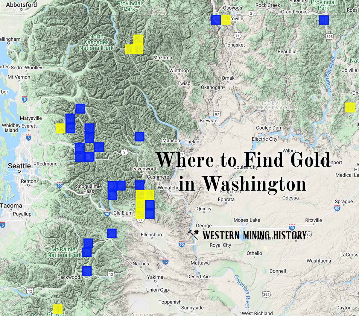
Washington Gold

"Where to Find Gold in Washington" looks at the density of modern placer mining claims along with historical gold mining locations and mining district descriptions to determine areas of high gold discovery potential in Arizona. Read more: Where to Find Gold in Washington.