The Sunnyside is a gold mine located in Valley county, Idaho at an elevation of 7,999 feet.
About the MRDS Data:
All mine locations were obtained from the USGS Mineral Resources Data System. The locations and other information in this database have not been verified for accuracy. It should be assumed that all mines are on private property.
Mine Info
Elevation: 7,999 Feet (2,438 Meters)
Commodity: Gold
Lat, Long: 44.9547, -115.13060
Map: View on Google Maps
Satelite View
MRDS mine locations are often very general, and in some cases are incorrect. Some mine remains have been covered or removed by modern industrial activity or by development of things like housing. The satellite view offers a quick glimpse as to whether the MRDS location corresponds to visible mine remains.
Sunnyside MRDS details
Site Name
Primary: Sunnyside
Secondary: See Thunder Mountain 0160850625
Secondary: See Dewey 0160850154
Secondary: Also Dewey Dome.
Commodity
Primary: Gold
Secondary: Silver
Location
State: Idaho
County: Valley
Land Status
Land ownership: National Forest
Note: the land ownership field only identifies whether the area the mine is in is generally on public lands like Forest Service or BLM land, or if it is in an area that is generally private property. It does not definitively identify property status, nor does it indicate claim status or whether an area is open to prospecting. Always respect private property.
Administrative Organization: Payette National Forest
Holdings
Type: Located Claim
Workings
Not available
Ownership
Owner Name: Coeur D'Alene Mines Corp.
Company ID: 1001475
Percent: 100.0
Home Office: Idaho
Info Year: 1986
Years: 1986 - 1992
Owner Name: Thunder Mtn Gold Inc.
Company ID: 1001475
Percent: 100.0
Home Office: Idaho
Info Year: 1992
Years: 1992 -
Owner Name: Coeur D'Alene Mines Corp.
Company ID: 1001475
Percent: 100.0
Home Office: Idaho
Info Year: 1992
Years: 292 -
Owner Name: Thunder Mountain Gold, Inc.
Percent: 100.0
Home Office: Washington
Info Year: 1996
Production
Not available
Deposit
Record Type: Site
Operation Category: Plant
Plant Type: Leach
Operation Type: Surface
Mining Method: Open Pit
Milling Method: Heap Leach-Merrill-Crowe
Year First Production: 1902
Discovery Year: 1899
Years of Production:
Organization:
Significant: N
Deposit Size: S
Physiography
General Physiographic Area: Rocky Mountain System
Physiographic Province: Northern Rocky Mountains
Mineral Deposit Model
Not available
Orebody
Not available
Structure
Not available
Alterations
Not available
Rocks
Not available
Analytical Data
Not available
Materials
Not available
Comments
Comment (Production): HEAP LEACH OPERATION PRODUCED 17,315 OZ AU FROM TREATING 529,500 MT ORE IN 1989. CLOSED IN 1990; RECLAMATION IN 1991.
Comment (Exploration): SOME EXPLORATION IS TAKING PLACE AS OF 1993 ALONG WITH WORK DONE ON THE ADJACENT DEWEY DOME THUNDER MOUNTAIN PROPERTIES.
Comment (Economic Factors): ON-OFF CN HEAP-LEACH OPERATION. AFTER AU-AG LEACHING, THE HEAPS ARE IRRIGATED WITH ALKALINE-CHLORINE SOLN UNTIL DRAINAGE CONTAINS < 0.20 MG/L OR LESS FOR 24 HR PERIOD. PROCESSED ORE IS THEN REMOVED FROM LEACH PAD AND BACKFILLED TO MINED OUT PITS.
Comment (Geology): THE ORE BODY IS A BLANKET DEPOSIT IN THE TOP 20-30 FEET OF A RHYOLITE FLOW BRECCIA
Comment (Deposit): GOOD POTENTIAL FOR FUTURE PRODUCTION BUT UNDER PRESENT ECONOMIC CONDITIONS IS CONSIDERED MARGINAL. ESTIMATED MARGINAL RESERVES ARE 2,107,000 TONS RANGING FROM 0.16-0.18 OUNCE GOLD PER TON PER R.J. MCRAE. G.E. ZIEGLER ALSO ESTIMATES AN ADDITIONAL 25 MILLION TONS OF POSSIBLE ORE CONTACT: ANNE MARIE OBERLY, (208) 385-0373. WILL NOT BE ANALYZED IN THE 1992 AU AVAILABILITY STUDY (TOO SMALL). 12-90-RESERVES EXHAUSTED. MINE CLOSURE TO BE COMPLETED 1992.
Comment (Workings): WASTE CLAYS MAY HAVE EROSION POTENTIAL. <2% SULFIDE.
References
Reference (Deposit): MSHA REPORT DATED JULY, 1982.
Reference (Deposit): ID DIV. OF AIR QUALITY. THUNDER MTN. MINE AIR QUALITY
Reference (Deposit): IBMG PAMP. 44, P40.
Reference (Deposit): USGS BULL 1304, P 69+
Reference (Deposit): PERMIT, MAY, 1986, 9 PP.
Idaho Gold

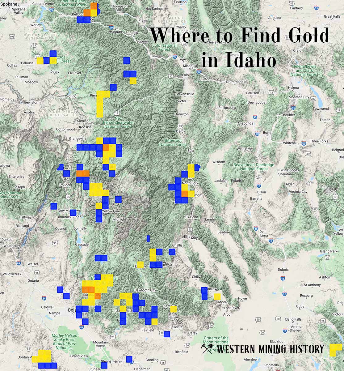
"Where to Find Gold in Idaho" looks at the density of modern placer mining claims along with historical gold mining locations and mining district descriptions to determine areas of high gold discovery potential in Idaho. Read more: Where to Find Gold in Idaho.