Location
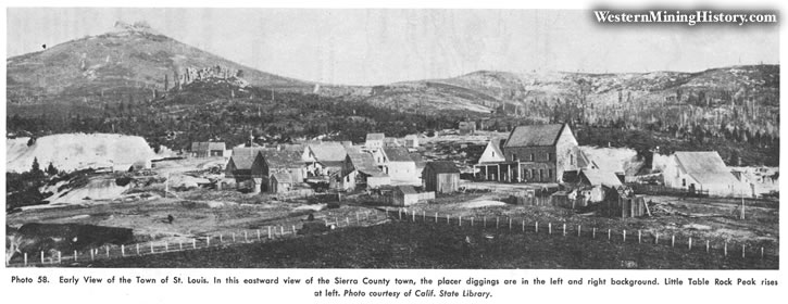
The Port Wine district is in northwestern Sierra County about 10 miles northwest of Downieville. The site was named by a party of prospectors who found a keg of port concealed in the bushes. The La Porte district adjoins on the northwest, the Poverty Hill district on the southwest, and the Poker Flat-Howland Flat district on the northeast. This district includes the "diggings" at Grass Flat, Queen City, and St. Louis. The area was extensively mined by hydraulicking and drifting during and after the gold rush and has been intermittently prospected since.
Geology
The Port Wine channel, a major branch of the La Porte channel, extends southwest through this area. It is roughly parallel to the La Porte channel for some miles and joins it at Scales. The channel is well-defined and several hundred feet wide. The gravels are quartz-rich and in places are covered by "pipe" clay and andesite. Bedrock is slate, quartzite, amphibolite, and greenstone.
Bibliography
Lindgren, Waldemar, 1911, Tertiary gravels of the Sierra Nevada: U.S. Geol. Survey Prof. Poper 73, pp. 108-110.
Mac Boyle, Errol. 1920, Sierra County, Port Wine mining district: California Min. Bur. Rept. 16, pp. 19-23.
Turner, H. W., 1897, Downieville folio, California: U. S. Geol. Survey Geol. Atlas of the U. S., folio 17, 8 pp.