Mine Discovery Tools for Google Earth Pro are collections of data files that assist in researching historical mining areas. The files are distributed in packages that focus on particular geographic areas, usually counties.
Click here to view Mine Discovery Tool packages available for purchase.
The data files consist of the following data files:
- Gold mine locations from the USGS MRDS database
- Non-gold mine locations from the USGS MRDS database
- Mining district locations
- USmin data
- Reference mining claim data
- PLSS section centers
- Quad map names by location (USGS and Forest Service where applicable)
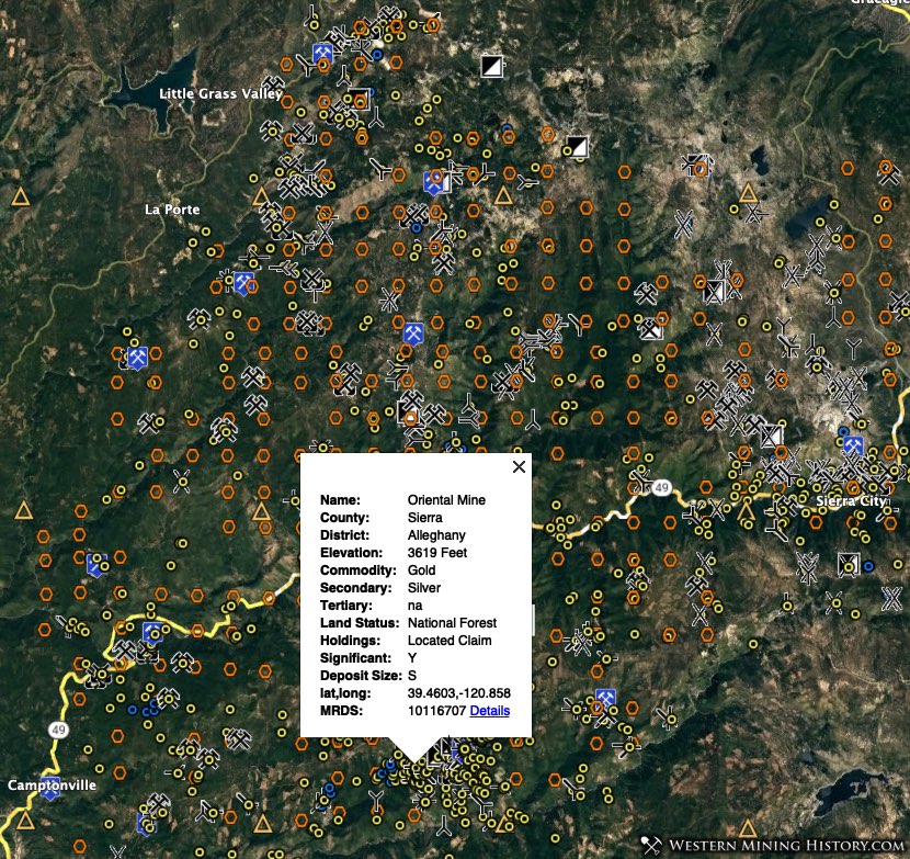
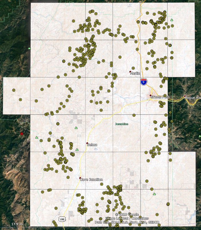
Mine Data
Mine data in the Mine Discovery Tools are county-level views from the WMH Expanded Index of USGS MRDS mine data (click here for more information on this data).
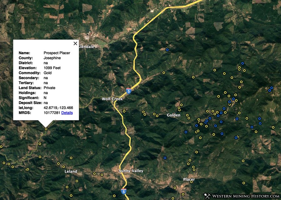
Mines are divided into two types – those that have gold listed as a primary commodity, and those that do not. (note that the non-gold mines may have gold listed as a secondary commodity in the USGS database).
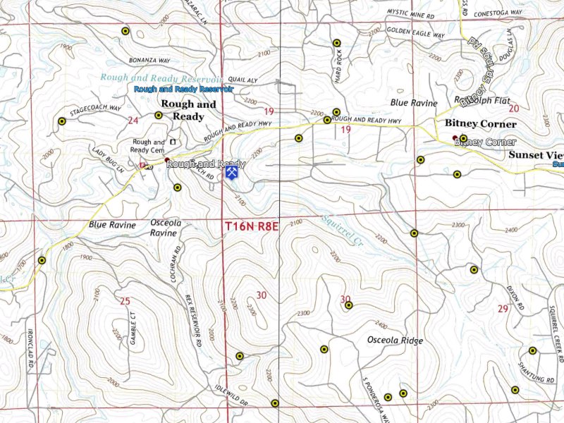
Mining Claim Data
The claim data is a county-level view from the WMH Mining Claim Research Tools. These tools are designed to make claim research with the BLM MLRS as easy as possible, they are not an up-to-date source of claim data.
Each PLSS section that contained active mining claims at the time the reference claim data was created has a marker that can be clicked to open an info window that contains useful information, including the number of claims and MTRS value.
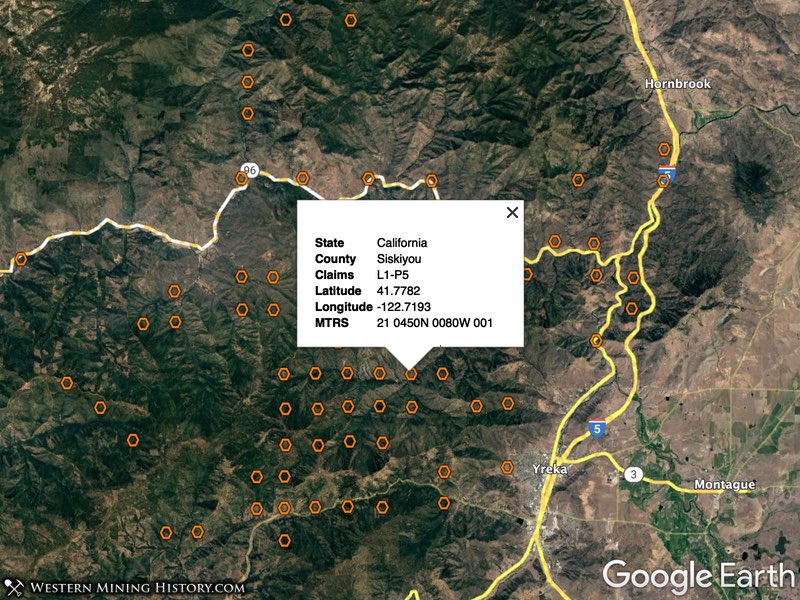
Claim values are formatted like “L1-P4”, which means that there is 1 lode claim and 4 placer claims in that section. MTRS value for that section is “21 0200N 0100E 008”. MTRS means Meridian Township Range Section, and is the location value for the particular section the claims are in.
This MTRS value can be copied and pasted right into the BLM’s LR2000 search form, eliminating several cumbersome steps and removing the guesswork from locating claims in particular sections.
PLSS Section Centers
The “PLSS Section Centers” layer contains the center points for all surveyed PLSS sections. These files differ from the claims reference files described above in that they contain all surveyed PLSS sections, while the claim research tools only contain sections that had active placer claims at the time the data was obtained from the BLM.

The “BLM_MTRS” field in the info window for each PLSS section center is in the same format used by the BLM MLRS application. Using these values, you can quickly search each section for active or closed mining claims.
For more information on how to do mining claim research, view the article Researching Mining Claims with the BLM MLRS.
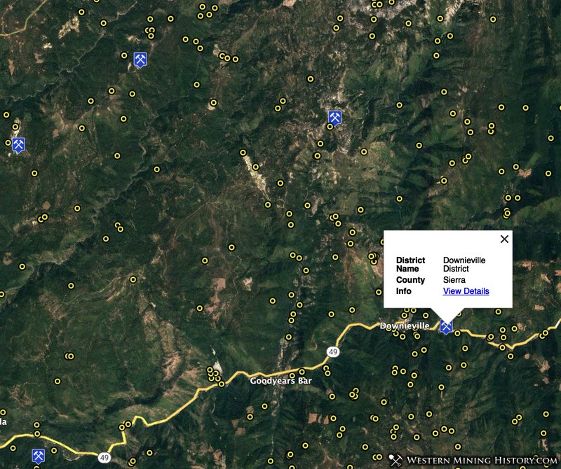
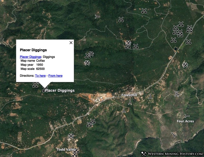
Mining District Locations
Approximate mining district location markers are included with each package. Usually only gold districts are located, however depending on the data source used other districts may also be included.
USmin Data
The mine symbol data from the USGS USmin Mineral Deposit Database is included for each county.
The USGS describes the data as “symbols indicating mining-related features digitized from historical USGS topographic maps in the western part of the conterminous US. Includes prospect pits, mine shafts and adits, quarries, open-pit mines, tailings piles and ponds, gravel and borrow pits, and other features.”
The USmin data distributed with WMH Mine Discovery Tools is in the form of unedited kml files distributed by the USGS.
USGS and Forest Service Quad Maps
The “Quad Map Names” layer contains the map name for each quadrangle that corresponds to a USGS or Forest Service Map. These names will help you quickly locate and download the maps you are interested in.
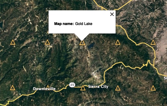
Once you have the Quad maps in the appropriate format (see instructions for details), you can create detailed topo map layers in Google Earth Pro to assist in your research.
The USGS and Forest Service maps vary in the details they contain. Each map could have unique information that will be useful for mine and claim research. An example is that the Forest Service maps contain locations of mine features like adits and mine dumps that are missing on the USGS maps.
Measuring Distances
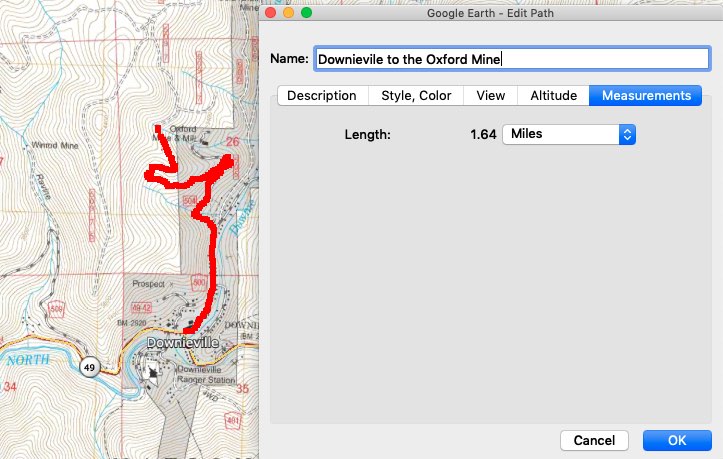
Google Earth Pro has a feature that allows you to draw routes between any two points and measure the distance between those points, even on winding mountain roads. The routes you draw can be saved for later reference.
Available Locations
Click here to view current Mine Discovery Tools packages. New packages for additional geographic areas will be added on a regular basis.
Additional details on these packages can be viewed at the WMH Mine Discovery Tools User Guide.