Copper Ridge District
Small district with copper and gold. According to Vanderwilt, 1947, the ore occurs in Dakota Sandstone on a north-trending ridge. No production has been reported.
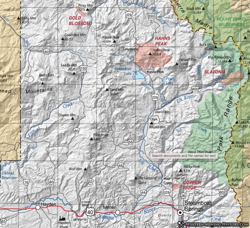
Gold Blossom District
The Gold Blossom District is enumerated by Henderson (1926) in his compilation of Colorado mining districts. The District occurs along Gold Blossom Creek in the northwest part of Routt County. The name is suggestive of placer activity, although even Parker (1974) does not mention the creek or the location in his classic work on Colorado placers. Another reference is Vanderwilt (1947).
Hahns Peak District (aka Columbine District)
The Hahns Peak District lies mostly within a horst on the western edge of the Park Range uplift (Segerstrom and Young, 1972). Intrusive rocks discussed in Wood (2003) include latite porphyry within breccia zones in sedimentary rocks. Mineralization occurs within the breccia zones with minerals of lead, zinc, silver, gold and copper. Mineralization consists of galena with silver and gold and some copper (Vanderwilt, 1947).
The earliest activity in the district was probably 1864 when placers were found in the gravels of Willow Creek. Placers were worked until 1910 and again in the 1930s. Small placers were mined in several locations, but the main ones were Ways Gulch east of Hahns Peak Village and Poverty Bar on Deep Creek northwest of the village (Parker, 1992). Lode deposits were found resulting in the opening of the Royal Flush and Tom Thumb mines, the latter being the largest in the district. According to Casaceli (1984) (as reported in Wood, 2003) exploration was carried out in the district as late as 1971 by Anaconda Mining, including geophysical surveys and drilling.
Red Gorge and Yarmony Districts
Vanderwilt (1947) actually says a great deal about the Yarmony District in his section on Routt County. He relates that considerable prospecting has been done in the area with malachite, azurite, and chalcopyrite in redbed sandstones in the area.
According to the 1919 report of the Colorado Bureau of Mines, a 30-ton leaching plant was installed at what is known as the Copper Spur of the Denver and Rio Grande Railroad to process the ores in 1916, with 30 tons of electrolytic copper produced. The plant closed in 1917.
A Red Gorge District is listed by mindat.org in Grand County and a Yarmony District in Eagle County and these are undoubtedly related geologically to the Yarmony occurrences listed here in Routt County.
Slavonia District
Vanderwilt (1947) lists the Slavonia District at the head of the Elk River in the Park Range east of Hahns Peak. The District features Precambrian gneiss, granite, and schist with younger dikes. Some chalcopyrite, galena, and sphalerite, with gold and silver, are found in quartz lenses and stringers. Small shipments were generated, mainly as samples. Bankley et al. (2000) reports stream sediment samples with anomalous concentrations of copper, lead, and zinc.
Eberhart (1969) notes a few remnants of a settlement around the Slavonia Mine. The area lies within the Mount Zirkel Wilderness Area.