Click on an image to get more details or a direct link.
Kelly mining camp, Kelly mine and dump in foreground
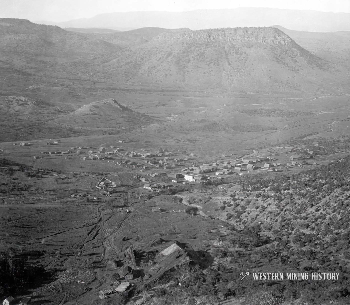
Kelly mining camp, Kelly mine and dump in foreground. Elephant Butte beyond with Cat Mountain showing over the north end of the ridge; San Mateo Mountains, in the background, looking southwest from point above Kelly mine. Socorro County, New Mexico. 1905. Plate 19-A in U.S. Geological Survey. Professional paper 68. 1910.
Kelly New Mexico - 1915
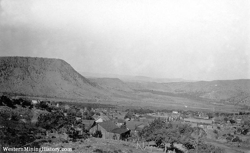
From a panorama of Kelly, Magdalena Mountains and Elephant Butte, look west from dump of Juanita Tunnel. Magdalena Mountain in right middle ground is also called Picture Mountain because the round patch of talus surrounded by brush on the northeast slope resembles a human head. The mountain is capped with pink rhyolite, which merges into the dike that forms the high cliff on the east slope. The dike strikes north parallel to the plane of the picture. The horizontal layers to the left of the dike represent the glassy top of the upper andesite.
The same formations constitute Elephant Butte, on the extreme left and the hill in the southwest corner of the district (photos 182 and 183). The low mounds in the valley between Magdalena Mountain and Elephant Butte are remnants of pediments equivalent to lower pediments with the district. Socorro County, New Mexico. July 1915. Plate 2-A, in U.S.Geological Survey Professional paper 200. 1942.Kelly New Mexico - 1916
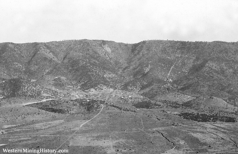
Socorro County, New Mexico. November 1916. Plate 2-B, in U.S.Geological Survey Professional paper 200. 1942.
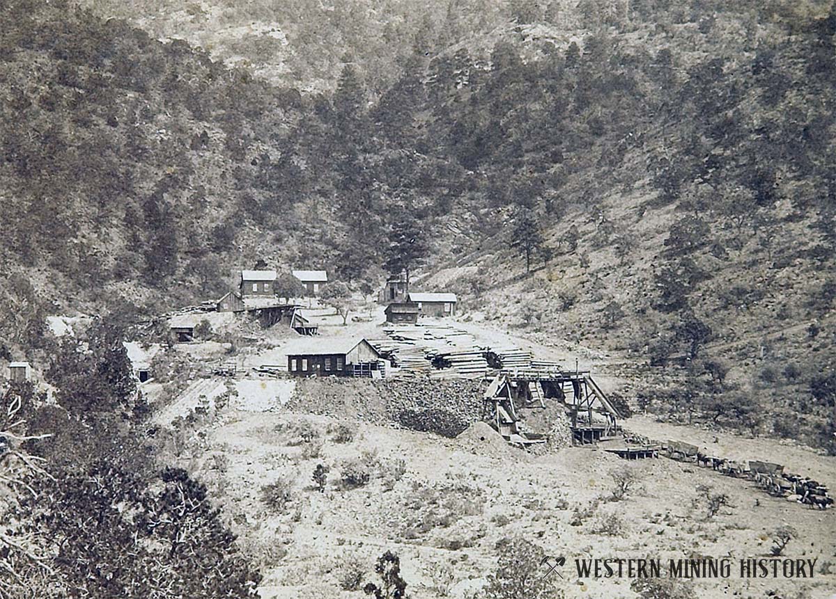
Kelly mine in 1916
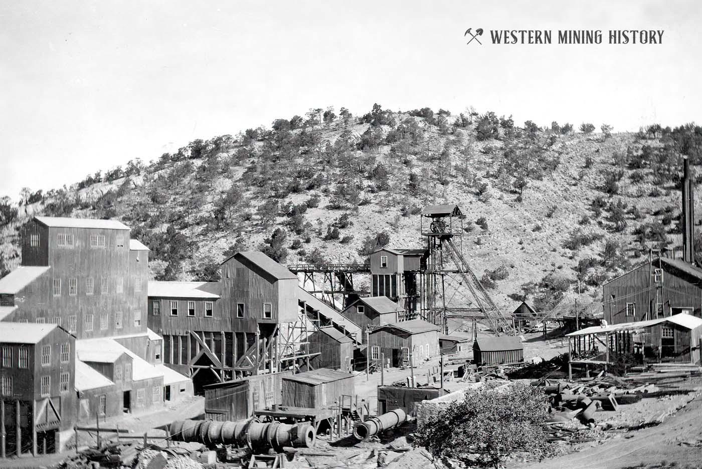
Form a panorama of surface plant of Kelly mine in 1916, looking north. Traylor shaft in left foreground; ore bin and dump of Kelly tunnel in right foreground. High slope on left is capped with cliff forming beds of Madera limestone. Lower quartzite member of Sandia formation crops out above ore bin on extreme right. Level-topped central area represents pediment F. Socorro County, New Mexico. Plate 35, in U.S.Geological Survey Professional paper 200. 1942.
Kelly mine in 1916
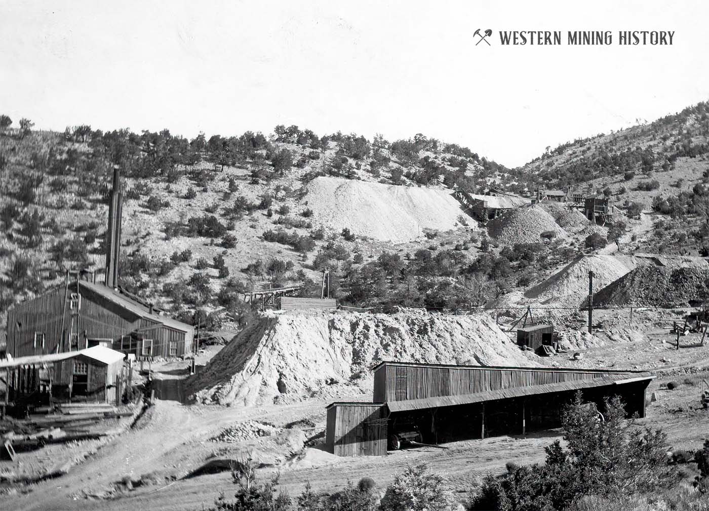
From a panorama of surface plant of Kelly mine in 1916, looking north. Traylor shaft in left foreground; ore bin and dump of Kelly tunnel in right foreground. High slope on left is capped with cliff forming beds of Madera limestone. Lower quartzite member of Sandia formation crops out above ore bin on extreme right. Level-topped central area represents pediment F. Socorro County, New Mexico. Plate 35, in U.S.Geological Survey Professional paper 200. 1942.
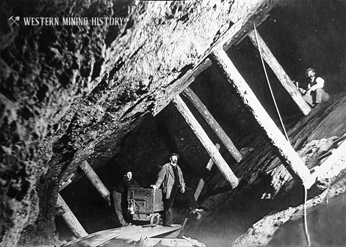
Inside a stope of the Kelly Mine
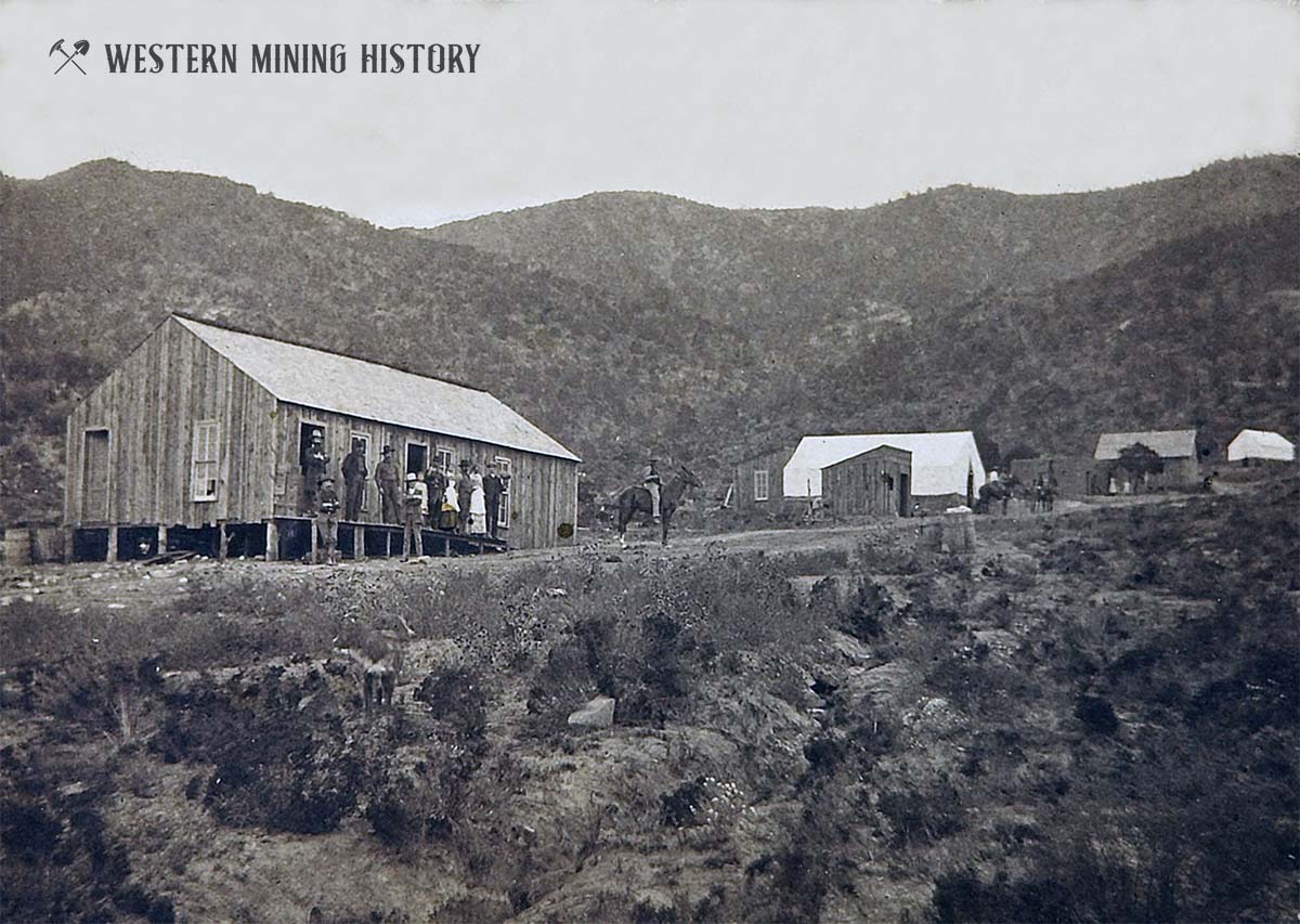
Kelly, New Mexico ca. 1880s
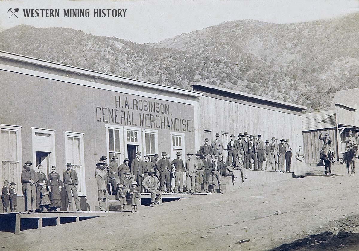
Kelly, New Mexico ca. 1880s
Early view of the Kelly Mine ca. 1883
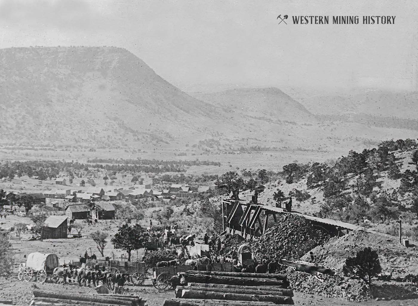
Ore being loaded to wagons at Kelly, New Mexico ca. early 1880s