The Cle Elum is a iron, chromium, and nickel mine located in Kittitas county, Washington at an elevation of 3,100 feet.
About the MRDS Data:
All mine locations were obtained from the USGS Mineral Resources Data System. The locations and other information in this database have not been verified for accuracy. It should be assumed that all mines are on private property.
Mine Info
Elevation: 3,100 Feet (945 Meters)
Commodity: Iron, Chromium, Nickel
Lat, Long: 47.43139, -121.05444
Map: View on Google Maps
Cle Elum MRDS details
Site Name
Primary: Cle Elum
Secondary: Cle Elum River Iron
Commodity
Primary: Iron
Primary: Chromium
Primary: Nickel
Tertiary: PGE
Location
State: Washington
County: Kittitas
District: Cle Elum District
Land Status
Land ownership: National Forest
Note: the land ownership field only identifies whether the area the mine is in is generally on public lands like Forest Service or BLM land, or if it is in an area that is generally private property. It does not definitively identify property status, nor does it indicate claim status or whether an area is open to prospecting. Always respect private property.
Holdings
Not available
Workings
Not available
Ownership
Owner Name: Burlington Northern Railroad
Years: 1976 -
Production
Not available
Deposit
Record Type: Site
Operation Category: Occurrence
Operation Type: Unknown
Discovery Year: 1887
Years of Production:
Organization:
Significant: N
Deposit Size: S
Physiography
General Physiographic Area: Pacific Mountain System
Physiographic Province: Cascade-Sierra Mountains
Physiographic Section: Northern Cascade Mountains
Mineral Deposit Model
Model Name: Lateritic Ni
Orebody
Form: LAMINATED, MASSIVE, PEBBLY, AND CONCRETIONARY BEDS
Structure
Type: L
Description: Ore On West Flank Of Assymmetric Anticline Plunging Southwest. Average Dip On Ore Is 32w
Alterations
Alteration Type: L
Alteration Text: Limonite, Goethite, Hematite Metamorphosed To Magnetite
Rocks
Name: Diabase
Role: Associated
Age Type: Host Rock Unit
Age Young: Eocene
Name: Diabase
Role: Associated
Age Type: Host Rock
Age Young: Eocene
Name: Diabase
Role: Associated
Age Type: Associated Rock Unit
Age Young: Late Jurassic
Analytical Data
Analytical Data: AVG. OF 57 CORE SAMPLES OF NICKELIFEROUS IRON = 40.86 % FE, 0.84 % NI, 1.64% CR. AL2O3 PRBABALY ABOUT 25%. 0.8-1.0% NI. ANALYSIS OF LATERITE GAVE 2.4% CR2O3, 8.96% SIO2, 16.415% AL2O3, 0.052% P, 0.111% S, 0.46% MN. UNDERLYING SERPENTINE AVERAGES 0.63% NI
Materials
Ore: Cliachite
Ore: Gibbsite
Ore: Boehmite
Ore: Diaspore
Ore: Magnetite
Ore: Garnierite
Gangue: Serpentine
Unknown: Hematite
Comments
Comment (Development): AREA WAS EXTENSIVELY DRILLED BY USBM IN LATE 1940'S
Comment (Deposit): THESE DEPOSITS RESEMBLE NICKELIFEROUS IRON LATERITES THAT OVERLIE LARGE AREAS OF SERPENTINE IN CUBA, THE PHILIPPINES, AND INDONESIA ; INFO.SRC : 1 PUB LIT
Comment (Commodity): FE, NI, AND CR INCREASE DOWNWARD WHILE AL2O3 AND SIO2 DECREASE DOWNWANRD. CO NOT ASSAYED BUT IS PROBABLY LOW. UNABLE TO FIND SOURCE OF PGE DATA; NO MENTION OF PGE IN REFERENCES CITED
Comment (Reserve-Resource): SOME MATERIAL COULD BE OPEN PITTED, OTHER WOULD HAVE TO BE MINED UNDERGROUND
Comment (Deposit): THICKNESS OF LATERITE RANGES FROM 0 TO 48 FT WITH AN AVERAGE THICKNESS OF 15 FT. PEBBLY NATURE MAY INDICATE REWORKING AND REDEPOSITION FROM ORIGINAL SITE.
Comment (Workings): SHALLOW CUTS, ADITS, SHAFTS
Comment (Location): ALONG VALLEY OF CLE ELUM RIVER IN WENATCHEE NATIONAL FOREST. LOCATION GIVEN IS AT MOUTH OF BIG BOULDER CREEK
Comment (Reserve-Resource): CORNWALL, 1966, INDICATED 10,000 - 200,000 TONS OF CONTAINED NICKEL IN LATERITE
Comment (Geology): DEPOSITS FORM STRATIGRAPHIC UNIT OVERLYING SERPENTINIZED PERIDOTITE AND UNDERLYING TERRESTRIAL SANDSTONE AND CONGLOMERATE. UNUSUAL MINERALOGY IS A RESULT OF METAMORPHISM OF THE DEPOSIT. ROCKS OF AREA ARE CUT BY MAFIC DIKES
Comment (Deposit): RECORD W001164 HAS BEEN DELETED.
References
Reference (Reserve-Resource): CORNWALL, 1966. OTHER RESERVE FIGURES ARE GIVEN IN GRANT (1976)
Reference (Deposit): 1943 DIREXPL U.S. BUREAU OF MINES
Reference (Deposit): 1944 UNKNOWN WASHINGTON GEOLOGICAL SURVEY
Reference (Deposit): GRANT, A.R., 1976, REPORT OF EVALUATION, MINERAL RESOURCE ANALYSIS STUDY ON UNITED STATES FOREST SERVICE LAND, STATE OF WASHINGTON: PREPARED FOR U.S. FOREST SERVICE - REGION 6, CONTRACT NO. 004724N, P. 30.
Reference (Deposit): DERKEY, R.E., JOSEPH, N.L., AND LASMANIS, RAYMOND, 1990, METAL MINES OF WASHINGTON - PRELIMINARY REPORT: WASHINGTON DIVISION OF GEOLOGY AND EARTH RESOURCES OPEN-FILE REPORT 90-18, P. 128.
Reference (Deposit): CORNWALL, H.R., 1973 , NICKEL, IN BROBST, D.A., AND PRATT, W.P., EDS., UNITED STATES MINERAL RESOURCES: U.S. GEOLOGICAL SURVEY PROFESSIONAL PAPER 820, P. 437-442.
Reference (Deposit): CORNWALL, H.R., 1966, NICKEL DEPOSITS OF NORTH AMERICA: U.S. GEOLOGICAL SURVEY BULLETIN 1223 , P. 54-55.
Reference (Deposit): LAMEY, C.A., AND HOTZ, P.E., 1951, THE CLE ELUM RIVER NICKELIFEROUS IRON DEPOSIT, KITTITAS COUNTY, WASHINGTON: U.S. GEOLOGICAL SURVEY BULLETIN 978-B, P. 27-67.
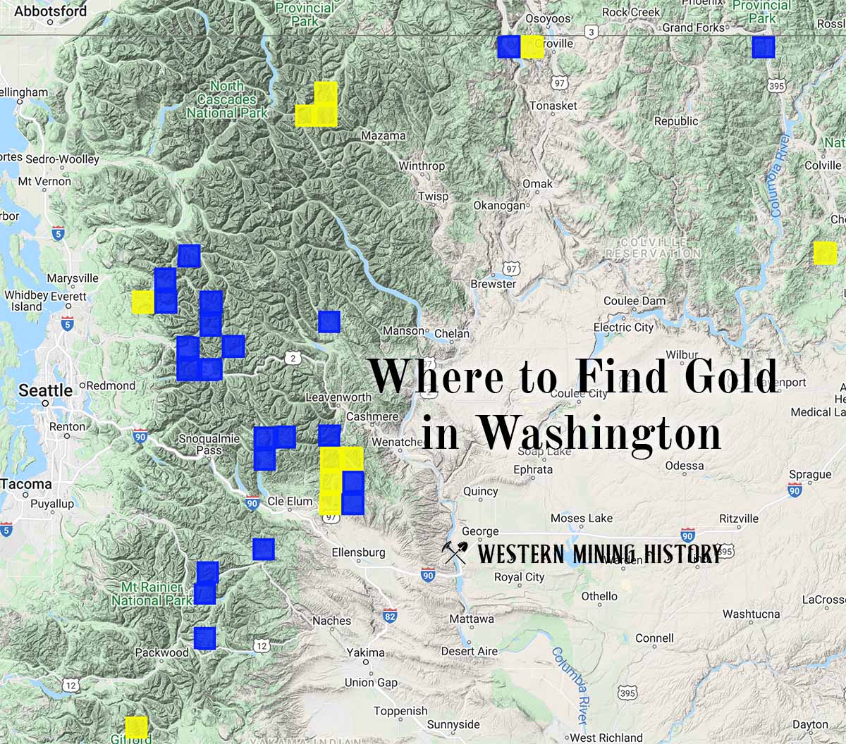
Washington Gold

"Where to Find Gold in Washington" looks at the density of modern placer mining claims along with historical gold mining locations and mining district descriptions to determine areas of high gold discovery potential in Arizona. Read more: Where to Find Gold in Washington.