The Wild Cat Basin is a mercury mine located in Grant county, Oregon.
About the MRDS Data:
All mine locations were obtained from the USGS Mineral Resources Data System. The locations and other information in this database have not been verified for accuracy. It should be assumed that all mines are on private property.
Mine Info
Wild Cat Basin MRDS details
Site Name
Primary: Wild Cat Basin
Secondary: Mill
Commodity
Primary: Mercury
Location
State: Oregon
County: Grant
District: Canyon (?)
Land Status
Administrative Organization: Malheur Natioal Forest
Holdings
Not available
Workings
Not available
Ownership
Not available
Production
Not available
Deposit
Record Type: Site
Operation Category: Occurrence
Operation Type: Unknown
Discovery Year: 1927
Years of Production:
Organization:
Significant: N
Deposit Size: S
Physiography
General Physiographic Area: Intermontane Plateaus
Physiographic Province: Columbia Plateau
Physiographic Section: Blue Mountain Section
Mineral Deposit Model
Not available
Orebody
Not available
Structure
Not available
Alterations
Not available
Rocks
Not available
Analytical Data
Not available
Materials
Not available
Comments
Comment (Location): N/2 OF TOWNSHIP, LOCATED AT CENTER OF N/2
Comment (Development): OPERATIONS WERE NEARLY CONTINUOUS DURING 1913-1924 AND 1935-1954
Comment (Deposit): CLAY BEDROCK IS PRESENT AT ABOUT 15 FT. MOST OF GOLD IS LOCATED NEAR BEDROCK.
Comment (Workings): ALL THE DREDGES COMBINED COVERED 2,603 ACRES AND HANDLED 60,625,514 YARDS OF GRAVEL. EARLY WORK WAS BY HAND AND HYDRAULIC MINING
Comment (Deposit): CONSV. RECORD ( M015025 ) HAS BEEN MERGED WITH THIS RECORD AND DELETED FROM THE OREGON FILE. ; INFO.SRC : BAILEY E H
Comment (Geology): BEDROCK IS ARGILLITE WITH MINOR GRANODIORITE. ON ADJACENT SLOPES OF UPPER PARTS OF CRACKER CREEK AND MC CULLY FORK ARE BENCH GRAVELS AND SCATTERED REMNANTS OF EARLY TERTIARY DRAINAGE SYSTEM WHICH HAS BEEN THE SOURCE OF CONSIDERABLE PLACER GOLD.
Comment (Deposit): RECORD M045457 HAS BEEN MERGED AND DELETED.
Comment (Location): DREDGED GROUND INCLUDES THE POWDER RIVER VALLEY FROM DEER CREEK TO SUMPTER IN ADDITION TO MC CULLY FORK AND CRACKER CREEK. ABOUT 8 MI OF VALLEY DREDGED. LOCATION GIVEN IS ON POWDER RIVER AT SUMPTER; PREVIOUS QUAD DESIGNATION = BOURNE 1:24000
Comment (Commodity): LARGEST NUGGET WEIGHED 1 PENNYWEIGHT
Comment (Production): PRODUCTION DATA INCLUDES RECORDED OUTPUT FROM ALL DREDGES. SUMPTER DREDGES PRODUCED MORE GOLD THAN ANY OTHER PLACER IN THE STATE AND EXCEEDED LODE OUTPUT MOST OF THE TIME. REPORTEDLY SMALL BYPRODUCT PT PRODUCTION
References
Reference (Deposit): BROOKS, H. C., 1963, QUICKSILVER IN OREGON: OREGON DEPT. OF GEOLOGY AND MINERAL INDUSTRIES, BULL. 55, 223 P.
Reference (Deposit): MERCURY IN OREGON, 1965, USBM IC 8252
Reference (Deposit): FREDERICK, F., 1945, STATE OF OREGON MAP SHOWING LOCATION OF QUICKSILVER DEPOSITS: OREGON DEPT. OF GEOL. AND MIN. INDUSTRIES, SCALE 1:1,000,000
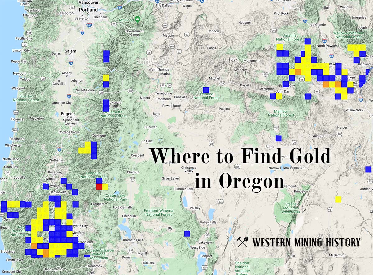
Oregon Gold

"Where to Find Gold in Oregon" looks at the density of modern placer mining claims along with historical gold mining locations and mining district descriptions to determine areas of high gold discovery potential in Oregon. Read more: Where to Find Gold in Oregon.