The Red Flat Laterite is a nickel mine located in Curry county, Oregon at an elevation of 2,500 feet.
About the MRDS Data:
All mine locations were obtained from the USGS Mineral Resources Data System. The locations and other information in this database have not been verified for accuracy. It should be assumed that all mines are on private property.
Mine Info
Elevation: 2,500 Feet (762 Meters)
Commodity: Nickel
Lat, Long: 42.34167, -124.28972
Map: View on Google Maps
Red Flat Laterite MRDS details
Site Name
Primary: Red Flat Laterite
Secondary: Red Flat Placer
Secondary: Red Gold Association Nos. 1-9
Commodity
Primary: Nickel
Tertiary: Gold
Tertiary: Mercury
Tertiary: Platinum
Tertiary: Silver
Tertiary: Chromium
Tertiary: Cobalt
Location
State: Oregon
County: Curry
District: Red Flat
Land Status
Land ownership: National Forest
Note: the land ownership field only identifies whether the area the mine is in is generally on public lands like Forest Service or BLM land, or if it is in an area that is generally private property. It does not definitively identify property status, nor does it indicate claim status or whether an area is open to prospecting. Always respect private property.
Administrative Organization: Siskiyou National Forest
Holdings
Not available
Workings
Not available
Ownership
Owner Name: Hanna Mining Co., Red Flats Nickel Corp., Big Basin Nickel Corp.
Years: 1977 -
Production
Not available
Deposit
Record Type: Site
Operation Category: Occurrence
Operation Type: Unknown
Years of Production:
Organization:
Significant: N
Deposit Size: M
Physiography
General Physiographic Area: Pacific Mountain System
Physiographic Province: Pacific Border Province
Physiographic Section: Klamath Mountains
Mineral Deposit Model
Model Name: Lateritic Ni
Orebody
Form: BLANKET
Form: BLANKET
Structure
Type: L
Description: Slumping And Landsliding Fairly Common
Alterations
Not available
Rocks
Not available
Analytical Data
Analytical Data: AVERAGE GRADE OF SOIL AND SAPROLITE IS ABOUT 0.80% NI, 0.15% CO, 1.14% CR2O3, AND 18% FE. WET ASSAYS, 1933, CLAIMED $20 AU, $6 AG, $20 NI, $20 PGE. BLACK SAND ANALYZED 40.9% CR2O3, 0.055% HG, OTHER TEST FAILED TO SHOW AU OR AG IN GRAVELS. ASSAY $0.70/TON AU. HG <0.00002 LB/TON
Materials
Ore: Mercury
Ore: Magnetite
Ore: Chromite
Ore: Garnierite
Ore: Cinnabar
Comments
Comment (Workings): THE CLAIMS HAVE BEEN EXPLORED BY ABOUT 5 MI OF PROSPECT ROADS AND 15,000 FT OF DOZER TRENCHING AND MANY CHURN DRILL AND HAND-AUGER HOLES
Comment (Geology): LATERITE IS A LOW FE (25-45%), HIGH MG, SI LATERITE. PART OF AN ULTRAMAFIC THRUST SHEET. LARGE, RELATIVELY FLAT UPLAND AREAS UNDERLAIN BY WEATHERED SERPENTINE AND LATERITE
Comment (Deposit): RECORD M061008 HAS BEEN MERGED AND DELETED.
Comment (Commodity): EARLY OWNERS CLAIMED TO HAVE FOUND AU, AG, PT, AND HG LOCALLY. PLACER MINING FOR AU, HG WAS CONDUCTED IN THE 1930'S AND LATER BUT THERE IS NO RECORD OF PRODUCTION
Comment (Deposit): THE TOTAL AREA OF LATERITIC SOIL IS ABOUT 1,100 ACRES; THE AVERAGE DEPTH OF SOIL AND SAPROLITE IS ESTIMATED AT ABOUT 8 FT
Comment (Location): PARTLY UNSURVEYED. MUCH OF AREA IN SISKIYOU NATIONAL FOREST. LOCATION GIVEN IS FOR CENTRAL PART OF RED FLAT IN SEC. 30, T. 37 S., R. 14 W.
Comment (Reserve-Resource): POSSIBLE COBALT RESERVES?
Comment (Development): PROPERTY LOCATED IN 1939 BY HARRY HEFFERLEY. SOME DRILLING HAS BEEN DONE BY USBM AND OTHER WORK HAS BEEN DONE BY ODGMI
References
Reference (Deposit): DOLE, HOLLIS, LIBBEY, E.W., AND MASON, R.S., 1948, NICKEL-BEARING LATERITE AREAS OF SOUTHWESTERN OREGON: OREGON DEPARTMENT OF GEOLOGY AND MINERAL INDUSTRIES, ORE BIN, V. 10, NO. 5, P. 33-38.
Reference (Deposit): RAMP, LEN, 1978, INVESTIGATIONS OF NICKEL IN OREGON: OREGON DEPARTMENT OF GEOLOGY AND MINERAL INDUSTRIES MISCELLANEOUS PAPER NO. 20, P. 15-18.
Reference (Deposit): RAMP, LEN, SCHLICKER, H.G., AND GRAY, J.J., 1977, GEOLOGY, MINERAL RESOURCES, AND ROCK MATERIAL OF CURRY COUNTY, OREGON: OREGON DEPARTMENT OF GEOLOGY AND MINERAL INDUSTRIES BULLETIN 93, P. 49.
Reference (Deposit): HOTZ, P.E., 1964, NICKELIFEROUS LATERITES IN SOUTHWESTERN OREGON AND NORTHWESTERN CALIFORNIA: ECONOMIC GEOLOGY, V. 59, P. 355-396.
Reference (Deposit): BROOKS, H.C., 1963, QUICKSILVER IN OREGON: OREGON DEPARTMENT OF GEOLOGY AND MINERAL INDUSTRIES BULLETIN 55, P. 99.
Reference (Deposit): U.S. BUREAU OF MINES, 1965, MERCURY IN OREGON, IN MERCURY POTENTIAL OF THE UNITED STATES: U.S. BUREAU OF MINES INFORMATION CIRCULAR 8252, P. 323.
Reference (Deposit): HUNDHAUSEN, R.J., MC WILLIAMS, J.R., AND BANNING, L.H., 1954, PRELIMINARY INVESTIGATION OF THE RED FLATS NICKEL DEPOSITS, CURRY COUNTY, OREG.: U.S. BUREAU OF MINES REPORT OF INVESTIGATIONS 5072, 19 P.
Reference (Deposit): OREGON DEPARTMENT OF GEOLOGY AND MINERAL INDUSTRIES, 1940, OREGON METAL MINES HANDBOOK, SOUTHWESTERN OREGON--COOS, CURRY, AND DOUGLAS COUNTIES: OERGON DEPARTMENT OF GEOLOGY AND MINERAL INDUSTRIES BULLETIN 14-C, V. 1, P. 64.
Oregon Gold

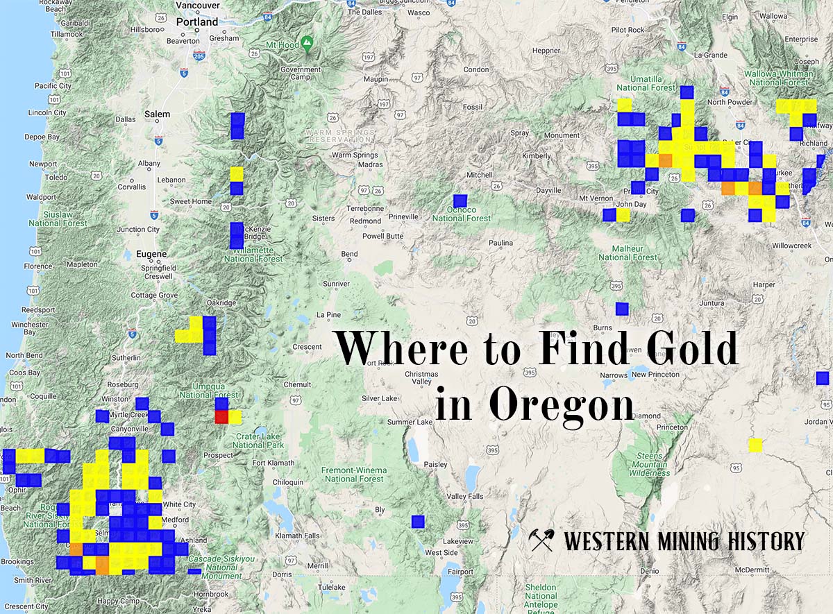
"Where to Find Gold in Oregon" looks at the density of modern placer mining claims along with historical gold mining locations and mining district descriptions to determine areas of high gold discovery potential in Oregon. Read more: Where to Find Gold in Oregon.