The Lone Star Mine is a silver and lead mine located in Okanogan county, Washington at an elevation of 2,480 feet.
About the MRDS Data:
All mine locations were obtained from the USGS Mineral Resources Data System. The locations and other information in this database have not been verified for accuracy. It should be assumed that all mines are on private property.
Mine Info
Elevation: 2,480 Feet (756 Meters)
Commodity: Silver, Lead
Lat, Long: 48.57778, -119.76583
Map: View on Google Maps
Lone Star Mine MRDS details
Site Name
Primary: Lone Star Mine
Secondary: Star
Commodity
Primary: Silver
Primary: Lead
Secondary: Gold
Secondary: Copper
Secondary: Zinc
Tertiary: Tungsten
Location
State: Washington
County: Okanogan
District: Conconcully District; Conconcully Area
Land Status
Not available
Holdings
Not available
Workings
Type: Underground
Ownership
Owner Name: Silver Consolidated Mining Co.
Home Office: Gerald Belgarde, Mgr., Conconcully, WA 98819
Years: 1979 -
Production
Year: 1943
Material type: ORE
Description: Ap_Grade: ^Tr Au, 1.85-7.35 Oz Ag, And 0.1-0.6 % Pb Per Ton.
Deposit
Record Type: Site
Operation Category: Past Producer
Deposit Type: Replacement
Operation Type: Unknown
Year First Production: 1890
Year Last Production: 1969
Discovery Year: 1886
Discovery Method: Ore-Mineral In Place
Years of Production:
Organization:
Significant: N
Deposit Size: S
Physiography
General Physiographic Area: Pacific Mountain System
Physiographic Province: Cascade-Sierra Mountains
Physiographic Section: Northern Cascade Mountains
Mineral Deposit Model
Not available
Orebody
Form: VEIN
Structure
Type: L
Description: The South End Of The Vein Has Been Offset As Much As 50 Ft By Faults.
Alterations
Alteration Type: L
Alteration Text: Sericitized Granodiorite
Rocks
Name: Diorite
Role: Associated
Age Type: Associated Rock
Age Young: Late Cretaceous
Name: Diorite
Role: Associated
Age Type: Associated Rock Unit
Age Young: Late Cretaceous
Name: Diorite
Role: Associated
Age Type: Host Rock
Age Young: Late Cretaceous
Analytical Data
Analytical Data: ASSAYS OF UP TO 20 OUNCES PER TON AG, 5.5 % PB, AND 2.2 % ZN HAVE BEEN OBTAINED FROM THE BANDS OF ORE. 7 OLD ASSAYS SHOW 30-65 % PB, 39.6-140 OZ AG, 0.1-1.6 OZ AU PER TON. 7 SAMPLES FROM A 1.5-10 FT WIDTH ASSAYED IN 1943 SHOWED TR-0.005 OZ AU, 1.85-7.35 OZ AG, 0.1-1.1 % ZN, 0.1-0.6 % PB, AND 0.01 % WO3.
Materials
Ore: Tetrahedrite
Ore: Stephanite
Ore: Chalcopyrite
Ore: Sphalerite
Ore: Galena
Ore: Pyrite
Gangue: Quartz
Comments
Comment (Workings): THE MINE CONTAINS OVER 2000 FT OF UNDERGROUND WORKINGS IN THE FORM OF SHAFTS, DRIFTS, AND CROSSCUTS. THE MAIN SHAFT, WHICH IS ON A MINUS 37 DEGREE INCLINE AND HEADS S85W, HAS WORKING LEVELS AT 100, 200, AND 300 FT. ON THE 100 FT LEVEL, THE VEIN HAS BEEN DRIFTED UPON FOR 110 FT NORTH AND 60 FT SOUTH. THIS LEVEL REACHES THE SURFACE 110 FT NORTH AND 67 FT SOUTH OF THE SHAFT COLLAR. ON THE 200 FT LEVEL, A DRIFT FOLLOWS THE VEIN 75 FT NORTH AND 205 FT SOUTH. THE 300 FT LEVEL WORKINGS ARE UNKNOWN. ABOUT 110 FT SE OF, AND 15 FT LOWER THAN THE COLLAR OF THE SHAFT, AN ADIT HAS BEEN DRIVEN SW 170 FT. NEAR THE FACE OF THIS ADIT, A SPARSELY MINERALIZED VEIN, HAS BEEN DRIFTED UPON 35 FT SOUTH AND 105 FT NORTH.
Comment (Geology): GEOL.DESC: FISSURE QTZ.; SPARSELY MINERALIZED
Comment (Deposit): COMPRISED OF JUMBO, GOLDEN CROWN, LONE STAR, GUBSER, AND MINERAL HILL PROPERTIES
Comment (Commodity): PRODUCTION 1886-1897, 1913, 1943, AND 1969. BETWEEN 1886 AND 1897 ABOUT $40000 HAD BEEN SPENT DEVELOPING THE MINE, BUT PRODUCTION AMOUNTED TO ONLY SEVERAL THOUSAND DOLLARS. TRIAL SHIPMENTS OF ORE WERE MADE TO SMELTERS IN 1913, 1943, AND 1969.
Comment (Location): WEST SIDE OF SALMON CREEK.
Comment (Production): UNKNOWN QUANTITY IN 1943.
Comment (Development): DEVELOPMENT FROM 1886-1890, 1969-1970 (FLOTATION MILL CONSTRUCTED, BUT NOT COMPLETED DURING THIS TIME), 1971, 1972, 1977, AND 1979; LIMITED EXPLORATION IN 1979.
Comment (Deposit): QUARTZ FISSURE VEINS, WITH BANDED QUARTZ. THE ORE MINERALS FOR THE MOST PART ARE ONLY SPARSELY SCATTERED THROUGHOUT THE VEIN. IN SOME PARTS OF THE VEIN, THE ORE MINERALS ARE CONCENTRATED INTO BANDS UP TO SEVERAL FEET WIDE THAT PARALLEL THE WALLS OF THE VEIN.
References
Reference (Deposit): WASH. DGER IC 69, P. 11
Reference (Production): WASH. DMG BULL 37, P. 221; IC 49, P. 24-26
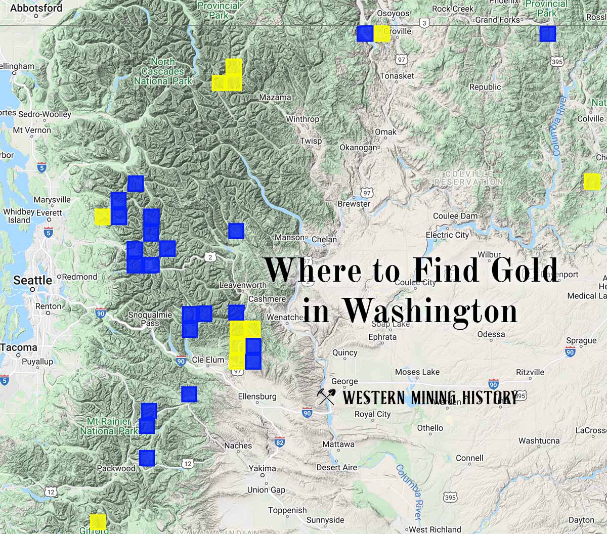
Washington Gold

"Where to Find Gold in Washington" looks at the density of modern placer mining claims along with historical gold mining locations and mining district descriptions to determine areas of high gold discovery potential in Arizona. Read more: Where to Find Gold in Washington.