The Methow Mine is a gold mine located in Okanogan county, Washington at an elevation of 1,499 feet.
About the MRDS Data:
All mine locations were obtained from the USGS Mineral Resources Data System. The locations and other information in this database have not been verified for accuracy. It should be assumed that all mines are on private property.
Mine Info
Elevation: 1,499 Feet (457 Meters)
Commodity: Gold
Lat, Long: 48.10694, -120.01833
Map: View on Google Maps
Methow Mine MRDS details
Site Name
Primary: Methow Mine
Secondary: New London
Secondary: Homestake
Secondary: Homestake-Long Adit
Secondary: Mineralite
Secondary: Roosevelt
Secondary: Tungstic
Secondary: Milwaukee
Commodity
Primary: Gold
Tertiary: Copper
Tertiary: Tungsten
Tertiary: Silver
Tertiary: Molybdenum
Location
State: Washington
County: Okanogan
District: Squaw Creek District; Methow Area
Land Status
Not available
Holdings
Not available
Workings
Type: Surface/Underground
Ownership
Owner Name: Methow Mining And Milling Co.
Home Office: Seattle, Wa.
Years: 1946 - 1973
Production
Not available
Deposit
Record Type: Site
Operation Category: Prospect
Operation Type: Unknown
Year First Production: 1940
Year Last Production: 1941
Discovery Method: Ore-Mineral In Place
Years of Production:
Organization:
Significant: N
Deposit Size: S
Physiography
General Physiographic Area: Pacific Mountain System
Physiographic Province: Cascade-Sierra Mountains
Physiographic Section: Northern Cascade Mountains
Mineral Deposit Model
Model Name: Polymetallic veins
Orebody
Form: PODS (SULFIDES), POCKETS AND STRINGERS (SCHEELITE)
Form: PODS (SULFIDES), POCKETS AND STRINGERS (SCHEELITE)
Form: PODS (SULFIDES), POCKETS AND STRINGERS (SCHEELITE)
Form: PODS (SULFIDES), POCKETS AND STRINGERS (SCHEELITE)
Form: PODS (SULFIDES), POCKETS AND STRINGERS (SCHEELITE)
Form: PODS (SULFIDES), POCKETS AND STRINGERS (SCHEELITE)
Form: PODS (SULFIDES), POCKETS AND STRINGERS (SCHEELITE)
Structure
Type: L
Description: Reverse Faults, Crosscutting Dikes
Alterations
Not available
Rocks
Name: Mafic Intrusive Rock
Role: Associated
Age Type: Host Rock Unit
Age Young: Late Jurassic
Name: Mafic Intrusive Rock
Role: Associated
Age Type: Host Rock
Age Young: Late Jurassic
Analytical Data
Analytical Data: USUALLY LESS THAN 0.25 % SCHEELITE.
Analytical Data: AVG. 0.44 OZ/TON AU, 0.8 OZ/TON AG, 1 % CU, TRACE W
Materials
Ore: Scheelite
Ore: Pyrite
Ore: Chalcopyrite
Gangue: Quartz
Comments
Comment (Deposit): MINERALIZED QUARTZ VEINS 3 IN.-15 FT WIDE. NEW LONDON VEIN: NARROW MINERALIZED QUARTZ VEIN ALONG FOOTWALL OF A NARROW BASIC DIKE (N60E, 55NW); HOMESTAKE VEIN: WIDE MINERALIZED QUARTZ VEIN; HOMESTAKE-LONG ADIT VEIN: 3 FT WIDE QUARTZ VEIN; MINERALITE VEIN: 2-4 FT QUARTZ VEIN; ROOSEVELT VEIN: 2.5-3 FT QUARTZ VEIN WITH PODFS OF SULFIDES IN VEIN WALLS, SCHEELITE IN POCKETS AND STRINGERS; MILWAUKEE VEIN: SCHEELITE IN FOOTWALL QUARTZ
Comment (Production): $40000 IN AU.
Comment (Location): NEW LONDON VEIN: NORTHEAST SLOPE HUNTER MTN (NW/4 SEC. 12); HOMESTAKE VEIN: CREST OF LARGE SPUR HALFWAY DOWN EAST SIDE HUNTER MTN; HOMESTAKE-LONG ADIT: EAST OF HOMESTAKE VEIN; MINERALITE VEIN: SE/4 SEC. 13 ABOUT 100 FT ABOVE HWY; ROOSEVELT VEIN: NE/4 SEC 8 ON EAST SIDE OF RIVER; TUNGSTIC VEIN: 1400 FT NORTH OF UPPER ROOSEVELT ADIT; MILWAUKEE VEIN: SE/4 SEC. 7 ABOUT 100 FT ABOVE RIVER.
Comment (Workings): NEW LONDON VEIN: LARGE OPEN CUT, 2 UNDERGROUND LEVELS. MAIN ADIT IS 350 FT LONG WITH STOPES BOTH ABOVE AND BELOW. 75 FT WINZE CONNECTS THIS LEVEL WITH LOWER LEVEL WHERE A DRIFT, WITH SOME STOPING, HAS BEEN DRIVEN FOR 100 FT ALONG ORE BODY.; HOMESTAKE VEIN: 50 FT SHAFT WITH 30 FT DRIFT AT BOTTOM FOLLOWING VEIN NORTHWARD.; HOMESTAKE-LONG ADIT VEIN: ADIT DRIVEN WESTWARD REPORTEDLY FOR 850 FT ON NEARLY VERTICAL VEIN.; MINERALITE VEIN: SEVERAL SMALL OPEN CUTS; ROOSEVELT VEIN: 2 ADITS DRIVEN EASTWARD. 700 FT LONG LOWER ADIT IS ABOUT 1700 FT EAST OF RIVER AND ABOUT 200 FT ABOVE IT. 140 FT LONG UPPER ADIT IS ABOUT 200 FT HIGHER; TUNGSTIC VEIN: NO WORKINGS; MILWAUKEE VEIN: 125 FT ADIT DRIVEN EASTWARD ON VEIN.
Comment (Geology): NARROW INCLINED DIKE ALONG NEW LONDON VEIN IS CUT BY 3-4 FT WIDE VERTICAL BASIC DIKE (N60E). SOUTHWARD (UPPER) PART OF INCLINED DIKE HAS BEEN FAULTED SEVERAL FT UPWARD ALONG VERTICAL DIKE RELATIVE TO LOWER PART. ORE BODY IS IN THE PART OF THE VERTICAL DIKE BETWEEN FAULTED PARTS OF THE INCLINED DIKE AND HAS SAME MINERAL COMPOSITION AS NARROW VEIN. ORE BODY IS CUT BY SEVERAL REVERSE FAULTS (ABOUT N75W, 55SW). EACH FAULT DISPLACES UPPER PART OF ORE BODY AS MUCH AS 10 FT TO THE NE.
Comment (Deposit): 4 CLAIMS ON EAST SIDE OF HUNTER MTN ON WEST SIDE OF METHOW RIVER AND AT LEAST 3 CLAIMS EAST OF RIVER. ; INFO.SRC : 1 PUB LIT; 2 UNPUB REPT
References
Reference (Deposit): BARKSDALE, J.D., 1975, GEOLOGY OF THE METHOW VALLEY, OKANOGAN COUNTY, WASHINGTON: WASHINGTON DIVISION OF GEOLOGY AND EARTH RESOURCES BULLETIN 68, P. 8-9, PL. 1.
Reference (Deposit): HUNTTING, M.T., 1956, INVENTORY OF WASHINGTON MINERALS - PART II, METALLIC MINERALS: WASHINGTON DIVISION OF MINES AND GEOLOGY BULLETIN 37, V. 1, P. 144, 147, 345-346.
Reference (Deposit): DERKEY, R.E., JOSEPH, N.L., AND LASMANIS, RAYMOND, 1990, METAL MINES OF WASHINGTON - PRELIMINARY REPORT: WASHINGTON DIVISION OF GEOLOGY AND EARTH RESOURCES OPEN-FILE REPORT 90-18, P. 233.
Reference (Deposit): BUNNING, B.B., 1990, GEOLOGIC MAP OF THE EAST HALF OF THE TWISP 1:100,000 QUADRANGLE, WASHINGTON: WASHINGTON DIVISION OF GEOLOGY AND EARTH RESOURCES OPEN-FILE REPORT 90-9, SCALE 1:100,000.
Reference (Production): WASH. DMG BULL 37, P. 144
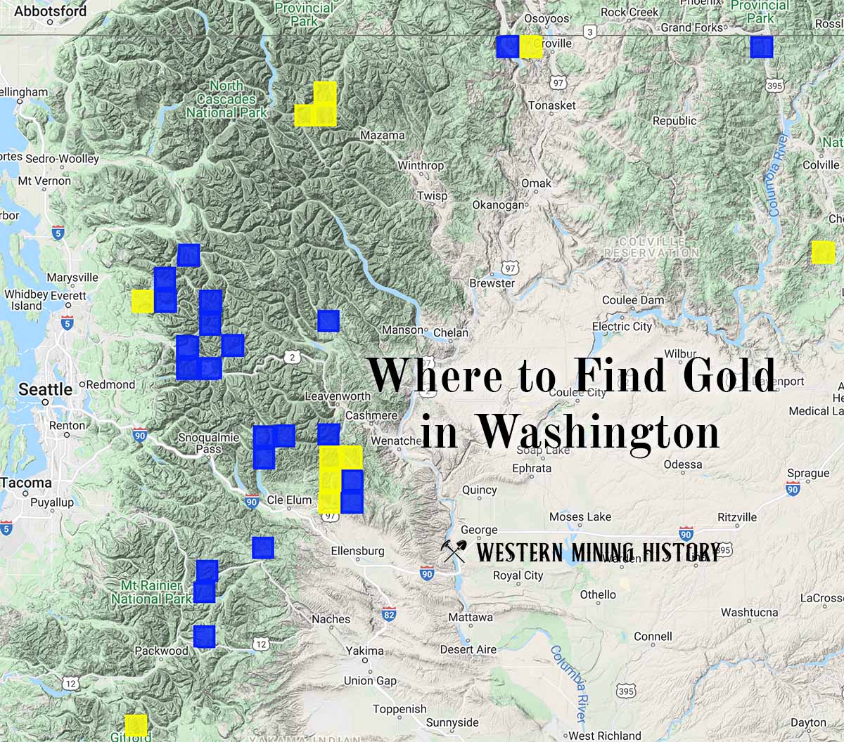
Washington Gold

"Where to Find Gold in Washington" looks at the density of modern placer mining claims along with historical gold mining locations and mining district descriptions to determine areas of high gold discovery potential in Arizona. Read more: Where to Find Gold in Washington.