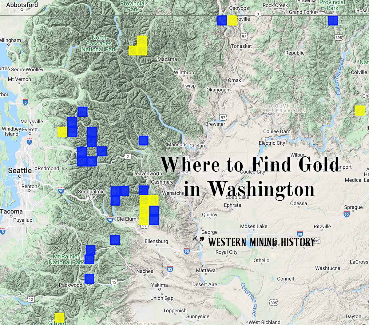
The Boundary Red Mountain Mine is a gold mine located in Whatcom county, Washington at an elevation of 4,751 feet.
About the MRDS Data:
All mine locations were obtained from the USGS Mineral Resources Data System. The locations and other information in this database have not been verified for accuracy. It should be assumed that all mines are on private property.
Mine Info
Elevation: 4,751 Feet (1,448 Meters)
Commodity: Gold
Lat, Long: 48.99528, -121.63028
Map: View on Google Maps
Boundary Red Mountain Mine MRDS details
Site Name
Primary: Boundary Red Mountain Mine
Secondary: Red Mountain Mine
Secondary: Boundary Red
Commodity
Primary: Gold
Secondary: Silver
Secondary: Copper
Tertiary: Tellurium
Tertiary: Bismuth
Location
State: Washington
County: Whatcom
District: Mount Baker District
Land Status
Land ownership: National Wilderness
Note: the land ownership field only identifies whether the area the mine is in is generally on public lands like Forest Service or BLM land, or if it is in an area that is generally private property. It does not definitively identify property status, nor does it indicate claim status or whether an area is open to prospecting. Always respect private property.
Administrative Organization: In Mount Baker Wilderness In Mount Baker National Forest
Holdings
Not available
Workings
Type: Underground
Ownership
Owner Name: Tom Bourn, Kitsap Lake, Wash., And John Wiatrick, Chicago
Years: 1966 -
Owner Name: Boundary Red Mountain Mining Co.
Production
Not available
Deposit
Record Type: Site
Operation Category: Past Producer
Operation Type: Unknown
Year First Production: 1912
Year Last Production: 1946
Discovery Year: 1898
Years of Production:
Organization:
Significant: N
Deposit Size: S
Physiography
General Physiographic Area: Pacific Mountain System
Physiographic Province: Cascade-Sierra Mountains
Physiographic Section: Northern Cascade Mountains
Mineral Deposit Model
Model Name: Low-sulfide Au-quartz vein
Orebody
Form: VEINS
Structure
Not available
Alterations
Alteration Type: L
Alteration Text: Oxidation
Rocks
Not available
Analytical Data
Analytical Data: MINE RUN ORE AVERAGED $15/TON AU. ORE SHOOT 520 FT LONG, 26 IN. WIDE HAD AVERAGE VALUE OF 1.13 OZ/TON AU. GOLD FINENESS 936-946
Materials
Ore: Gold
Ore: Chalcopyrite
Ore: Pyrite
Ore: Pyrrhotite
Gangue: Quartz
Comments
Comment (Commodity): SILVER IS PRESENT APPEARS TO BE ALLOYED WITH GOLD. GRAINS OF GOLD AS BIG AS 2 MM WERE PRESENT IN ORE SHOOTS.
Comment (Location): UNSURVEYED. ON NORTH SLOP OF MT. LARRABEE. DISCREPENCIES IN LOCATIONS AMONG THE VARIOUS REFERENCES; DERKEY AND OTHERS LOCATION IS PRESUMED CORRECT
Comment (Production): IN 1914, THE MINE PRODUCTION WAS $15,000. FROM APRIL TO DECEMBER OF 1916, 10,441 TONS OF ORE YIELDED $148.578 IN GOLD.
Comment (Deposit): FINELY DIVIDED GOLD IN QUARTZ VEINS, 6 IN.-10 FT THICK (AVG 3 FT). VEINS CROP OUT ON SURFACE AS FAR AS 900 FT ALONG STRIKE, BUT BECAUSE OF SEVERAL NORTH-TRENDING FAULTS, VEINS ARE NOT CONTINUOUS FOR MORE THAN 100 FT. AU IS DISTRIBUTED IRREGULARLY AND TENDS TO FOLLOW MICROBRECCIATED PARTS OF VEIN PARALLEL TO MARGINS OF MAIN VEIN.
Comment (Workings): 4 MAIN LEVELS OF MINE. PARTS OF THE BOUNDARY RED MOUNTAIN VEIN HAVE NOT YET BEEN MINED. DETAILED DIAGRAM OF WORKINGS IN MOEN P. 81
Comment (Development): BY 1913, GOLD WAS BEING CRUSHED IN 5 STAMP MILL. IN 1916, 5 ADDITIONAL STAMPS WERE ADDED. IN 1914, MINE WAS THE MAIN GOLD PRODUCER IN COUNTY
Comment (Geology): DEPOSIT LIES ALONG FAULTS IN CONTACT ZONE BETWEEN CHILLIWACK GROUP AND SLESSE DIORITE. GOLD-BEARING VEINS PROBABLY FORMED DURING 2 STAGES OF MINERALIZATION. INITIALLY, FRACTURES WERE FILLED WITH QUARTZ CONTAINING PYRITE, PYRRHOTITE, AND CHALCOPYRITE. HYDROTHERMAL GOLD-BISMUTH TELLURIDE SOLUTIONS LATER INFILTRATED VEINS.
Comment (Deposit): 6 PATENTED CLAIMS (SEE SKETCH MAP IN MOEN). ; INFO.SRC : 1 PUB LIT
References
Reference (Deposit): TABOR, R.W., HAUGERUD, R.A., BOOTH, D.B., AND BROWN, E.B., 199X, PRELIMINARY GEOLOGIC MAP OF THE MOUNT BAKER 30 X 60 MINUTE QUADRANGLE, WASHINGTON: U.S. GEOLOGICAL SURVEY OPEN-FILE REPORT 9X-XXX, SCALE 1:100,000 (IN PREPARATION IN 1993).
Reference (Production): MOEN, P. 80
Reference (Deposit): HUNTTING, M.T., 1956, INVENTORY OF WASHINGTON MINERALS - PART II, METALLIC MINERALS: WASHINGTON DIVISION OF MINES AND GEOLOGY BULLETIN 37, V. 1, P. 176.
Reference (Deposit): MOEN, W.S., 1969, MINES AND MINERAL DEPOSITS OF WHATCOM COUNTY, WASHINGTON: WASHINGTON DIVISION OF MINES AND GEOLOGY BULLETIN 57, P. 79-82.
Reference (Deposit): PATTY, E.N., 1921, THE METAL MINES OF WASHINGTON: WASHINGTON GEOLOGICAL SURVEY BULLETIN 23, P. 306-309.
Reference (Deposit): GRANT, A.R., 1976, REPORT OF EVALUATION, MINERAL RESOURCE ANALYSIS STUDY ON UNITED STATES FOREST SERVICE LAND, STATE OF WASHINGTON: PREPARED FOR U.S. FOREST SERVICE - REGION 6, CONTRACT NO. 004724N, P. 29,
Reference (Deposit): DERKEY, R.E., JOSEPH, N.L., AND LASMANIS, RAYMOND, 1990, METAL MINES OF WASHINGTON - PRELIMINARY REPORT: WASHINGTON DIVISION OF GEOLOGY AND EARTH RESOURCES OPEN-FILE REPORT 90-18, P. 544.
Washington Gold

"Where to Find Gold in Washington" looks at the density of modern placer mining claims along with historical gold mining locations and mining district descriptions to determine areas of high gold discovery potential in Arizona. Read more: Where to Find Gold in Washington.