The Yellowbottom-Boulder Creek Area is a zinc, lead, silver, and gold mine located in Linn county, Oregon at an elevation of 2,201 feet.
About the MRDS Data:
All mine locations were obtained from the USGS Mineral Resources Data System. The locations and other information in this database have not been verified for accuracy. It should be assumed that all mines are on private property.
Mine Info
Elevation: 2,201 Feet (671 Meters)
Commodity: Zinc, Lead, Silver, Gold
Lat, Long: 44.58917, -122.36528
Map: View on Google Maps
Yellowbottom-Boulder Creek Area MRDS details
Site Name
Primary: Yellowbottom-Boulder Creek Area
Commodity
Primary: Zinc
Primary: Lead
Primary: Silver
Primary: Gold
Secondary: Molybdenum
Secondary: Copper
Tertiary: Arsenic
Tertiary: Bismuth
Tertiary: Antimony
Location
State: Oregon
County: Linn
District: Quartzville Area
Land Status
Land ownership: BLM Administrative Area
Note: the land ownership field only identifies whether the area the mine is in is generally on public lands like Forest Service or BLM land, or if it is in an area that is generally private property. It does not definitively identify property status, nor does it indicate claim status or whether an area is open to prospecting. Always respect private property.
Holdings
Not available
Workings
Not available
Ownership
Owner Name: Orvana Resources Corp. (Pre-
Production
Not available
Deposit
Record Type: Site
Operation Category: Occurrence
Operation Type: Unknown
Years of Production:
Organization:
Significant: N
Deposit Size: S
Physiography
General Physiographic Area: Pacific Mountain System
Physiographic Province: Cascade-Sierra Mountains
Physiographic Section: Northern Cascade Mountains
Mineral Deposit Model
Model Name: Polymetallic veins
Orebody
Form: VEINS
Structure
Type: L
Description: Sardine Syncline (Immediately To East), Shear Zones, Brecciated Zones
Alterations
Alteration Type: L
Alteration Text: Ubiquitous Propylitic Alteration, Structurally Controlled Argillic-Phyllic Alteration, Linear To Cylindrical Zones Of Brecciated And Silicified Rock, And Tourmaline-Quartz Alteration Of Breccia Zones
Rocks
Not available
Analytical Data
Analytical Data: BRECCIATED ROCKS CONTAIN AS MUCH AS 580 PPM AU, 5.5 PPM AG, 495 PPM CU, 50 PPM MO, 520 PPM ZN, 930 PPM PB, 976 PPM AS, 56 PPM SB, AND 53 PPM BI
Materials
Ore: Chalcopyrite
Ore: Pyrite
Ore: Galena
Ore: Sphalerite
Gangue: Calcite
Gangue: Chlorite
Gangue: Tourmaline
Gangue: Quartz
Gangue: Sericite
Comments
Comment (Commodity): GALENA AND SPHALERITE PRESENT ONLY LOCALLY WITHIN AREA AND CHALCOPYRITE HAS BEEN REPORTED BUT NOT SEEN BY NICHOLSON (1988)
Comment (Development): ORVANA COLLECTED AND ANALYZED SAMPLES IN CONJUNCTION WITH EXPLORATION IN THE QUARTZVILLE DISTRICT
Comment (Deposit): PORPHYRY-TYPE SYSTEM SUGGESTED AT DEPTH BENEATH AREA THAT POSSIBLY INCLUDES BRECCIA-PIPE COPPER MINERALIZATION, AN UNPUBLISHED DEPOSIT MODEL BECAUSE AREA INCLUDES MINERALIZED BRECCIA PIPES AND BRECCIATED ZONES. SEVERAL SHEAR ZONES ARE ASSOCIATED WITH MINERALIZATION AND MAY REPRESENT ZONES ALONG WHICH FLUIDS FROM A COOLING PLUTON AT DEPTH MIGRATED (NICHOLSON, 1988)
Comment (Workings): A FEW SMALL TEST PITS NEAR CONFLUENCE OF YELLOWSTONE AND QUARTZVILLE CREEKS
Comment (Geology): OTHER SMALL INTRUSIONS OF VARIOUS COMPOSITIONS ARE PRESENT IN AREA. SULFUR ISOTOPIC COMPOSITIONS INDICATE A MAGAMTIC SOURCE FOR SULFUR AND SULFUR ISOTOPES AND FLUID INCLUSIONS INDICATE TEMPERATURES OF FORMATION OF 157 TO 260 DEGREES C. VOLCANIC ROCKS OF AREA DIP 10-20 DEGREES SE, PRESUMABLY INTO SARDINE SYNCLINE
Comment (Deposit): AREA IS USED BY RECREATIONAL GOLD PANNERS
Comment (Location): AREA IS IMMEDIATELY WEST OF QUARTZVILLE MINING DISTRICT IN A RECREATIONAL MINING CORRIDOR ADMINISTERED BY THE U.S. BUREAU OF LAND MANAGEMENT
References
Reference (Analytical Data): NICHOLSON, 1988
Reference (Deposit): NICHOLSON, D.K., 1988, GEOLOGY, GEOCHEMISTRY, AND MINERALIZATION OF THE YELLOWBOTTOM-BOULDER CREEK AREA, LINN COUNTY, OREGON: CORVALLIS, OREGON STATE UNIVERSITY, M.S. THESIS, 186 P
Oregon Gold

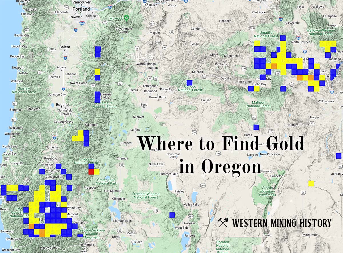
"Where to Find Gold in Oregon" looks at the density of modern placer mining claims along with historical gold mining locations and mining district descriptions to determine areas of high gold discovery potential in Oregon. Read more: Where to Find Gold in Oregon.