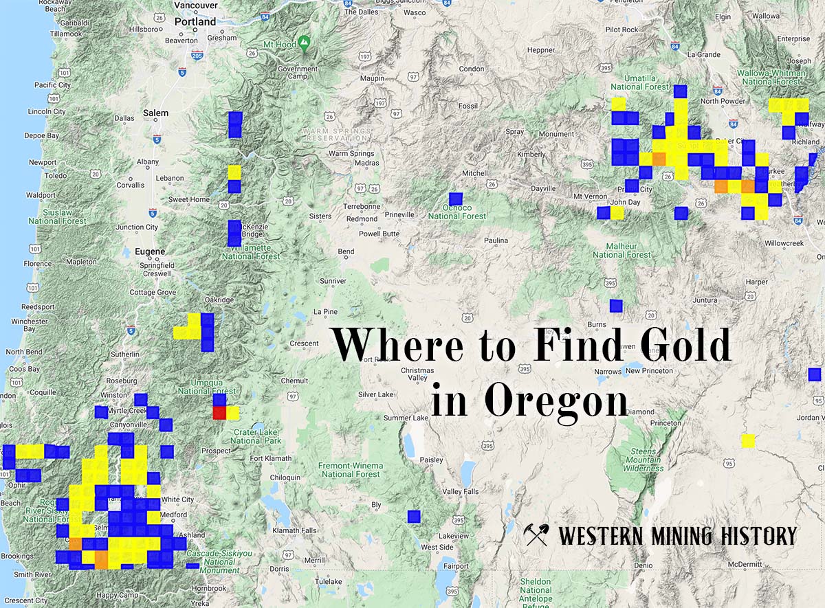
The Sanger Mine is a gold mine located in Baker county, Oregon at an elevation of 5,000 feet.
About the MRDS Data:
All mine locations were obtained from the USGS Mineral Resources Data System. The locations and other information in this database have not been verified for accuracy. It should be assumed that all mines are on private property.
Mine Info
Elevation: 5,000 Feet (1,524 Meters)
Commodity: Gold
Lat, Long: 44.99389, -117.40750
Map: View on Google Maps
Mine Description
This old mine is located on a branch of Goose Creek near the top of the Powder River Eagle Creek divide. The following description of the deposit is taken from Lindgren (1901, p. 738-739) and a Department mine-file report compiled in the early 1900's by Charles P. Berkey.
The principal vein, called the Summit lode, was discovered in 1870, and was actively worked during the following years. In 1874 the production was $60,000 from ore containing $16 to the ton. The total production to 1887 is unknown, though probably small, but a mill was then built, and in 1889 production began to increase rapidly. The Mint reports for the 4 years 1889-1892 give $813,000 as the production of the mine. Production ceased in 1897. Total output is estimated at about $1,500,000.
The rocks at the Sanger mine are dark-colored, medium-to-fine-grained mudstones and shales of the Upper Triassic Hurwal Formation. The rocks are pyritic near the veins. The Summit vein strikes nearly due east, dips 30° N. and has been worked to a depth of 400 feet on the dip from several adits and an inclined shaft. An old map dated January 1, 1901 seems to indicate that drifting was done on at least two other veins or fault zones, one paralleling the summit vein and the other crossing it at nearly right angles. The ore shoot in the upper stopes of the Summit vein was 600 feet long, about 15 inches wide and averaged $20 to $25 a ton in gold; below the zone of oxidation the vein widened to 2 to 4 feet and the value dropped to $12 a ton. The gangue is coarse quartz with a little calcite and about 3 percent sulfides, consisting mostly of pyrite with a little sphalerite and galena. Much of the gold was free. In its easterly extension on all levels the vein bends in a broad curve to the south and appears to blend with the strike of the host rocks, losing its characteristic size and value. Toward the west the vein has been offset by faulting, at which point mining ceased. Other veins on the property include the Packwood, Golden Eagle, and Knight. The Big Vein at the head of Fir Gulch may have been the source of the rich placers on Fir Gulch.
Source: Gold and Silver in Oregon, State of Oregon Department of Geology and Mineral Industries, 1968
Sanger Mine MRDS details
Site Name
Primary: Sanger Mine
Commodity
Primary: Gold
Tertiary: Lead
Tertiary: Zinc
Tertiary: Copper
Location
State: Oregon
County: Baker
District: Eagle Creek
Land Status
Administrative Organization: Wallowa-Whitman National Forest
Holdings
Not available
Workings
Type: Underground
Ownership
Not available
Production
Not available
Deposit
Record Type: Site
Operation Category: Past Producer
Deposit Type: Vein
Operation Type: Unknown
Year First Production: 1870
Discovery Year: 1870
Discovery Method: Unknown
Years of Production:
Organization:
Significant: N
Physiography
General Physiographic Area: Intermontane Plateaus
Physiographic Province: Columbia Plateau
Physiographic Section: Payette Section
Physiographic Detail: Wallowa Mountains
Mineral Deposit Model
Not available
Orebody
Form: TABULAR
Structure
Type: R
Description: Ne Trending Blue Mountains Uplift
Alterations
Alteration Type: L
Alteration Text: Pyritization Of Wall Rocks, Argillic Selvage
Rocks
Name: Diorite
Role: Associated
Age Type: Associated Rock
Age Young: Late Cretaceous
Name: Diorite
Role: Associated
Age Type: Host Rock
Age Young: Late Triassic
Analytical Data
Not available
Materials
Ore: Chalcopyrite
Ore: Gold
Ore: Galena
Ore: Pyrite
Ore: Sphalerite
Gangue: Calcite
Gangue: Quartz
Comments
Not available
References
Reference (Deposit): 1962 GEOLMAP ORE. DEPT. GEOL. MIN. IND.: MAP
Reference (Production): BROOKS, H. C., AND RAMP, L., 1968, GOLD AND SILVER IN OREGON, P. 91
Reference (Deposit): LINDGREN, W., 1901, THE GOLD BELT OF THE BLUE MOUNTAINS: USGS 22ND ANNUAL REPORT, P. 738-739
Reference (Deposit): PROSTKA, H. J., 1962, GEOLOGY OF THE SPARTA QUADRANGE, OREGON: OREGON DEPT. OF GEOL. AND MIN. INDUSTRIES; MAP WITH TEXT, SCALE 1:62500
Reference (Deposit): BROOKS, H. C., AND RAMP, L., 1968, GOLD AND SILVER IN OREGON: OREGON DEPT. GEOL. AND MIN. IND. BULL. 61:91-92.
Reference (Deposit): 1901 RECON W. LINDGREN: REF. 1
Oregon Gold

"Where to Find Gold in Oregon" looks at the density of modern placer mining claims along with historical gold mining locations and mining district descriptions to determine areas of high gold discovery potential in Oregon. Read more: Where to Find Gold in Oregon.