The Salmon Canyon Copper Company Prospect is a copper and cobalt mine located in Lemhi county, Idaho at an elevation of 3,701 feet.
About the MRDS Data:
All mine locations were obtained from the USGS Mineral Resources Data System. The locations and other information in this database have not been verified for accuracy. It should be assumed that all mines are on private property.
Mine Info
Elevation: 3,701 Feet (1,128 Meters)
Commodity: Copper, Cobalt
Lat, Long: 45.30135, -114.55660
Map: View on Google Maps
Salmon Canyon Copper Company Prospect MRDS details
Site Name
Primary: Salmon Canyon Copper Company Prospect
Secondary: Jeep Nos. 1-10 Lodes
Secondary: Shoup Operations
Commodity
Primary: Copper
Primary: Cobalt
Secondary: Gold
Secondary: Silver
Tertiary: Arsenic
Tertiary: Lead
Location
State: Idaho
County: Lemhi
District: Mineral Hill Mining District
Land Status
Land ownership: National Forest
Note: the land ownership field only identifies whether the area the mine is in is generally on public lands like Forest Service or BLM land, or if it is in an area that is generally private property. It does not definitively identify property status, nor does it indicate claim status or whether an area is open to prospecting. Always respect private property.
Administrative Organization: Salmon National Forest
Holdings
Type: Located Claim
Workings
Type: Underground
Ownership
Owner Name: Salmon Canyon Copper Co.
Percent: 100.0
Home Office: JAMESTOWN ND 58401
Info Year: 1978
Production
Year: 1968
Mined: 55.000 mt
Material type: Concentrates
Deposit
Record Type: Site
Operation Category: Past Producer
Operation Type: Underground
Year First Production: 1978
Discovery Year: 1960
Years of Production:
Organization:
Significant: N
Deposit Size: S
Physiography
General Physiographic Area: Rocky Mountain System
Physiographic Province: Northern Rocky Mountains
Physiographic Detail: Clearwater Mountains
Mineral Deposit Model
Not available
Orebody
Form: TABULAR, MASSIVE, IRREGULAR
Structure
Not available
Alterations
Alteration Type: L
Alteration: SILICIFICATION
Rocks
Name: Schist
Role: Host
Description: Biotite Schist
Age Type: Host Rock
Age Young: Neoproterozoic
Name: Schist
Role: Host
Description: Biotite Schist
Age Type: Host Rock Unit
Age Young: Neoproterozoic
Analytical Data
Analytical Data: ORE 1 - 5% CU, TRACES CO, AS.
Materials
Ore: Chalcopyrite
Unknown: Arsenopyrite
Unknown: Chalcocite
Unknown: Pyrite
Unknown: Erythrite
Unknown: Galena
Unknown: Garnet
Unknown: Quartz
Comments
Comment (Location): On Salmon River Corridor
Comment (Development): Econ.Com: Ore Now Must Be Shipped 200 Miles To Ketchum; Problems With Mine Waste Disposal On Steep Terrain, Water Pollution
Comment (Workings): Tunnels, 3 Levels
Comment (Location): As 0f 1996 This Property Could Be The Salmon Caynon Exploration Project Mentioned In A Sept. 1996, The Mining Record, Article. However The Location Of This Property And The Locations Given In The Article And Other Sources Do Not Coordinate. Owner As Listed In The Mining Record Article Is The Formation Capital Corp. Exploration Is Being Done By Double Creek Mining Corp. Fifty One Claims Have Been Located On The Deposit And These Claims Have Been Overstaked By 12 Additional Claims.
Comment (Economic Factors): The Mill Is Capable Of Processing 150 To 200 Tons Of Ore A Day Depending On Grindability. The Mill Is Now On A Trial Run Basis And Is Processing 35 To 50 Tons Per Day And Is 35 Miles From The Mine. Mill Feed Grade For Cobalt Ranges From 1.06 % Down To A Trace And The Copper Concen- Trate Contains 1.25 % Cobalt. The Concentrates Are Being Shipped To Sherrit Gordon Mines Limited, Edmonton, Alta., Canada.
Comment (Geology): Outcrops Can Be Traced On The Surface For 3000 Feet. Erythrite (Cobalt Bloom) Is Common. Bill Cameron, Formerly With Coastal Mining, A Hanna Subsidiary, Stated That, "It Is A Sedimentary Deposit Several Hundred Feet Thick Containing .5 % Low Grade Cooper And 20 To 40 Feet Of +1 % Copper.". This Is Probaly A Strata Bound Copper Deposit.
Comment (Workings): The Main Adit Has Been Driven 2100 Ft. Into The Mountain
Comment (General): USBM WFOC Wilderness Studies
References
Reference (Deposit): Bennett, E. H., 1976, Personal Communication
Reference (Deposit): Griner, W. C., 1975, Seventy - First Annual Report Of The Mining Industry Of Idaho For 1973 - 1974, 98 P.
Reference (Deposit): Cater, F. W., Pinckney, D. M., And Stotelmeyer, R. M., 1975 , Mineral Resources Of The Clear Creek - Upper Big Deer Creek Area, Contiguous To The Idaho Primitive Area, Lemhi County, Idaho: USGS Bulletin 1391-C, P. 35 - 36
Reference (Deposit): Weis, P.L., L.J. Schmitt, E.T. Tuchek. Mineral Resources Of The Salmon River Breaks Primitive Area, Idaho., U.S. Geological Survey Bulletin 1353-C, 1972, 91 Pp.
Reference (Deposit): Bureau Of Mines Mineral Property File 21.031
Reference (Deposit): Behre Dolbear And Company Inc. Engineering-Evaluation Report For Salmon Canyon Copper Company. 1979, 41 Pp.; Available Upon Request From Bumines, WFOC Mineral Property File, Spokane, Wa.
Reference (Deposit): Garvey, M. Metals Marketing Division, Sherritt-Gordon Ltd, Toronto, Ontario, Canada. Personal Communication. Sept. 4, 1984.
Reference (Deposit): Lund, K., Evans, K. V., And Esparza, L. Mineral Resource Potential Of The Special Mining Management Zone - Clear Creek, Lemhi County, Idaho. U.S. Geol. Surv. Misc. Field Studies Map Mf-1576-A, 1983, 9 Pp.
Reference (Deposit): U.S. Bureau Of Mines. WFOC Mineral Property File No. 0160590450; Available Upon Request From Bumines-WFOC, Spokane, Wa.
Reference (Reserve-Resource): The Mining Record, Sept 4, 1996, P25.
Reference (Reserve-Resource): Randol Mining Directory, 1996/97, U.S. Mines And Mining Companies, P200.
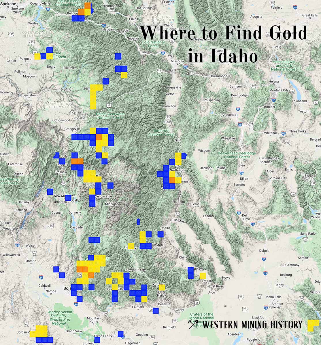
Idaho Gold

"Where to Find Gold in Idaho" looks at the density of modern placer mining claims along with historical gold mining locations and mining district descriptions to determine areas of high gold discovery potential in Idaho. Read more: Where to Find Gold in Idaho.