WMH Gold Maps for Google Earth Pro are designed to locate areas with high potential for finding placer gold. A core feature of these maps is the highlighting of townships that contain both active placer mining claims and historical gold mines.
The screenshot below uses data from the Idaho Gold Map and shows gold-bearing PLSS townships across the state (this view was created with Google My Maps).

Townships that contain both active placer claims and historical gold mine records are shaded in one of the following colors based on how many active placer claims are in the township: 1 – 10 claims: blue; 10 – 50 claims: yellow; 50 – 100 claims: orange.
Additional images in this article contain more data points. Yellow circles are gold mines, hexagonal markers are PLSS sections that contain active placer mining claims, and blue markers with pick axes are district locations.
In this analysis we will be looking at the gold townships highlighted by the WMH Idaho Gold Map and identifying which have the highest potential for gold discovery.
Township PLSS numbers cited in this article are in the same format used in the BLM MLRS application, and can be copied and pasted directly into the MLRS search form.
Related: Researching Mining Claims with the BLM MLRS
The following list summarizes the top gold townships in Idaho as ranked by the WMH Idaho Gold Map.
1. Idaho County – Florence District
The Florence district (or French Creek) is one of Idaho’s oldest, and richest gold mining areas. Gold was discovered here in 1861, and the town of Florence was the site of a significant gold rush. A USGS report summarizes the early activity here:
In the 1860’s this area was one of the most productive in the State; the gulches and stream beds swarmed with miners working the rich gravels. The gravels were only 4 to 10 feet thick, and the richer parts soon were exhausted, after which the Chinese took over and reworked the tailings. The total output of the district, most of which was produced in the 1860’s, was valued between $15 and $30 million.
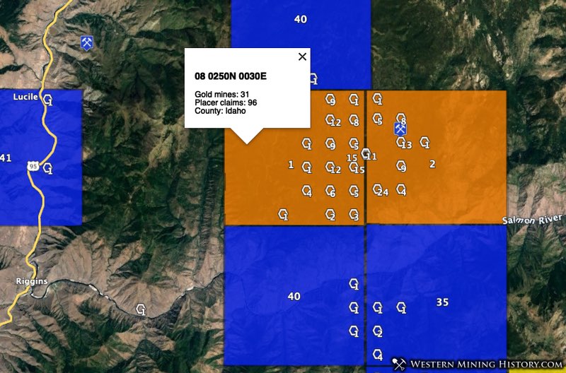
The top two gold areas by placer density in the state of Idaho are 08 0250N 0030E (96 placer claims, 31 gold mines), and 08 0250N 0040E (91 placer claims, 17 gold mines), both within the Florence district.
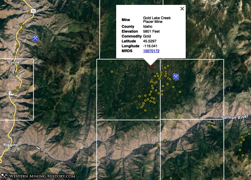
Looking at just the gold mine data for this area reveals the distribution of historical mines.
This district is one of the richest of the early placer camps, although lode mining in the area has been described as negligible.
2. Boise County – Boise Basin Districts
This is a large area that contains many districts and is Idaho’s most productive historical gold mining area. This section will take a look at some of the top townships, but there are too many active mining areas in the Boise Basin to describe here in detail. For additional details see the WMH Idaho Gold Map.
Placer gold was discovered in Boise Basin in 1862. Thousands of miners flocked to this area and many towns and mining districts were established. The Idaho City district alone is credited with over two million ounces of gold production.
The following sections will take a look at some of the top modern placer mining areas in the Boise Basin.
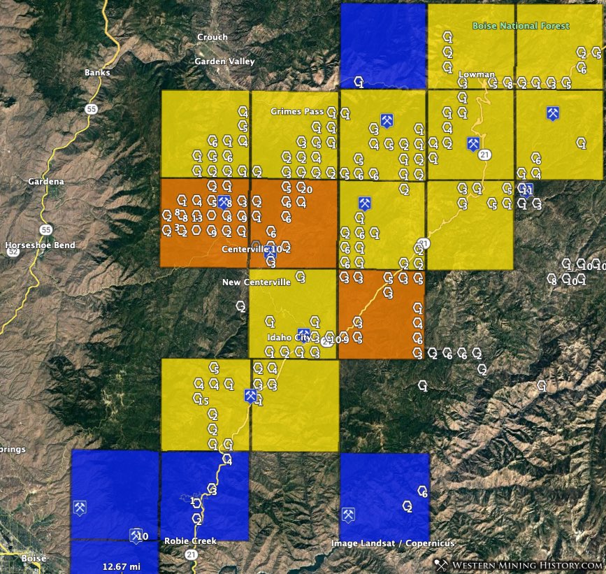
Centerville, Pioneerville, Quartzburg, Grimes Pass Districts
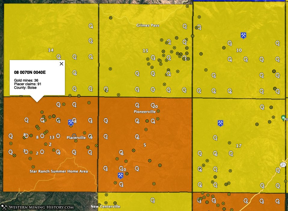
Township 08 0070N 0040E (91 placer claims, 36 gold mines), seen at the bottom left part of the image above, is the second highest gold potential township in Idaho. This township is the location of the historic mining town of Placerville. The Placerville district is sometimes described as part of the larger Quartzburg district.
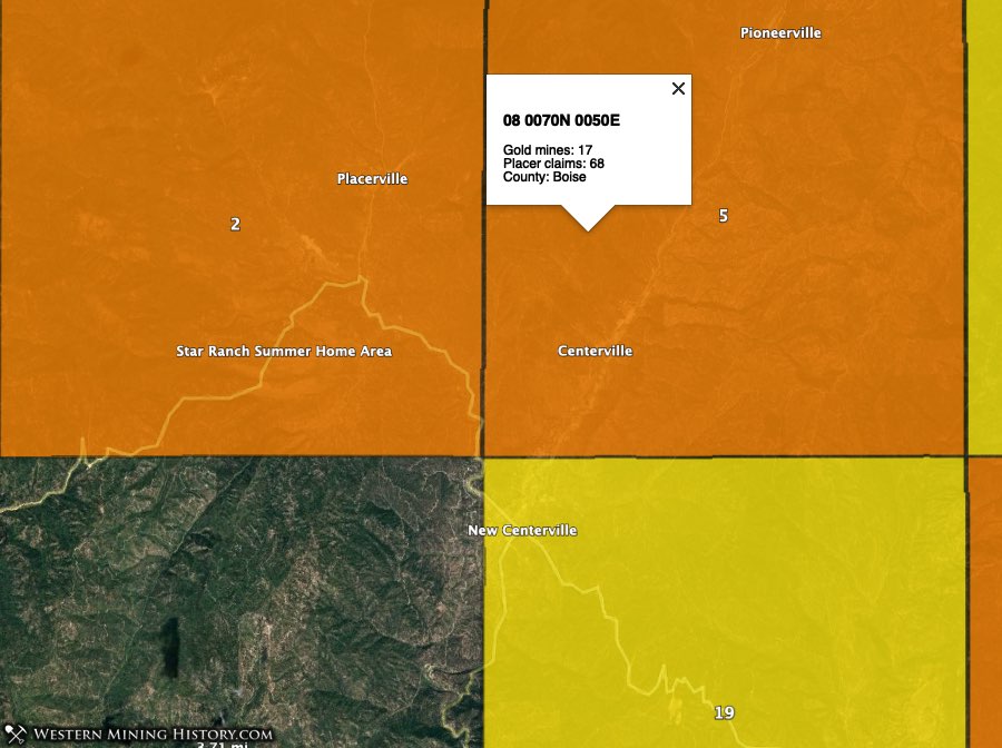
To the east, township 08 0070N 0050E (68 placer claims, 17 gold mines) ranks fifth. Part of the Centerville district is in the southern part of this township while the Pioneerville district is in the northern part. Centerville was one of Boise Basin’s most productive placer mining areas, while Pioneerville is known for its lode mines.
To the north, township 08 0080N 0060E (45 placer claims, 22 gold mines) ranks tenth, 08 0080N 0040E (38 placer claims, 6 gold mines) ranks 14th, and 08 0080N 0050E (36 placer claims, 43 gold mines) ranks 15th. These townships are the location of the Grimes Pass district, which is often described as part of the Pioneerville district.
Idaho City and Moore Creek Districts
The Idaho City and Moore Creek Districts are south of the Boise Basin districts described above. Historically, the Idaho City area is one of the state’s richest gold producers.
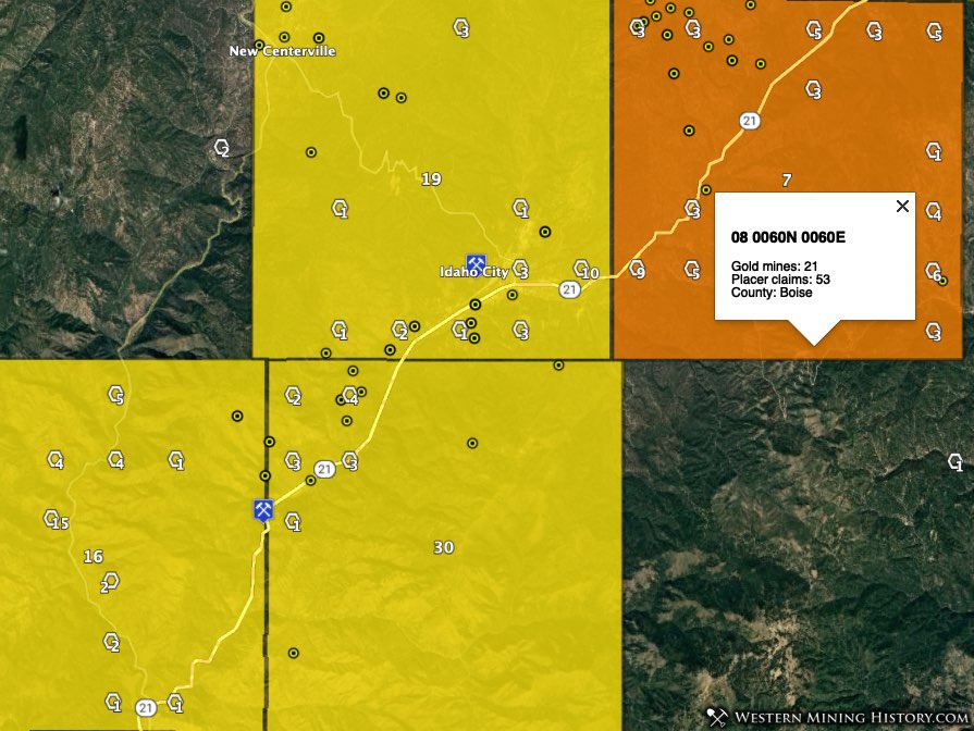
Township 08 0060N 0060E (53 placer claims, 21 gold mines) is the location of the eastern part of the Idaho City district and ranks seventh in the state for townships with high placer gold potential. Township 08 0060N 0050E (25 placer claims, 26 gold mines) is the location of the town of Idaho City and ranks 19th.
To the south, townships 08 0050N 0040E (35 placer claims, 4 gold mines) and 08 0050N 0050E (13 placer claims, 11 gold mines) rank 16th and 30th respectively. These townships are the location of the Moore Creek district.
3. Shoshone County – Murray Area
The rich placer gold deposits of the Murray area were not worked until the 1880s, and they predate the massive silver-lead deposits that would make the Coeur d’Alene area one of the richest mining regions in the world.
Today the area is still actively mined for placer gold, as shown by the numerous active placer claims.
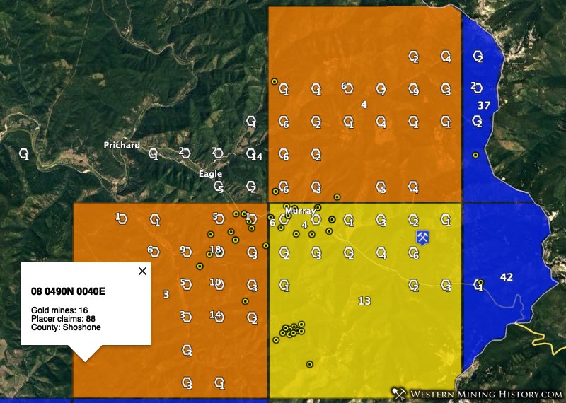
Township 08 0490N 0040E (88 placer claims, 16 gold mines) ties for the third highest gold potential township in the state, while 08 0490N 0040E (74 placer claims, 4 gold mines) ranks fourth. Township 08 0490N 0050E (40 placer claims, 27 gold mines) ranks 13th.
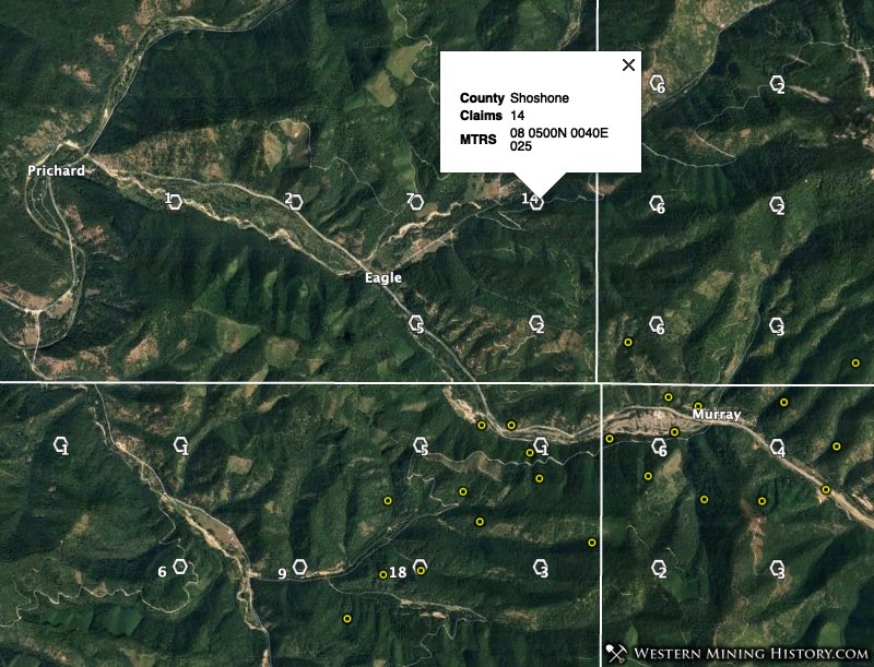
An odd result is seen in the township where Prichard and Eagle are located. This area is recognized as a placer gold area but there are no USGS gold mine records here so the township does not get ranked by the WMH gold map analysis. Nonetheless this area has numerous active placer mining claims.
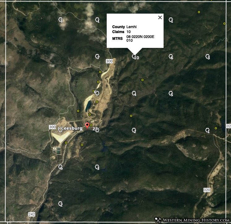
4. Lemhi County – Eureka and Mackinaw Districts
The Mackinaw district is the site of Leesburg, one of Idaho’s oldest and richest placer mining areas. This area is west and northwest of the town of Salmon.
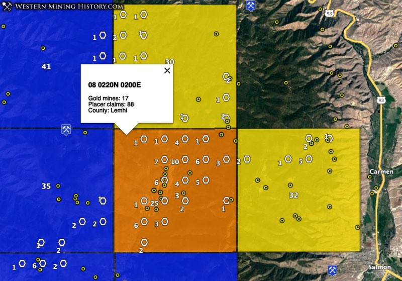
Township 08 0220N 0200E (88 placer claims, 17 gold mines) ties for the third highest gold potential township in the state. This township is roughly divided down the middle by the boundary between the Mackinaw district to the west, and the Eureka district to the east.
Other notable townships are seen in yellow in the image above. Township 08 0230N 0200E (13 placer claims, 5 gold mines) ranks 30th while township 08 0220N 0210E (11 placer claims, 15 gold mines) ranks 32nd. Additional townships seen in blue are also contain active placer mining areas.
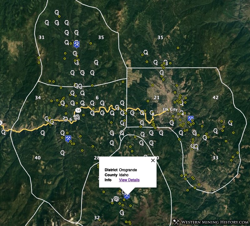
5. Idaho County – Elk City Area
Placer mining in the Elk City area dates back to the 1860s. Lode mining became important here after 1900. Today Elk City is the center of one of the state’s most active placer mining areas.
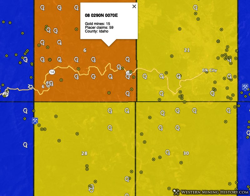
Township 08 0290N 0070E (59 placer claims, 15 gold mines) ranks as the sixth highest gold potential township in the state. Most of the claims are along the South Fork of the Clearwater River, location of the historic Tenmile district.
As the image above illustrates, adjacent townships also contain many claims. To the east of the Tenmile district is the Elk City district, and to the south is the Orogrande district. North of Tenmile is the Newsome district. The image below has estimated district borders added.
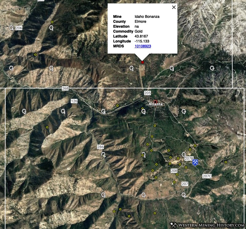
6. Elmore County – Atlanta and Rocky Bar Area
Placer mining started in the Rocky Bar area in 1863 and the placers mines on Bear Creek operated for a full decade. The placer gold was traced to lode deposits which were quickly developed. The USGS gives a summary of production in the region.
The 1870’s and 1880’s were years of intense lode-mining activity, but by the early 1900’s many of the mines closed. Gold mining in Elmore County, with the exception of that in the Atlanta district, continued to decline, although by 1956 the Atlanta district also ceased significant production. Gold production for the county from 1889 through 1942 was 381,396 ounces and from 1943 through 1959 it was 60,300 ounces. A total of 441,696 ounces was produced through 1959.
The primary districts in this are are the Rocky Bar (formerly known as the Bear Creek and Red Warrior districts), Featherville, Atlanta (Yuba), and Black Warrior.
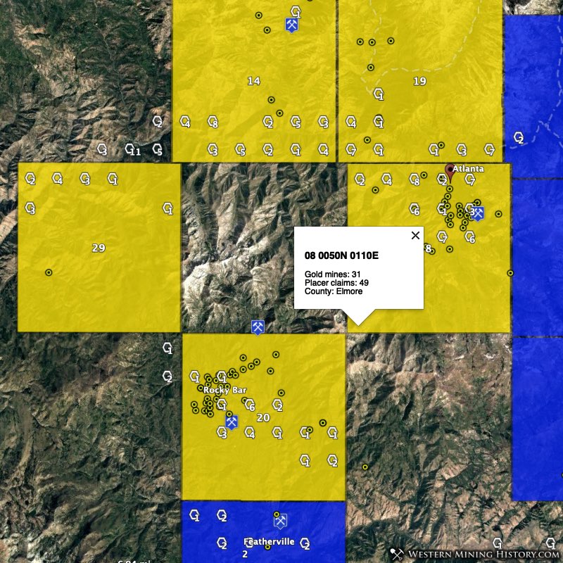
Township 08 0050N 0110E (49 placer claims, 31 gold mines), the location of Atlanta, ranks as the eighth highest gold potential township in the state. Townships 08 0060N 0100E (38 placer claims, 4 gold mines) and 08 0060N 0100E (25 placer claims, 7 gold mines), North and northwest of Atlanta, rank 14th and 19th, respectively.
Township 08 0040N 0100E (24 placer claims, 37 gold mines), the location of Rocky Bar, ranks 20th.
7. Idaho County – Warren Area
Warren is another of the states rich historic placer mining areas, dating back to the 1860s. The USGS summarizes the district history.
Rich placers were discovered in Warren Meadows in 1862 shortly after the discoveries at Florence; rich lode deposits were found as early as 1866. Before 1900 an estimated $15 million in gold was mined from the district; most of it, from placers. After the initial boom period which lasted through the 1860’s, activity continued on a much-reduced scale, especially from 1902 to 1932.
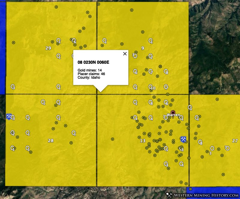
Township 08 0230N 0060E (46 placer claims, 14 gold mines), north of Warren, ranks as the ninth highest gold potential township in the state. Township 08 0220N 0060E (40 placer claims, 64 gold mines), location of the town of Warren, ranks 13th.
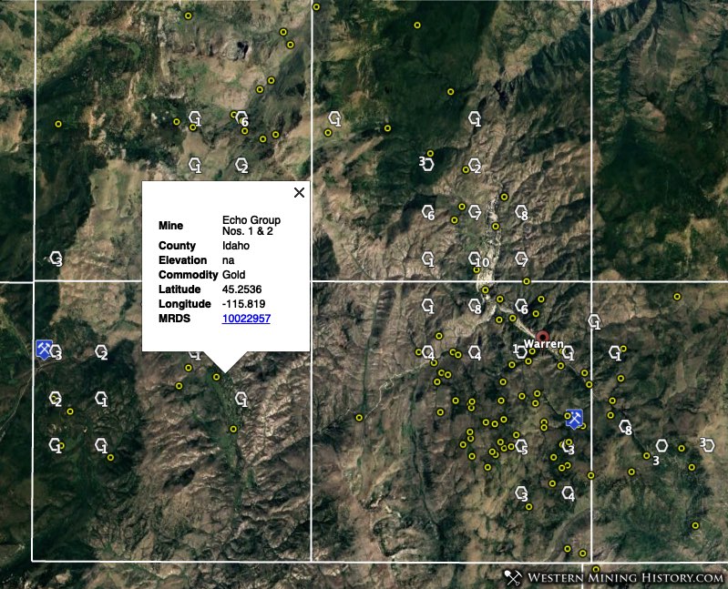
Adjacent townships also rank high, with the 27th, 28th, and 29th ranked townships for placer gold potential residing in this area.
8. Owyhee County – Owyhee Mountains / Silver City
Silver City is famous for its fabulously rich silver mines, but it started out in 1863 as a gold placer district. The USGS states that “by 1865 the richest placers were exhausted, but the Chinese continued lower grade placer mining for a number of years.”
Despite the placer mining era at Silver City reaching its peak more than 150 years ago, there are still many active placer claims here.
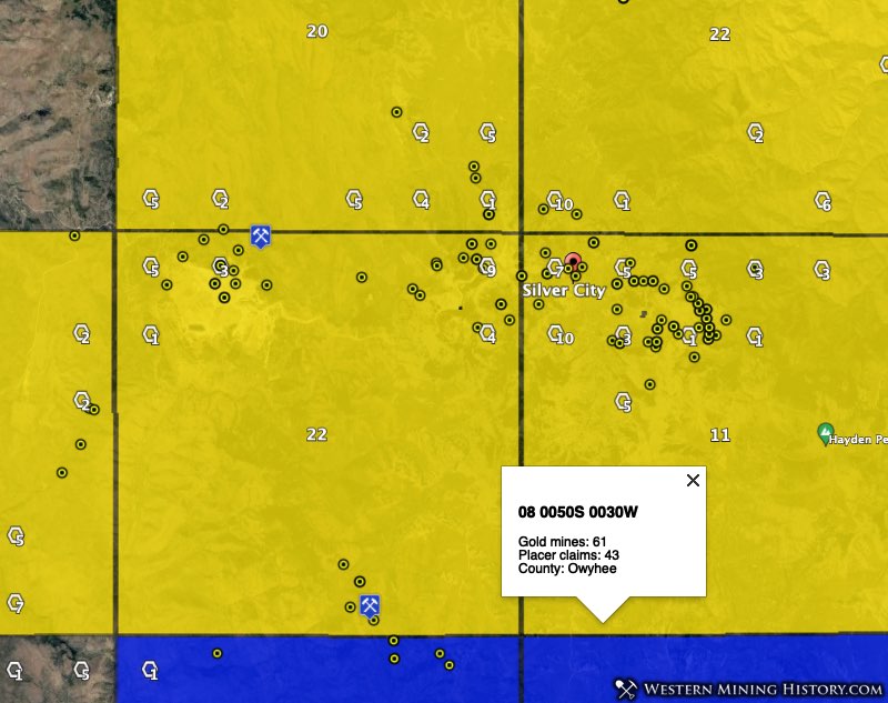
Township 08 0050S 0030W (43 placer claims, 61 gold mines), location of Silver City, ranks as the 11th highest gold potential township in the state. Adjacent townships to the north and west rank 20th to 22nd by number of active placer claims.
9. Bonneville County – Mount Pisgah District
The Mount Pisgah district is a little-known gold mining area in the eastern part of Idaho near the Wyoming border. Most of the placer production here was in the 1870s, with lode mining also being important during subsequent decades.
Although Mount Pisgah is the least historically important district on this list, it still ranks high for number of modern placer claims.
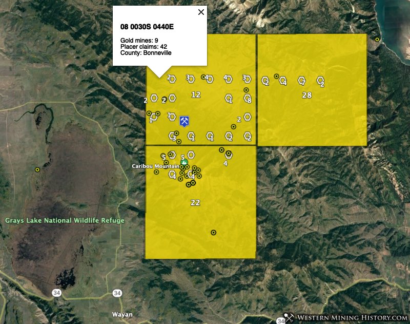
Township 08 0030S 0440E (42 placer claims, 9 gold mines) ranks as the 12th highest gold potential township in the state. Adjacent townships to the south and east rank 22th and 28th by number of active placer claims.
10. Clearwater County – Pierce Area
Gold was discovered on Orofino Creek near Pierce in 1860, making this the site of the earliest gold discovery in Idaho. The placer mines here were active for decades, and around 1900 lode mining became important. Records of production from this district are incomplete, but are estimated at over five million dollars in gold.
The original placer district was known as the Musselshell district, but later the entire area became known as just Pierce. Today many claims are still active on Orofino and other creeks to the east of Pierce.
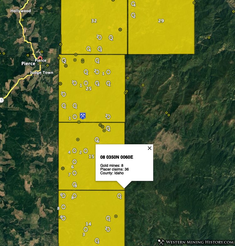
Township 08 0340N 0060E (38 placer claims, 2 gold mines) ranks as the 14th highest gold potential township in the state. Township 08 0350N 0060E (36 placer claims, 8 gold mines) ranks 15th. Additional townships to the north rank 25th to 32nd.
Conclusion
This list looks at some of the top placer gold locations in Idaho, but it is hardly complete. The Idaho Gold Map identifies many areas throughout the state where active placer claims and historical gold mines are present.
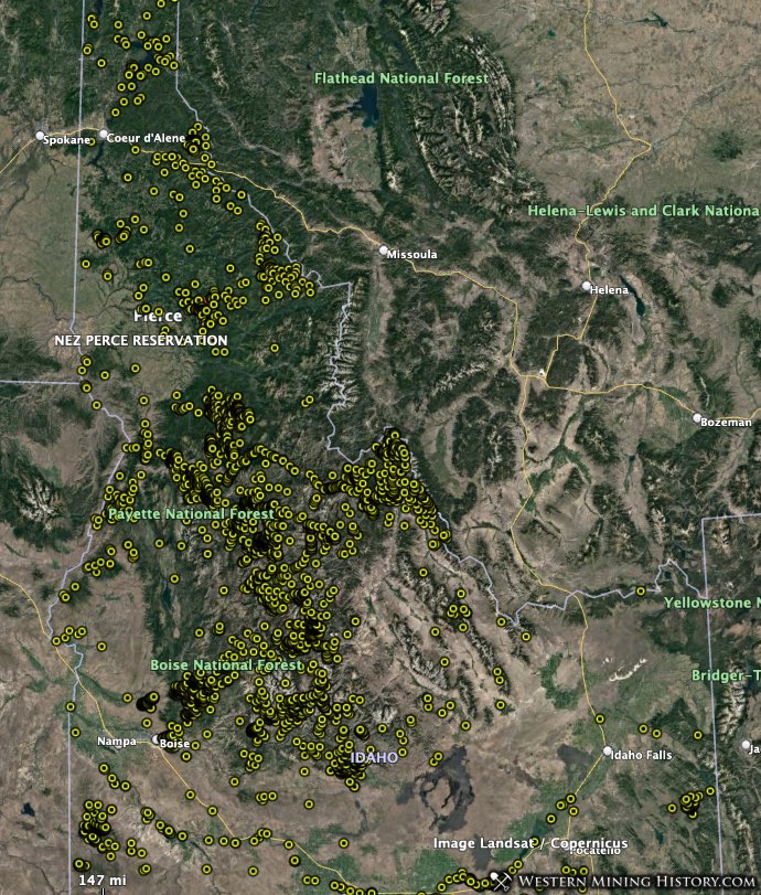
The following image shows the general distribution of all gold mines in the state.
While it is illegal to mine or prospect for gold on an established mining claims, there is still a lot of unclaimed ground, even in historically important mining areas.
Using the Idaho Gold Map, areas with high gold potential can be quickly identified and used as the basis for additional research. Prospectors can focus on the most active placer gold areas and attempt to discover their own claim, or they can look at those areas on the map that have many historical gold mines and few claims in an attempt to stake a claim in an area with less competition.
Notes on the Data Used in this Analysis
While the methods used here allow for a quick overview of all potential gold areas in the state, they are not perfect. Occasionally some historical gold mines will be located near modern surface mining operations for things like evaporite minerals, and the the correlation between active placer claims and the adjacent historical gold mines are coincidental only and do not indicate an area with strong gold potential.
Claim counts were created using BLM active placer claim data distributed on August 1, 2020.
Gold mine numbers cited for each township are the number of USGS records, some of which are duplicates.