The Empire Mine is a silver, copper, and gold mine located in Custer county, Idaho at an elevation of 8,501 feet.
About the MRDS Data:
All mine locations were obtained from the USGS Mineral Resources Data System. The locations and other information in this database have not been verified for accuracy. It should be assumed that all mines are on private property.
Mine Info
Elevation: 8,501 Feet (2,591 Meters)
Commodity: Silver, Copper, Gold
Lat, Long: 43.89197, -113.66932
Map: View on Google Maps
Empire Mine MRDS details
Site Name
Primary: Empire Mine
Secondary: Sultana
Secondary: Idaho Metals Co.
Secondary: Empire Copper Co.
Secondary: White Knob
Secondary: Cossack Tunnel
Secondary: Idaho Alta Drive
Secondary: Copper Bullion
Secondary: Alberta
Secondary: Darlington Shaft
Secondary: Phoenix
Secondary: Vaught
Commodity
Primary: Silver
Primary: Copper
Primary: Gold
Secondary: Tungsten
Secondary: Molybdenum
Secondary: Zinc
Tertiary: Lead
Location
State: Idaho
County: Custer
District: Alder Creek District
Land Status
Land ownership: Private
Note: the land ownership field only identifies whether the area the mine is in is generally on public lands like Forest Service or BLM land, or if it is in an area that is generally private property. It does not definitively identify property status, nor does it indicate claim status or whether an area is open to prospecting. Always respect private property.
Holdings
Not available
Workings
Type: Surface/Underground
Ownership
Owner Name: Honolulu Copper Co., Inc.
Owner Name: Ivie Mining Co.; Myke, Inc.
Production
Year: 1942
Time Period: 1901-1942
Material type: ORE
Description: Cp_Grade: ^5.37 % Cu, 2.968 Oz Ag/Ton, 0.052 Oz Au/Ton ( 1913 )
Year: 1956
Material type: ORE
Description: Ap_Grade: ^1.6 % Cu
Year: 1942
Material type: ORE
Description: Ap_Grade: ^2.08 % Wo3, 2.45 % Cu, 1.35 Oz Ag/Ton, 0.105 Oz Au/Ton
Deposit
Record Type: Deposit
Operation Category: Past Producer
Deposit Type: Cu-Zn skarn deposit
Operation Type: Underground
Year First Production: 1902
Discovery Year: 1884
Discovery Method: Ore-Mineral In Place
Years of Production:
Organization:
Significant: Y
Deposit Size: S
Physiography
General Physiographic Area: Rocky Mountain System
Physiographic Province: Northern Rocky Mountains
Physiographic Detail: White Knob Mountains
Mineral Deposit Model
Model Name: Porphyry Cu
Orebody
Form: LINEAR, IRREGULAR
Structure
Type: L
Description: Jointing, Faults
Alterations
Alteration Type: L
Alteration: oxidation
Alteration Text: Oxidation
Rocks
Name: Granite
Role: Associated
Age Type: Host Rock
Age Young: Paleocene
Name: Granite
Role: Associated
Age Type: Associated Rock
Age Young: Paleocene
Analytical Data
Analytical Data: 4 SAMPLES OF W ORE AVG. 0.24 OZ AU/TON, 1.75 OZ AG/TON, 3.28% CU, 4.28% WO
Materials
Ore: Powellite
Ore: Molybdenite
Ore: Sphalerite
Ore: Chalcocite
Ore: Tenorite
Ore: Tetrahedrite
Ore: Malachite
Ore: Chalcopyrite
Ore: Galena
Ore: Bornite
Ore: Scheelite
Ore: Covellite
Ore: Cuprite
Gangue: Quartz
Gangue: Calcite
Gangue: Epidote
Gangue: Fluorite
Gangue: Gypsum
Gangue: Specularite
Gangue: Magnetite
Gangue: Pyroxene
Gangue: Wollastonite
Gangue: Pyrrhotite
Gangue: Pyrite
Comments
Comment (Development): Main Empire Workings Include Copper Bullion Tunnel, Alberta Tunnel, Cossack Tunnel, Idaho Alta Metals Company Drive, Darlington Tunnel
Comment (Production): Item 2 Totaled 1 Carload; 1901-1942 Production Intermittent; Value of Production Prior To 1912 Estimated At $2,000,000; 1912-1918 Production Value $12,681,940 (Ross, C. P., 1930); 114 Units WO3 From Item 1 (Hobbs, S. W., 1964)
Comment (Workings): 9 Levels
Comment (Geology): Umpleby (1917) Refers To Nelson and Ross' (1968) Leucogranite Porphyry As Granite Porphyry and Dikes As Trachyte Porphyry; Leland (1957) Calls the Leucogranite Granite Dacite and the Dike Basalt; Hobbs (1964) Refers To Leucogranite Porphyry As Dacite of the White Knob Stock
References
Reference (Deposit): 1945 Compile USBM Mineral Yearbooks For 1943-1949
Reference (Deposit): 1956 Recon Idaho Bureau Of Mines And Geology Pamphlet 108
Reference (Deposit): 1964 Compile Idaho Bureau Of Mines And Geology Spec. Rept. No. 1
Reference (Deposit): 1968 Geolmap Nelson, W. H. And Ross, C. P., Bull. 1252-A
Reference (Deposit): 1974 Compile State Mine Inspector'S Report For 1973-1974
Reference (Production): Item 1, Cook, E. F., 1956, Idaho Bureau Of Mines And Geology Pamphlet 108; Items 2, 8-12, Leland, G. R., 1957, Univ. Idaho M. S. Thesis; Item 8 Grade, Umpleby, J. B., 1917, USGS Prof. Paper 97; Items 3-7, 13, Usbm, 1945-1951, Mineral Yearbooks For 1943-1949
Reference (Deposit): Cook, E. F., 1956, Tungsten Deposits Of South-Central Idaho: Idaho Bureau Of Mines And Geology Pamphlet 108, 40 P.
Reference (Deposit): USBM, 1945-1951, Gold, Silver, Copper, Lead, And Zinc In Idaho: USBM Mineral Yearbooks For 1943-1949
Reference (Deposit): 1917 Geolmap Umpleby, J. B., Prof. Paper 97
Reference (Deposit): 1930 Geolmap Idaho Bureau Of Mines And Geology Pamphlet 33
Reference (Deposit): Griner, W. C., 1974, Seventy-First Annual Report Of The Mining Industry Of Idaho For 1973-1974
Reference (Deposit): Leland, G. R., 1957, General Geology And Mineralization Of The Mackay Stock Area: Moscow, Idaho, Univ. Of Idaho, M. S. Thesis, 71 P.
Reference (Deposit): Ross, C. P., 1930, Geology And Ore Deposits Of The Seafoam, Alder Creek, Little Smoky And Willow Creek Mining Districts, Custer And Camas Counties, Idaho: Idaho Bureau Of Mines And Geology Pamphlet 33, 26 P.
Reference (Deposit): Minobras, 1975, Idaho Industrial Minerals: Minobras
Reference (Deposit): Hobbs, S. W., 1964, Mineral Resource-Tungsten, Idaho Bureau Of Mines And Geology Spec. Rept. No. 1, P. 223-233.
Reference (Deposit): Nelson, W. H., And Ross, C. P., 1968, Geology Of Part Of The Alder Creek Mining District, Custer County, Idaho: USGS Bull. 1252-A, 30 P.
Reference (Deposit): Umpleby, J. B., 1917, Geology And Ore Deposits Of The Mackay Region, Idaho: USGS Prof. Paper 97, 129 P.
Reference (Deposit): Chang, Zahoshan, and Meinert, L.D., 2010, The Empire Mine, Idaho: Exploration implications of unusual skarn features related to high fluorine activity: Economic Geology v. 103, 909-938.
Idaho Gold

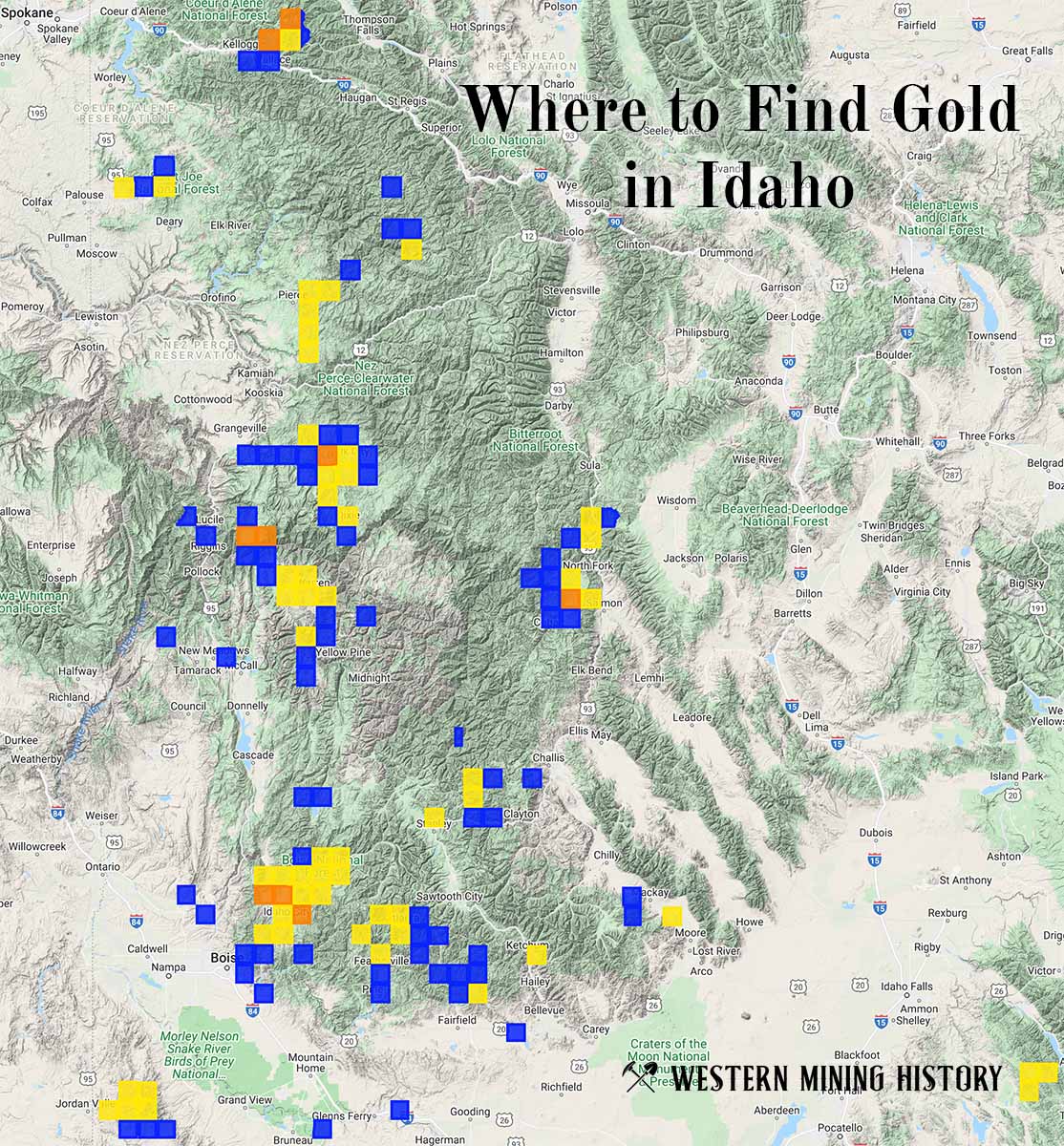
"Where to Find Gold in Idaho" looks at the density of modern placer mining claims along with historical gold mining locations and mining district descriptions to determine areas of high gold discovery potential in Idaho. Read more: Where to Find Gold in Idaho.