The Baker Lake Prospect is a molybdenum mine located in Custer county, Idaho at an elevation of 8,501 feet.
About the MRDS Data:
All mine locations were obtained from the USGS Mineral Resources Data System. The locations and other information in this database have not been verified for accuracy. It should be assumed that all mines are on private property.
Mine Info
Elevation: 8,501 Feet (2,591 Meters)
Commodity: Molybdenum
Lat, Long: 44.0594, -114.56030
Map: View on Google Maps
Baker Lake Prospect MRDS details
Site Name
Primary: Baker Lake Prospect
Secondary: Uncle Jess Deposit
Commodity
Primary: Molybdenum
Tertiary: Tungsten
Tertiary: Gold
Tertiary: Lead
Tertiary: Copper
Tertiary: Zinc
Tertiary: Silver
Location
State: Idaho
County: Custer
District: Boulder Creek, East Fork Districts
Land Status
Land ownership: National Forest
Note: the land ownership field only identifies whether the area the mine is in is generally on public lands like Forest Service or BLM land, or if it is in an area that is generally private property. It does not definitively identify property status, nor does it indicate claim status or whether an area is open to prospecting. Always respect private property.
Administrative Organization: Challis National Forest
Holdings
Not available
Workings
Not available
Ownership
Owner Name: Eddie Baker
Owner Name: Asarco (American Smelting And Refining Co.)
Production
Not available
Deposit
Record Type: Site
Operation Category: Prospect
Operation Type: Unknown
Discovery Year: 1922
Discovery Method: Unknown
Years of Production:
Organization:
Significant: N
Deposit Size: L
Physiography
General Physiographic Area: Rocky Mountain System
Physiographic Province: Northern Rocky Mountains
Physiographic Detail: Salmon River Mountains
Mineral Deposit Model
Not available
Orebody
Form: FLAKES
Structure
Type: R
Description: Stocks
Type: L
Description: Quartzite Bedding, Uncle Jess Fault
Alterations
Not available
Rocks
Not available
Analytical Data
Analytical Data: 28 OTHER SAMPLES FOUND 0.004% CU, 0.002% PB
Analytical Data: 0.02% ZN
Analytical Data: TRACE AU & AG
Analytical Data: CHIP SAMPLES NORTH ZONE: 0.01 - 0.33% MOS2
Analytical Data: SUBSURFACE SAMPLES AVE 0.15% MOS2, SURFACE SAMPLES AVE 0.10% MOS2: SAMPLES FROM SOUTH ZONE AVERAGED 0.12% MOS2.
Analytical Data: 19 SAMPLES RANGED 0.002 - 0.02% WO3
Materials
Ore: Malachite
Ore: Chalcopyrite
Ore: Molybdenite
Ore: Scheelite
Ore: Sphalerite
Ore: Galena
Gangue: Calcite
Gangue: Pyrite
Gangue: Chlorite
Gangue: Quartz
Gangue: Garnet
Comments
Comment (Reserve-Resource): 100,000 THOUSAND TONS FROM NORTH ZONE, 35000 THOUSAND TONS SOUTH ZONE
Comment (Location): AT BASE AND 1 MI NE OF CASTLE PEAK LAND STATUS VALUE CALCULATED 7-94 USING GIS OVERLAY ANALYSIS WITH USFS LAND OWNERSHIP BOUNDARIES, 1:126,720 SCALE.
Comment (Development): ASARCO DID GEOLMAP, GEOCHEM AND DDH IN 1968 AND HELD 50 CLAIMS IN AREA BY 1969
Comment (Deposit): TWO MINERALIZED ZONES: NORTH AND SOUTH. SOUTH ZONE AVERAGES 325 FT. IN WIDTH, STRIKES N 40-60 DEG E, AND DIPS 60-70 DEG SE.
Comment (Geology): WHITE CLOUD STOCK DATED LJUR-ETERT BY VISGER ( 1974 ); QUARTZ-ALBITE DIKE TRENDS NE AND IS 90 FT LONG
References
Reference (Deposit): TSCHANZ, C. M., AND OTHERS, 1974, MINERAL RESOURCES OF THE EASTERN PART OF THE SAWTOOTH NATIONAL RECREATION AREA, CUSTER AND BLAINE COUNTIES, IDAHO: USGS OPEN-FILE REPORT, 648 P.
Reference (Deposit): SPOKESMAN REVIEW, SEPT. 29 , 1968
Reference (Deposit): 1974 RECON TSCHANZ, C. M., AND OTHERS, OPEN-FILE REPT.
Reference (Deposit): SPOKANE CHRONICE, OCT. 1 , 1969
Reference (Deposit): VISGER, F.J., 1974 , THE GEOLOGY OF THE UNCLE JESS MOLYBDENITE DEPOSIT, CUSTER COUNTY, IDAHO: CHENEY, WASHINGTON, EASTERN WASHINGTON COLLEGE, M.S. THESIS, 29 P.
Reference (Deposit): 1922 DIREXPL JESS BAKER, USGS OPEN-FILE REPT.
Reference (Deposit): 1939 COMPILE MOLYBDENUM SYNDICATE, USGS OPEN-FILE REPT.
Reference (Deposit): 1942 COMPILE US BUREAU MINES, USGS OPEN-FILE REPT. {{ 4) 1968 DIREXPL AMERICAN SMELTING AND REFINING CO., USGS OPEN-FILE REPT.
Reference (Deposit): 1945 COMPILE
Reference (Deposit): IBMG MINES & PROSPECTS OF THE CHALLIS QUAD, 1982, MITCHELL
Reference (Deposit): VANNOY AND OTHERS, 1986, USGS BULL.1545E, P.254, N0.92, 93
Reference (Deposit): ROSS, C. P., 1937, U. S. GEOLOGICAL SURVEY BULLETIN 877, P. 154.
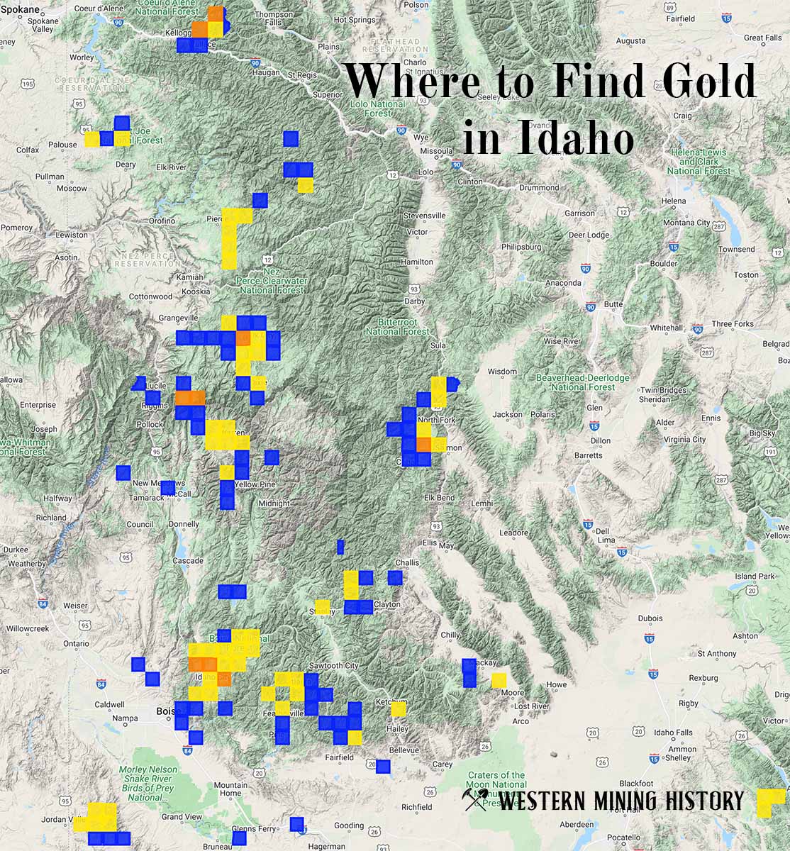
Idaho Gold

"Where to Find Gold in Idaho" looks at the density of modern placer mining claims along with historical gold mining locations and mining district descriptions to determine areas of high gold discovery potential in Idaho. Read more: Where to Find Gold in Idaho.