The Polar Star Mine is a copper mine located in Skamania county, Washington at an elevation of 3,399 feet.
About the MRDS Data:
All mine locations were obtained from the USGS Mineral Resources Data System. The locations and other information in this database have not been verified for accuracy. It should be assumed that all mines are on private property.
Mine Info
Elevation: 3,399 Feet (1,036 Meters)
Commodity: Copper
Lat, Long: 46.3525, -122.10611
Map: View on Google Maps
Polar Star Mine MRDS details
Site Name
Primary: Polar Star Mine
Secondary: Claims: Phil Sheridan Nos. 1 and 2
Secondary: Polar Star Jr. Nos. 1-3
Secondary: Polar Star Nos. 1-3
Secondary: Black Falls Nos. 1 and 2
Secondary: Blackhawk
Commodity
Primary: Copper
Secondary: Silver
Secondary: Gold
Tertiary: Arsenic
Tertiary: Molybdenum
Location
State: Washington
County: Skamania
District: St. Helens District - Ryan Lake Area
Land Status
Land ownership: National Monument
Note: the land ownership field only identifies whether the area the mine is in is generally on public lands like Forest Service or BLM land, or if it is in an area that is generally private property. It does not definitively identify property status, nor does it indicate claim status or whether an area is open to prospecting. Always respect private property.
Administrative Organization: Mt St. Helens National Monument
Holdings
Type: Patented
Workings
Type: Underground
Ownership
Owner Name: Champion International Corp.
Years: 1992 -
Production
Not available
Deposit
Record Type: Site
Operation Category: Prospect
Deposit Type: Vein, porphyry copper
Operation Type: Underground
Years of Production:
Organization:
Significant: N
Deposit Size: S
Physiography
General Physiographic Area: Pacific Mountain System
Physiographic Province: Cascade-Sierra Mountains
Physiographic Section: Northern Cascade Mountains
Mineral Deposit Model
Not available
Orebody
Form: BRECCIA MATRIX
Structure
Not available
Alterations
Alteration Type: L
Alteration Text: Oxidation, Sericitized
Rocks
Name: Quartz Monzonite
Role: Host
Age Type: Host Rock Unit
Age Young: Miocene
Name: Quartz Monzonite
Role: Host
Age Type: Host Rock
Age Young: Miocene
Analytical Data
Analytical Data: 3 SAMPLES (1909): 4.2-15.4% CU, 0.09-0.7 OZ/TON AU, 3.59-14.56 OZ/TON AG
Analytical Data: 0.05-5.13% CU, TR-0.08 OZ/TON AU, 0-2.88 OZ/TON AG. ASSAY OF MATERIAL STOCKPILED AT PORTAL (1958): 3.45% CU, 2.6 OZ/TON AG, 0.08/TON AU. ASSAY OF LENS SEVERAL IN.-36 IN. THICK, TRACED FOR 6 FT IN A DRIFT: 0.1% CU, TR AU, 0.5 OZ/TON AG. 5 SAMPLES TAKEN ALONG ORE BODY AVERAGE $89/TON IN CU+AU+AG (AT 1905 VALUES). A SMELTING TEST FROM AVERAGE ORE TAKEN FROM DEPTH OF 10 FT IN WINZE AND FROM ADIT AVERAGED 17.9% CU+AU+AG
Analytical Data: 10 SAMPLES (1908): 4.9-30.8% CU, 0.02-0.08 OZ/TON AU, 0.80-10.8 OZ/TON AG
Materials
Ore: Chalcopyrite
Ore: Arsenopyrite
Ore: Malachite
Ore: Chalcocite
Ore: Bornite
Ore: Pyrite
Gangue: Talc
Gangue: Tourmaline
Gangue: Sericite
Gangue: Quartz
Comments
Comment (Development): MAIN DEVELOPMENT WORK UNDERTAKEN BY CASCADIA MINING & DEVELOPEMTN CO FROM 1901 THROUGH 1905. DRILLING IN SUMMER OF 1991 BEING UNDERTAKEN BY CHAMPION INTERNATIONAL CORP. AND CONTINUED IN 1992
Comment (Reserve-Resource): IN 1958 AN ESTIMATED 350 TONS OF ORE WAS STOCKPILED AT THE PORTAL. IN 1960 STOCKPILE AND OTHER DUMP MEATERIAL WAS USED TO SURFACE LOGGING ROADS IN THE AREA.
Comment (Location): NEAR BLACK FALLS, LOW ON SOUTHERN SLOPE OF GOAT MOUNTAIN NORTH OF GREEN RIVER NEAR NORTH EDGE OF BLAST ZONE FROM 1980 ERUPTION OF MOUNT ST. HELENS. PROPERTY CONSISTS OF 11 PATENTED CLAIMS, 19 UNPATENTED CLAIMS.
Comment (Deposit): DEPOSIT HAS BEEN GIVEN THE INFORMAL NAME OF A BRECCIA PIPE CU DEPOSIT, FOR WHICH THERE IS NO PUBLISHED MODEL. ADIT WAS DRIVEN ALONG A PERSISTANT FRACTURE ZONE IN QUARTZ MONZONITE - FRACTURES RANGE FROM SEVERAL IN.-2 FT THICK. MATERIAL IN FRACTURE ZONE CONSISTS OF QUARTZ, GOUGE, TALC, AND WALL-ROCK FRAGMENTS CEMENTED BY QUARTZ. PYRITE AND MINOR CHALCOPYRITE ARE PRESENT IN QUARTZ AND IN SILICIFIED AND SERICITIZED WALL ROCK. CHALCOCITE CONTAINING 80 OZ/TON AG IS REPORTED TO BE EXPOSED AT THE BOTTOM OF A 100 FT WINZE. ABOUT 10 FT BELOW DRIFT IN NO. 2 WINZE IS SPECTACULAR EXPOSURE OF NEARLY MASSIVE BORNITE AND CHALCOPYRITE.
Comment (Workings): 775 FT ADIT, FIRST 450 FT OF ADIT BEARS N40E, REMAINING 325 FT BEARS N85-90E. RAISE, 2 WINZES, SEVERAL SHAFTS
Comment (Deposit): MAPS OF CLAIMS AND MINE WORKINGS AVAILABLE and property description, MOEN (1977, p. 18-24)
Comment (Deposit): MRDS RECORD M700155 HAS BEEN MERGED WITH THIS RECORD AND DELETED
Comment (Workings): 11 MINES, 0 PROSPECTS.
References
Reference (Deposit): DERKEY, R.E., GULICK, C.W., AND LINGLEY, W.S., JR., 1993, WASHINGTON'S MINERAL INDUSTRY - 1992: WASHINGTON GEOLOGY, V. 21, NO. 1, P. 3-25.
Reference (Deposit): ASHLEY, R.P., AND PETERSON, J.A., 1991, FILED EXAM WITH CONSULTANT RON PARKER WORKING FOR CHAMPION LUMBER
Reference (Deposit): MOEN, W.S., 1977, ST. HELENS AND WASHOUGAL MINING DISTRICTS OF THE SOUTHERN CASCADES OF WASHINGTON: WASHINGTON DIVISION OF GEOLOGY AND EARTH RESOURCES INFORMATION CIRCULAR 60, P. 17-24.
Reference (Deposit): LANDES, HENRY, THYNG, W.S., LYON, D.A., AND ROBERTS, MILNOR, 1902, THE METALLIFEROUS RESOURCES OF WASHINGTON, EXCEPT IRON: WASHINGTON GEOLOGICAL SURVEY ANNUAL REPORT FOR 1901, V. 1, PT. 2, P. 134.
Reference (Deposit): HUNTTING, M.T., 1956, INVENTORY OF WASHINGTON MINERALS - PART II, METALLIC MINERALS: WASHINGTON DIVISION OF MINES AND GEOLOGY BULLETIN 37, V. 1, P. 78. (also includes Black Falls property on p. 76)
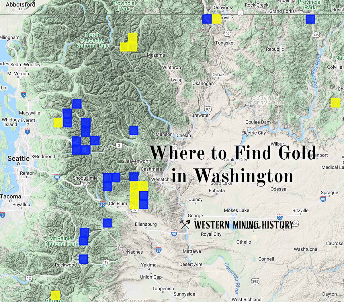
Washington Gold

"Where to Find Gold in Washington" looks at the density of modern placer mining claims along with historical gold mining locations and mining district descriptions to determine areas of high gold discovery potential in Arizona. Read more: Where to Find Gold in Washington.