The Haynes-Stellite Mine is a copper and cobalt mine located in Lemhi county, Idaho at an elevation of 6,250 feet.
About the MRDS Data:
All mine locations were obtained from the USGS Mineral Resources Data System. The locations and other information in this database have not been verified for accuracy. It should be assumed that all mines are on private property.
Mine Info
Elevation: 6,250 Feet (1,905 Meters)
Commodity: Copper, Cobalt
Lat, Long: 45.1123, -114.31534
Map: View on Google Maps
Haynes-Stellite Mine MRDS details
Site Name
Primary: Haynes-Stellite Mine
Secondary: Cobalt Mine
Secondary: Mona Group
Secondary: Belielle
Secondary: Beliel Group
Commodity
Primary: Copper
Primary: Cobalt
Tertiary: Nickel
Tertiary: Uranium
Location
State: Idaho
County: Lemhi
District: Blackbird
Land Status
Land ownership: National Forest
Note: the land ownership field only identifies whether the area the mine is in is generally on public lands like Forest Service or BLM land, or if it is in an area that is generally private property. It does not definitively identify property status, nor does it indicate claim status or whether an area is open to prospecting. Always respect private property.
Administrative Organization: Salmon National Forest
Holdings
Not available
Workings
Type: Underground
Ownership
Owner Name: Haynes-Stellite Co. (later absorbed by Union Carbide Co.)
Info Year: 1947
Years: 1915 -
Owner Name: M. Belielle
Info Year: 1947
Years: 1900 - 1915
Owner Name: Hanna Mining Co.
Production
Year: 1921
Time Period: 1917-1921
Material type: CON
Description: Cp_Grade: ^17.74% Co
Deposit
Record Type: Site
Operation Category: Past Producer
Operation Type: Underground
Year First Production: 1917
Discovery Year: 1900
Discovery Method: Ore-Mineral In Place
Years of Production:
Organization:
Significant: Y
Deposit Size: S
Physiography
General Physiographic Area: Rocky Mountain System
Physiographic Province: Northern Rocky Mountains
Physiographic Detail: Salmon River Mountains
Mineral Deposit Model
Model Name: Blackbird Co-Cu
Orebody
Form: IRREGULAR VEINLETS, MASSES
Structure
Type: L
Description: Haynes-Stellite Structural Block
Alterations
Alteration Type: L
Alteration: Silicification
Alteration Type: L
Alteration: Tourmalinization
Alteration Text: Silicification, Tourmalinization
Rocks
Name: Schist
Role: Host
Age Type: Host Rock Unit
Age Young: Mesoproterozoic
Age Old: Mesoproterozoic
Name: Phyllite
Role: Host
Age Type: Host Rock Unit
Age Young: Mesoproterozoic
Age Old: Mesoproterozoic
Name: Quartzite
Role: Host
Age Type: Host Rock Unit
Age Young: Mesoproterozoic
Name: Quartzite
Role: Host
Age Type: Host Rock
Age Young: Mesoproterozoic
Analytical Data
Analytical Data: Umpleby (1913, p. 165) describes one 20 foot sample ran a fraction less than 2% cobalt, and a second ran 2% nickel and less than 1% cobalt.
Analytical Data: 1.0% Co
Analytical Data: LOW-GRADE RADIOACTIVE ROCK RANGING FROM 0.013 - 0.018% EQUIVALENT URANIUM FOUND
Materials
Ore: Cobaltite
Ore: Annabergite
Ore: Smaltite
Gangue: Limonite
Gangue: Pyrite
Gangue: Quartz
Gangue: Tourmaline
Comments
Comment (Location): N. SIDE BLACKBIRD CREEK, 4 MI. UP FROM ITS MOUTH
Comment (Development): HAYNES-STELLITE NOW INCLUDED IN BLACKBIRD MINE, SEE NO. 363. ; ECON.COM: CO EXTRACTION PROBLEMS
Comment (Workings): WORKINGS CONSIST OF 3 MAIN ADITS AND 2 MINOR ADITS, 10 STAMP MILL, AERIAL TRAMWAY
Comment (Geology): GEOL.DESC: FINE-GRAINED COBALTITE AND MINOR AMOUNTS OF PYRITE IN INTENSELY TOURMALINIZED AND SILICIFIED FAULT BRECCIA, LIMITED ON STRIKE AND DIP.
Comment (Production): Reed and Herdlick (1947, p.6) "Last worked in 198, the property has produced about 45% of the district's total cobalt output."
Comment (Geology): Reed and Herdlick (1947, p.8) "Cobalt found in silicified and tournmalinized breccias....Haynes-Stellite-type mineralizationis confined to the less deformed and more quartzitic rocks."
Comment (Development): 14 Unpatented Claims; Claims Relocated In 1939 Became Parts Of Haynes - Stellite Mine, Ludwig Property, And Patty B Property. ; Econ.Com: Transportation And Other Costs Made Shipments Unprofitable (1915).
Comment (Location): Location identified by Art Bookstrom on Google Earth.
Comment (Geology): "Country rock is interbedded quartzite and sandy phyllite. Mineralized rock consists of a silicified and tourmalinized brecciated zone containing small stringers and disseminated grains of very fine-grained cobaltite, and minor amounts of pyrite." Vhay (1948, plate 3B)
References
Reference (Deposit): ANDERSON, A.L., 1943, PRELIMINARY REPORT ON THE COBALT DEPOSITS IN THE BLACKBIRD DISTRICT: IDAHO BUREAU OF MINES AND GEOLOGY PAMPHLET 61.
Reference (Deposit): CANNEY, F.C., 1953, PRELIMINARY REPORT OF GEOCHEMICAL INVESTIGATIONS IN THE BLACKBIRD DISTRICT, IDAHO: USGS OPEN-FILE REPT 53-31, 21 p.
Reference (Deposit): TRITES, A.F. AND TOOKER, E.W., 1953, URANIUM AND THORIUM DEPOSITS IN EAST-CENTRAL IDAHO, SOUTHWESTERN MONTANA: USGS BULL. 988-H, P. 175-176.
Reference (Deposit): ROSS, C.P., 1931, CLASSIFICATION OF THE LODE DEPOSITS OF SOUTH-CENTRAL IDAHO: ECONOMIC GEOLOGY, V. 26, NO. 2, P. 169-185.
Reference (Deposit): BALDWIN, J.A., OCTOBER 8, 1976, PERSONAL COMMUNICATION.
Reference (Deposit): TREXLER, B.D., JR., 1974, UNPUBLISHED BLACKBIRD REPORT
Reference (Deposit): Reed, G.C. and Herdlick, J.A., 1947, Blackbird cobalt deposits, Lemhi County, Idaho: U.S. Bureau of Mines R.I. 4012, 36 p.
Reference (Deposit): Bell, R. N., 1912, Thirteenth Annual Report Of The Mining Industry Of Idaho For The Year 1911.
Reference (Deposit): BILBREY, J.H., JR., 1962, U.S. BUREAU OF MINES INF. CIRC. 8103, P.26
Reference (Deposit): VHAY, J.S., 1948, COBALT-COPPER DEPOSITS IN THE BLACKBIRD DISTRICT, LEMHI COUNTY, IDAHO: USGS STRATEGIC MINERALS INV. PRELIM. REPT. 3-219.
Reference (Deposit): SHOCKEY, P.N., 1957, RECONNAISSANCE GEOLOGY OF THE LEESBURG QUADRANGLE, LEMHI COUNTY, IDAHO: IDAHO BUREAU OF MINES AND GEOLOGY PAMPHLET 113, 42 P.
Reference (Deposit): UMPLEBY, J.B., 1913, GEOLOGY AND ORE DEPOSITS OF LEMHI COUNTY, IDAHO: USGS BULL. 528, 182 P.
Reference (Production): BILBREY, J.H. JR., 1962, USBM INF. CIRC. 8103; ANDERSON, A.L., 1947, IDAHO BUREAU OF MINES AND GEOLOGY PAMPHLET 61. ; TREXLER, B.D., JR., 1974, UNPUBLISHED REPORT; VHAY, J.S., 1948, USGS STRATEGIC MINERALS INV. PRELIM. REPT. 3-219
Reference (Reserve-Resource): UNPUBLISHED COBALT REPORT
Reference (Deposit): HESS, F.L., 1921, COBALT: USGS MINERAL RESOURCES OF US, 1917, PT. 1, P. 899-901
Reference (Deposit): BELL, R.N., 1918, NINETEENTH ANNUAL REPORT OF THE MINING INDUSTRY OF IDAHO FOR THE YEAR 1917, 131 P.
Idaho Gold

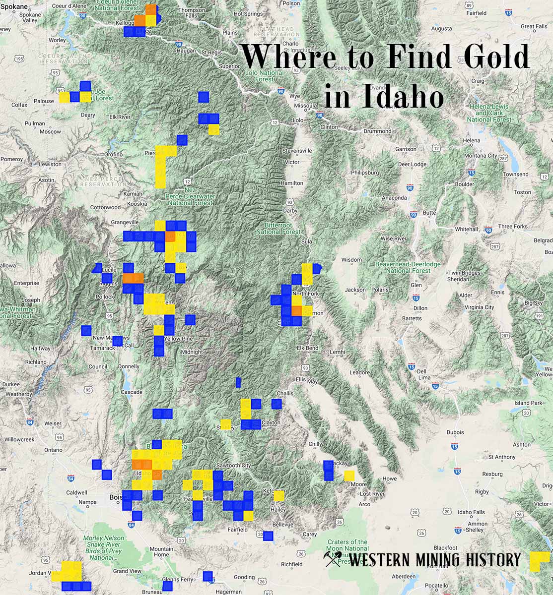
"Where to Find Gold in Idaho" looks at the density of modern placer mining claims along with historical gold mining locations and mining district descriptions to determine areas of high gold discovery potential in Idaho. Read more: Where to Find Gold in Idaho.