The Black Pine Project is a copper and cobalt mine located in Lemhi county, Idaho at an elevation of 7,500 feet.
About the MRDS Data:
All mine locations were obtained from the USGS Mineral Resources Data System. The locations and other information in this database have not been verified for accuracy. It should be assumed that all mines are on private property.
Mine Info
Elevation: 7,500 Feet (2,286 Meters)
Commodity: Copper, Cobalt
Lat, Long: 45.04685, -114.20380
Map: View on Google Maps
Black Pine Project MRDS details
Site Name
Primary: Black Pine Project
Secondary: Blackpine Mine
Secondary: Shulenberger Prospect
Secondary: Cobalt Nos. 1, 2, 5, 6, 10, 15, and 16 Cobalt Nos. 1, 2, 5, 6, 10, 15, and 16
Commodity
Primary: Copper
Primary: Cobalt
Secondary: Silver
Secondary: Gold
Tertiary: Nickel
Location
State: Idaho
County: Lemhi
District: Blackbird Mining District
Land Status
Land ownership: National Forest
Note: the land ownership field only identifies whether the area the mine is in is generally on public lands like Forest Service or BLM land, or if it is in an area that is generally private property. It does not definitively identify property status, nor does it indicate claim status or whether an area is open to prospecting. Always respect private property.
Administrative Organization: Salmon National Forest
Holdings
Type: Located Claim
Workings
Type: Surface/Underground
Ownership
Owner Name: Montana Coal And Iron Co.
Home Office: Montana
Info Year: 1960
Owner Name: Formation Metals (Formation Capital Corp.)
Percent: 100.0
Home Office: Canada
Info Year: 1992
Production
Not available
Deposit
Record Type: Site
Operation Category: Past Producer
Plant Type: Leach
Plant Subtype: Hydromet
Operation Type: Surface
Mining Method: Open Pit
Milling Method: Leach-Solvent-Extract-Electrowin
Discovery Method: Ore-Mineral In Place
Years of Production:
Organization:
Significant: Y
Deposit Size: S
Physiography
General Physiographic Area: Rocky Mountain System
Physiographic Province: Northern Rocky Mountains
Mineral Deposit Model
Model Name: Blackbird Co-Cu
Orebody
Form: SHEAR ZONE
Form: IRREGULAR VEINLETS, STRINGERS, PODS
Structure
Type: L
Structure: Bedding
Type: L
Structure: Syncline
Type: L
Structure: Reverse Faults
Alterations
Alteration Type: L
Alteration: Oxidation
Alteration Type: L
Alteration: Chloritization
Alteration Type: L
Alteration: SERICITIC
Rocks
Name: Quartzite
Role: Host
Age Type: Host Rock Unit
Age Young: Neoproterozoic
Analytical Data
Analytical Data: CO GENERALLY LESS THAN 0.1%. BUT LOCALLY AS MUCH AS 2.7%
Analytical Data: MODERATE TONNAGE OF 6 % CU ORE
Analytical Data: THERE ARE HIGH GRADE BANDS OF SOLID CHALCOPYRITE IN VEIN
Materials
Ore: Malachite
Ore: Covellite
Ore: Chalcocite
Ore: Bornite
Ore: Chalcopyrite
Gangue: Pyrite
Gangue: Limonite
Comments
Comment (Exploration): THE DMEA HAS DONE A GOOD DEAL OF DEVELOPMENT WORK AT THIS PROPERTY. THE PROGRAM RESULTED IN THE DISCOVERY OF 29,800 ST OF INDICATED ORE WITH AN AVERAGE GRADE OF 6.1% COPPER AND 2,200 ST OF INFERRED ORE WITH AN AVERAGE GRADE OF 5.4% CU. IN 1994 EXPLORATION 5 OF 6 ZONES WERE TESTED; PROGRAM DISCOVER- ED 9.2 FT OF 1.249% CO AND 0.409 OZ AU/ST (14.02 G/MT).
Comment (Economic Factors): A NEARLY COMPLETE MILL FACILITY IS STILL LOCATED ON THE PROPERTY.
Comment (Geology): ORE IS BOTH CU-CO OXIDES AND CO-CU-AU SULFIDES.
Comment (Economic Factors): OLD UNDERGROUND MINE WORKING WILL BE OPENED UP, MAPPED, SAMPLED TO CONFIRM RESERVES AND DEFINE PRESENCE OF HIGH GRADE COBALT.
Comment (Economic Factors): MINE WAS LAST MINED IN THE 1960; THEIR ARE OVER 4500 FT OF UNDERGROUND WORKINGS.
Comment (Deposit): 2 VEINS
Comment (Development): FLOTATION MILL IN 1956 ; ECON.COM: HEAVY GROUND ALONG MINERALIZED SHEAR ZONES REQUIRES MUCH TIMBERING (SIX MILLSITES BEING VALIDLY USED IN CONJUNCTION WITH THESE CLAIMS - BLACK PINE, CROSS CUT COPPER, NO. 1 FRACTION, BIG COBALT, BIG COBALT NOS 1 AND 2)
Comment (Geology): BEDDING TRENDS NW AND DIPS NE ; GEOL.DESC: 2 VEIN ZONES:(A)CHALCOPYRITE-PYRITE ON 40-90 FT. NORTHWEST-STRIKING, NORTHEAST DIPPING SHEAR ZONE(NO COBALT);(B)QUARTZ VEIN CARRYING COBALTIAN ARSENOPYRITE 140 FT. NORTHEAST OF (A) ZONE; COUNTRY ROCK HIGHLY FOLDED.
Comment (Location): NEAR HEADWATERS OF N. BRANCH OF COPPER CREEK
Comment (Production): ITEM 1 WAS PROBABLY A TEST SHIPMENT (This statement doesn't make sense. No production was given in old MRDS record, or at least was not copied to new MRDS record.)
Comment (Workings): 5 ADITS TRENDING NW WITH DRIFTS TO SW; NUMEROUS TRENCHES
References
Reference (Economic Factors): Forest Service Mineral EXAM 1958 PLUM
Reference (Deposit): MITCHELL, V.E., ET AL, 1982, ELK CITY QUAD: Idaho Bureau of Mines and Geology MINES AND PROSPECT 1982 MAP SERIES. scale 1:250,000.
Reference (Deposit): INTERATIONAL MINING NEWS, 9-28-94, P1.
Reference (Deposit): MINING RECORD, 8-10-94, P.3.
Reference (Deposit): THE NORTHERN MINER, 4-12-93, P.3.
Reference (Deposit): THE NORTHERN MINER, 6-21, 93, P.16.
Reference (Deposit): SHOCKEY, P.N., 1957, RECONNAISSANCE GEOLOGY OF THE LEESBURG QUADRANGLE, LEMHI COUNTY, IDAHO: IDAHO BUREAU OF MINES AND GEOLOGY PAMPHLET 113, 42 P.
Reference (Reserve-Resource): RANDOL MINING DIRECTORY, 1996/97, U.S. MINES & MINING COMPANIES, P. 194.
Reference (Reserve-Resource): RANDOL MINING DIRECTORY, 1994/95, U.S. MINES & MINING COMPANIES, P. 267.
Reference (Reserve-Resource): THE NORTHERN MINER, 11-1-93, P.1, 10.
Reference (Reserve-Resource): ITEM 1, UNPUBLISHED COBALT REPORT; ITEM 2, DMEA FILES
Reference (Deposit): JONES, R.W., 1959, BLACKPINE: IDAHO BUREAU OF MINES AND GEOLOGY OPEN-FILE REPT.
Idaho Gold

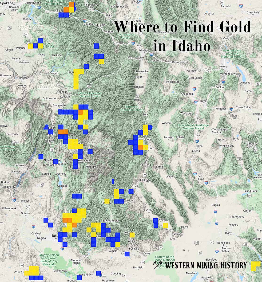
"Where to Find Gold in Idaho" looks at the density of modern placer mining claims along with historical gold mining locations and mining district descriptions to determine areas of high gold discovery potential in Idaho. Read more: Where to Find Gold in Idaho.