The Southwest Oregon Beach Sands is a chromium mine located in Coos county, Oregon at an elevation of 299 feet.
About the MRDS Data:
All mine locations were obtained from the USGS Mineral Resources Data System. The locations and other information in this database have not been verified for accuracy. It should be assumed that all mines are on private property.
Mine Info
Elevation: 299 Feet (91 Meters)
Commodity: Chromium
Lat, Long: 43.3167, -124.60000
Map: View on Google Maps
Southwest Oregon Beach Sands MRDS details
Site Name
Primary: Southwest Oregon Beach Sands
Secondary: Shepard Mine
Secondary: Section 33 Deposit
Secondary: Lagoons Area
Secondary: Eagle Mine
Secondary: Pioneer Mine
Secondary: Independence Mine
Secondary: Butler Or Baker Mine
Secondary: Chickamin Mine
Secondary: Krome Corporation Mine
Commodity
Primary: Chromium
Tertiary: Garnet
Tertiary: Aluminum
Tertiary: Calcium
Tertiary: Gold
Tertiary: Iron
Tertiary: Platinum
Tertiary: Silica
Tertiary: Titanium
Tertiary: Zirconium
Location
State: Oregon
County: Coos
District: Unorganized District
Land Status
Land ownership: Private
Note: the land ownership field only identifies whether the area the mine is in is generally on public lands like Forest Service or BLM land, or if it is in an area that is generally private property. It does not definitively identify property status, nor does it indicate claim status or whether an area is open to prospecting. Always respect private property.
Holdings
Type: Other
Type: Fee Ownership
Workings
Type: Surface
Ownership
Not available
Production
Not available
Deposit
Record Type: Site
Operation Category: Past Producer
Operation Type: Surface
Mining Method: Strip-Hillside
Year First Production: 1943
Discovery Year: 1852
Years of Production:
Organization:
Significant: N
Deposit Size: S
Physiography
Not available
Mineral Deposit Model
Not available
Orebody
Not available
Structure
Not available
Alterations
Not available
Rocks
Not available
Analytical Data
Not available
Materials
Unknown: Chromite
Unknown: Zircon
Unknown: Rutile
Unknown: Quartz
Unknown: Olivine
Unknown: Manganite
Unknown: Ilmenite
Unknown: Garnet
Unknown: Epidote
Unknown: Pyroxene
Comments
Comment (Deposit): RECORD 040 EXTENDS INTO DRAINAGE BASINS 7316 AND 7317 RECORD 040 BEACH AREAS ARE USED FOR RECREATIONAL PURPOSES RECORD 040 EMPIRE QUAD LANGLOIS QUAD GOLD BEACH PORT OXFORD 050 GOLD WAS PRODUCED FROM DISCOVERY DATE UNTIL 1930 ON SMAL 050 MAPPING AND SURFACE SAMPLING CONTINUED FROM 1941 THRU 19 060 UPLIFTING EROSION AND SUBMERGENCE 080 CONTROLED BY WEATHERING AND REDEPOSITION OF SOURCE ROCK 101 GOLD AND PLATINUM OCCURS IN TRACE AMOUNTS SEE USBM FILES 15.20 15.22 15.39 15.40 15.48 AND 15.113 RECORD 130 WORKING CAP. 360 M EQUIPMENT 3MM DEVELOPMENT 0 AC RECORD 130 EXPLORATION COST 0 BENEFICIATION BY GRAVITY PRODUCES1600 MT 25% GRADE 70% RECOV TO HI TENSION AND MAGNETIC PLANT PRODUCES 42% GRADE 90% RECO
References
Reference (Reserve-Resource): USGS BULLETIN 945E GEOLOGY OF DEPOSITS RESOURCE ESTIMATES
Reference (Reserve-Resource): AND EXPLORATION.
Reference (Deposit): U.S. GEOLOGICAL SURVEY BULLETIN 945-E, 1944, P. 140.
Oregon Gold

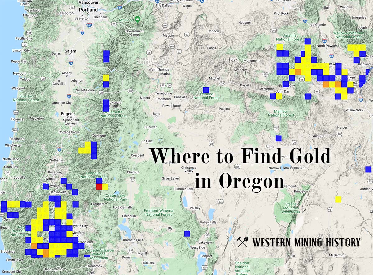
"Where to Find Gold in Oregon" looks at the density of modern placer mining claims along with historical gold mining locations and mining district descriptions to determine areas of high gold discovery potential in Oregon. Read more: Where to Find Gold in Oregon.