The Dewey Mine is a gold mine located in Valley county, Idaho at an elevation of 7,598 feet.
About the MRDS Data:
All mine locations were obtained from the USGS Mineral Resources Data System. The locations and other information in this database have not been verified for accuracy. It should be assumed that all mines are on private property.
Mine Info
Elevation: 7,598 Feet (2,316 Meters)
Commodity: Gold
Lat, Long: 44.9578, -115.14470
Map: View on Google Maps
Dewey Mine MRDS details
Site Name
Primary: Dewey Mine
Secondary: Dewey
Secondary: Dewey-Sunnyside
Secondary: Dewey Dome
Secondary: Dewey Hill
Secondary: Sunnyside
Secondary: Golden Reef
Commodity
Primary: Gold
Secondary: Silver
Tertiary: Titanium
Location
State: Idaho
County: Valley
District: Thunder Mountain District
Land Status
Land ownership: National Forest
Note: the land ownership field only identifies whether the area the mine is in is generally on public lands like Forest Service or BLM land, or if it is in an area that is generally private property. It does not definitively identify property status, nor does it indicate claim status or whether an area is open to prospecting. Always respect private property.
Administrative Organization: Payette National Forest
Holdings
Type: Private Lease
Type: Patented
Type: Located Claim
Workings
Type: Surface/Underground
Ownership
Owner Name: Golden Reef Mining Co.
Company ID: 1001565
Percent: 100.0
Home Office: P. O. Box 8007, Boise, Id 83707
Info Year: 1981
Owner Name: Dewey Mining Co.
Percent: 100.0
Home Office: Idaho
Info Year: 1996
Owner Name: USMX, Inc.
Home Office: Colorado
Info Year: 1996
Years: 1993 -
Owner Name: Thunder Mountain Gold, Inc.
Percent: 50.00
Home Office: Washington
Info Year: 1996
Years: 1992 -
Owner Name: Dewey Mining Co.
Percent: 50.00
Home Office: Idaho
Info Year: 1996
Years: 1992 -
Production
Not available
Deposit
Record Type: Site
Operation Category: Past Producer
Plant Type: Leach
Operation Type: Surface
Mining Method: Open Pit
Milling Method: Heap Leach-Electrowin
Discovery Year: 1894
Discovery Method: Ore-Mineral In Place
Years of Production:
Organization:
Significant: Y
Deposit Size: S
Physiography
General Physiographic Area: Rocky Mountain System
Physiographic Province: Northern Rocky Mountains
Mineral Deposit Model
Not available
Orebody
Not available
Structure
Not available
Alterations
Alteration Type: L
Alteration: Silicification
Alteration Type: L
Alteration: Complex Clay - Mineral Alteration
Rocks
Name: Clastic Sedimentary Rock
Role: Host
Age Type: Host Rock
Age Young: Eocene
Analytical Data
Analytical Data: ASSAYS OF 7 SAMPLES AVERAGED 0.11 TROY OZ AU AND 0.25 TROY OZ AG/TON. AVERAGE GRADE ALL SEDIMENTS 0.02 OZ AU AND 0.23 OZ AG/TON
Materials
Ore: Pyrargyrite
Ore: Anatase
Ore: Rutile
Ore: Ilmenite
Gangue: Montmorillonite
Gangue: Kaolinite
Gangue: Jarosite
Gangue: Zircon
Gangue: Fluorite
Gangue: Clinoptilolite
Gangue: Chalcedony
Gangue: Goethite
Comments
Comment (Production): 1896 - 1942. TOTAL AU AND AG PRODUCTION ESTIMATED MORE THAN $445,000 (MOSTLY PRIOR TO 1908).
Comment (Deposit): THIS PROPERTY IS ADJACENT TO THE THUNDER MOUNTAIN PROPERTY. USMX FOCUSED DEVELOPMENT DRILLING ON PROPERTY, 1994. OTHER TARGETS IN THE AREA INCLUDED POWDER CABIN; GOLD BUG EXT; & LIGHTNING PEAK:
Comment (Geology): GOLD OCCURS IN DISSEMINATED, VEIN, AND PLACER DEPOSITS. MARGINAL RESERVES TOTAL 3,719,000 TONS AVERAGING 0.13-0.18 OUNCES GOLD PER TON.
Comment (Economic Factors): PROPERTY COULD BE DEVELOPED INTO MINE BY 1997 WITH AN ESTIMATED 5 YEAR LIFE.
Comment (Development): 10 - STAMP MILL; 13 CLAIMS, INCLUDING SEVERAL FRACTIONS, TOTAL 141.26 ACRES ; ECON.COM: 1909 MUDFLOW MAY REMOBILIZE
Comment (Workings): MILL, 2 MAIN HAULAGE LEVELS, 2 INTERMEDIATE LEVELS, SEVERAL ADITS. ONE STOPE WAS 10 SQUARE SETS HIGH, 46 SQUARE SETS LONG. ALL STOPES WERE BIG.
Comment (Geology): CARBONACEOUS MUDFLOW BRECCIA AVERAGED 0.05 OZ AU AND 0.18 OZ AG/TON; CARBONACEOUS VOLCANIC SANDSTONE AVERAGED 0.05 OZ AU AND 0.32 OZ AG/TON.
Comment (Location): NEAR HEAD OF MULE CREEK ON NW SLOPE OF THUNDER MOUNTAIN
Comment (Exploration): IN 1993 THE COMBINED COMPANIES ENTERED INTO AN AGREEMENT WITH U.S.M.X. TO DO EXPLORATION DRILLING ON THE DEWEY CLAIMS.
Comment (Ownership): IN MARCH OF 1992 THUNDER MOUNTAIN GOLD AND DEWEY MINING COMPANY ENTERED INTO AN AGREEMENT TO COMBINE THE MAJORITY OF THE CLAIM GROUPS IN THE THUNDER MOUNTAIN GOLD MINING DISTRICT, INTO THE THUNDER MOUNTAIN PROJECT. THE DEWEY WILL BE THE FIRST MINE. USMX (THE LESSEE) WILL OPERATE THE MINE USING A CONTRACT MINER.
References
Reference (Deposit): AMERICAN MINES HANDBOOK, 1997, PP. 263, 271.
Reference (Deposit): RANDOL MINING DIRECTORY, 1994/95, U.S. MINES & MINING COMPANIES, P269.
Reference (Reserve-Resource): AMERICAN MINES HANDBOOK, 1997, P 271.
Reference (Reserve-Resource): RANDOL MINING DIRECTORY, 1996/97, U.S. MINES & MINING COMPANIES, P195.
Reference (Deposit): CATER, F. W., AND OTHERS, 1973, MINERAL RESOURCES OF THE IDAHO PRIMITIVE AREA AND VICINITY, IDAHO: U. S. GEOLOGICAL SURVEY BULL. 1304, 431 P.
Reference (Deposit): 1936 RECON IDAHO BUREAU OF MINES AND GEOLOGY PAMPH 44
Reference (Reserve-Resource): MINERAL RESOURCES OF THE IDAHO PRIMITIVE AREA AND VICINITY, IDAHO, GEOLOGICAL SURVEY BULLETIN 1304, 1973, PG. 60-61, AND 68-76.
Reference (Deposit): 1927 OTHER IDAHO BUREAU OF MINES AND GEOLOGY PAMPH 25
Reference (Deposit): USBM, 1975, ACTIVITY OF IDAHO MINING PROPERTIES 1974, USBM, BOISE, IDAHO, 61 P.
Reference (Deposit): ROSS, C. P., 1927 , ORE DEPOSITS IN THE TERTIARY LAVA IN THE SALMON RIVER MOUNTAINS, IDAHO: IDAHO BUREAU OF MINES AND GEOLOGY PAMPHLET 25 , 20 P.
Reference (Production): SHENON, P. J., AND ROSS, C. P., 1936, IDAHO BUREAU OF MINES AND GEOLOGY PAMPHLET 33, P. 38.
Reference (Deposit): SHENON, P. J., AND ROSS, C. P., 1936, GEOLOGY AND ORE DEPOSITS NEAR EDWARDSBURG AND THUNDER MOUNTAIN, IDAHO: IDAHO BUREAU OF MINES AND GEOLOGY PAMPHLET 44, 45 P.
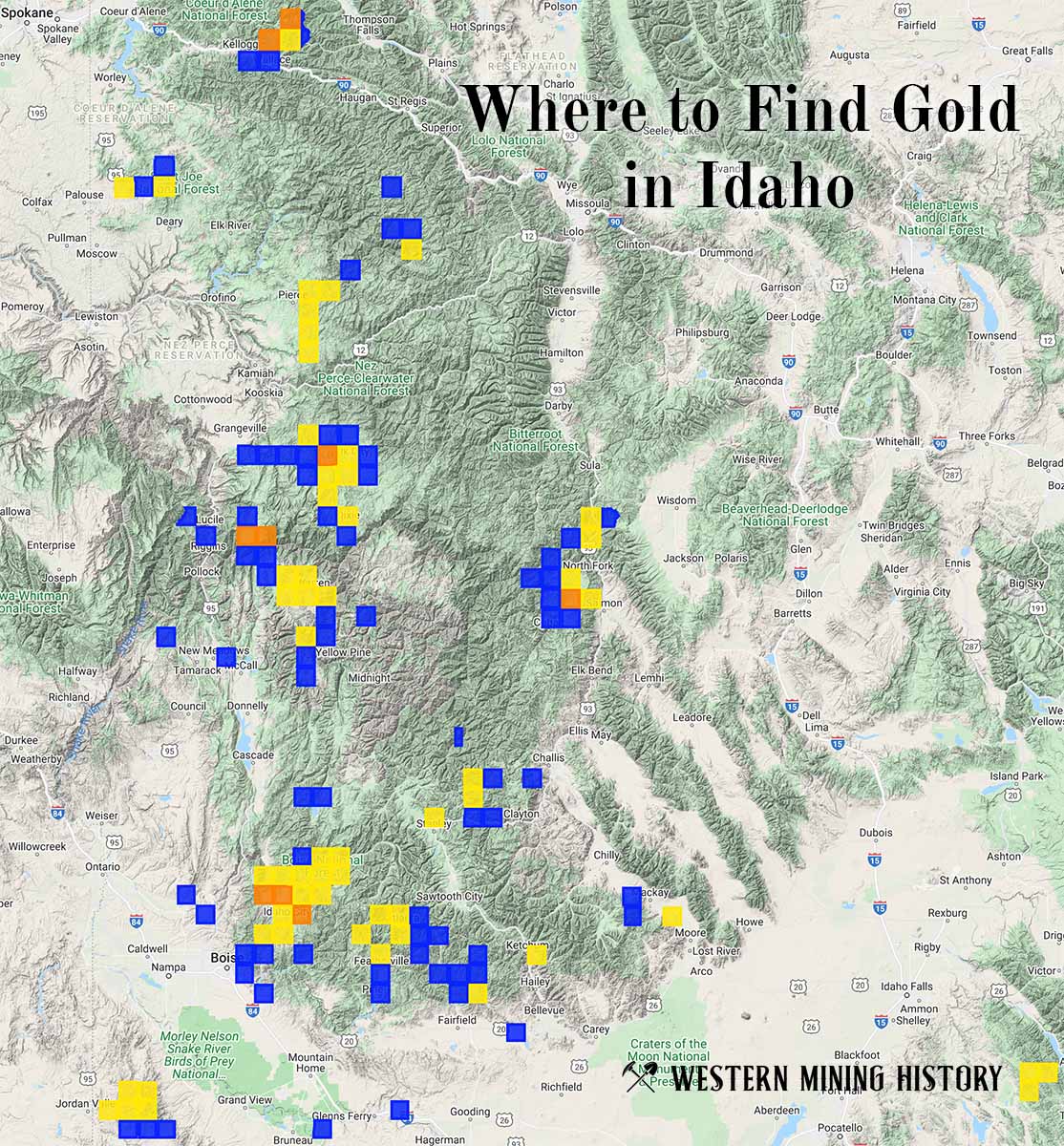
Idaho Gold

"Where to Find Gold in Idaho" looks at the density of modern placer mining claims along with historical gold mining locations and mining district descriptions to determine areas of high gold discovery potential in Idaho. Read more: Where to Find Gold in Idaho.