The Olson and Stanford Hi-Al Clay is a mine located in Latah county, Idaho at an elevation of 2,799 feet.
About the MRDS Data:
All mine locations were obtained from the USGS Mineral Resources Data System. The locations and other information in this database have not been verified for accuracy. It should be assumed that all mines are on private property.
Mine Info
Elevation: 2,799 Feet (853 Meters)
Commodity:
Lat, Long: 46.7786, -116.63720
Map: View on Google Maps
Olson and Stanford Hi-Al Clay MRDS details
Site Name
Primary: Olson and Stanford Hi-Al Clay
Commodity
Tertiary: Iron
Tertiary: Aluminum
Tertiary: Water, Free
Tertiary: Titanium
Tertiary: Silica
Location
State: Idaho
County: Latah
District: Unorganized District
Land Status
Land ownership: Private
Note: the land ownership field only identifies whether the area the mine is in is generally on public lands like Forest Service or BLM land, or if it is in an area that is generally private property. It does not definitively identify property status, nor does it indicate claim status or whether an area is open to prospecting. Always respect private property.
Holdings
Type: Private Lease
Type: Fee Ownership
Workings
Type: Surface
Ownership
Owner Name: Green Refractories Inc., A. P.
Home Office: Idaho
Info Year: 1975
Owner Name: Troy Fire Brick Co.
Home Office: Idaho
Info Year: 1975
Owner Name: Robert And Albert Olson
Home Office: Idaho
Info Year: 1975
Production
Not available
Deposit
Record Type: Site
Operation Category: Past Producer
Operation Type: Surface
Mining Method: Unknown
Year First Production: 1909
Discovery Year: 1907
Years of Production:
Organization:
Significant: N
Deposit Size: L
Physiography
General Physiographic Area: Intermontane Plateaus
Physiographic Province: Columbia Plateau
Physiographic Section: Walla Walla Plateau
Mineral Deposit Model
Not available
Orebody
Not available
Structure
Not available
Alterations
Not available
Rocks
Not available
Analytical Data
Not available
Materials
Unknown: Kaolinite
Unknown: Limonite
Unknown: Ilmenite
Comments
Comment (Production): IN 1975, THE HIGH IRON AREAS WERE EXCLUDED FROM THE EVALUATION. MATRIX GRADES AND TONNAGES ARE BASED ON WET TONNES THERE ARE THREE SETS OF COSTS; ORIGINAL 1975 COSTS; COSTS UPDATED FROM 1975 TO 1979; AND COMPLETELY RECOSTED 1979 COSTS. THE LIFE OF THE DEPOSIT IS 52 YEARS AT A PRODUCTION RATE OF 2213000 TONNES PER YEAR. THE MILL CAPACITY CAN BE INCREASED TO ACCUNT FOR THIS; OR ANOTHER MILL CAN BE ADDED SUBSEQUENTLY OR CONCURRENTLY AND OPERATED FOR 27 YEARS IN ADDITION TO THE CURRENT MILL WHICH WOULD OPERATE FOR 25 YEARS.
Comment (Reserve-Resource): MATRIX GRADES AND TONNAGES DEVELOPED IN HOUSE IN 1975 FROM U.S. BUREAU OF MINES DRILL HOLE INFORMATION AND USGS GEOLOGICAL DATA. SEE IDAHO PAMPHLET NO. 109, 1956, P. 11- 14.
References
Reference (Deposit): TULLIS, E.L., 1944, CONTRIBUTIONS TO THE GEOLOGY OF LATAH COUNTY: GEOLogical SOCIETY OF AMERICA BULLETIN, VOL. 55, no. 2, PP. 131-164.
Reference (Deposit): SWEET, A.T., AND G.D. GARDNER. ELIMINATION OF IRON IN AMMONI SULFATE PROCESS FOR PRODUCTION OF ALUMINA FROM CLAY. BUMI REPT. OF INV. 4183, 1948, 13 PP.
Reference (Deposit): SCHEID, V.E., HOSTERMAN, J.S., AND SOHN, I.G., 1954, OLSON HIGH-ALUMINA AND HIGH-IRON CLAY DEPOSITS, LATAH COUNTY, IDAHO: U.S. GEOLOGICAL SURVEY OPEN FILE REPORT 54-272, 25 p.
Reference (Deposit): SCHEID, V.E., HOSTERMAN, J.W., AND SOHN, I.G., 1954, STANFORD CLAY DEPOSIT, LATAH COUNTY, IDAHO: U.S. GEOLOGICAL SURVEY OPEN FILE REPORT 54-273, 27 p.
Reference (Deposit): SCHEID, V.E., AND HOSTERMAN, J.W., 1953, GEOLOGIC SETTING OF THE Clay DEPOSITS OF LATAH COUNTY, IDAHO, AND ADJACENT AREAS: U.S. SURVEY OPEN FILE REPORT 53-232, 15 p.. [superseded by B-1091]
Reference (Deposit): SCHEID, V.E., 1940, CLAY RESOURCES OF LATAH COUNTY, IDAHO: UNIV. OF IDAHO THESiS.
Reference (Deposit): PRATER, L.S., BENEFICATION TESTS ON LATAH COUNTY CLAYS: IDAHO BUREAU OF MINES AND GEOLOGY PAMPHLET 66, 1943.
Reference (Deposit): PARDEE, J.T., AND BRYAN, KIRK, 1926, THE GEOLOGY OF THE LATAH FORM IN RELATION TO THE LAVAS OF THE COLUMBIA PLATEAU NEAR SPOKANE, WASH.: U.S. GEOLOGICAL SURVEY PROFessional PAPER 140-A.
Reference (Deposit): MIHELICH, MIRO, 1950, HIGH ALUMINA CLAY--THE OLSON DEPOSIT: UNIV OF IDAHO THESiS.
Reference (Deposit): KIRKHAM, V. R. D., AND JOHNSON, M.M., 1929, THE LATAH FORMATION: JOURnal OF GEOLogy, VOL. 37.
Reference (Deposit): HOSTERMAN, J.W., V.E. SCHEID, V.T. ALLEN, AND I.G. SOHN, 1960, INVESTIGATIONS OF SOME CLAY DEPOSITS IN WASHINGTON AND IDAHO: U.S. GEOLOGICAL SURVEY BULLetin 1091, 147 P.
Reference (Deposit): HITE, T.H., 1930, THE ORIGIN OF CERTAIN CLAY DEPOSITS IN LATAH COUNTY IDAHO: UNIV. OF IDAHO THESIS.
Reference (Deposit): ANDERSON, A.L., 1929, PAPER CLAY POSSIBILITIES OF LATAH COUNTY, ID: UNIV. OF IDAHO THESIS.
Reference (Deposit): HUBBARD, C.R. 1956, CLAY DEPOSITS OF NORTH IDAHO: IDAHO BUReau of MINEs AND GEOLogy, PAMPHLET 109, 36 P.
Reference (Deposit): Hubbard, C.R., 1957, MINERAL RESOURCES OF LATAH COUNTY: IDAHO BUREAU OF MINES AND GEOLogy, COUNTY REPorT 2, P. 16-18.
Idaho Gold

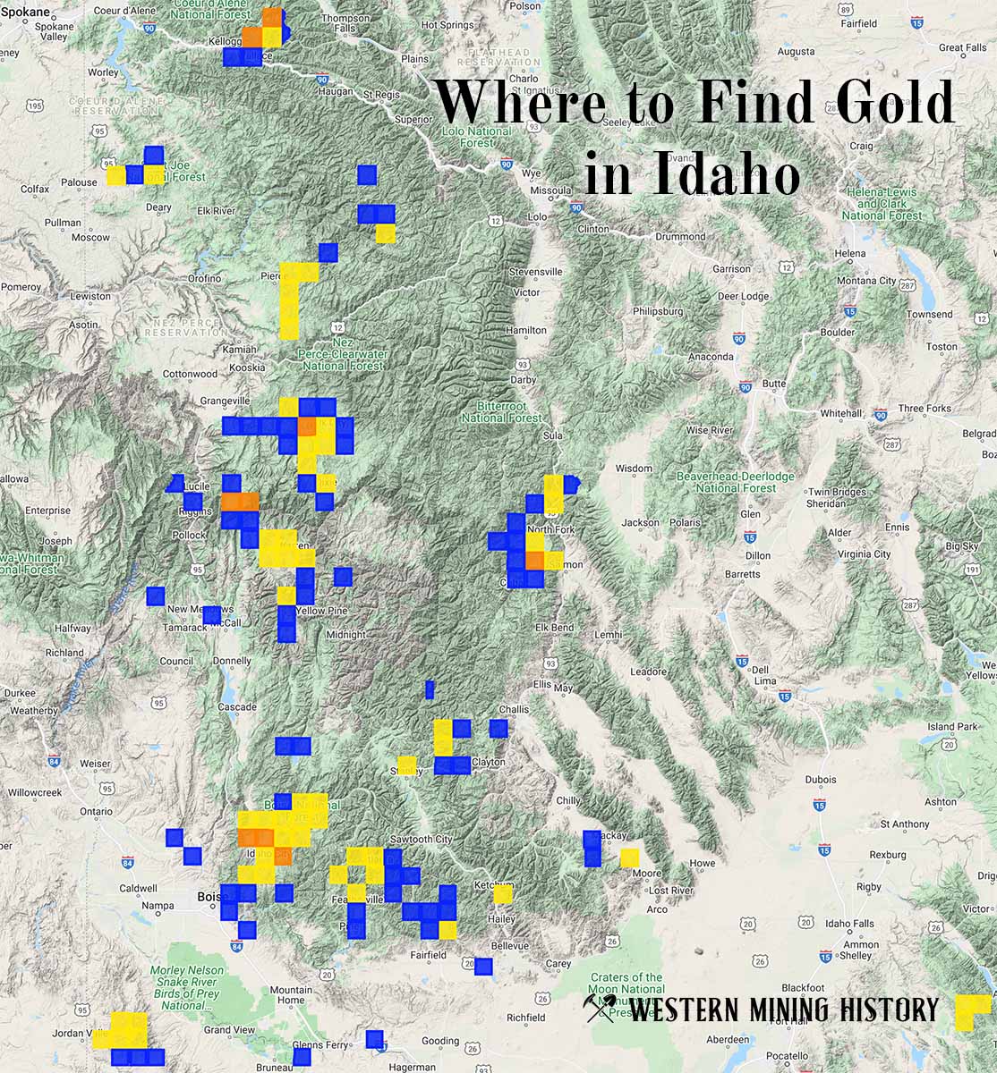
"Where to Find Gold in Idaho" looks at the density of modern placer mining claims along with historical gold mining locations and mining district descriptions to determine areas of high gold discovery potential in Idaho. Read more: Where to Find Gold in Idaho.