The Iron King Mine is a chromium mine located in Grant county, Oregon at an elevation of 5,400 feet.
About the MRDS Data:
All mine locations were obtained from the USGS Mineral Resources Data System. The locations and other information in this database have not been verified for accuracy. It should be assumed that all mines are on private property.
Mine Info
Elevation: 5,400 Feet (1,646 Meters)
Commodity: Chromium
Lat, Long: 44.3533, -118.92280
Map: View on Google Maps
Iron King Mine MRDS details
Site Name
Primary: Iron King Mine
Secondary: Billie Girl
Commodity
Primary: Chromium
Location
State: Oregon
County: Grant
District: John Day District
Land Status
Land ownership: National Forest
Note: the land ownership field only identifies whether the area the mine is in is generally on public lands like Forest Service or BLM land, or if it is in an area that is generally private property. It does not definitively identify property status, nor does it indicate claim status or whether an area is open to prospecting. Always respect private property.
Holdings
Type: Patented
Workings
Type: Surface
Ownership
Owner Name: Clinton P. Haight, Woodburn, Or
Percent: 100.0
Home Office: Oregon
Info Year: 1984
Production
Year: 1918
Description: 32 Percent Cr203 Avg Shipping Ore 2700 Metric Tonnes Ore/Year
Year: 1917
Description: 32 Percent Cr203 Avg Shipping Ore 2700 Metric Tonnes Ore/Year
Year: 1916
Description: 32 Percent Cr203 Avg Shipping Ore 450 Metric Tonnes Ore/Year
Deposit
Record Type: Site
Operation Category: Past Producer
Operation Type: Surface
Mining Method: Unknown
Year First Production: 1916
Years of Production:
Organization:
Significant: N
Deposit Size: M
Physiography
General Physiographic Area: Intermontane Plateaus
Physiographic Province: Columbia Plateau
Physiographic Section: Walla Walla Plateau
Mineral Deposit Model
Not available
Orebody
Not available
Structure
Not available
Alterations
Not available
Rocks
Not available
Analytical Data
Not available
Materials
Unknown: Serpentine
Unknown: Picotite
Unknown: Olivine
Comments
Comment (Deposit): FIELD OP FIRST QUARTER F.Y. 1980 SAYS "NO DEPOSIT REPORT PLANNED OWNER: CLINTON P. HAIGHT JR. OTHER NAME: BILLIE GIRL. CR: FE RATIO IS 1.55 TO 1. DROPPED FROM EVALUATION DURING FY 1980 PROPERTY PATENTED 1969 OR 1970. ACTIVITY IN RECENT PAST CONSISTED OF MINOR MAPPING AND SAMPLING IN ADDITION TO ANNUAL ASSESSMENT WORK. SMALL SCALE DRILLING PROGRAM MAY HAVE DELINEATED ADDITIONAL RESOURCES. HOWARD BROOKS, DOGAMI, PERS. COMM. OCT 9, 1984.
Comment (Geology): SHAPE OF ORE BODY: OREBODY APPEARS TO BE A NEARLY HORIZONTAL TABULAR MASS EHICH IS BOUNDED LATERALLY BY FAULTS AND WHICH IS BROKEN INTO A COMPLEX SERIES OF BLOCKS WHICH RISE LIKE STEPS IN A NORTHWARD DIRECTION. TYPE OF WALLROCK ALTERATION: SERPENTINIZATION. STRIKE AND DIP OF MINERALIZED ZONE: MINERALIZED TREND IS ABOUT N12E. THE ZONE IS BASICALLY HORIZONTAL.
Comment (Exploration): THE GRADE & TONNAGE WAS OBTAINED FROM DIAMOND DRILLING AND DETAILED SAMPLING RESULTS OF WORK PERFORMED IN 1939. AND 1943.
Comment (Reserve-Resource): QUANTITY AND GRADE FIGURES ARE FROM: WAR MINERALS REPORT 204, JOHN DAY CHROMIUM DEPOSITS, GRANT COUNTY, OREG,(SUP- PLEMENT TO W.M.R. 49). U.S. BUREAU OF MINES. JUNE 1944. TONNAGE FACTOR = 10 CUBIC FEET/TON
Comment (Reserve-Resource): DATA FROM WAR MINERALS REPORT 204, JOHN DAY CHROMIUM CEPOSITS, GRANT COUNTY, OREGAN, USBOM, JUNE 1944.
Comment (Geology): CHROMIUM PICOTITE INDIVIDUAL GRAIN SIZE AVERAGES 0.2-0.5MM IN DIAMETER. CHROME TO IRON RATION IS 1.55 TO 1. CHROMITE OCCURRENCE IS BOTH MASSIVE AND DISSEMINATED WITHIN THE OREBODY.
References
Reference (Reserve-Resource): ALLEN, J. E. CHROMITE DEPOSITS IN OREGON. OREGON STATE BULL.
Reference (Reserve-Resource): ANONYMOUS. JOHN DAY CHROMIUM DEPOSITS, GRANT COUNTY, OREGON.
Reference (Reserve-Resource): U.S. BUREAU OF MINES WAR MINERALS REPORT 49, 1943, 30 PP.
Reference (Reserve-Resource): 9, 1941, P. 55.
Reference (Deposit): U.S. BUREAU OF MINES RI 5238, 1956, P. 9, 15.
Reference (Deposit): P. 27-28.
Reference (Deposit): OR. DEPT. GEOL. AND MIN. INDUST. BULLETIN 14-B, 1941,
Reference (Deposit): U.S. GEOLOGICAL SURVEY BULLETIN 725-A, 1920, P. 49.
Reference (Deposit): OR. DEPT. GEOL. AND MIN. INDUST. BULLETIN 9, 1938, P. 55.
Oregon Gold

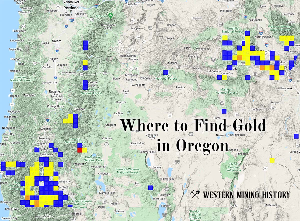
"Where to Find Gold in Oregon" looks at the density of modern placer mining claims along with historical gold mining locations and mining district descriptions to determine areas of high gold discovery potential in Oregon. Read more: Where to Find Gold in Oregon.