The first documented discovery of gold in the Black Hills of what is now South Dakota occurred in 1874. However, the 1868 Treaty of Laramie had established this region as home of the Sioux people, and outsiders were forbidden from entering these lands.
Despite the restrictions, prospectors continued to enter the area illegally following the 1874 discovery. By 1875 many gold deposits had been found, including the rich placers of Deadwood Gulch. The trickle of prospectors turned into a flood by 1876, and the miners, prospectors, business owners, and thousands of other new arrivals started forming what were illegal settlements.
In 1877 a new treaty with the Sioux was imposed by the U.S. government, allowing white settlers to enter the Black Hills legally. This amplified the gold rush even more, and settlements were quickly evolving into permanent towns and cities.
Ultimately the Black Hills would be one of the Nation’s premier gold mining regions, with production that lasted over a century. This collection of photos illustrate the early history of the area.
1876-1877 – Gold Rush Towns
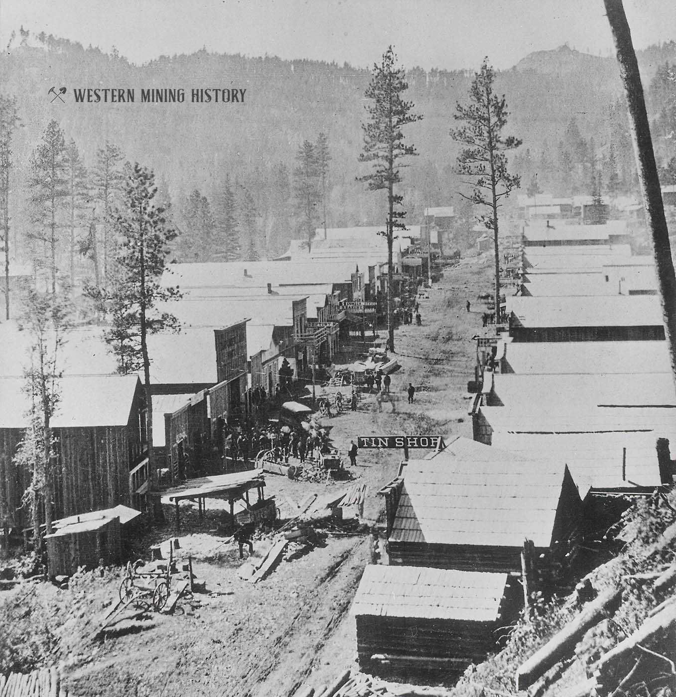
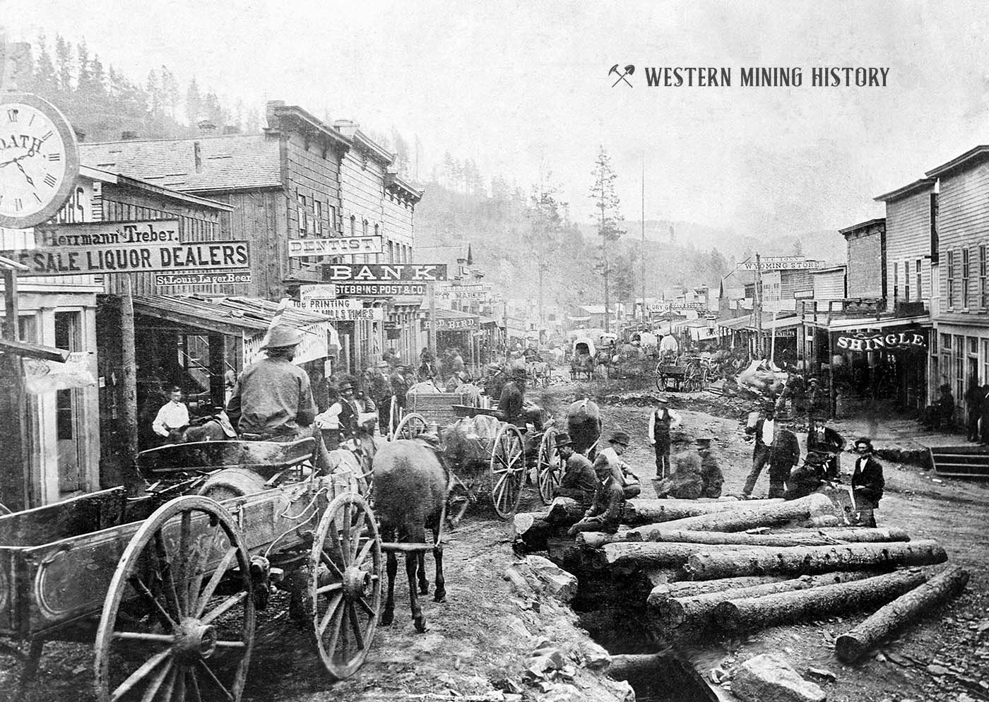
While very many settlements would form throughout the Black Hills mining districts, the central towns were in and around Deadwood Gulch. Deadwood, formed in 1876, was the name of the primary settlement. These photos illustrate the frenzy of activity at Deadwood during this period.
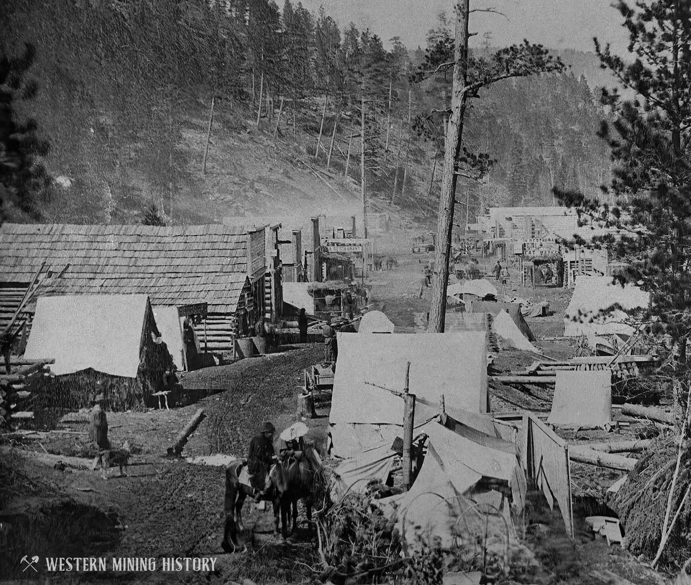
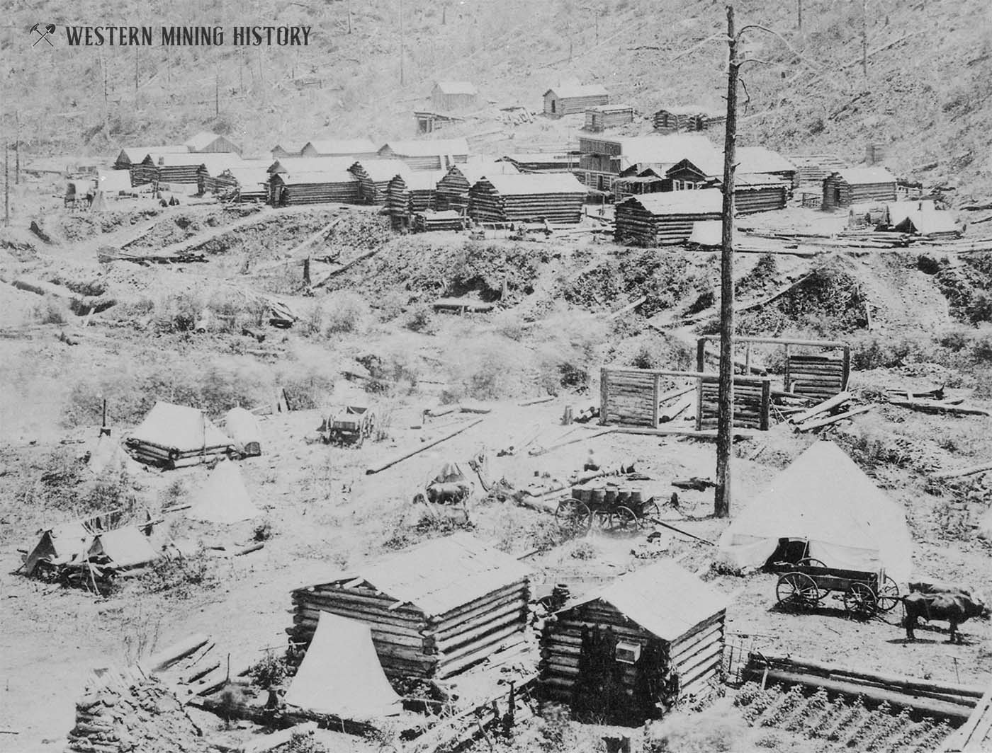
The settlement of Gayville was established near Deadwood. The image below shows the town in its earliest form – as a collection of tents and log cabins. Note the wagon full of barrels and the garden at the lower right part of the photo.
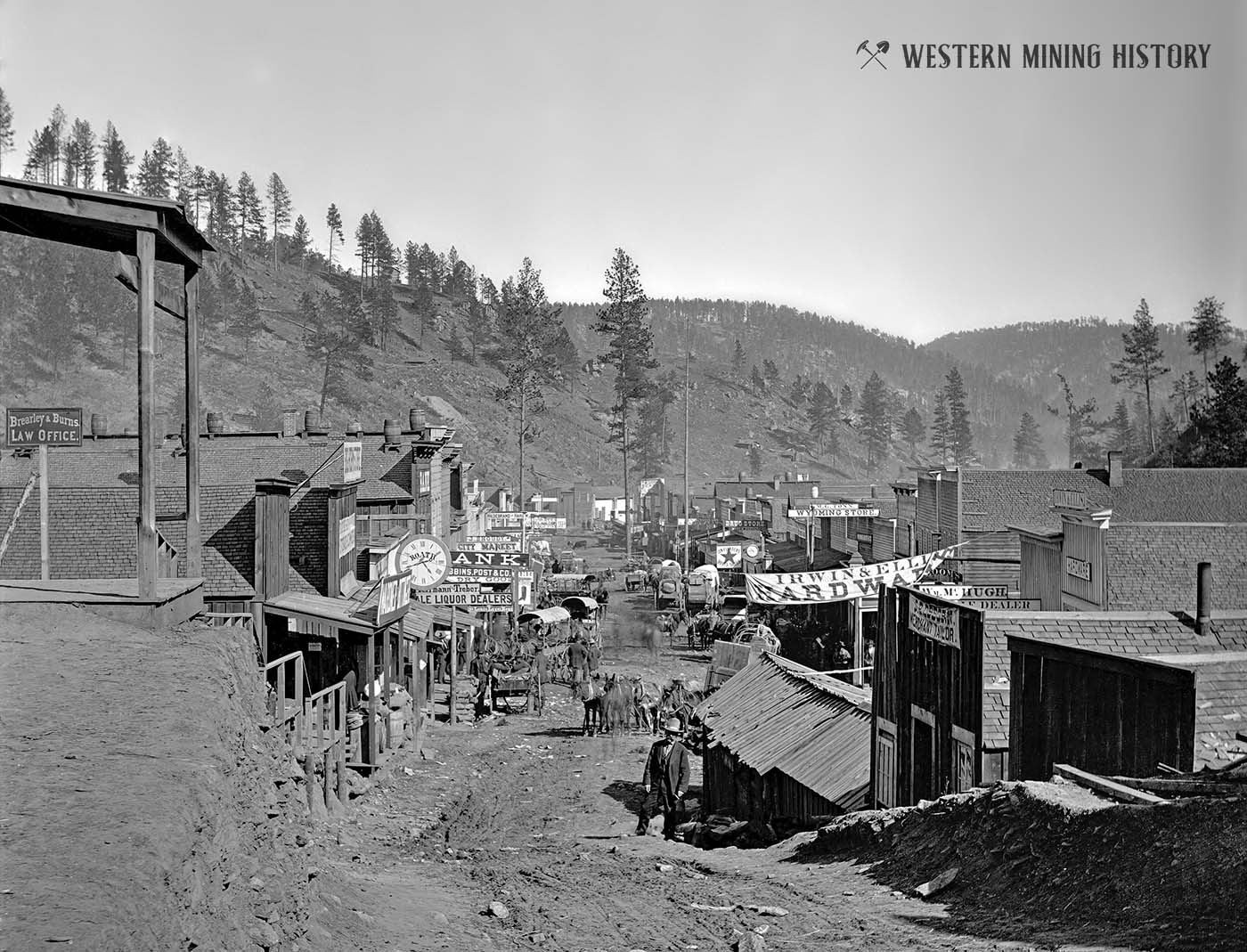
The image below appears to be early in 1877 and is notable for the structures that appear in the middle of Main street (to the right in the photo below). The long, low building next to the man standing in the foreground apparently covered a gold-bearing vein that was being mined right in the middle of the road.
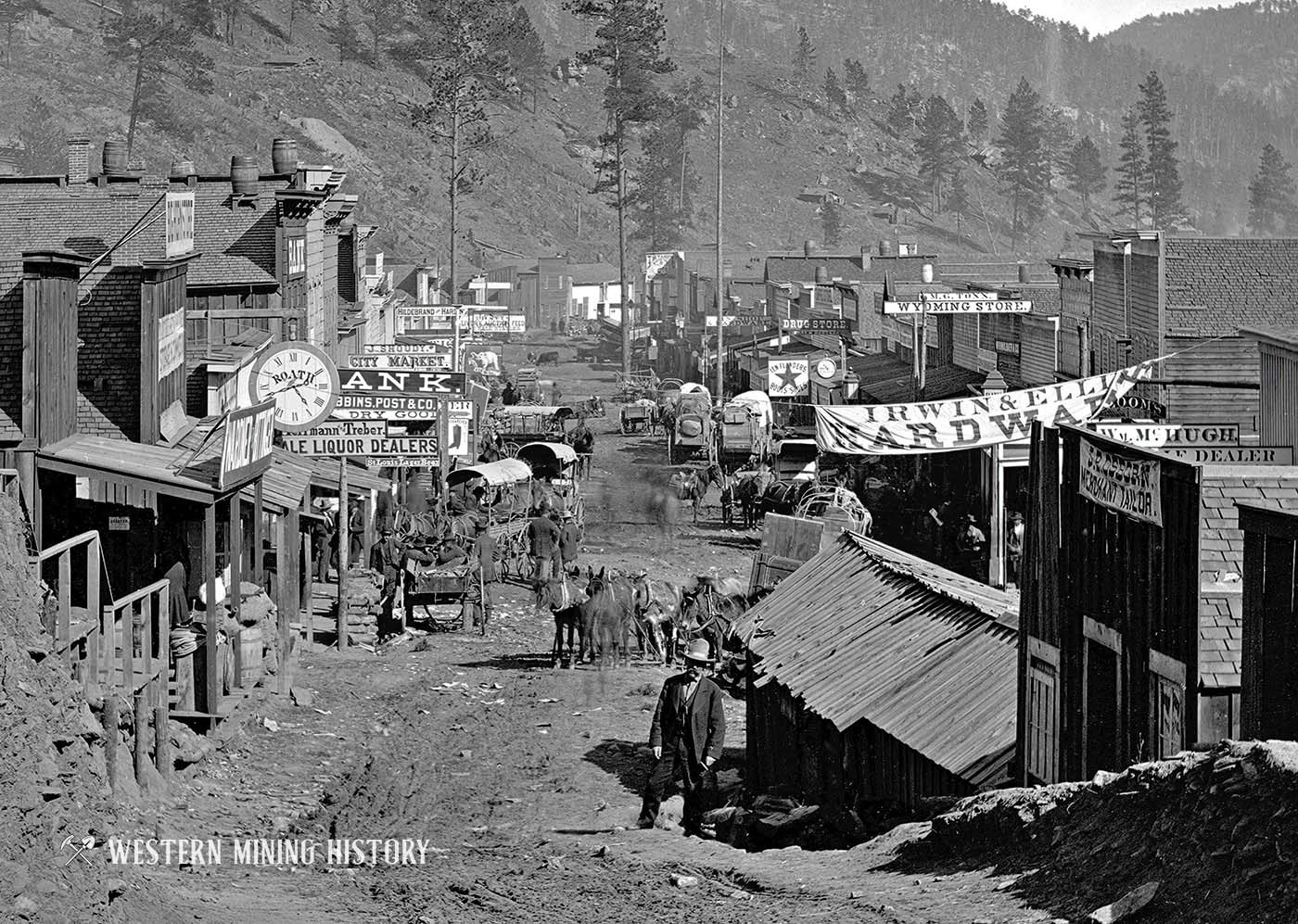
Here’s a closer view of the first image for comparison again, where the man is standing is right next to where the vein is visible on the later photo.
Comparing the above image with the same view from 1876 shows how much changed in the first year of the gold rush.
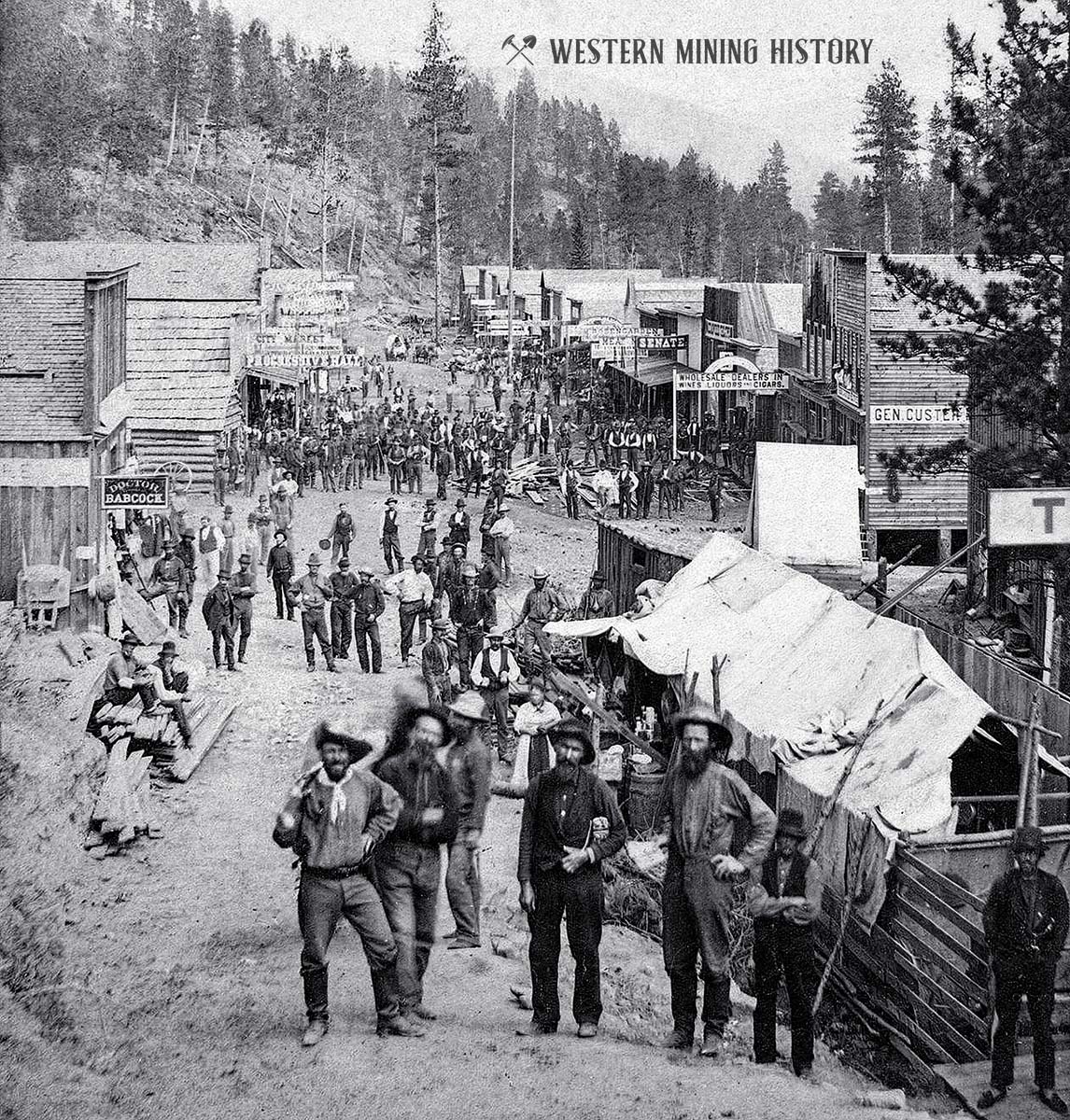
The following photo is one of the most famous Deadwood Scenes. Note that gold-bearing material has been mined right out of the middle of Main Street.
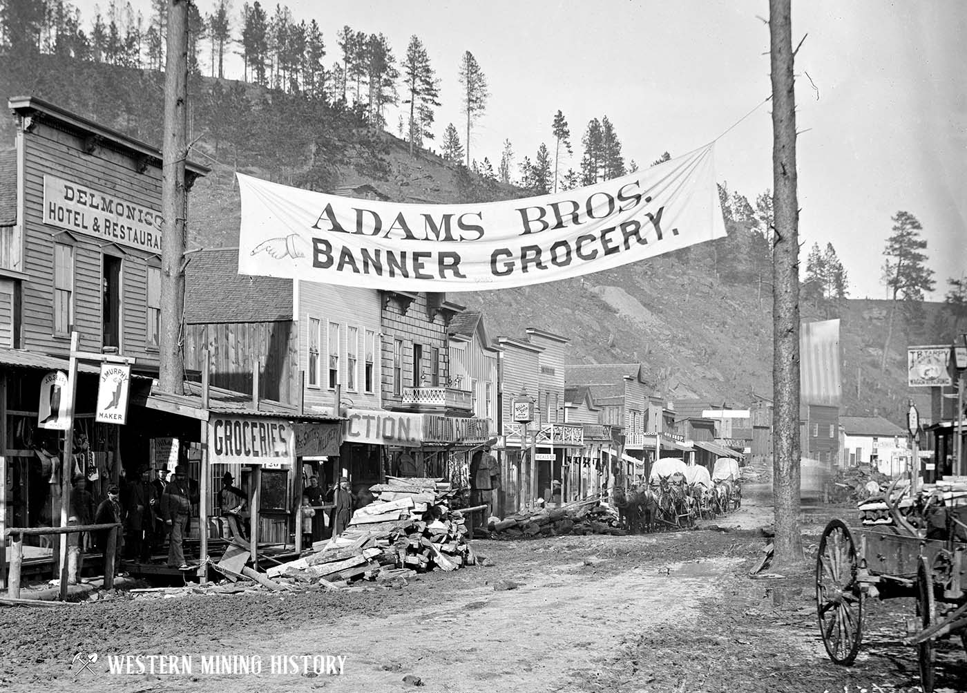
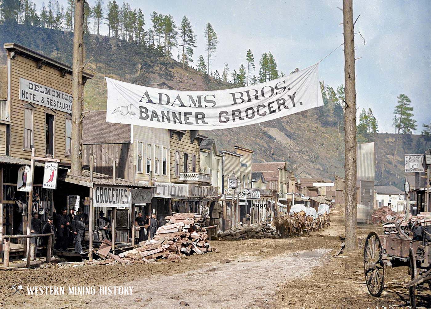
The following photo shows the many businesses that have been established on Main Street by 1877. Many people have asked why, in the 1876 photo shown above, were the two tall pine trees preserved? It seems plausible that since the “Adam Bros” banner has been hung from those same two trees, that enterprising business owners who were first on the scene protected the trees for their own use, as seen below.
The following image has been identified by different sources as either Wall Street or Lee Street, each of which is perpendicular to Main Street and are important parts of the commercial district.
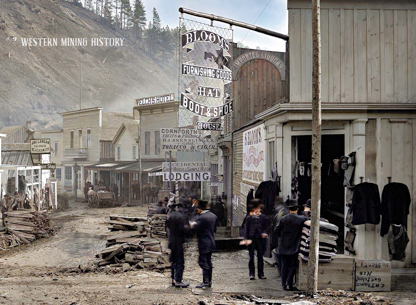
Some of the businesses visible in this scene are Bloom’s mercantile, Welches Hotel, Conforths Fruit & Produce, H.J. Brendlinger Tobacco & Cigar store, Occidental Chop House & Sample Room, and Jas Langan Colorado Blacksmith.
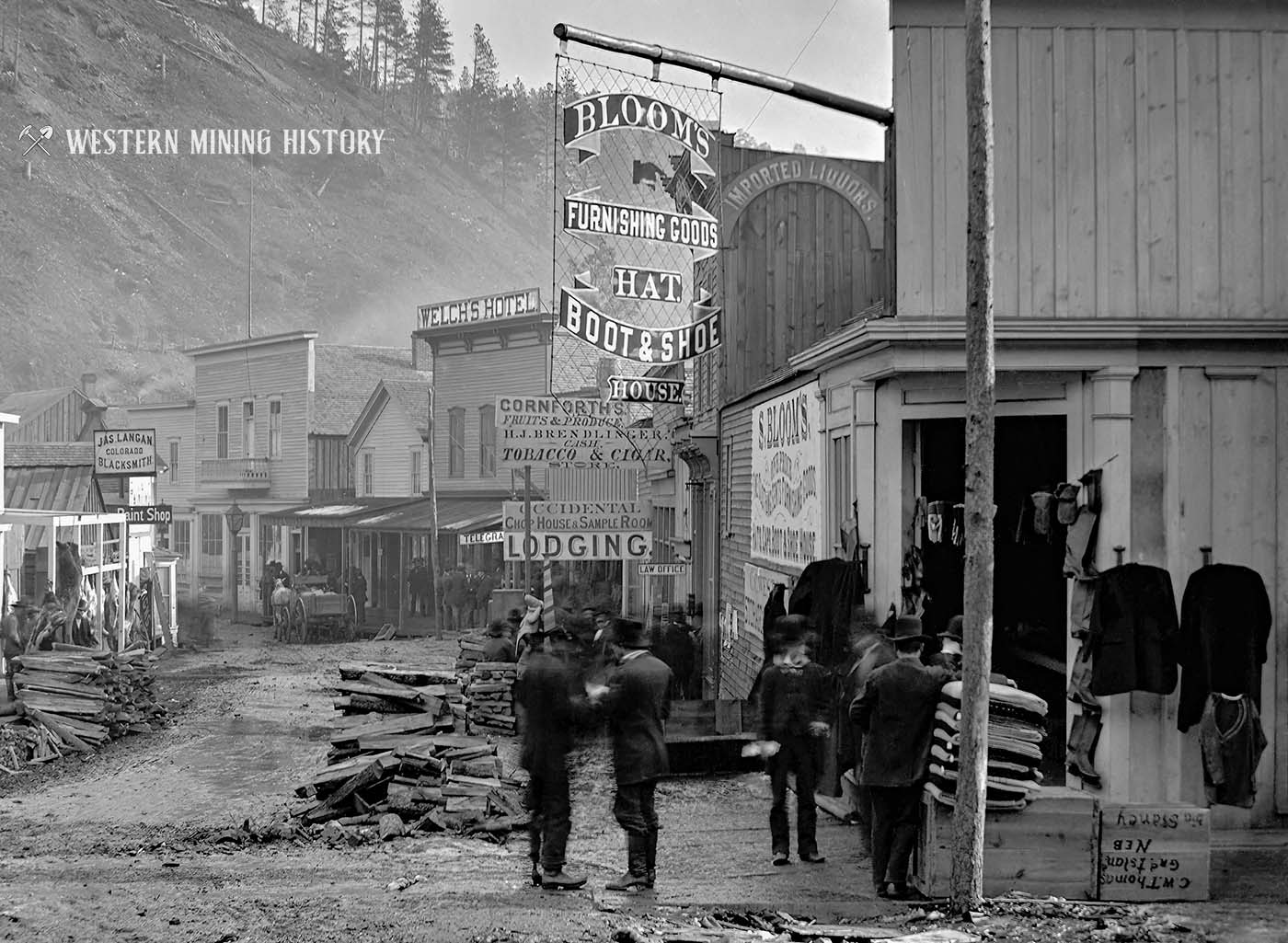
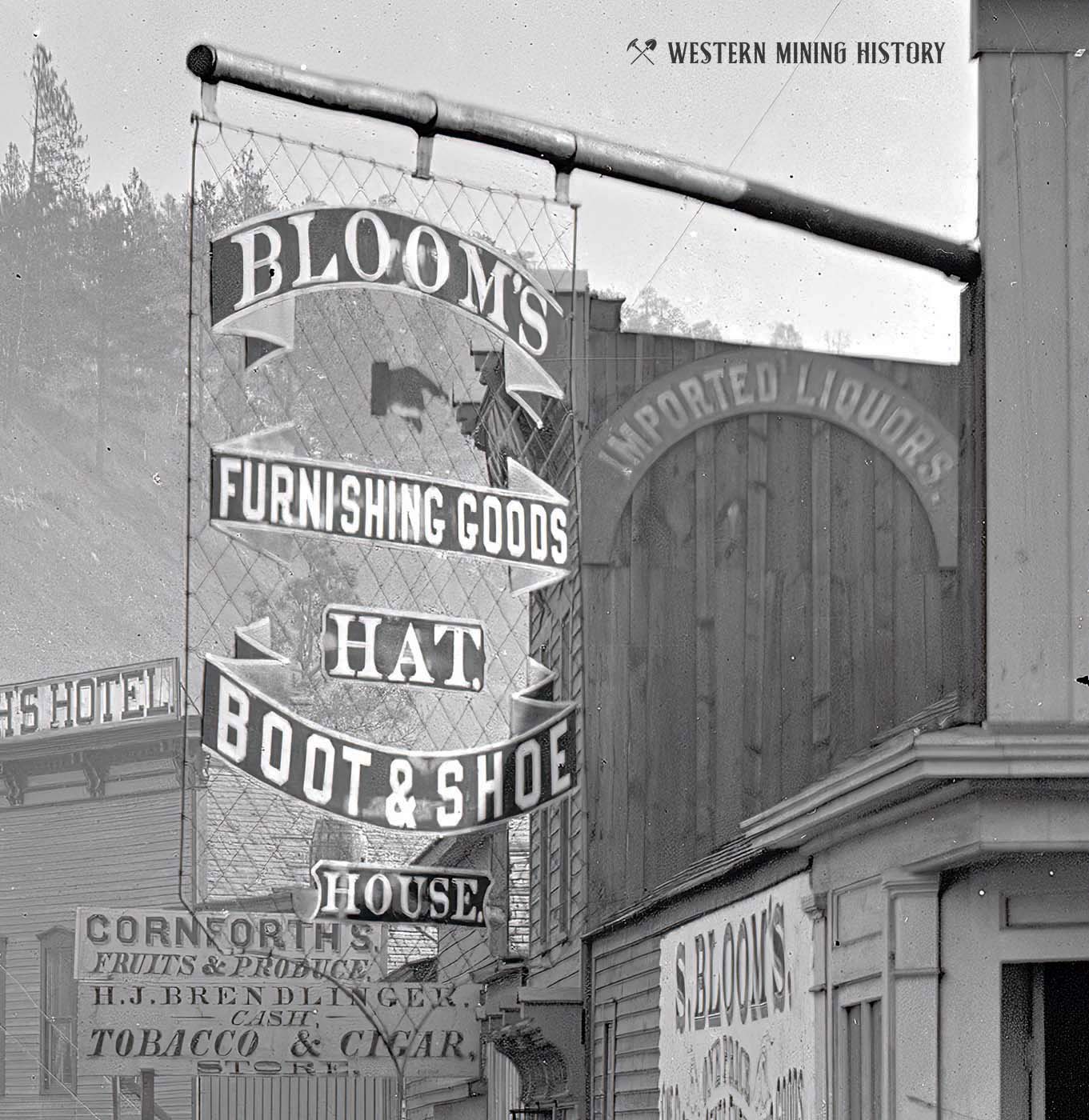
The photo above has many interesting details, including the ornate sign for “Bloom’s Furnishings, Goods, Hat, Boot & Shoe” mercantile. The image below gives a closer look at the sign.
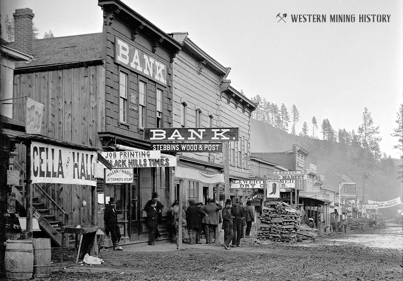
This section of Main Street was home to Cella and Hall (likely grocers), Miller and Haste – Attorneys at Law, the Bank Building of Stebbins Wood & Post, Karcher boot maker, J. Shoudy City Market, and others.
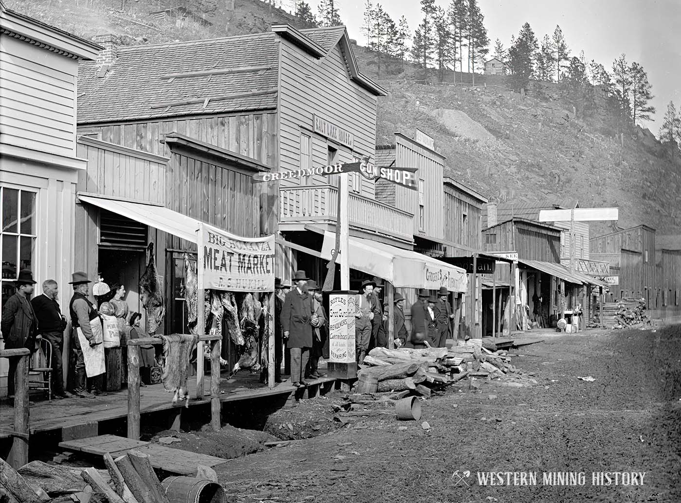
The following view of lower Main Street shows the Big Bonanza Meat Market, the Creedmoor Gun Shop which advertises “Shot Guns, Revolvers, Cartridges of all kinds, and Repairing.”
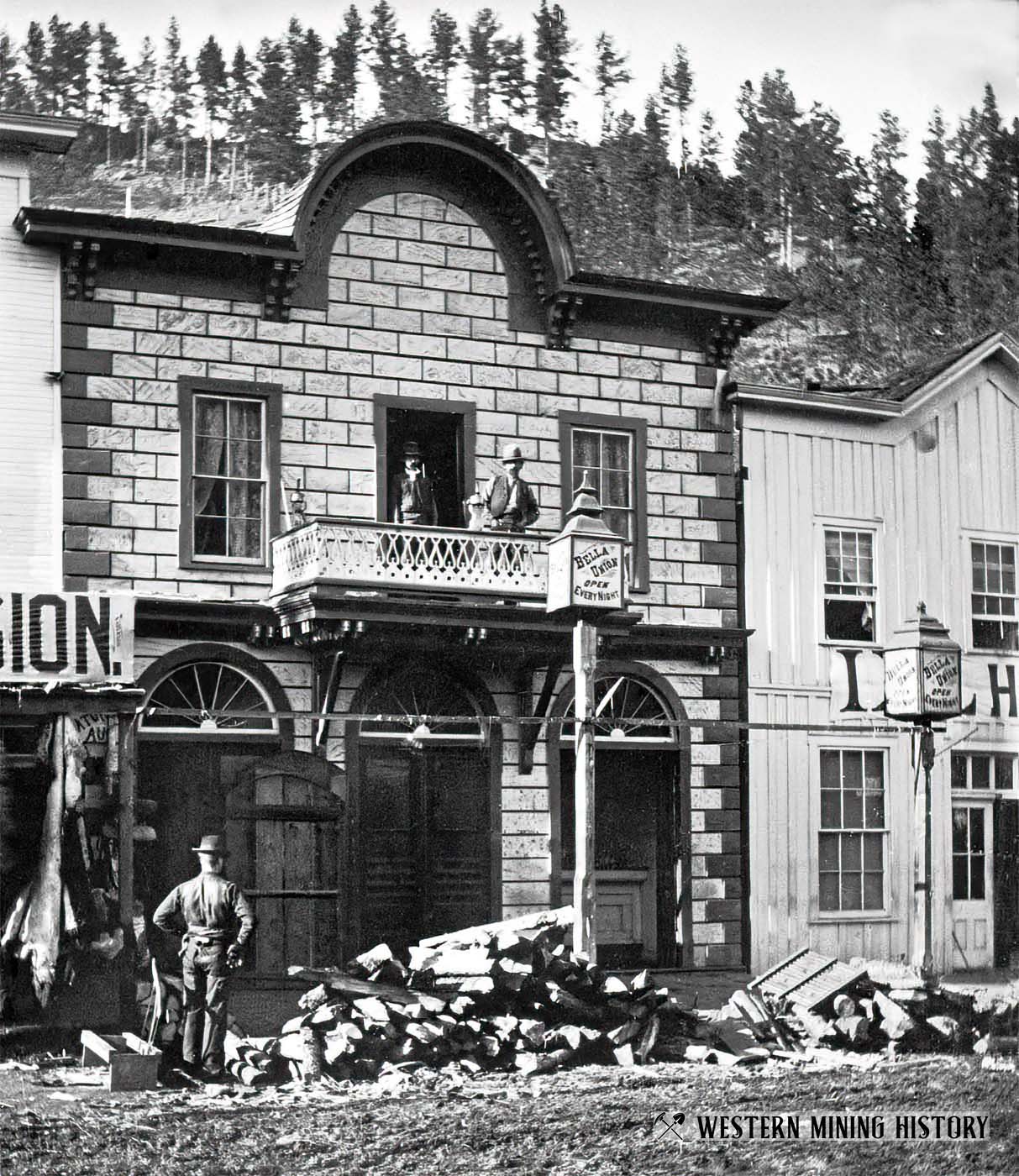
The Bella Union Theater, seen here in 1877, was “Open Every Night” according to the ornate sign on a post in front of the building. Although this establishment was depicted as a gambling hall and brothel in the television series “Deadwood”, it was actually described as an upscale establishment, where a regular ladies night encouraged men to bring their wives, and town meetings were held.
An article from the August 1877 edition of the Black Hills Daily Times states “Gilday & Giniven receive a benefit at the Bella Union on Saturday the 25th, when Giniven will dance a jig against an unknown from Gayville, for the championship and a heavy gold sack.”
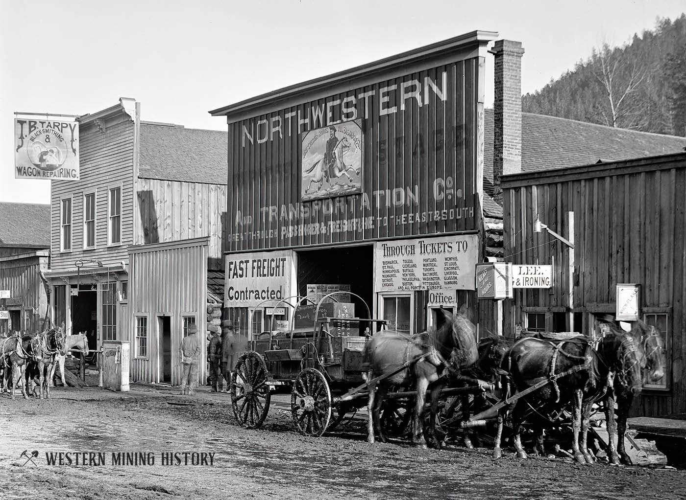
Another view of Main Street, this time showing J.B. Tarpy Blacksmithing & Wagon Repairing, and the Northwestern Express, Stage, and Transportation Company “Great Through Passenger & Freight Line to the East and South.”
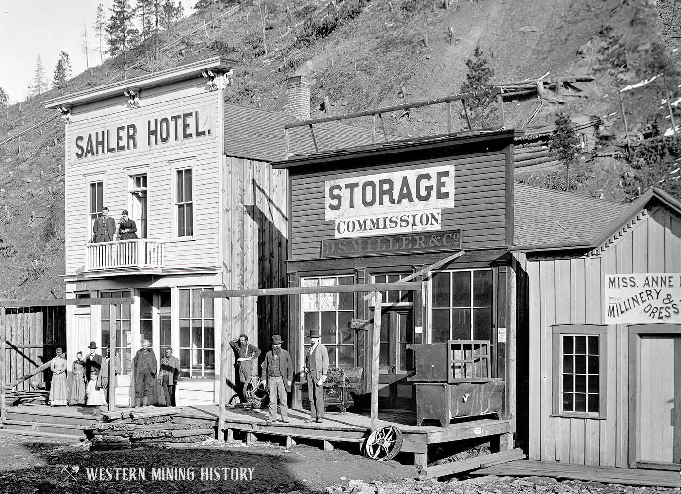
The following image shows the Sahler Hotel, D.S. Miller & Co. Storage & Commission, and a Millinery & Dress Maker owned by Miss Anne Dunne.
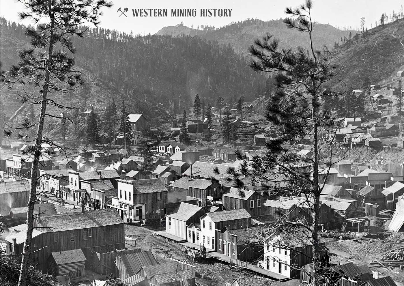
The following view of Deadwood’s commercial district shows a town that is rapidly expanding during the 1877 rush.
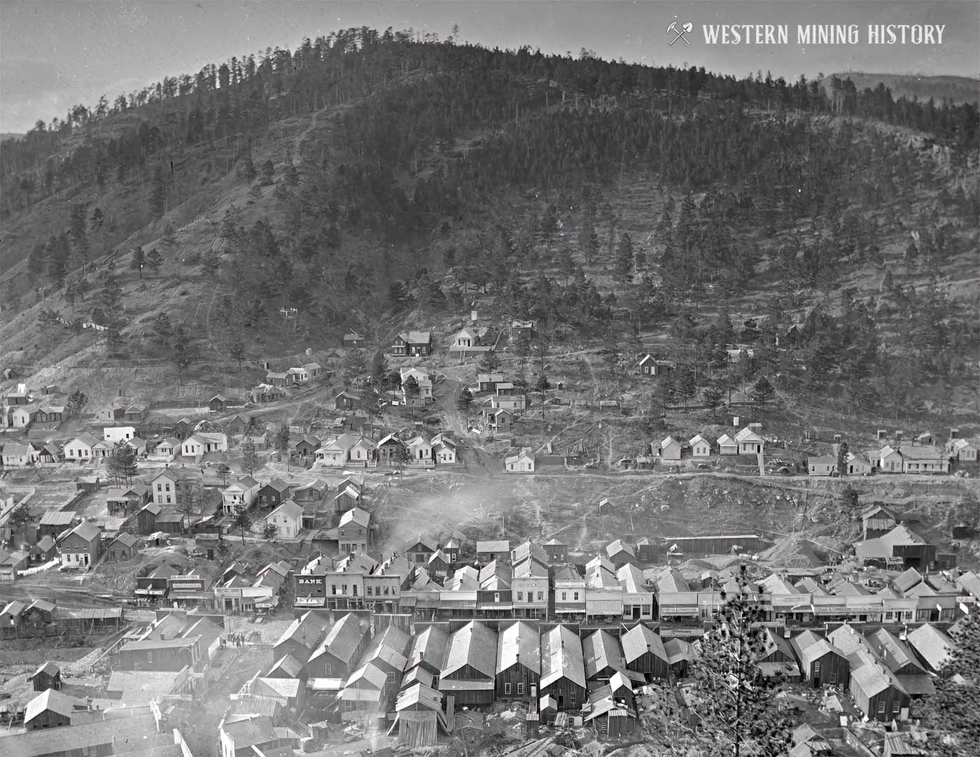
A second view from high up on an adjacent mountain gives a good look at Deadwood’s commercial district, and the neighborhoods that are forming on the hillsides.
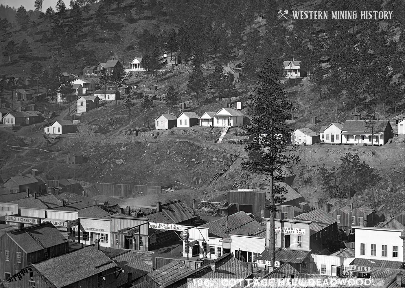
The following image gives a closer look at the residential section known as Cottage Hill.
This view from the west gives a different perspective on the growing town in Deadwood Gulch.
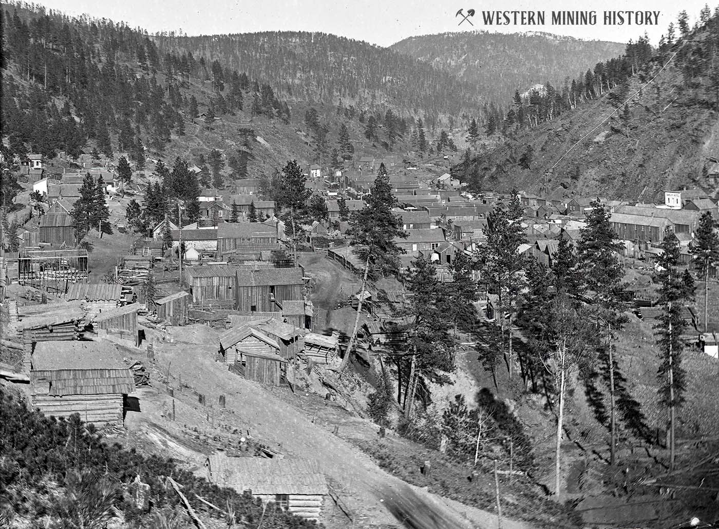
This rare view shows the early Chinatown in Deadwood. Chinese were the largest minority group in the city, with a population of around 400 by the 1880s.
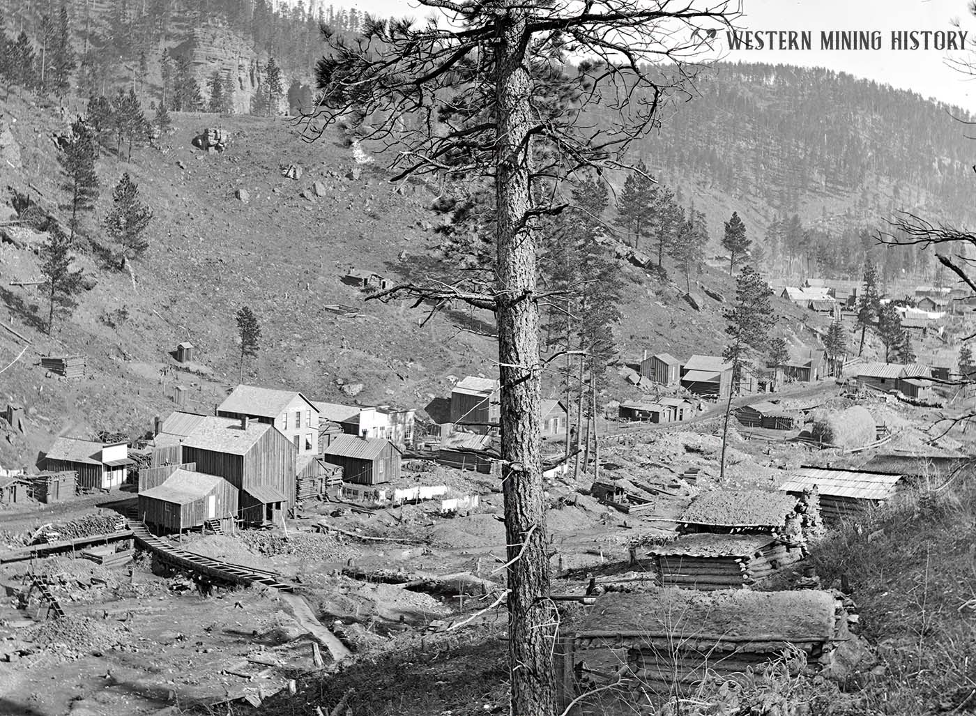
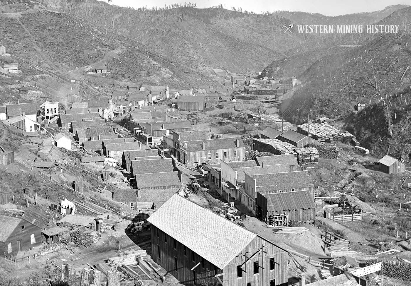
Deadwood was not the only boom town that resulted from the gold rush. The following image shows the nearby town of Central City, named after the famous mining city of Central City, Colorado.
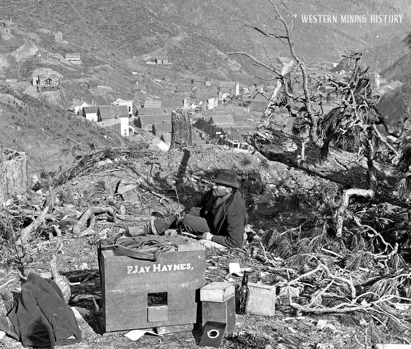
Most of the 1877 photos on this page were taken by frontier photographer Frank Jay Haynes. The following image shows an unidentified man posing with Hayne’s photography equipment. Central City is seen in the background.
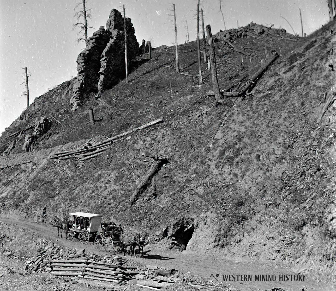
The following image shows two passenger stage wagons passing each other on the Deadwood toll road. Note the miner’s prospect tunnel on the road. The distinctive rock feature was called “Devil’s Pulpit”.
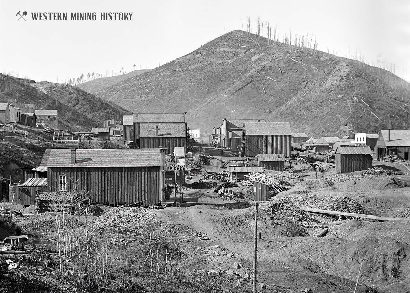
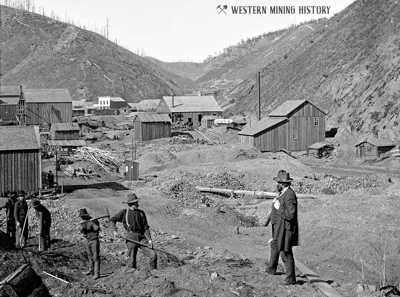
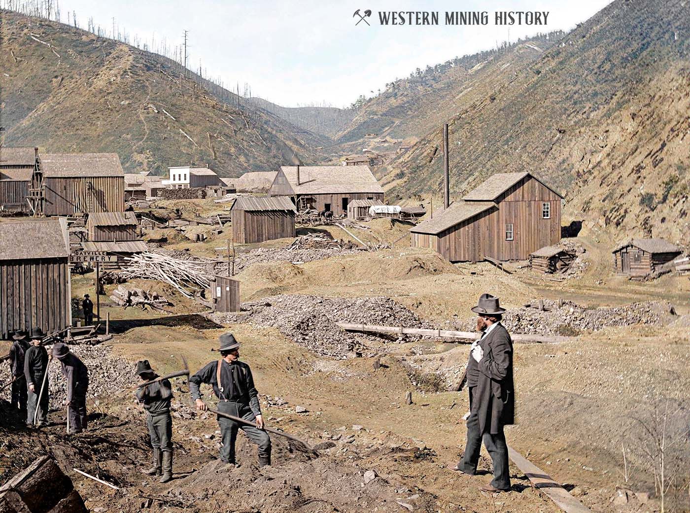
Another active community near Deadwood was Gayville, seen pictured below. The closet building on the left is the Gayville Brewery. A fire in August of 1877 burned most of the town, but thankfully for the thirsty miners the brewery was one of the few structures that was spared.
The murder of Wild Bill Hickok at Deadwood on August 2, 1876 is one of the Old West’s most famous events. Hickock was buried at the local cemetery, and the following photo of his grave was taken 18 days after his death.
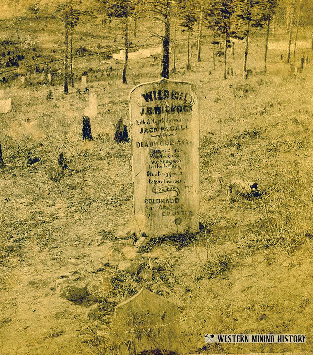
The image was published by the Black Hills View Company on Sherman Street, Deadwood, and reportedly photographed on August 20, 1876, 18 days after Hickock’s death. Wooden marker reads: “Wild Bill, J. B. Hickok killed by the assassin Jack McCall in Deadwood, Black Hills, August 2nd, 1876. Pard, we will meet again in the happy hunting ground to part no more. Good bye, Colorado Charlie, C. H. Utter.”
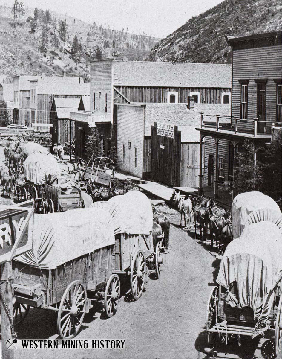
The city of Deadwood developed at a rapid pace. Both the town and the mines required massive quantities of goods and equipment, all of which were transported by freight wagons in the early years. In the following image, freight wagons crowd Deadwood’s Main Street ca. 1880.
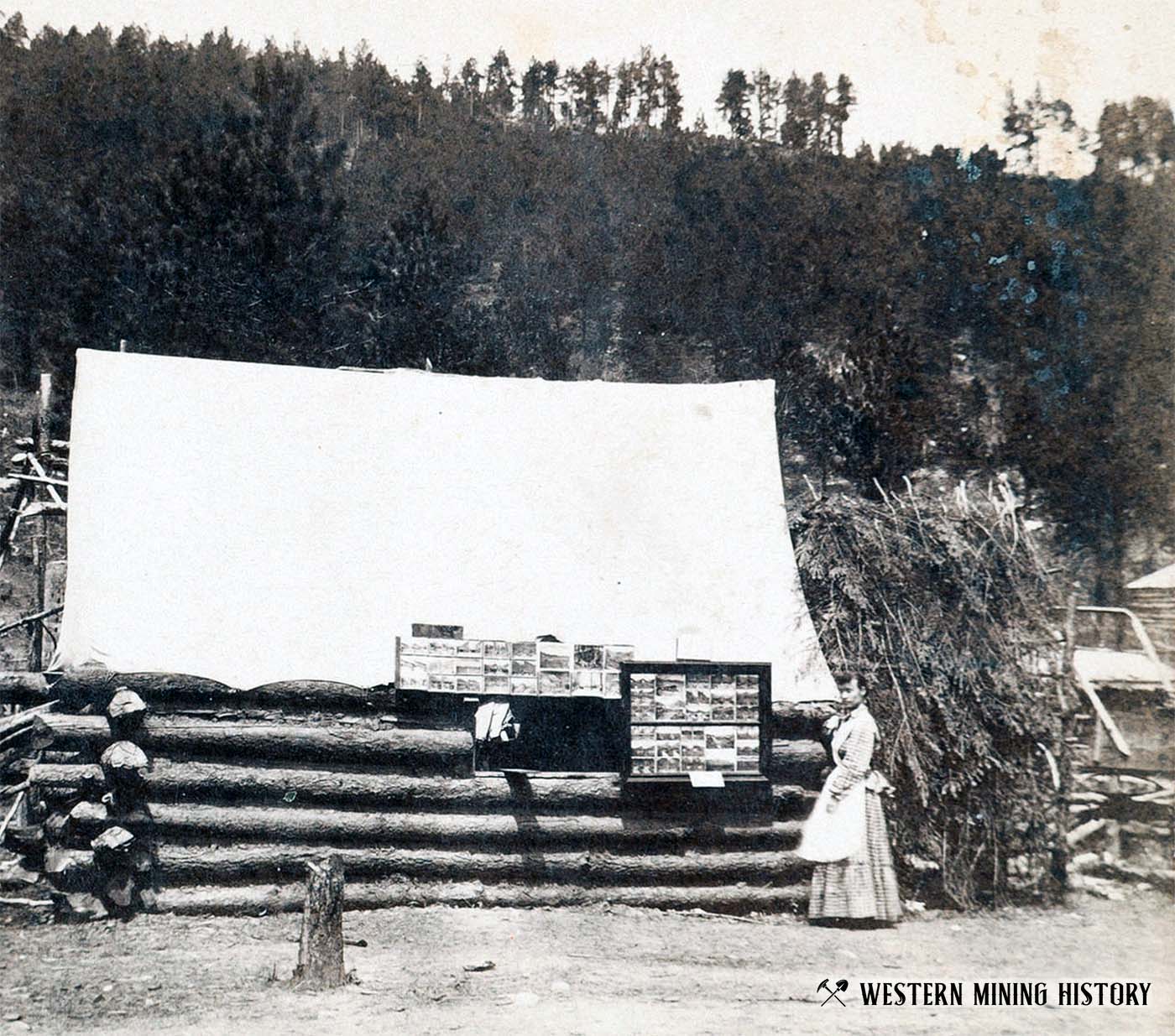
Most of the photos in these collections were taken by professional photographers, with the intention of selling copies of them to the public. Many were sold as souvenirs around the country, but some were peddled at local galleries. The photo below is captioned “First Photograph Gallery in Black Hills.”
The Mines
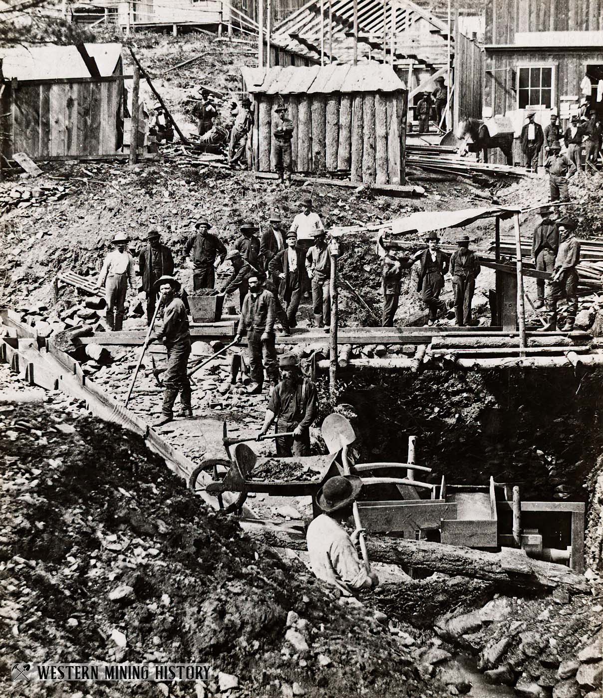
In the first few years of the Black Hills gold rush, the majority of the gold was recovered in placer mines. These relatively easy to work mines were accessible to men with little capital or experience. The scene below illustrates an early placer mining scene in Deadwood Gulch
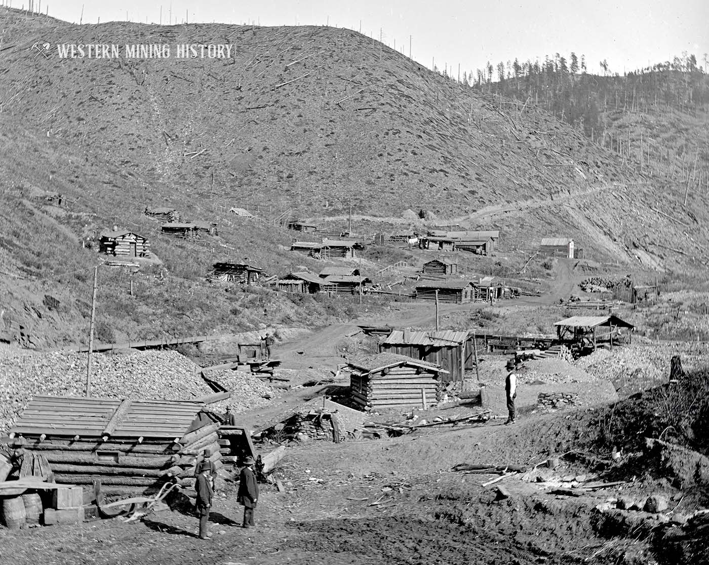
Not every mining community became a permanent town. The photo below depicts one of the first placer gold locations discovered in the Deadwood area. Miner’s cabins were built among the diggings, and were abandoned once the gold ran out.
The following fascinating photo shows a saloon built right in the dump of an early gold mine. Note the miner’s tents on the hillside. One can imagine that miners preferred to spend their evenings in the saloon rather than in their tents.
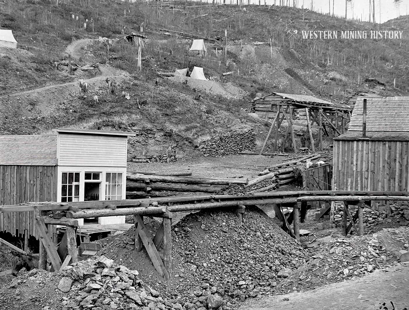
The following photo of the Hidden Treasure mine is undated, but it appears to predate the photo above, likely making it a late 1876, or early 1877 view.
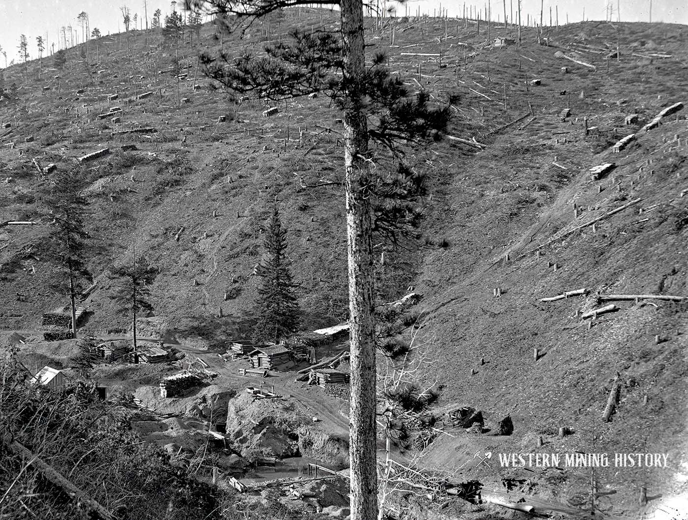
This interesting photo from Sawpit Gulch shows miner’s cabins at some placer workings. Also shown is that all the trees on the mountain have been harvested and stacked as many piles of firewood. If you look closely there is a small cabin at the top of the hill, perhaps this was where the wood cutters lived.
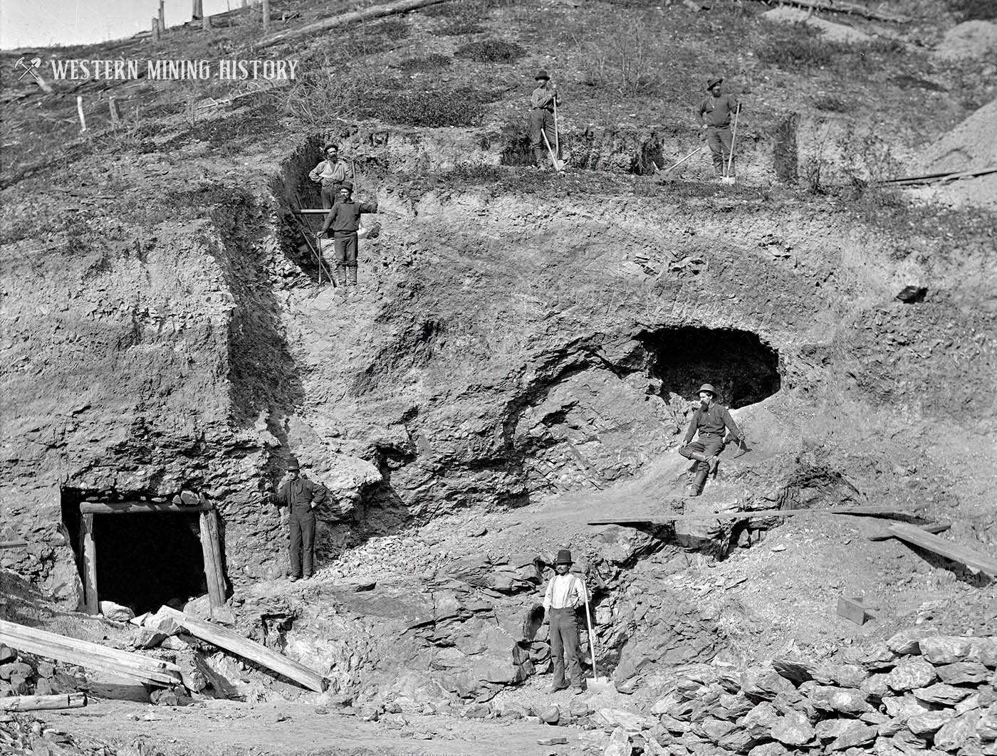
Although most of the early mining was of the placer type, some hard-rock (or quartz) mining was getting started during the initial years of the gold rush. The following photo shows a group of men developing their modest quartz mine in 1877.
In this photo two men are observing an area in the gulch that was thoroughly worked out by placer miners.
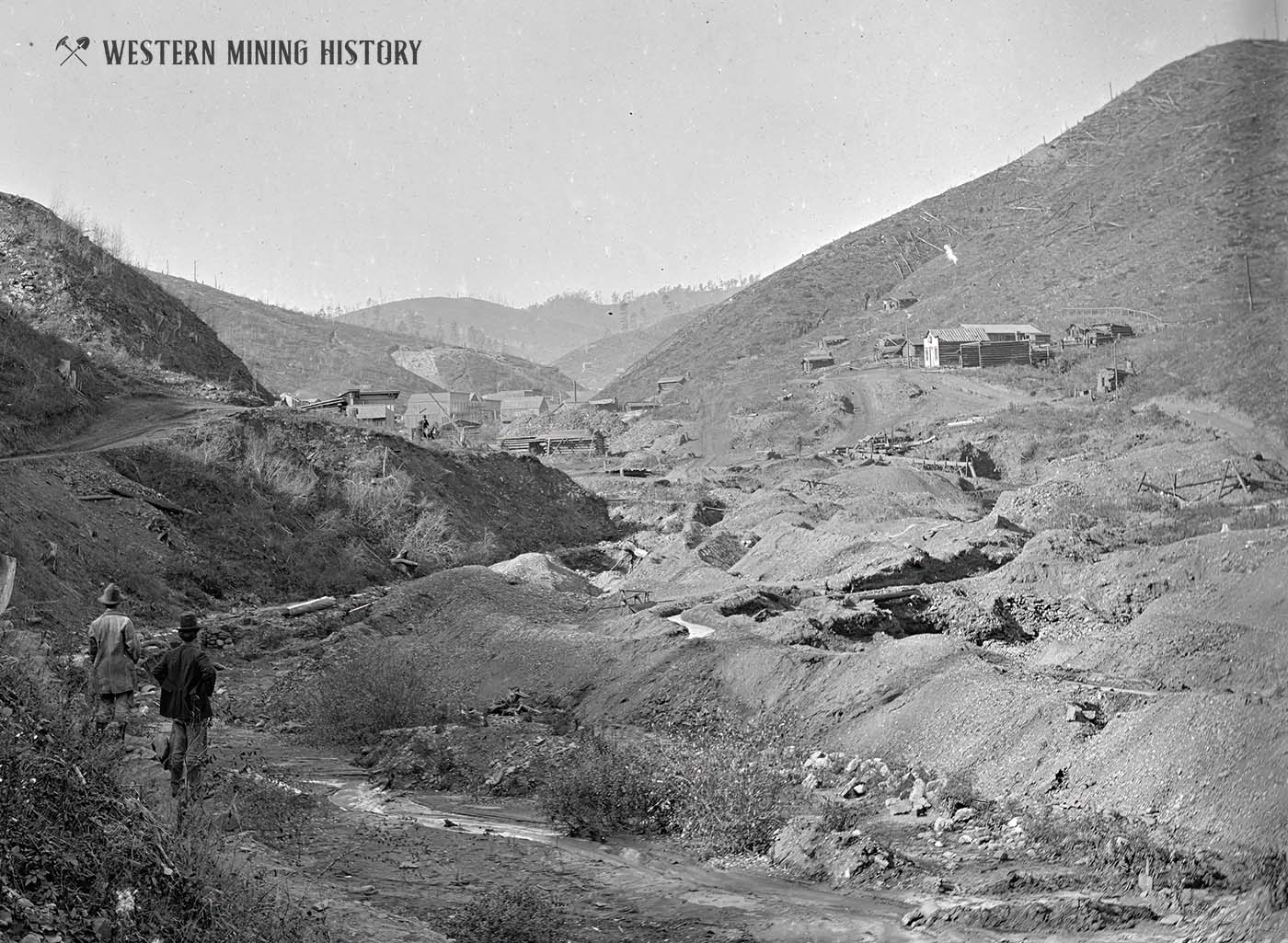
This photo from Gayville gives another look of the close proximity of the placer mines to the communities where the miners lived. Note the early stamp mills for processing ore on the right.
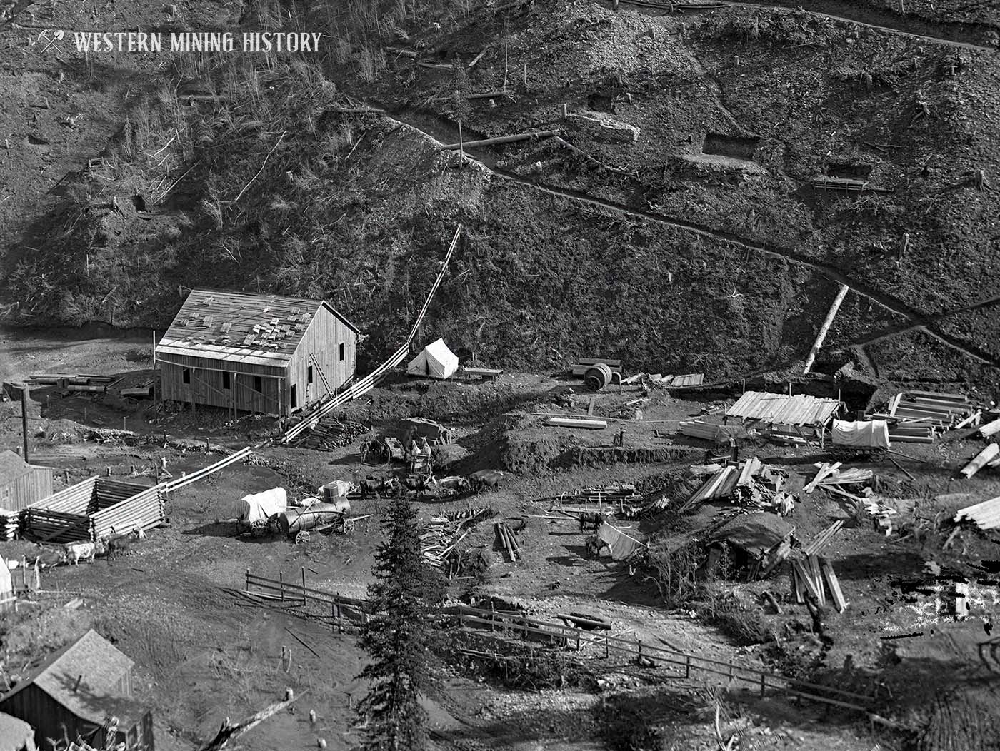
Below is a photo of the Father DeSmet and Alpha Mine as it was in 1877. This photo, like others on the page, has many interesting details of how miners built their homes at the mines. Seen below are miners tents, permanent buildings under construction, fenced areas for livestock, and mining infrastructure being assembled.
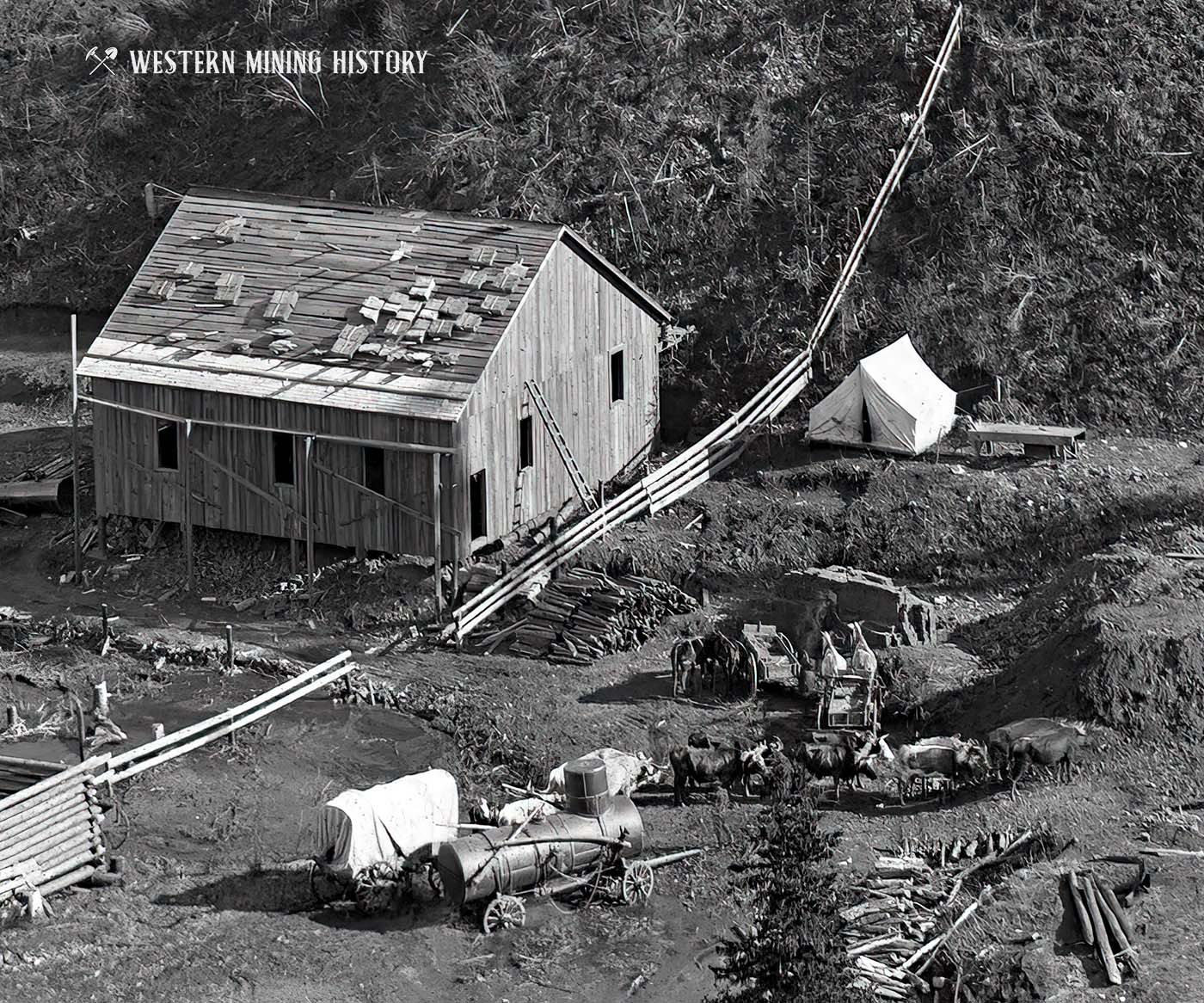
Zooming in on a portion of the photo reveals more detail: a boiler seemingly stuck in the mud, a team of oxen pulling a covered wagon, a miner’s tent, and a building that is in the process of having wooden shingles installed.
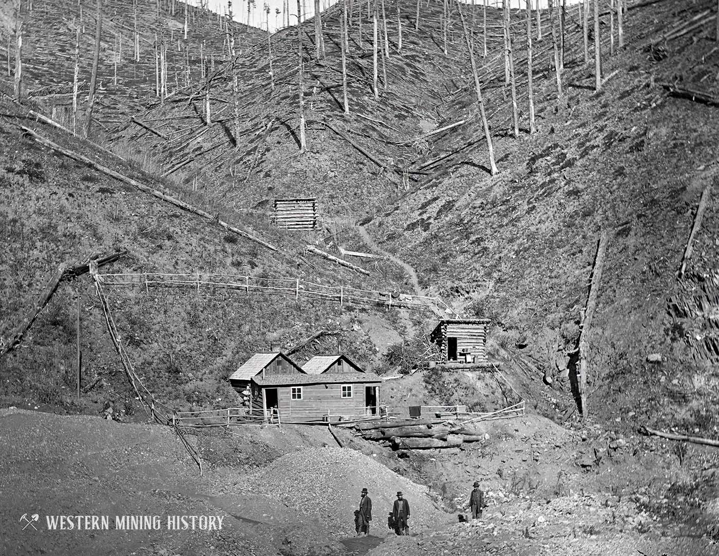
The following photo of the Wheeler placer mine reveals how the miners lived while working their mines. Note the cabins set into the hill, with an extension of the buildings built to the front. The outbuilding and fence suggest they kept livestock.
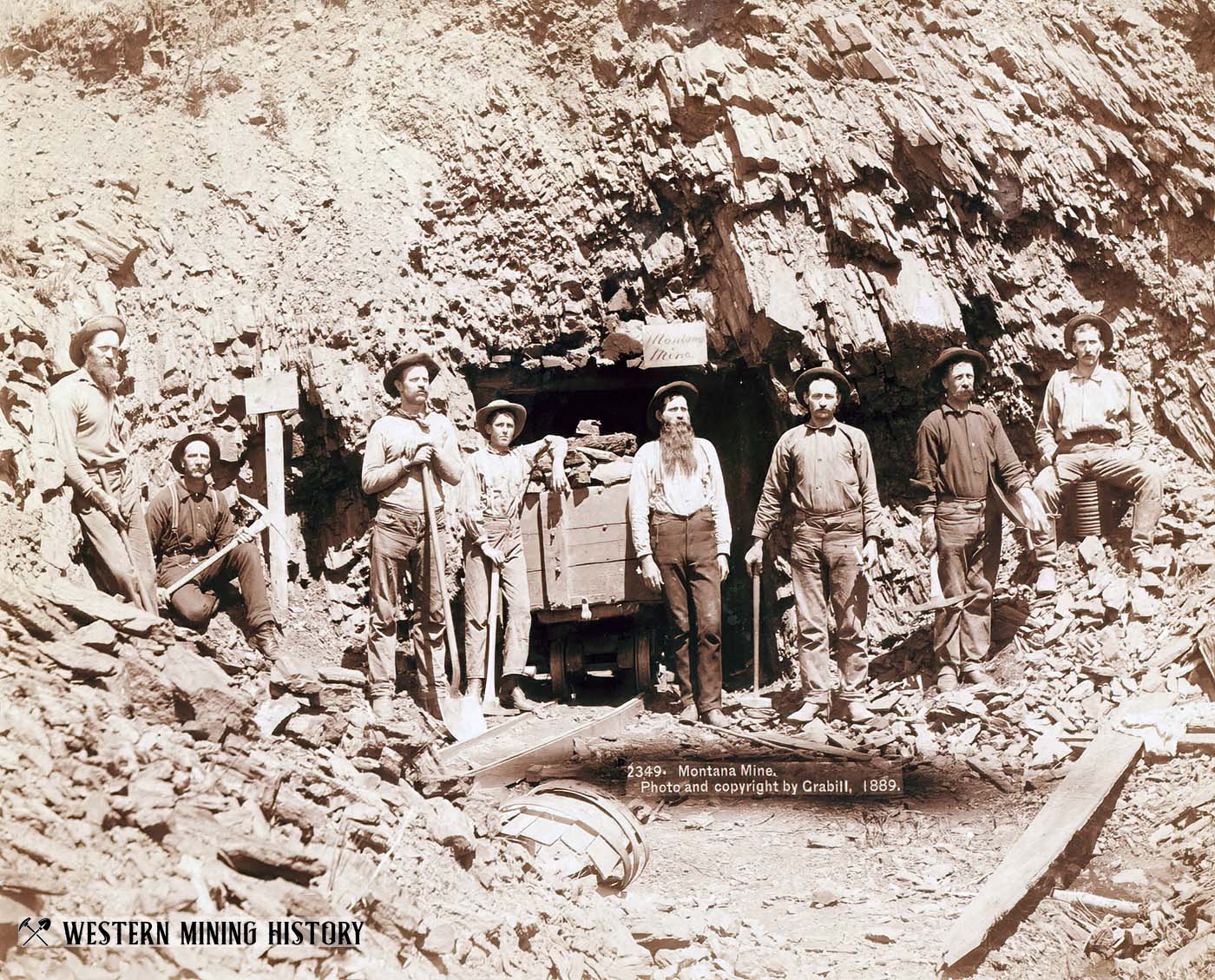
Over a decade later, new quartz mines were still being discovered, as this 1889 photo of the crew of the Montana Mine shows.
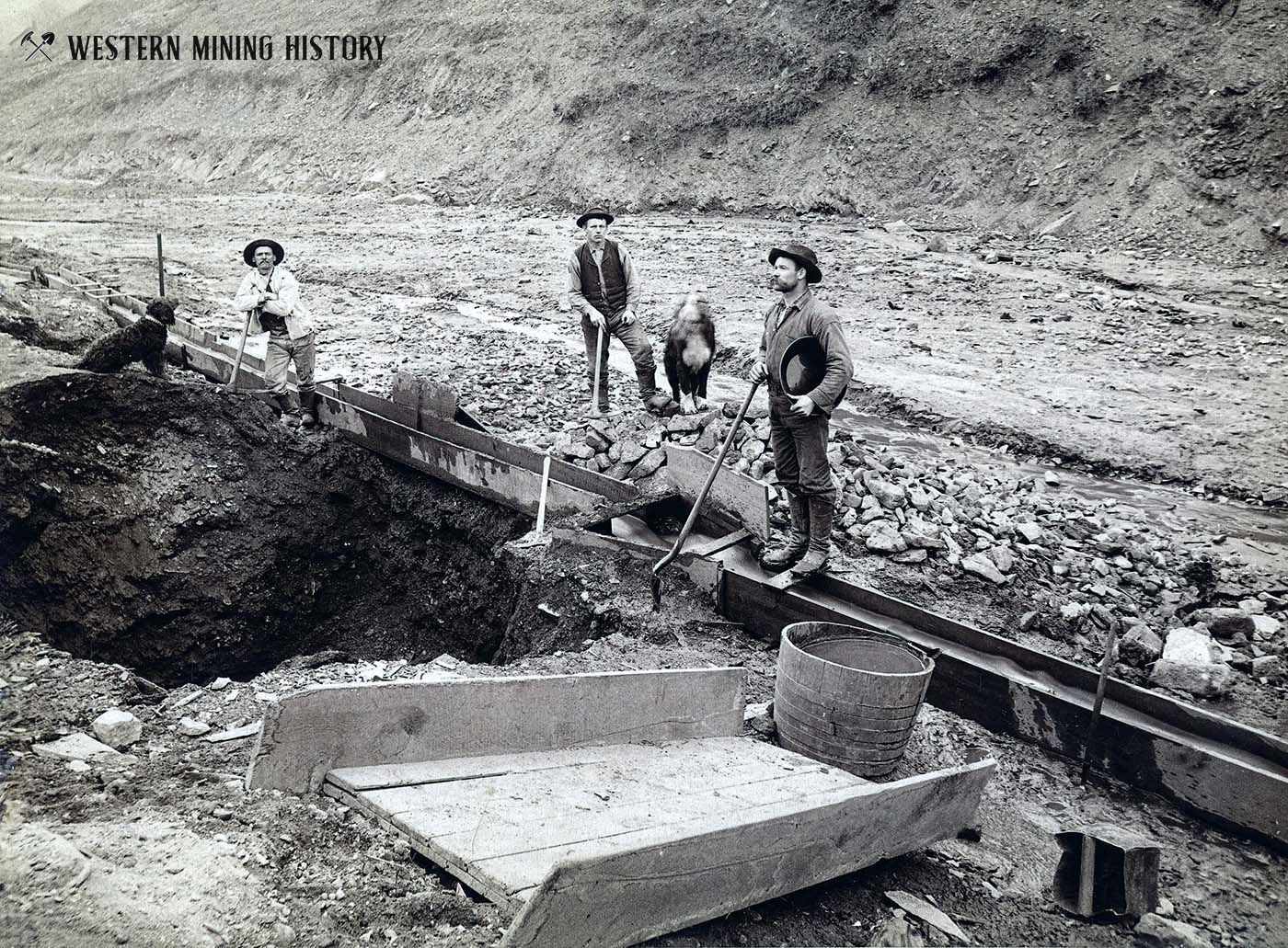
The following image shows three miners working a placer operation with their dogs somewhere in the Deadwood area. The miners are digging deep into an old riverbed channel and placing the gold-rich gravels into a long sluice box.
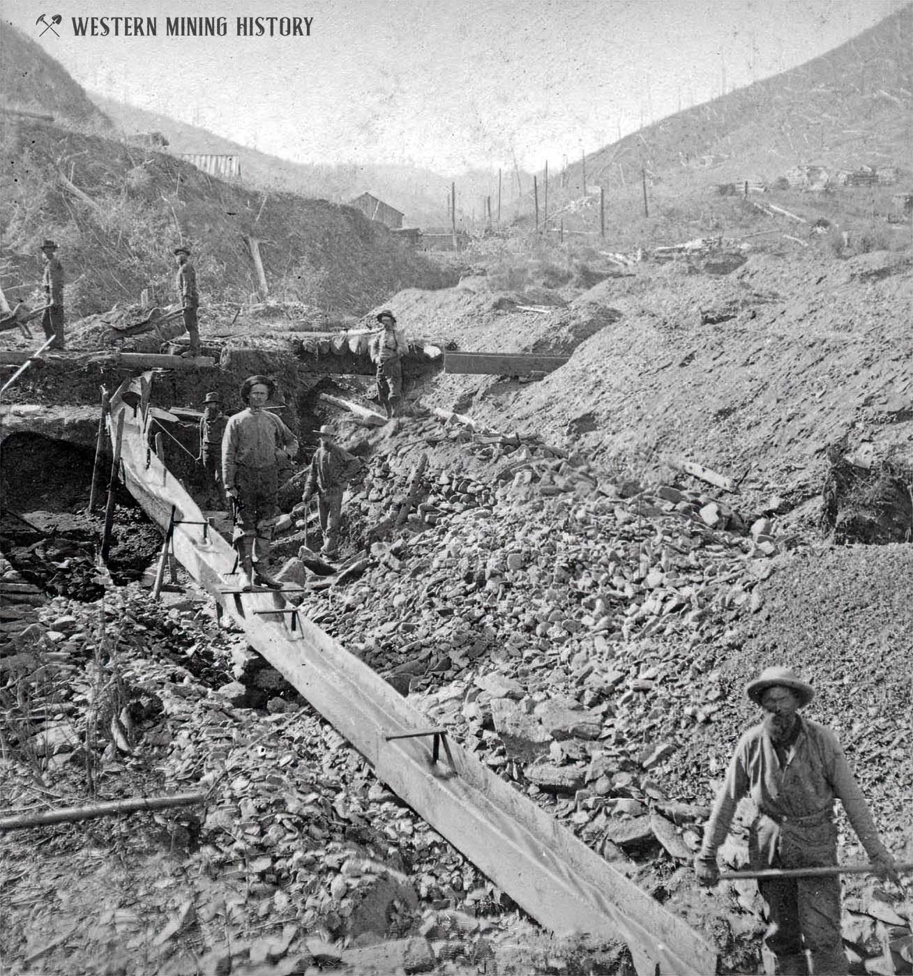
The next photo appears to be from the Gayville area. The amount of material that these placer miners moved by hand is astounding.
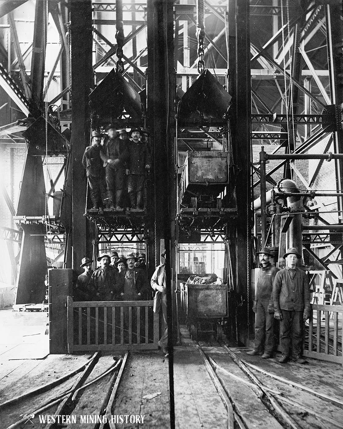
Hard rock mines started as humble operations as seen in the photos above, but some of them evolved into massive operations with shafts that extended hundreds, and sometimes thousands, of feet into the ground. The following image shows the shaft house of the Homestake mine in 1900. The photo is a composite, showing how both miners and ore were transported into and out of the mine.
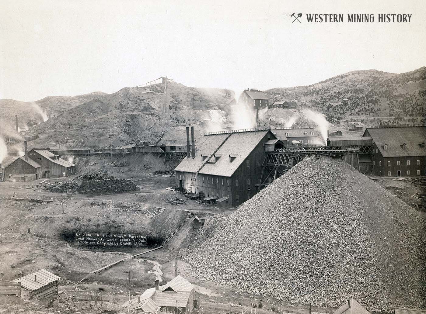
Of the hundreds of gold mines that operated in the Deadwood area, the Homestake was the largest and richest of them all. The following photo shows the mills of the Homestake mine in 1889.
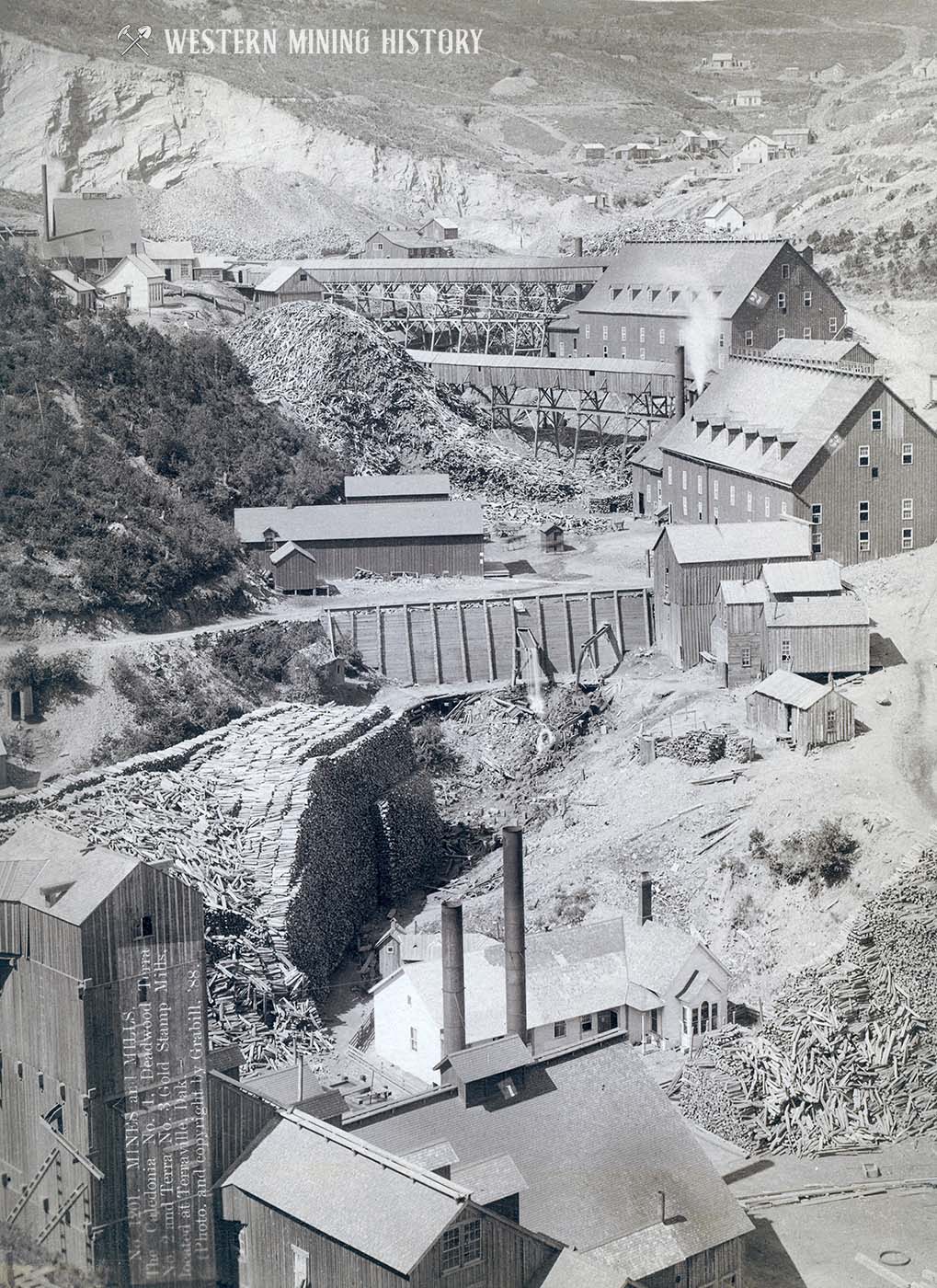
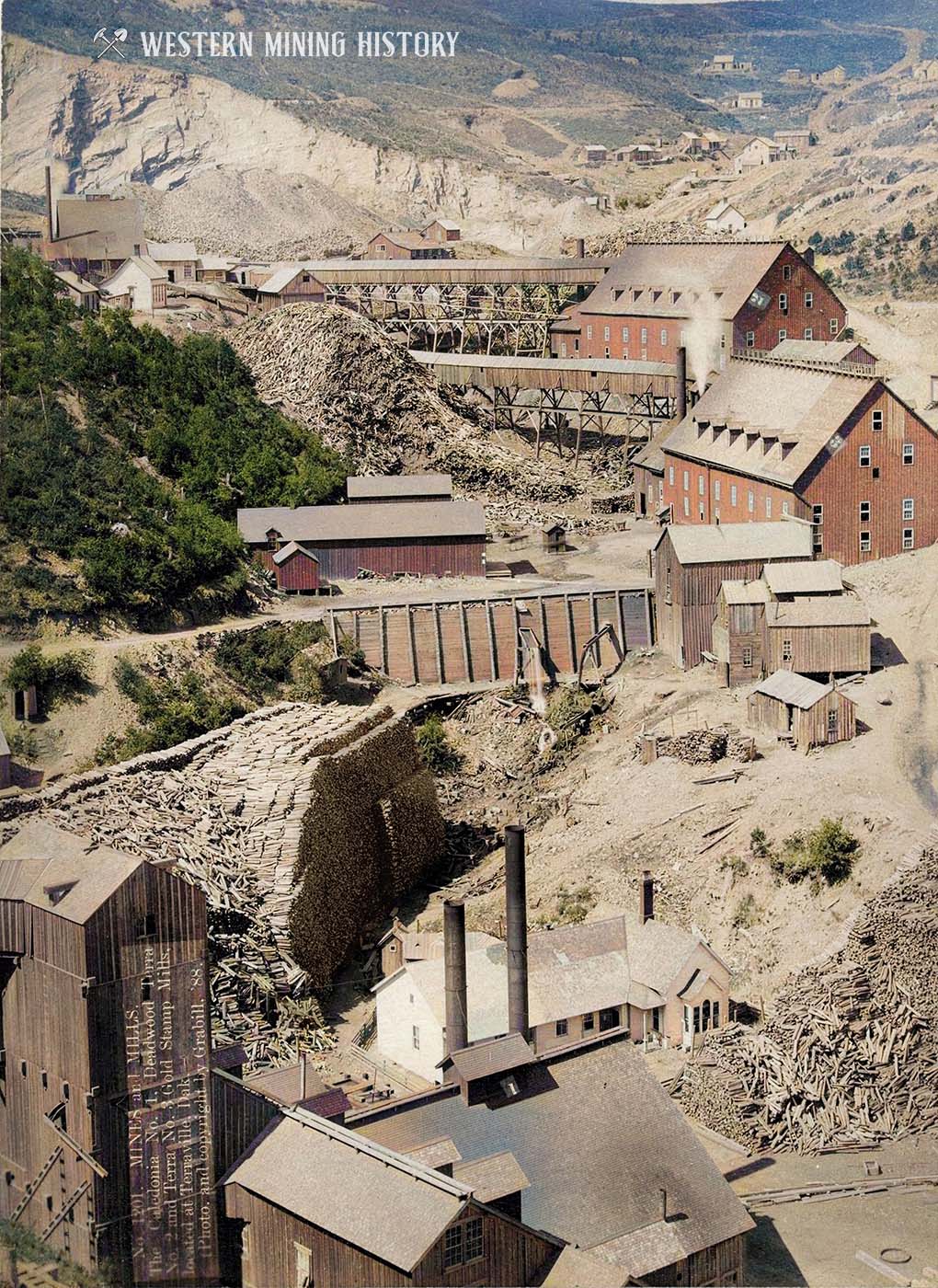
Ore from hard-rock mines needed to be processed to separate the gold from the waste rock. The most common method used at the time was the stamp mill. Pictured below are the stamp mills of Terraville in 1888. Note the massive piles of wood that were used to feed the boilers that powered these facilities.
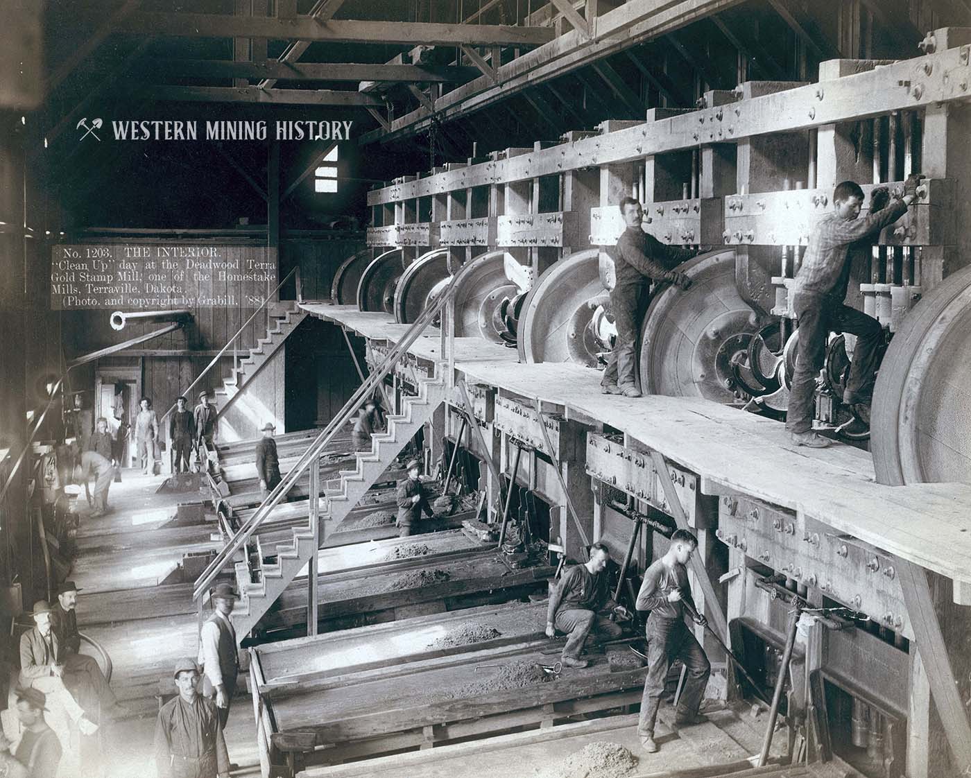
The following image shows a battery of stamps that were used to crush the ore into fine dust. The photo contains the caption: “Clean Up day at the Deadwood Terra Gold Stamp Mill; one of the Homestake mills, Terraville, Dakota.”
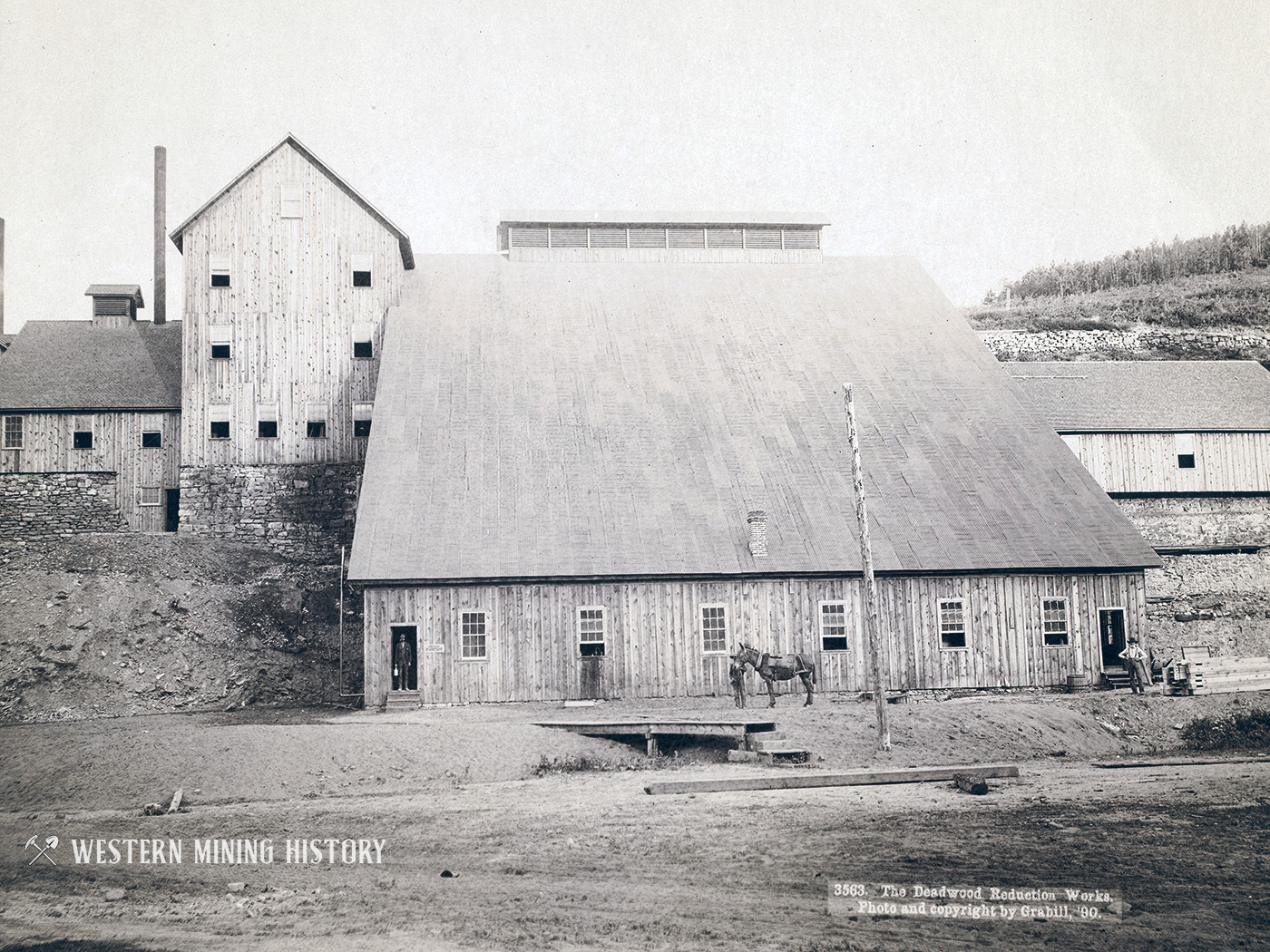
The following image from 1890 shows the Deadwood Reduction Works, one of many mills in the area.
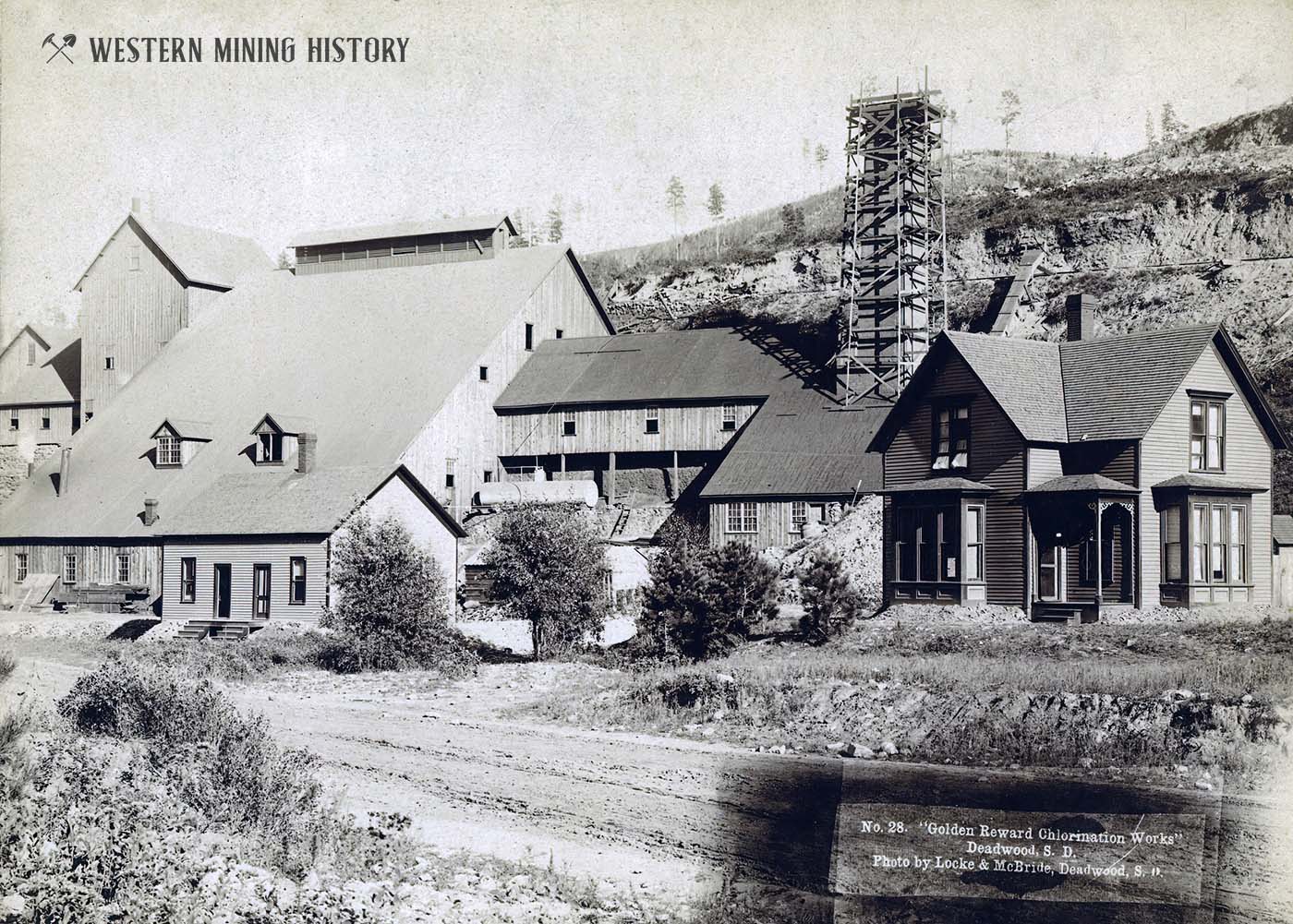
By the 1890s, improved milling processes were becoming available. The Golden Reward chlorination works, seen in the photo below, advanced milling technology in the Black Hills area.
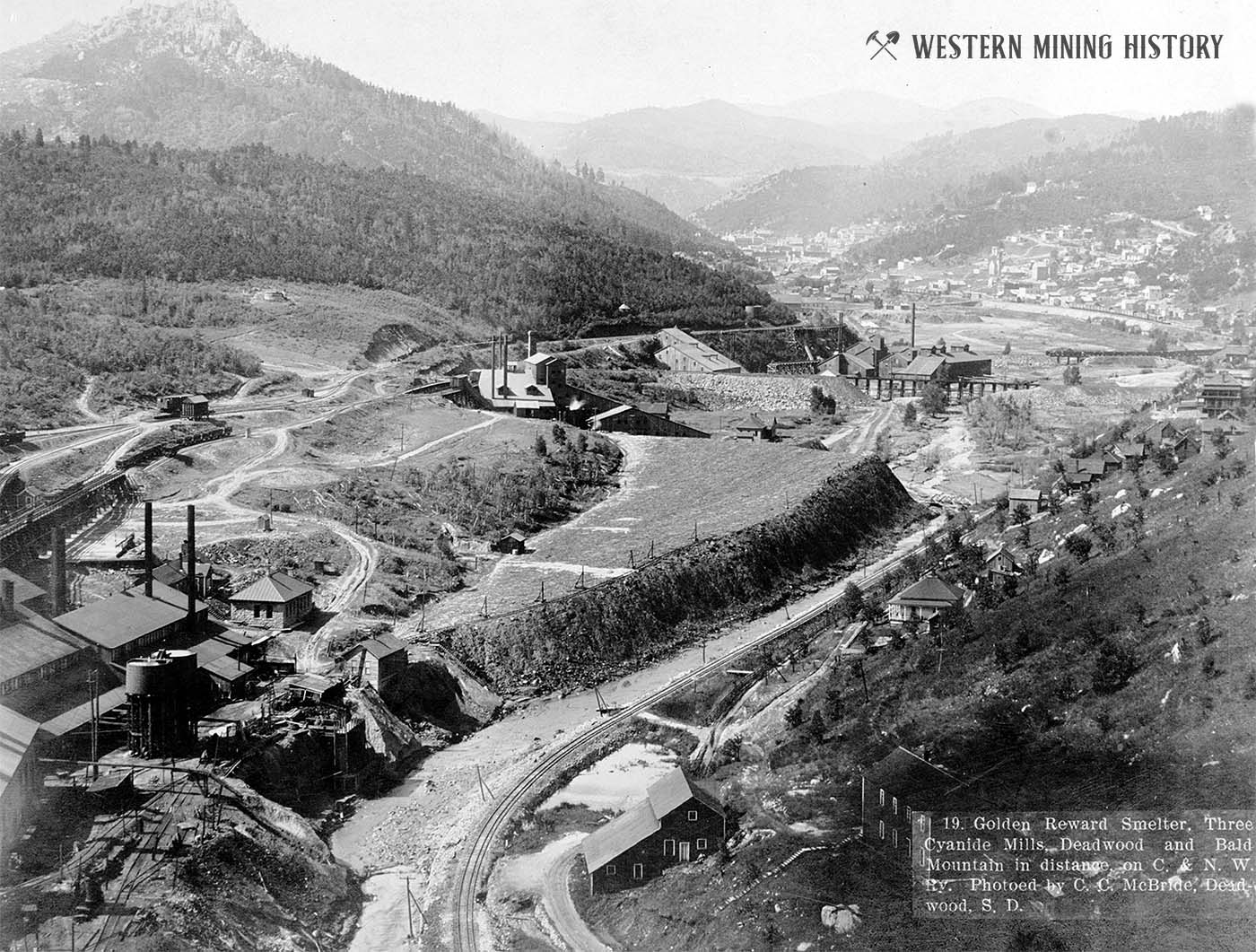
Deadwood became a major milling center for mines of the area as the following image illustrates. The caption on the image reads “Golden Reward smelter, three cyanide mills, Deadwood and Bald Mountain in distance on C. & N. W. Ry.”
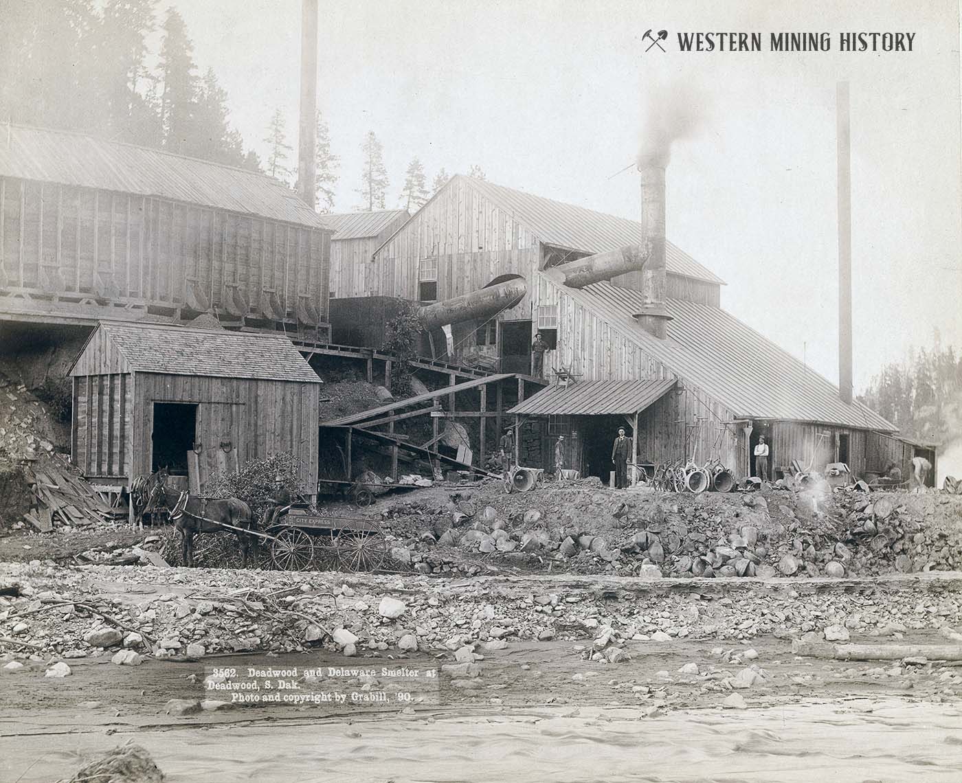
In some cases additional processes were needed to separate the gold from the waste rock in the ores. Smelting was a process that involved roasting the ores with furnaces. Seen below is the Deadwood and Delaware smelter in 1890.
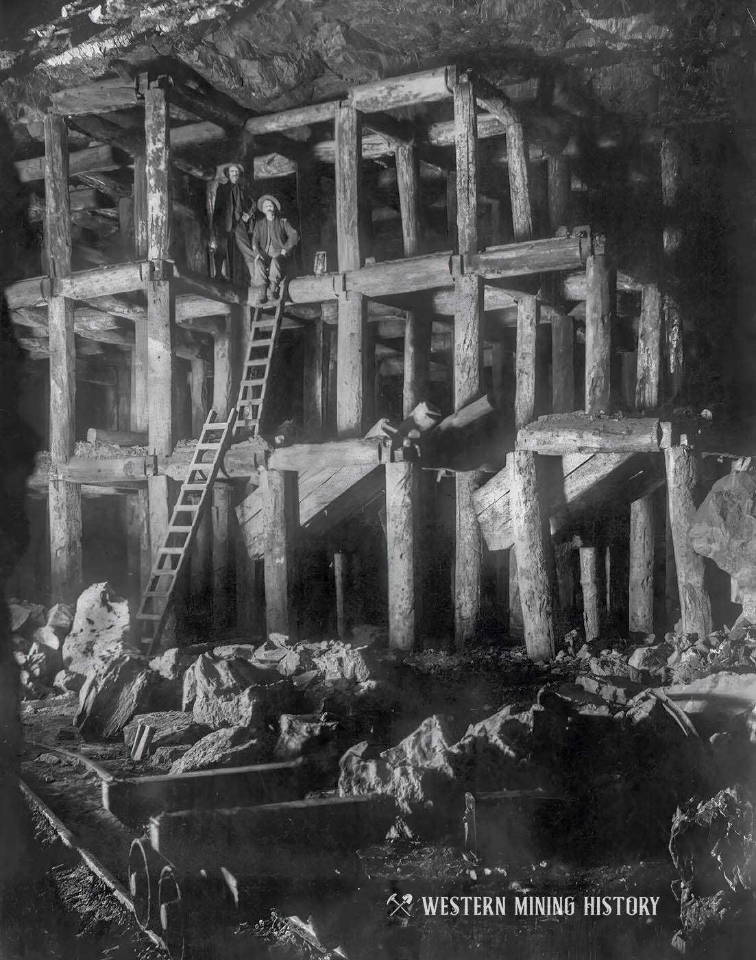
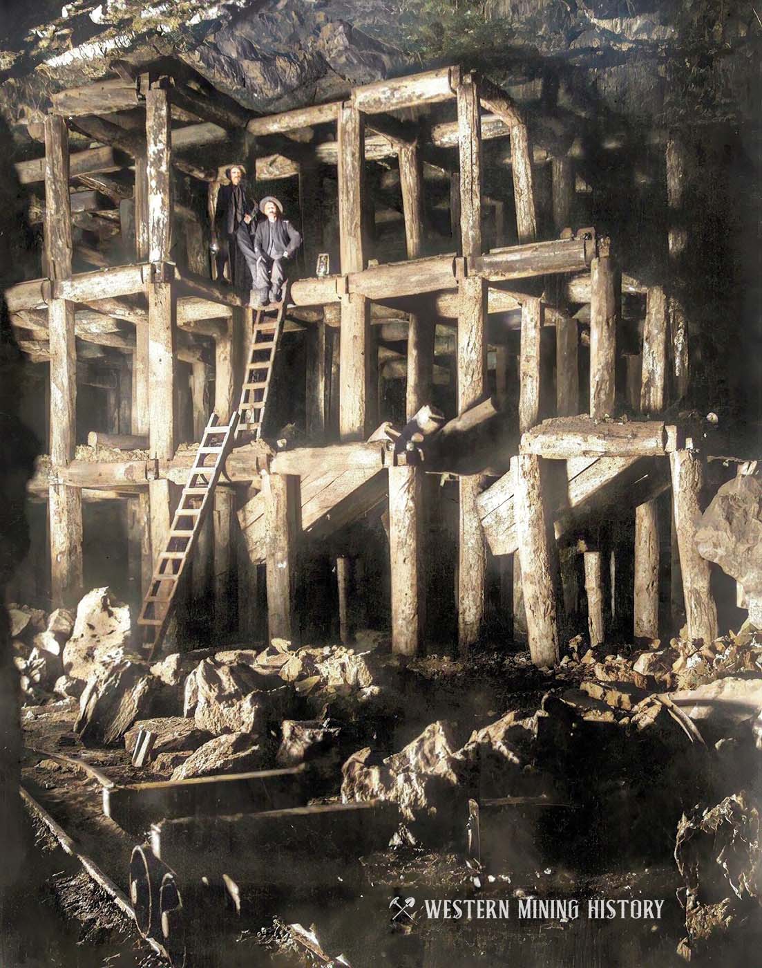
The large chambers (or “stopes”) that were created as ore was removed were reinforced with “square-set timbers” as seen below in this underground photo from the Homestake Mine in 1908.
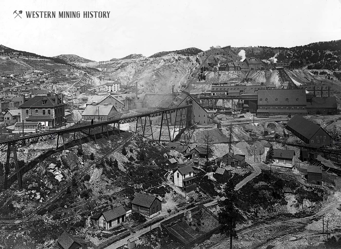
The Homestake mine operated for over a century and was ultimately the deepest and richest underground gold mine in the nation. Here we see the mine, and the city of Lead that grew up around it, around 1900.
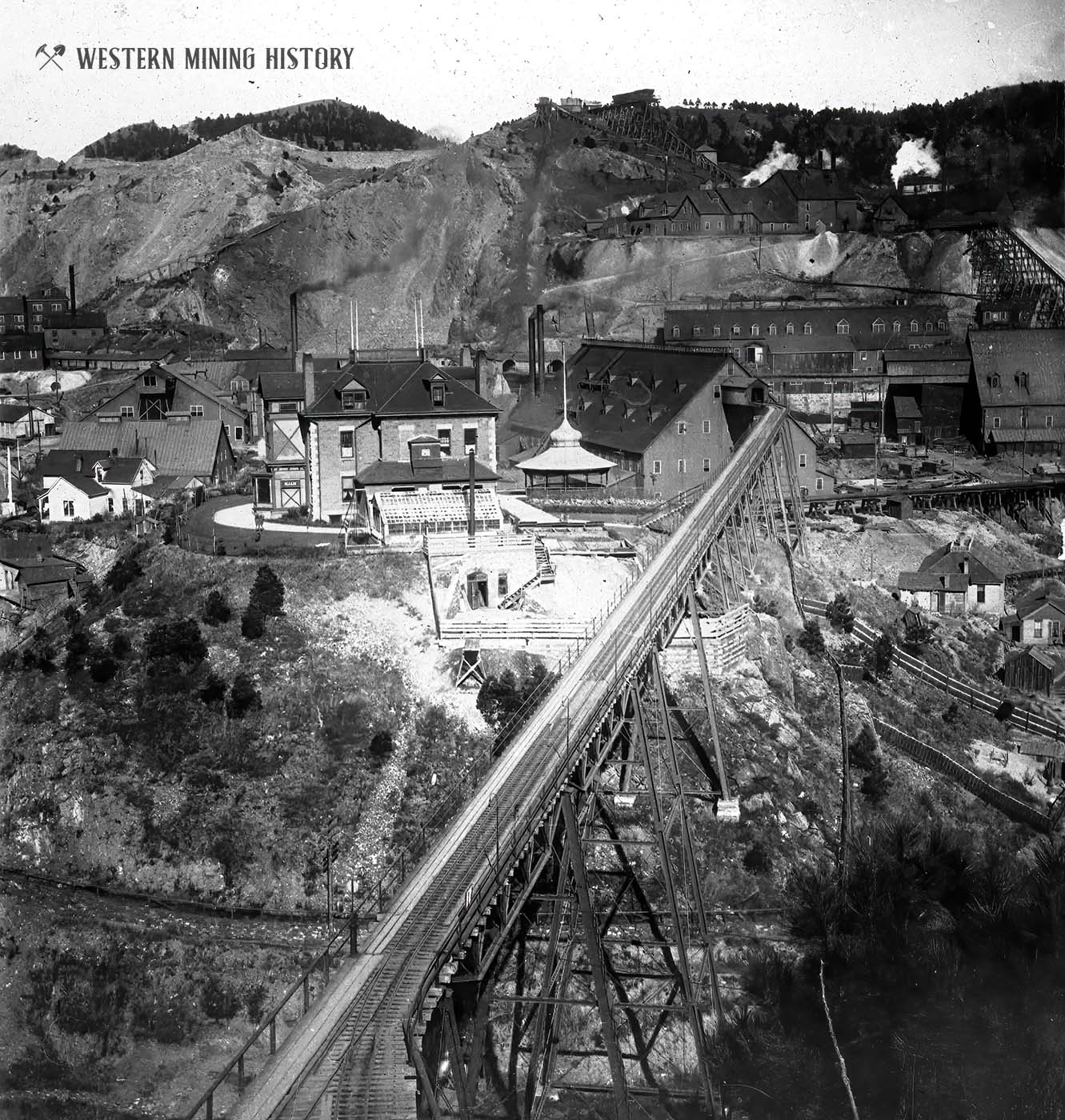
In another view of the Homestake mine, the massive infrastructure that supported the mine is highlighted. Note the mine headquarters building with the ornate pavilion – only the richest mines would justify such expenses.
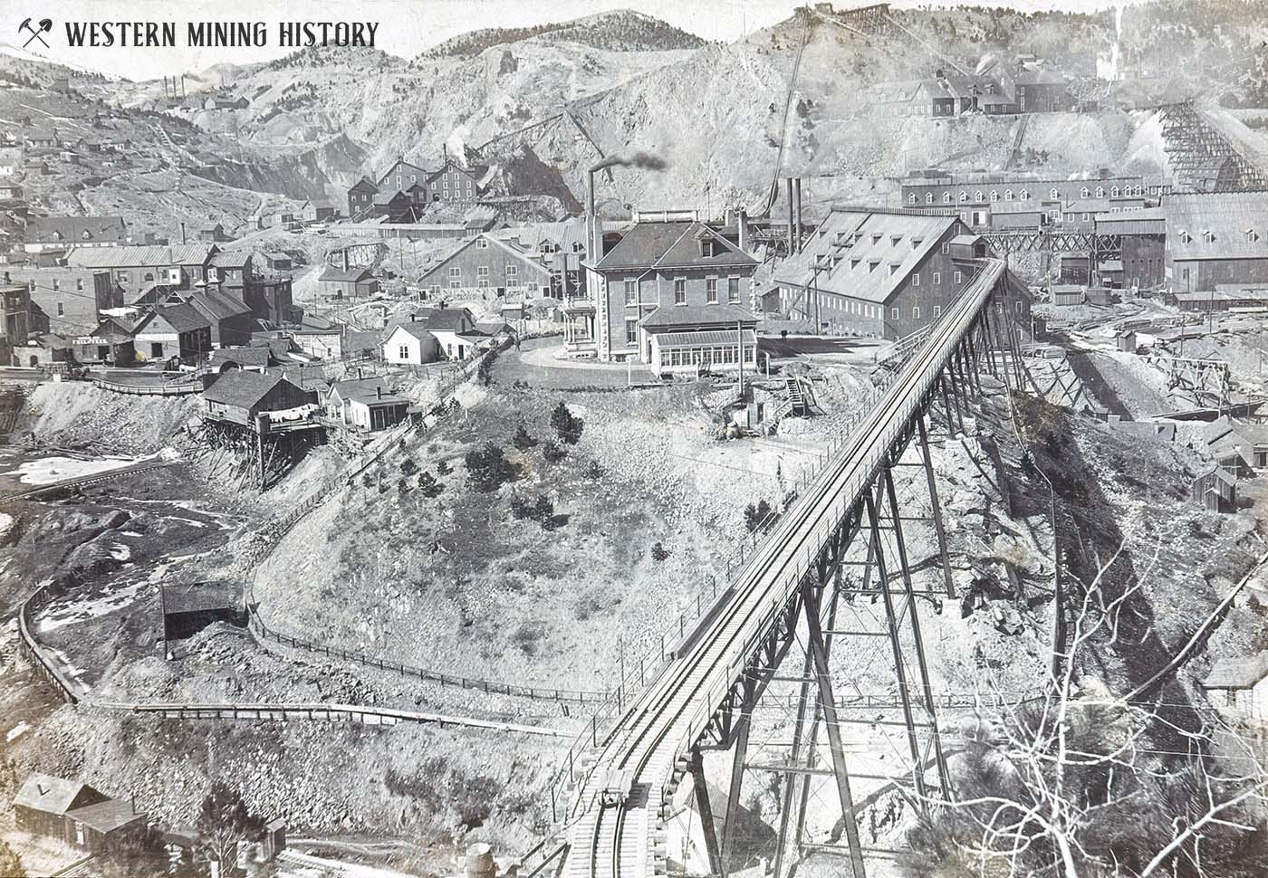
One last image of the mighty Homestake provides a clear view of this famous mine.
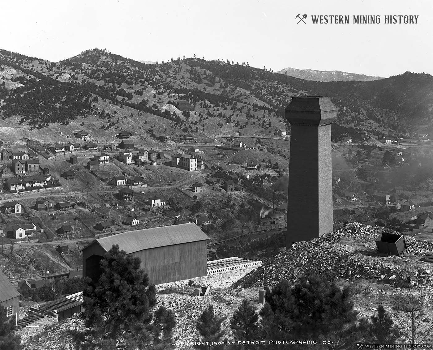
The following image shows a unique view from the Homestake Mine. Captured in this 1900 image by William Henry Jackson is a large brick smokestack, and an interesting rail feature with a large stone retaining wall with a building covering it.
Mining Cities in Later Decades
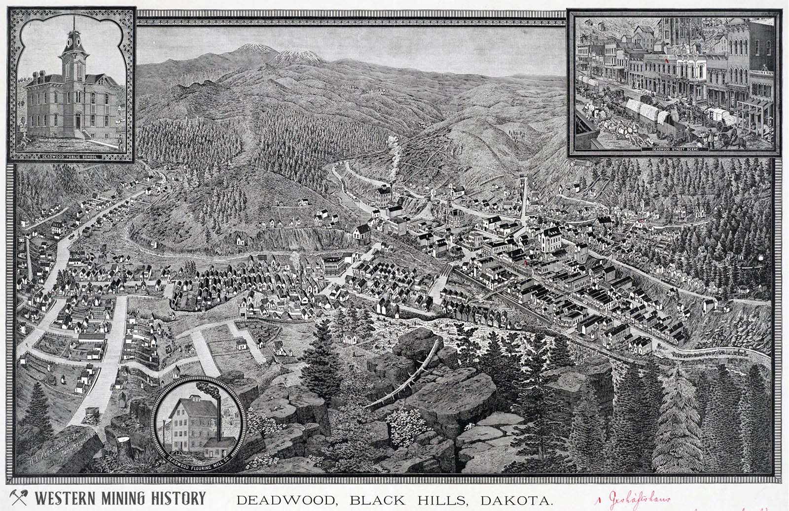
As the the mining industry expanded over years and decades, frontier boom towns became substantial industrial cities. The illustrated view below shows the growth of Deadwood by 1884.
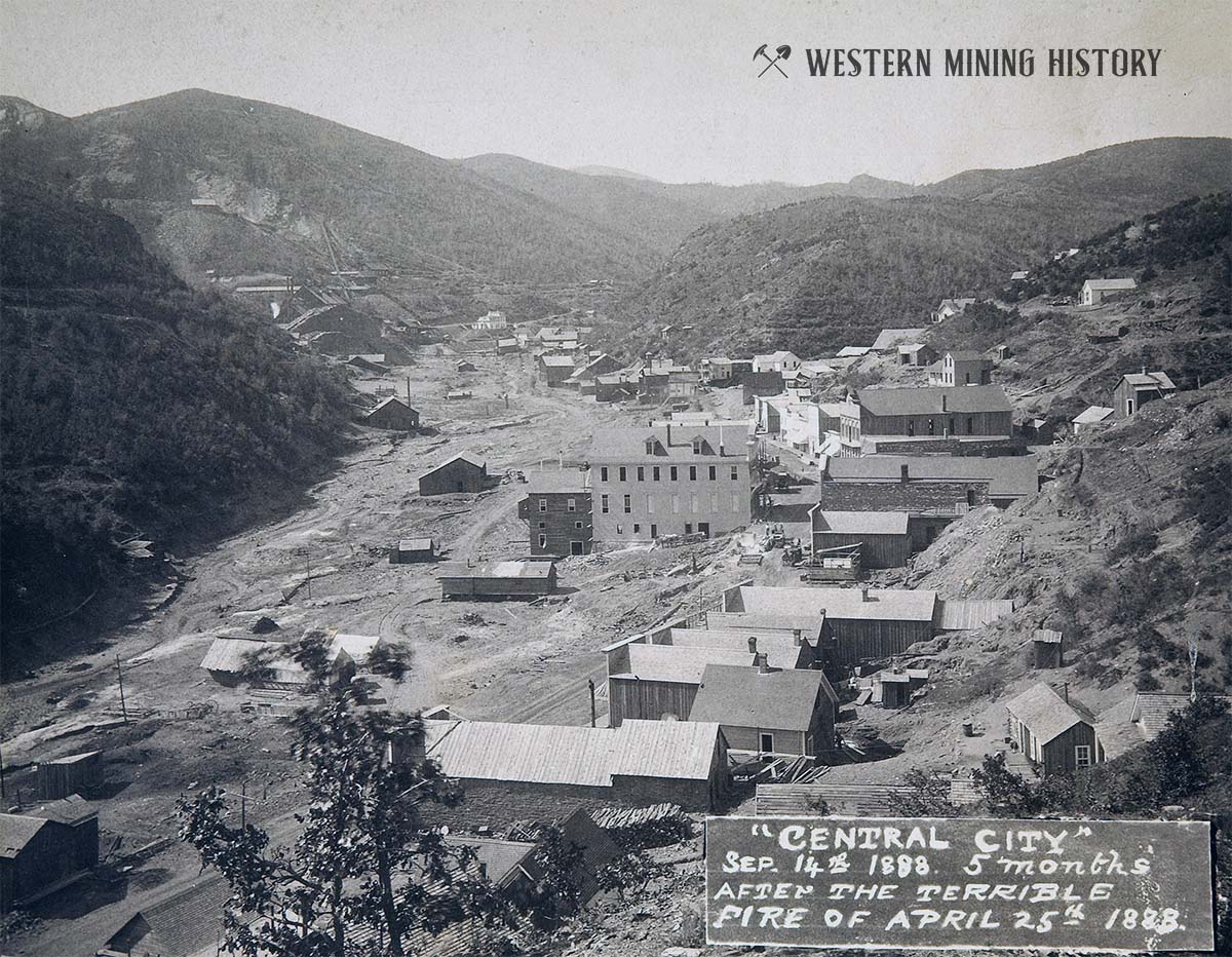
Central City was already declining by 1888 when a disastrous fire destroyed much of the town. The photo below shows the extent that the commercial district had been rebuilt five months after the fire.
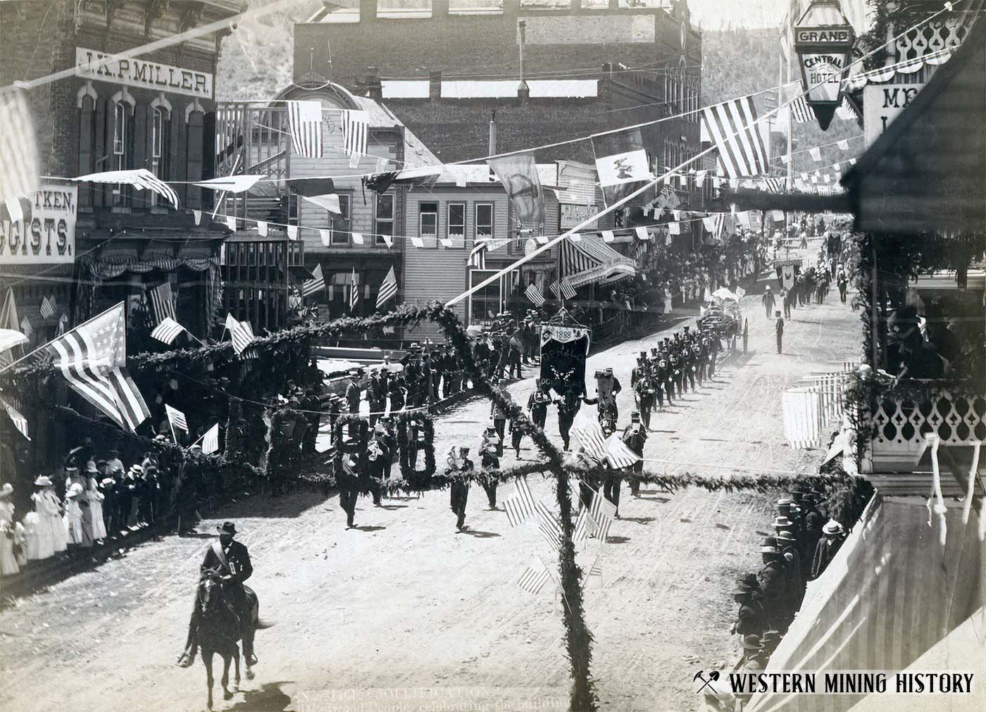
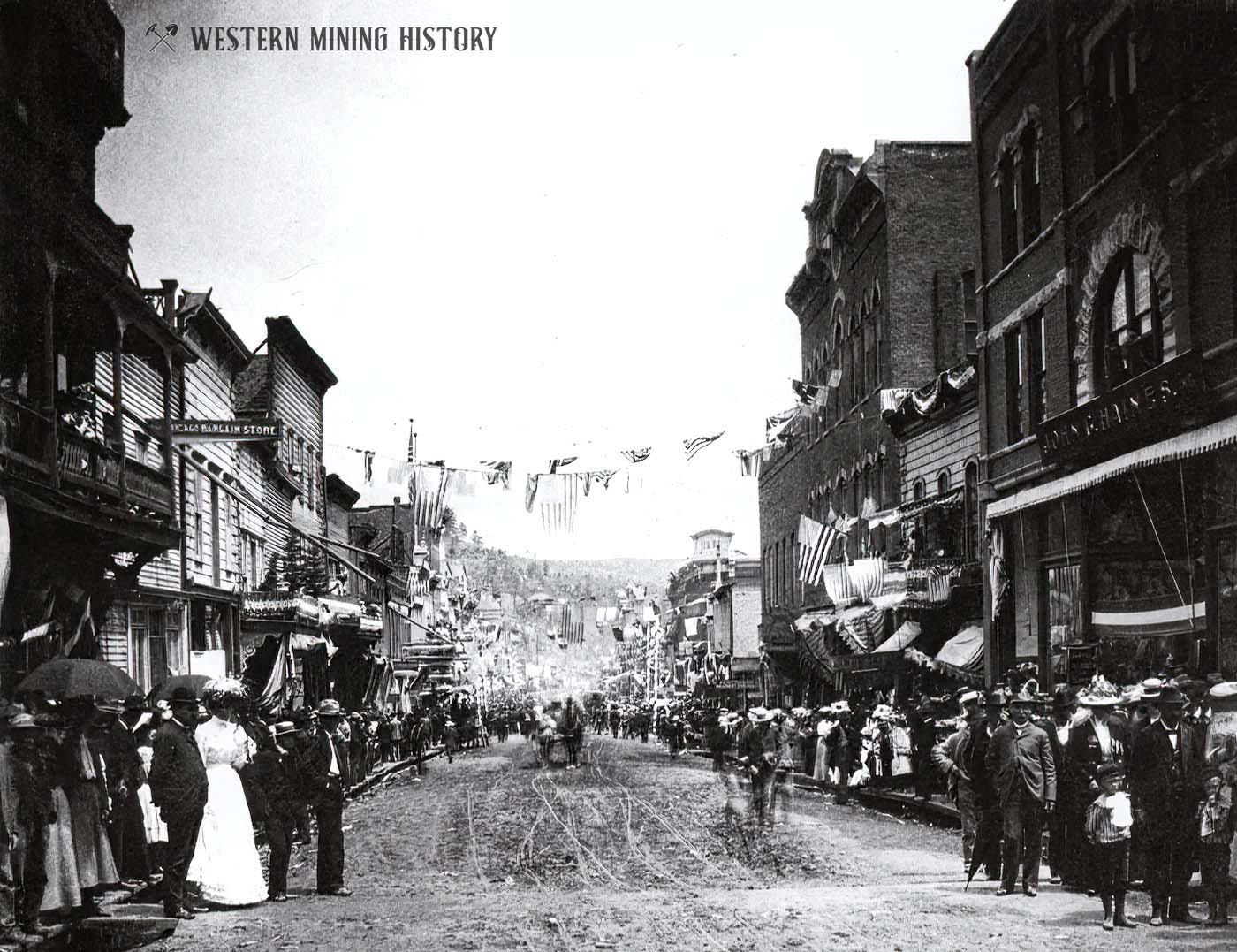
In this 1888 photo, the citizens of Deadwood are celebrating the connection of Deadwood and Lead by railroad. It is remarkable to think that the town of Deadwood was first settled just 12 years before this photo was taken.
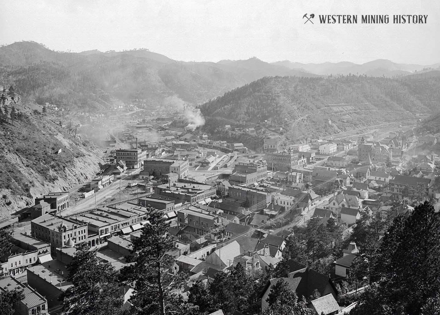
By the turn of the century, Deadwood was a prosperous and modern city as seen in the photo below.
In the following 1901 photo, the residents of Deadwood celebrate the passing of a quarter century since the founding of this great gold city.
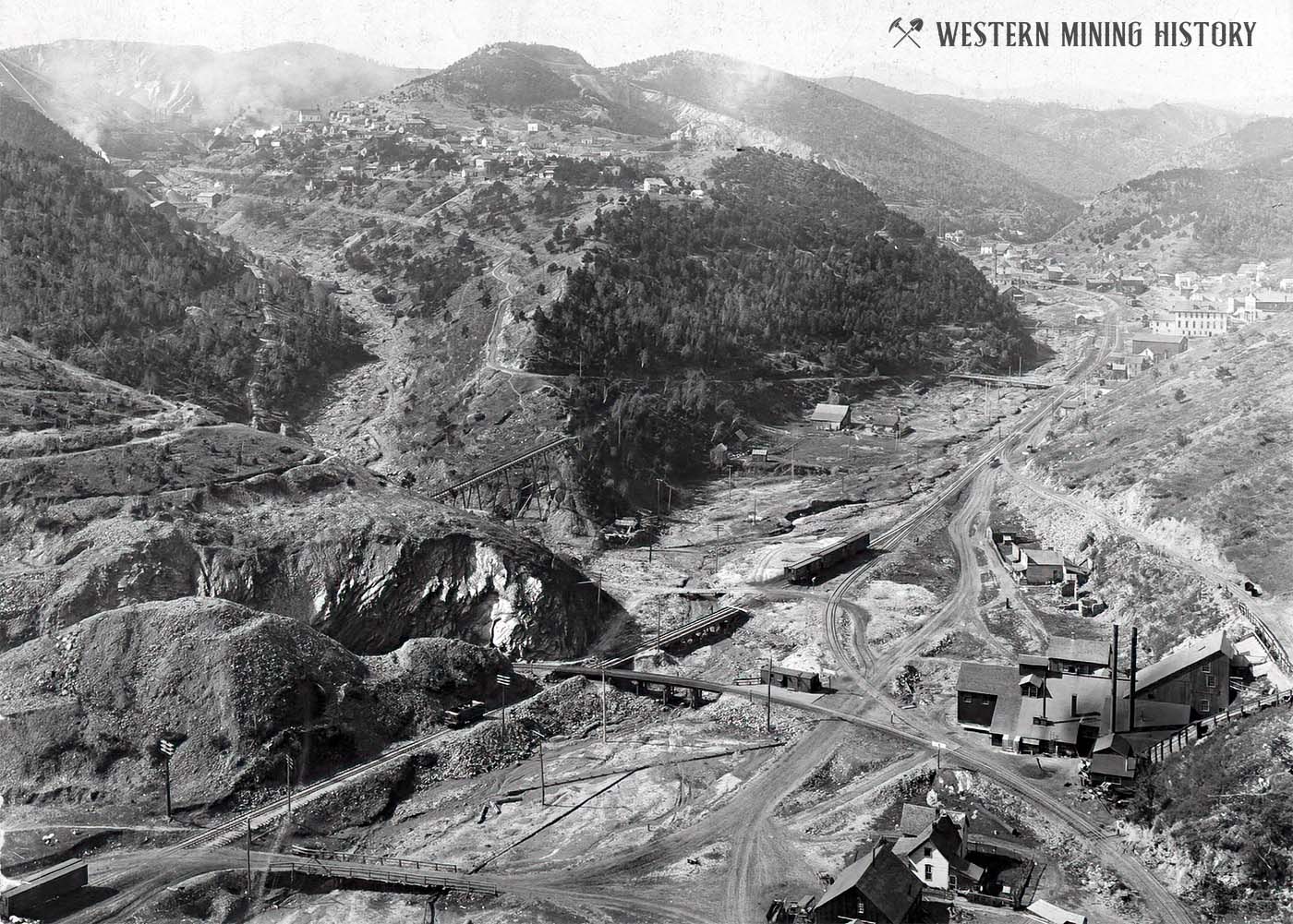
This image illustrates the scale of industry throughout the Deadwood area mining operations. Seen here are Central City on the right, and Terraville high on the hill to the left.
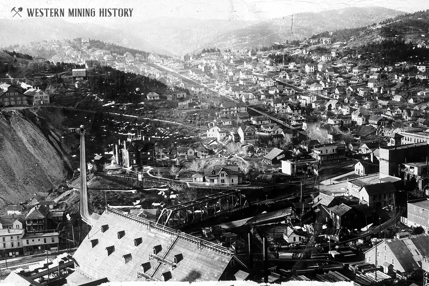
This view of Lead in the shadow of the mighty Homestake Mine illustrates the prosperity that gold brought to that city.
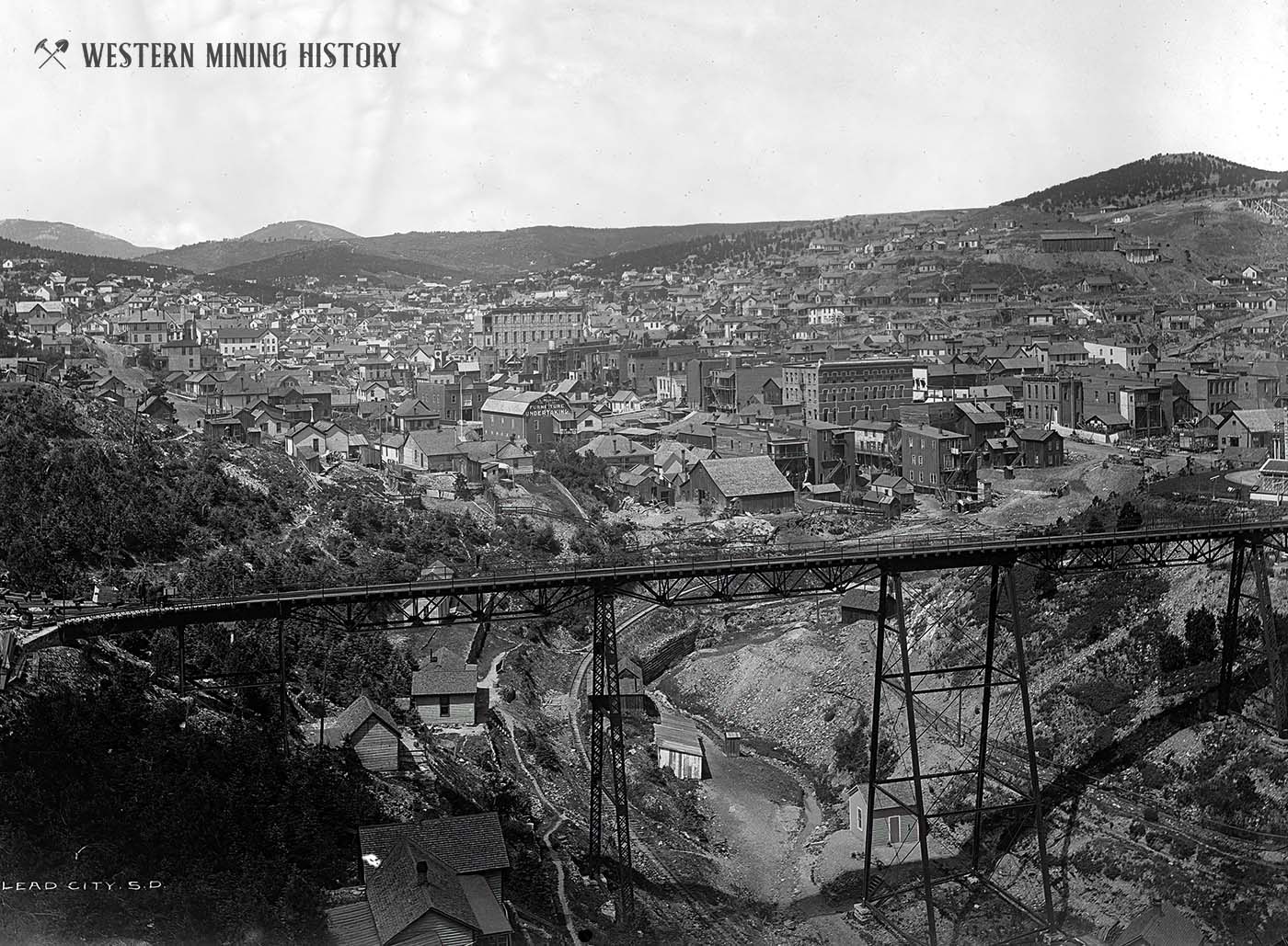
Another photo of Lead depicts a modern city of substantial brick buildings.
Deadwood and Lead are still active cities full of amazing historical buildings, and are popular tourist destinations for those wanting to experience mining history first hand.
Colorized Images from the Black Hills
Modern software is creating new ways to visualize historic scenes. Colorization is one way to experience the old west in a way that that more closely represents the way the pioneers did.
In historical photos that have a more grainy or abstract appearance, a colorized image can look like a painting as in the following example.
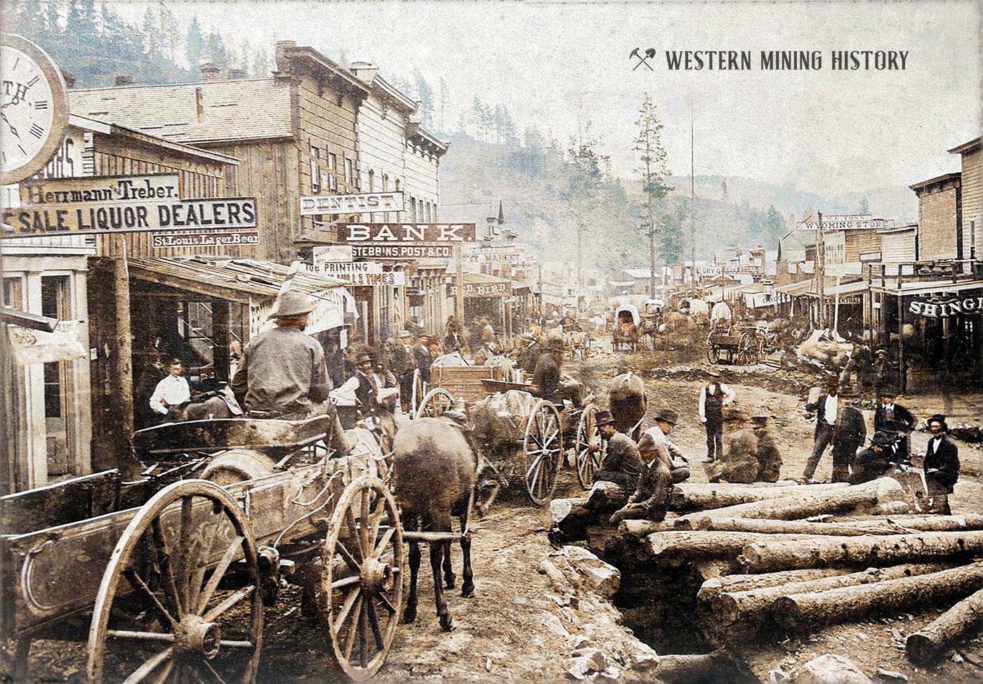
While the photo above has the abstract quality of a painting, the photo below illustrates in incredible detail what Main Street in Deadwood looked like in 1877.
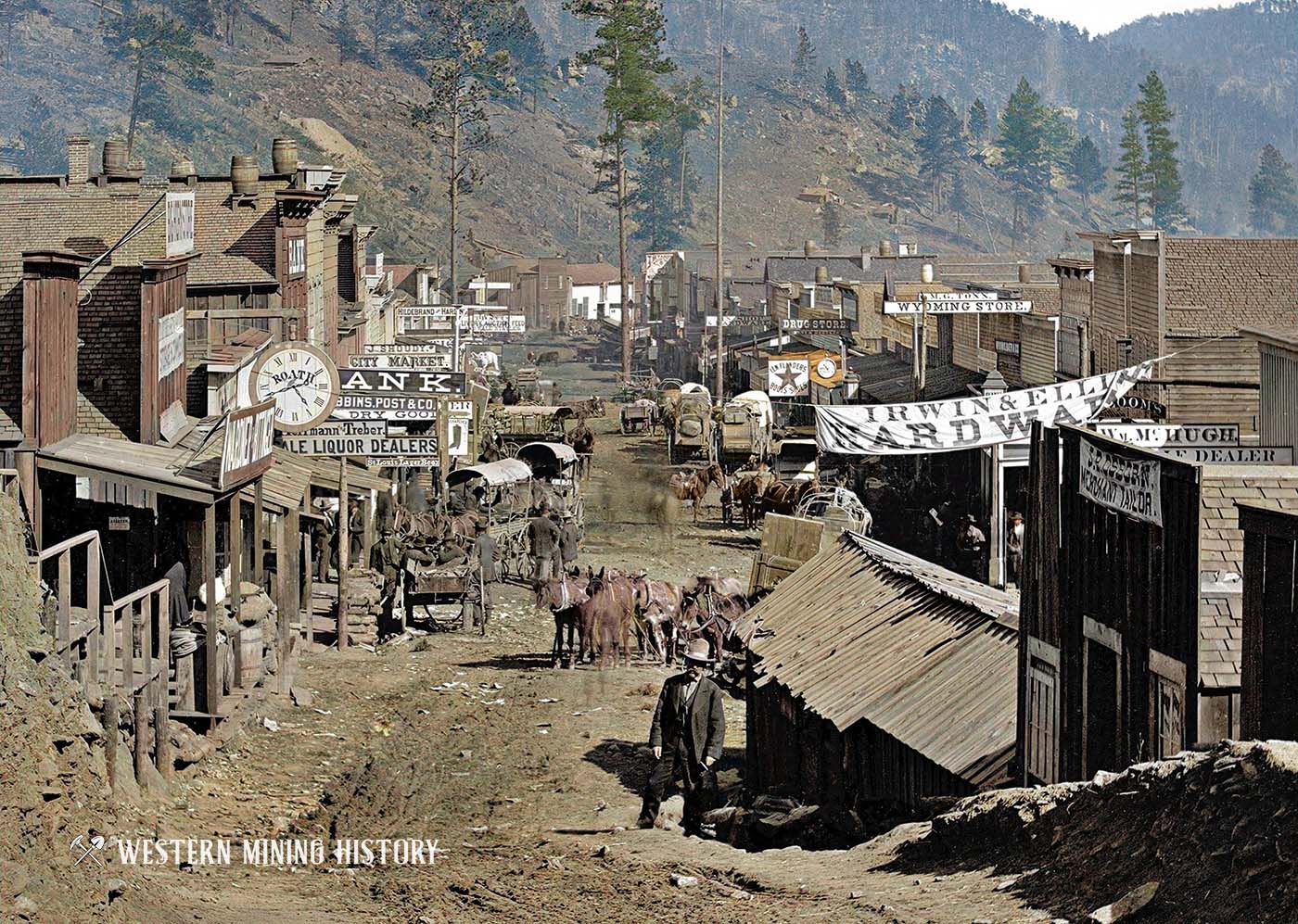
The above below depicts Main Street – Deadwood, Dakota Territory in 1877. A banner for Adam Bros. Banner Grocery hangs across the road. The Delmonico Hotel and Restaurant can be seen on the left.
Historical images that were taken by leading photographers of the time sometimes achieve a level of detail that rival modern photos, and colorizations can result in stunning scenes as in the photo below of Deadwood in 1877.
This colorized version of Gayville shows the young boom town in the months before most of it burned down.
Adding some color to this image of the square set timbering in the Homestake Mine helps us understand what it was like working deep underground.
The Homestake mine produced enough rich ore to utilize many large milling facilities. Shown here are the mills of Terraville in 1888.
More Photo Collections from Western Mining History
The following collections capture more of the West’s amazing mining history:
A Collection of Arizona Mining Photos
A Collection of Arizona Mining Photos highlights some of the best historic scenes from various Arizona districts during the peak mining years between the 1870s and the 1920s.
50 Incredible Photos of Colorado Mining Scenes
Colorado’s spectacular scenery and the richness of the state’s mines attracted many of the top photographers working at the time. These are some of the most incredible mining scenes from the state of Colorado: 50 Incredible Photos of Colorado Mining Scenes
The Comstock Lode: Nevada’s Big Bonanza
The Comstock Lode was the West’s first great silver mining district. Photos of the towns, mines, and mills are available at The Comstock Lode: Nevada’s Big Bonanza
A Collection of Nevada Mining Photos
The first mines in Nevada were discovered in the 1850s, and by the 1860s new districts were being discovered throughout the state. Nevada would first be known as the “Silver State” but would eventually become the largest gold producing state in the Nation. These are some of the best historical photos from Nevada’s notable mining districts: A Collection of Nevada Mining Photos
Best Historical Photos: Colorized Mining Scenes
Best Historical Photos: Colorized Mining Scenes is a collection of the best colorized images of mines, miners, and mining towns.
