Colorado is characterized by the most rugged and mountainous terrain of any state in the US, and those mountains were rich in minerals waiting to be discovered by prospectors as far back as 1858.
Development of mines in Colorado was slow at first due to the extremes of terrain and weather, and the remoteness of many of the state’s mountain ranges. However, by the 1880s most areas of the state had been opened, and mining on a large scale had begun.
Colorado’s spectacular scenery and the richness of the state’s mines attracted many of the top photographers working at the time. The result is that today more amazing photography of Colorado’s historic mining industry is available than of any other state.
These are some of the most incredible mining scenes from the state of Colorado.
Cripple Creek
Gold was not discovered at Cripple Creek until the 1890s, a late date for a major discovery in the West. The mines at Cripple Creek would go on to create the second most wealth of any gold district in the country, with only Deadwood, South Dakota producing more.
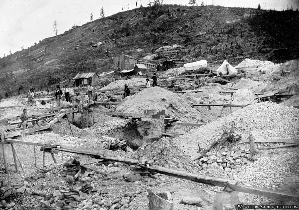
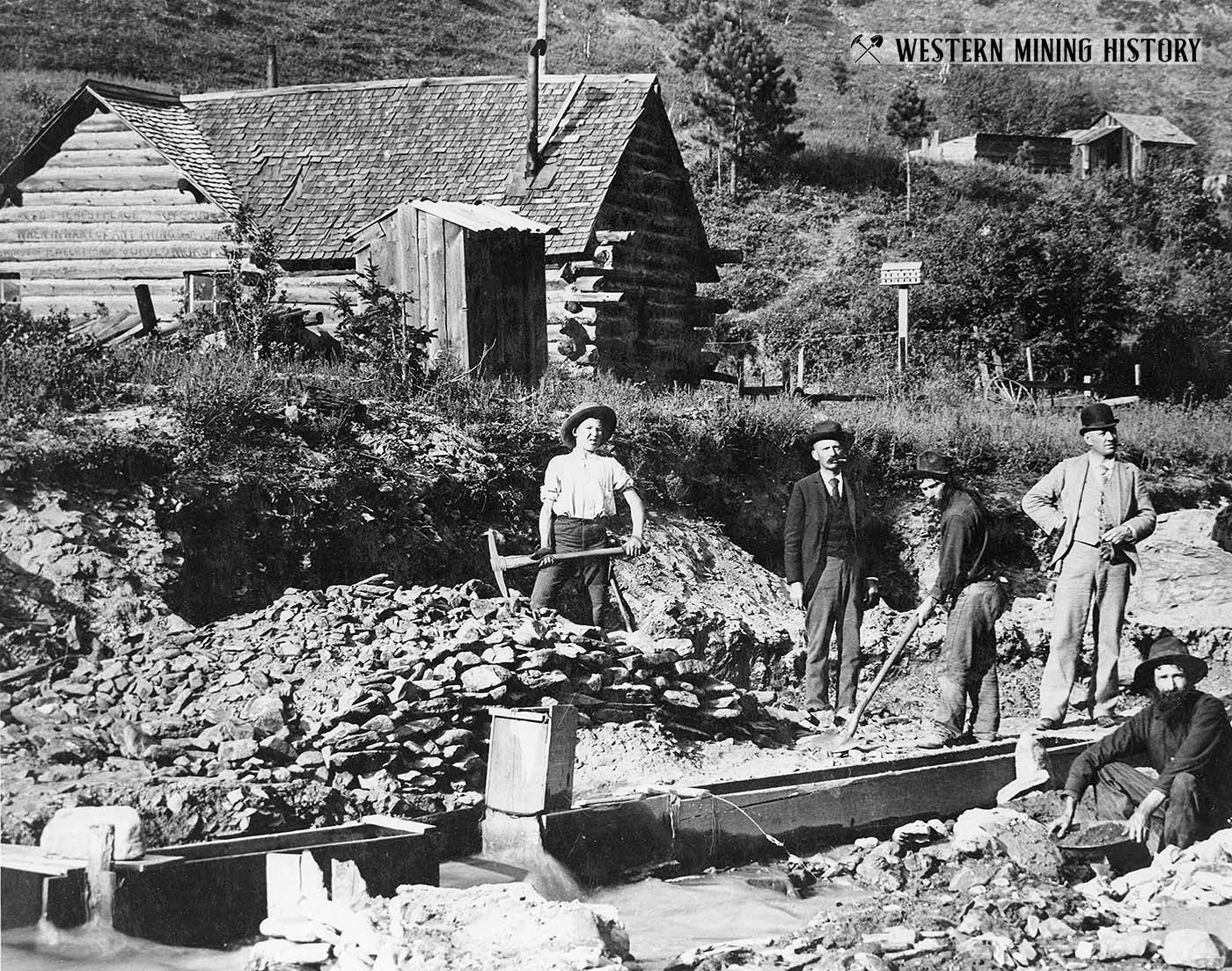
Cripple Creek is known as one of the nation’s leading lode mining districts, but like most gold districts the first mines here were placer mines.

The Gold King Mine was one of the first mines discovered in the Cripple Creek district. Of the two men standing behind the wheelbarrow, the man on the right is believed to be Bob Womack, credited with the initial discovery of gold in the district.
This early Cripple Creek gold mine is operated out of a canvas tent. Canvas tents were commonly the first form of shelter setup at a camp or mine.
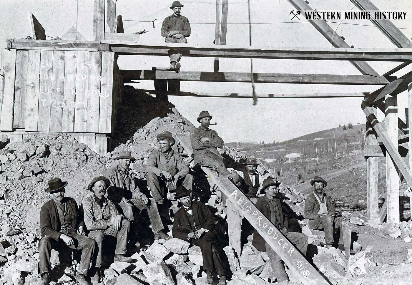
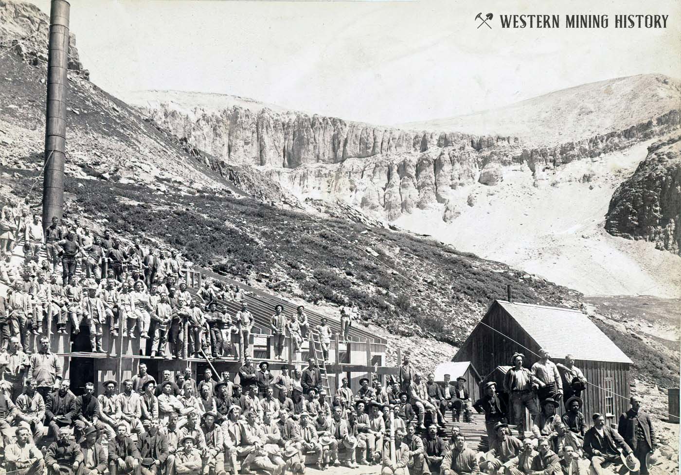
Like all great mining districts, the early mines were relatively small in scale. In the photo below, a mine crew is shown posing at a mine described as “a big producer”.
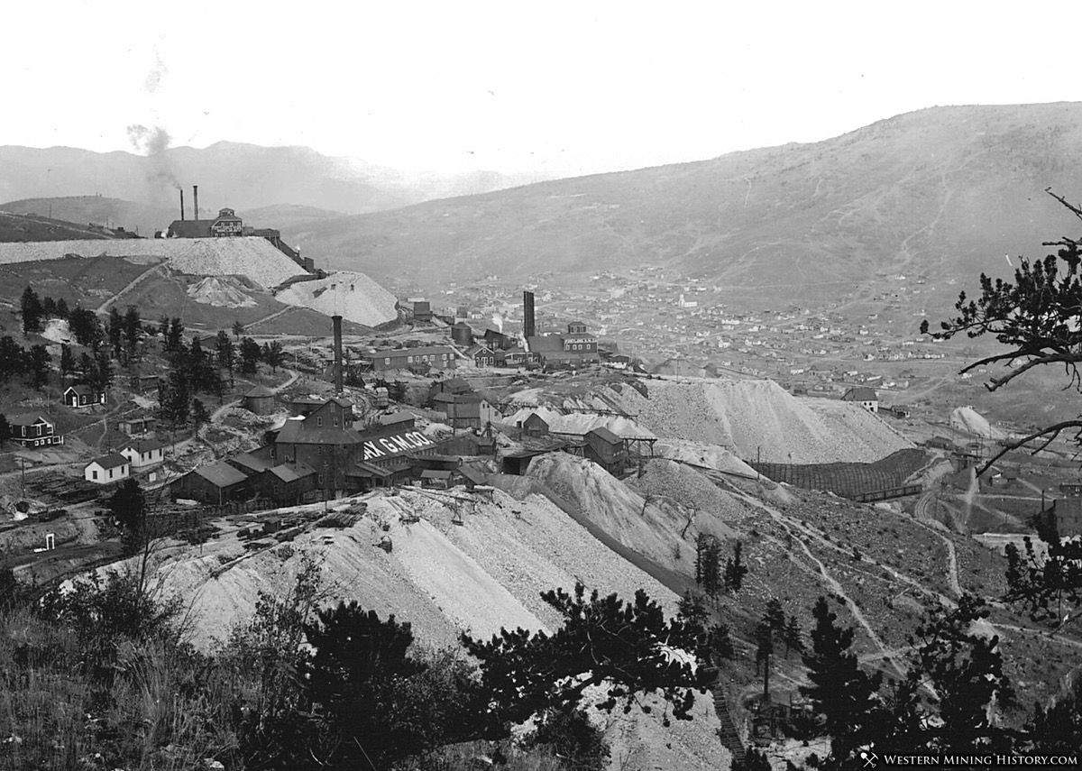
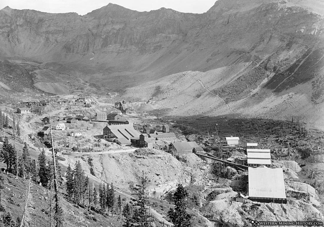
The men in the photo above probably did not realize just how big the Cripple Creek mines would become. The photo below gives an overview of the Battle Mountain mines, with the town of Goldfield in the background.
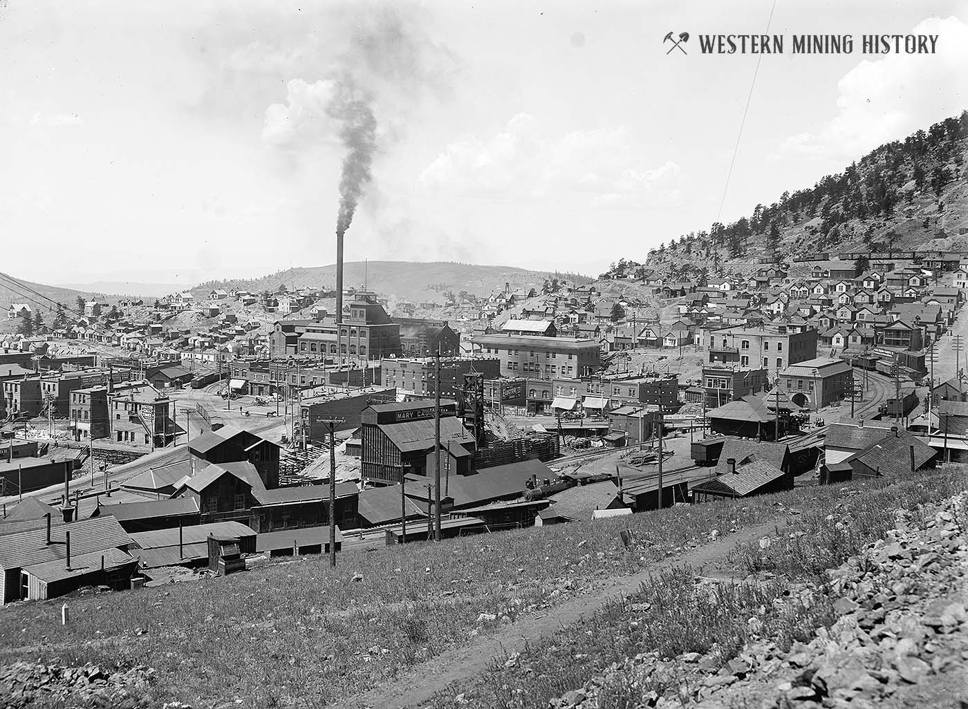
Many settlements were established in the Cripple Creek district. Victor was a city of some significance, only second to Cripple Creek in importance. The following view shows Victor, with the magnificent Gold Coin Mine right in the heart of downtown.
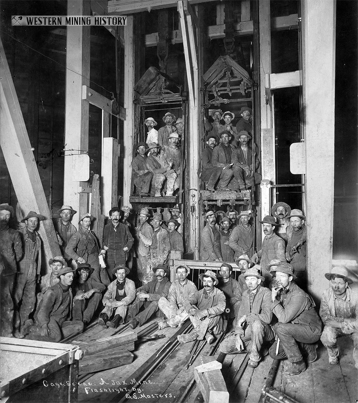
The Ajax mine, located just north of Victor, was one of the district’s top gold producers. In the photo below, miners are posing at the cages of the Ajax shaft ca. 1900.
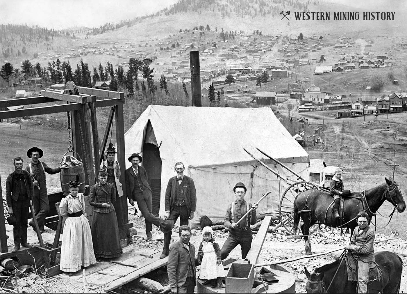
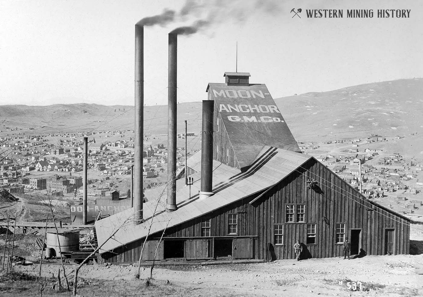
The crew of the Moon Anchor Mine enjoyed a magnificent view of the ever-growing city of Cripple Creek during the 1890s.
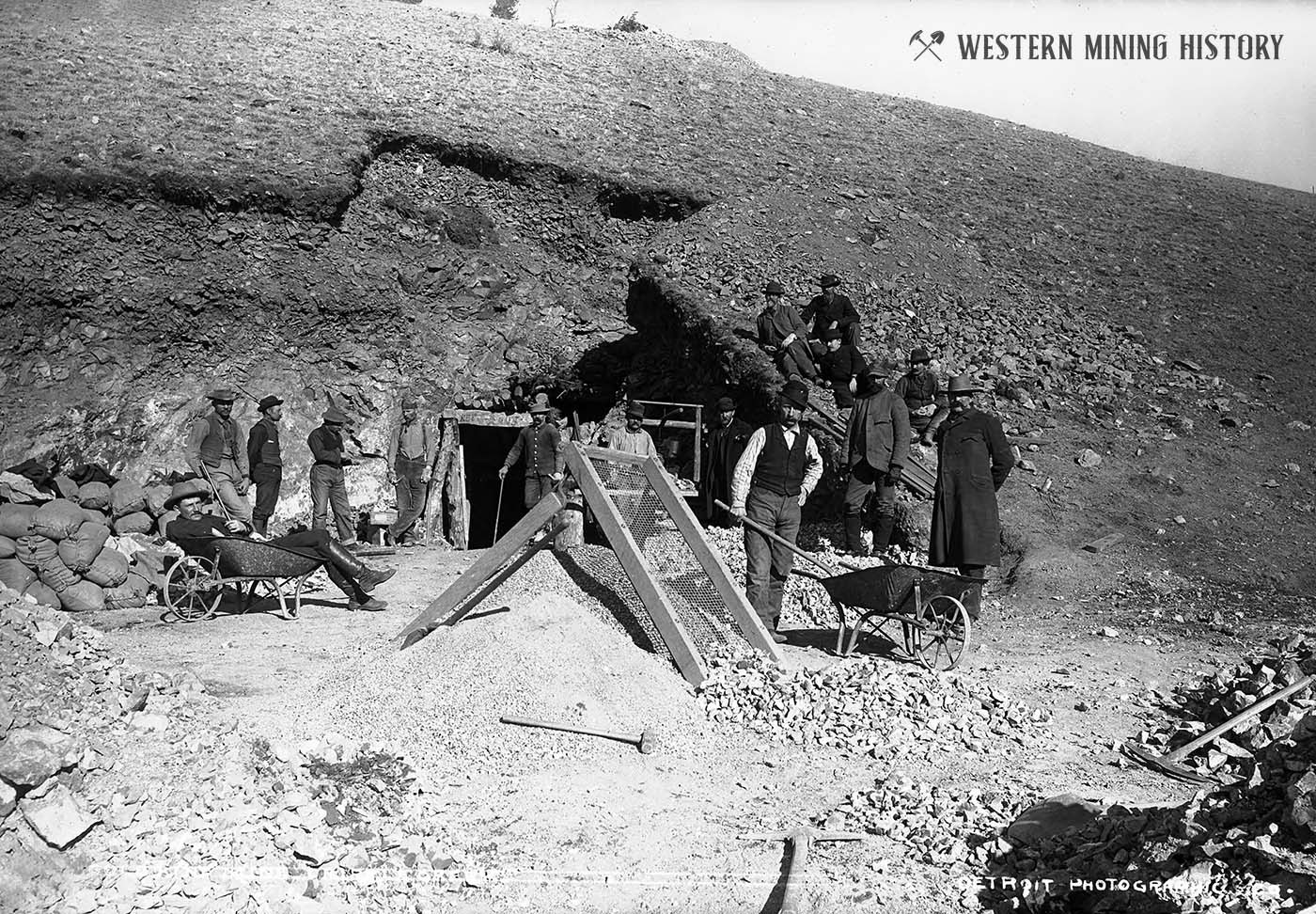
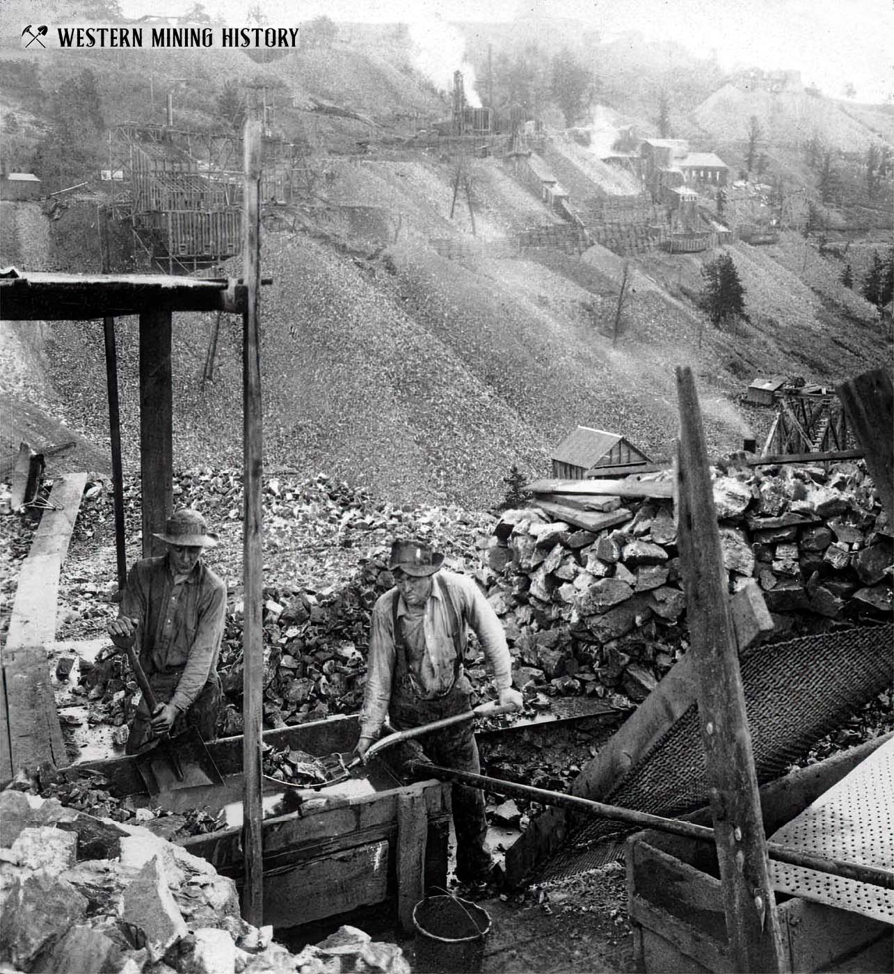
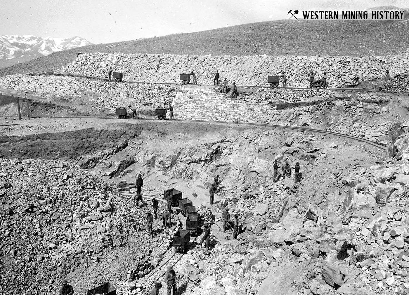
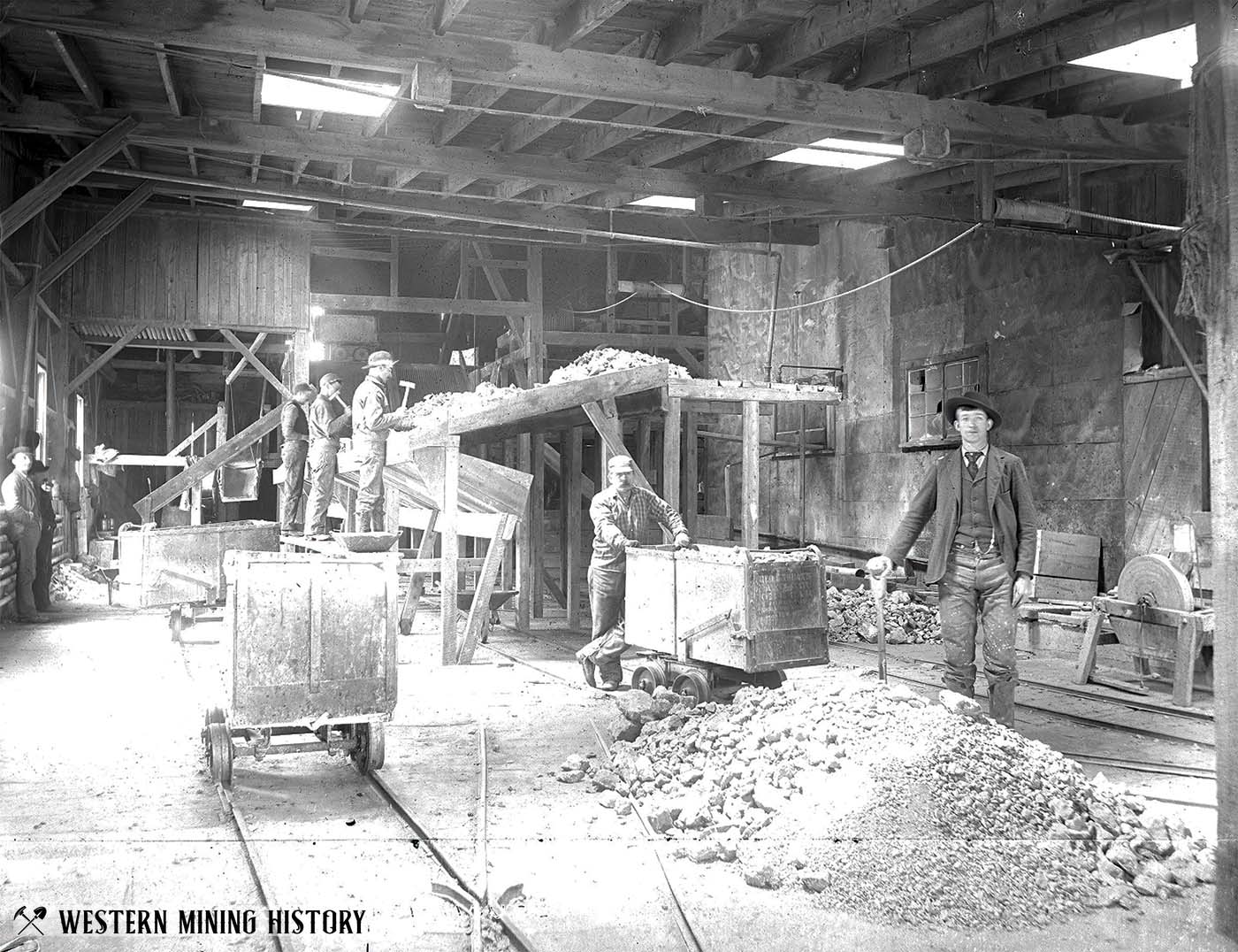
Bull Hill, just east of the city of Cripple Creek, was an area with a high concentration of mines. In this scene, two miners shovel ore onto a screen at the Nightingale mine.
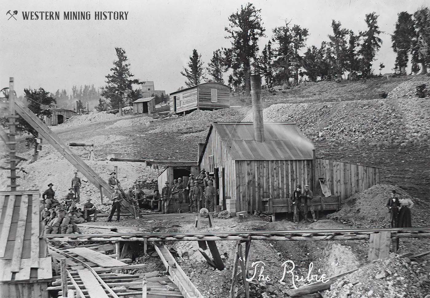
The Rubie mine was just west of Goldfield. The site of the mine is now part of the modern open-pit mine.
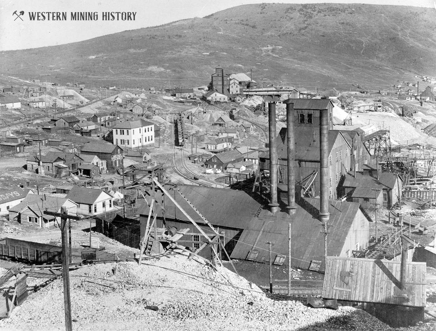
At over 10,600 feet, Independence was a significant mining community built among some of the district’s top mines. The scale of industry seen in this photo gives some sense of how rich the Cripple Creek mines were. Today the Independence town site is has been consumed by an active open-pit mine.
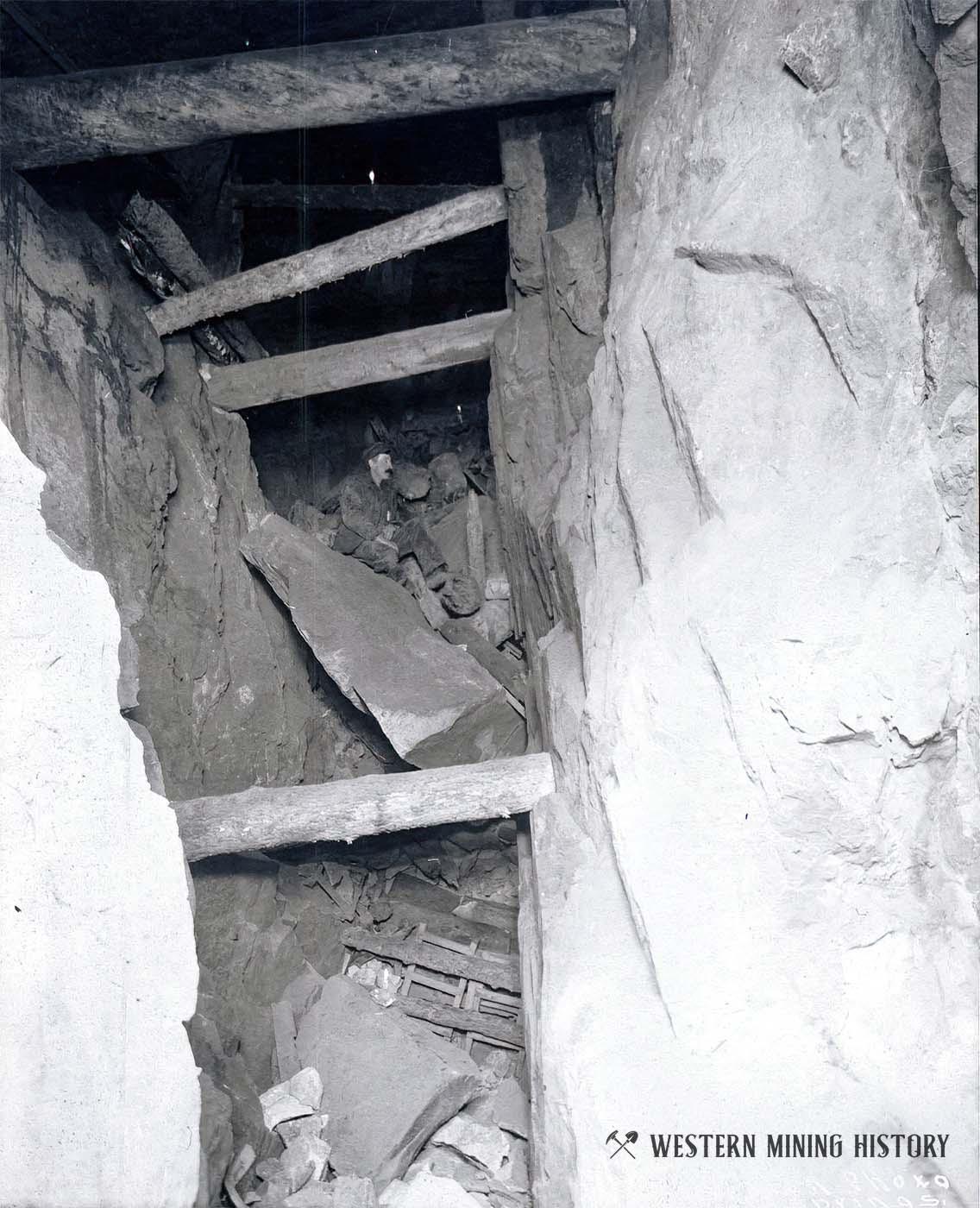
This photo from 1907 shows a stope in a Cripple Creek district mine that has partially collapsed. Note the crushed ladders and timbers in the bottom part of the image.
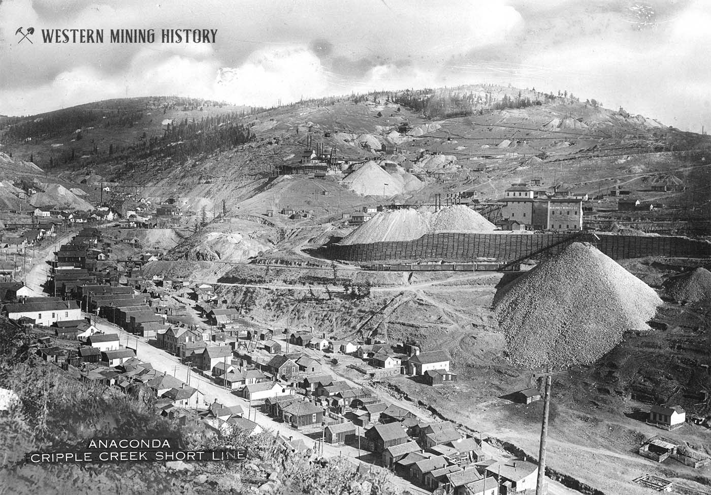
Anaconda was another Cripple Creek district community built among the mines. Today the Anaconda town site is covered by tailings from an open-pit mining operation.
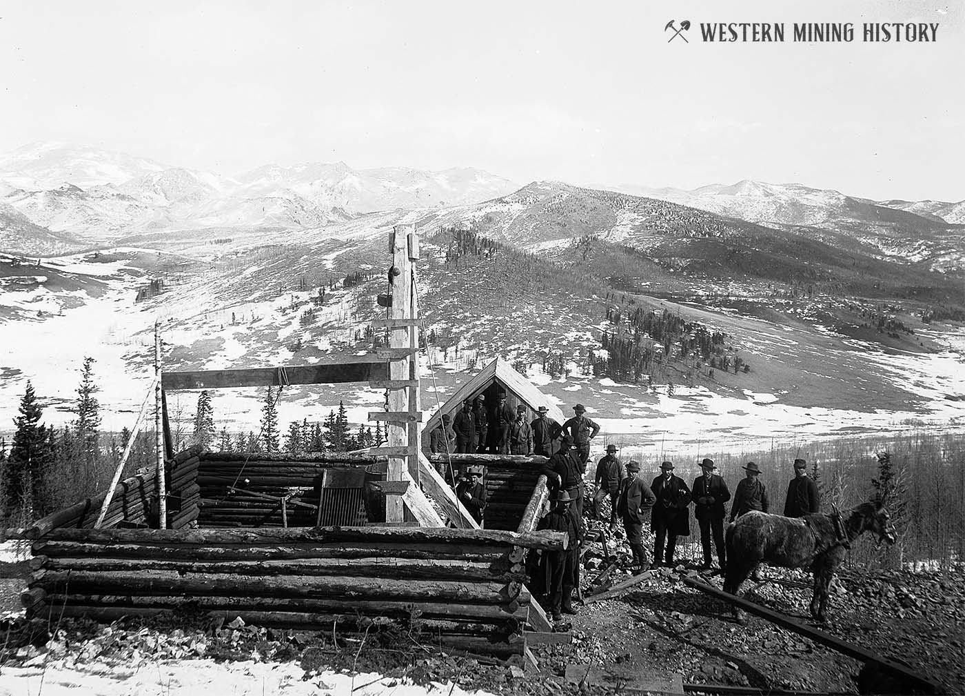
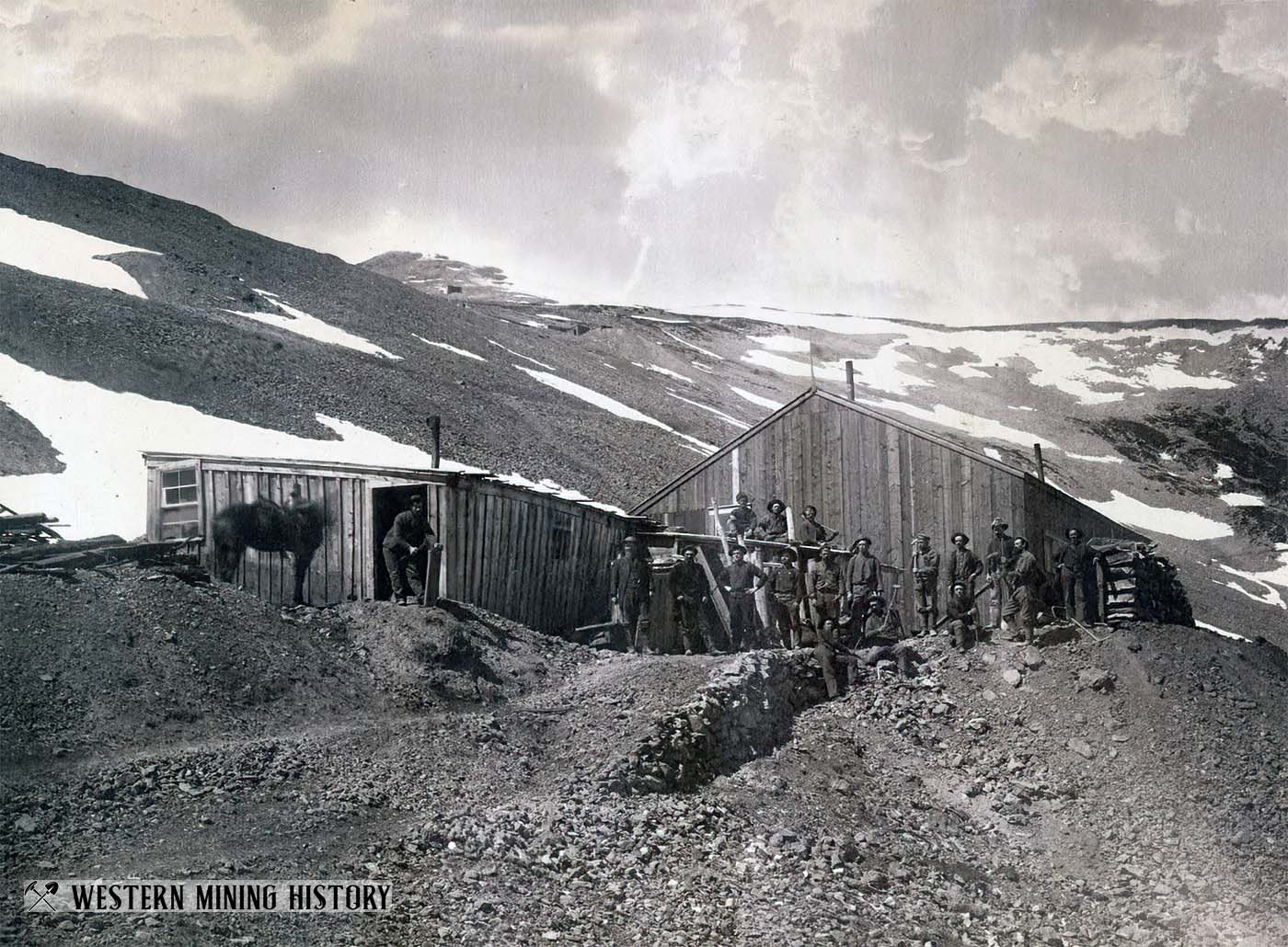
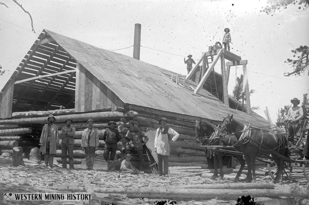
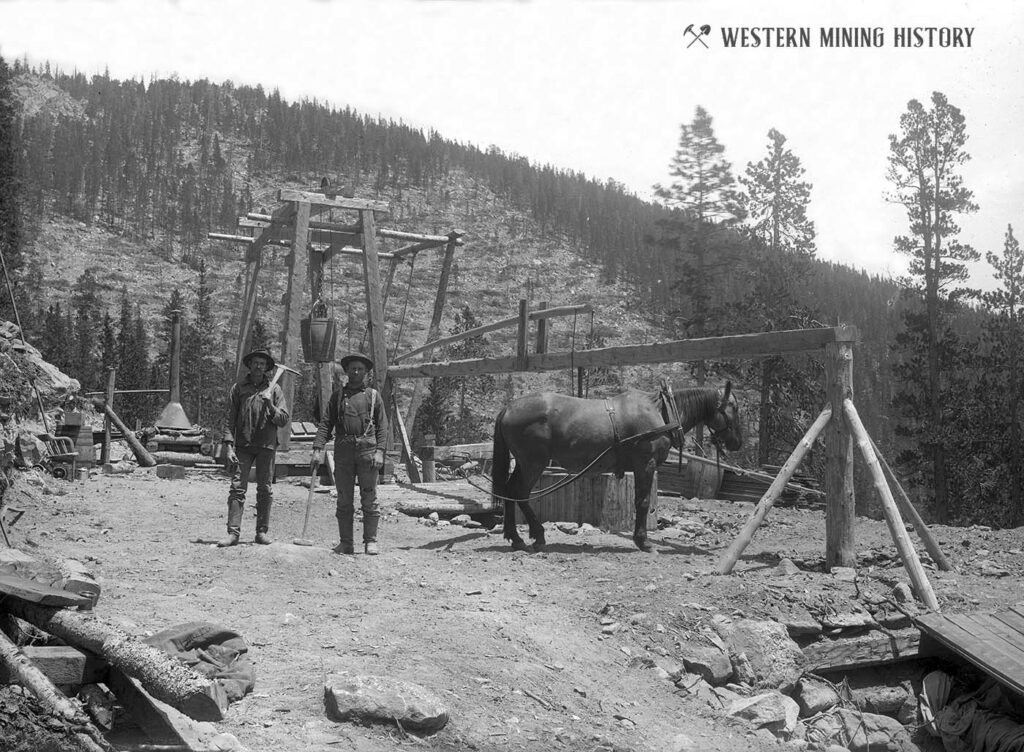
Altman was the site of the district’s highest-elevation settlement, and the location of many of its top mines. The following photo shows early work at the Buena Vista mine, complete with horse whim powering the hoist of a rudimentary log shaft house.
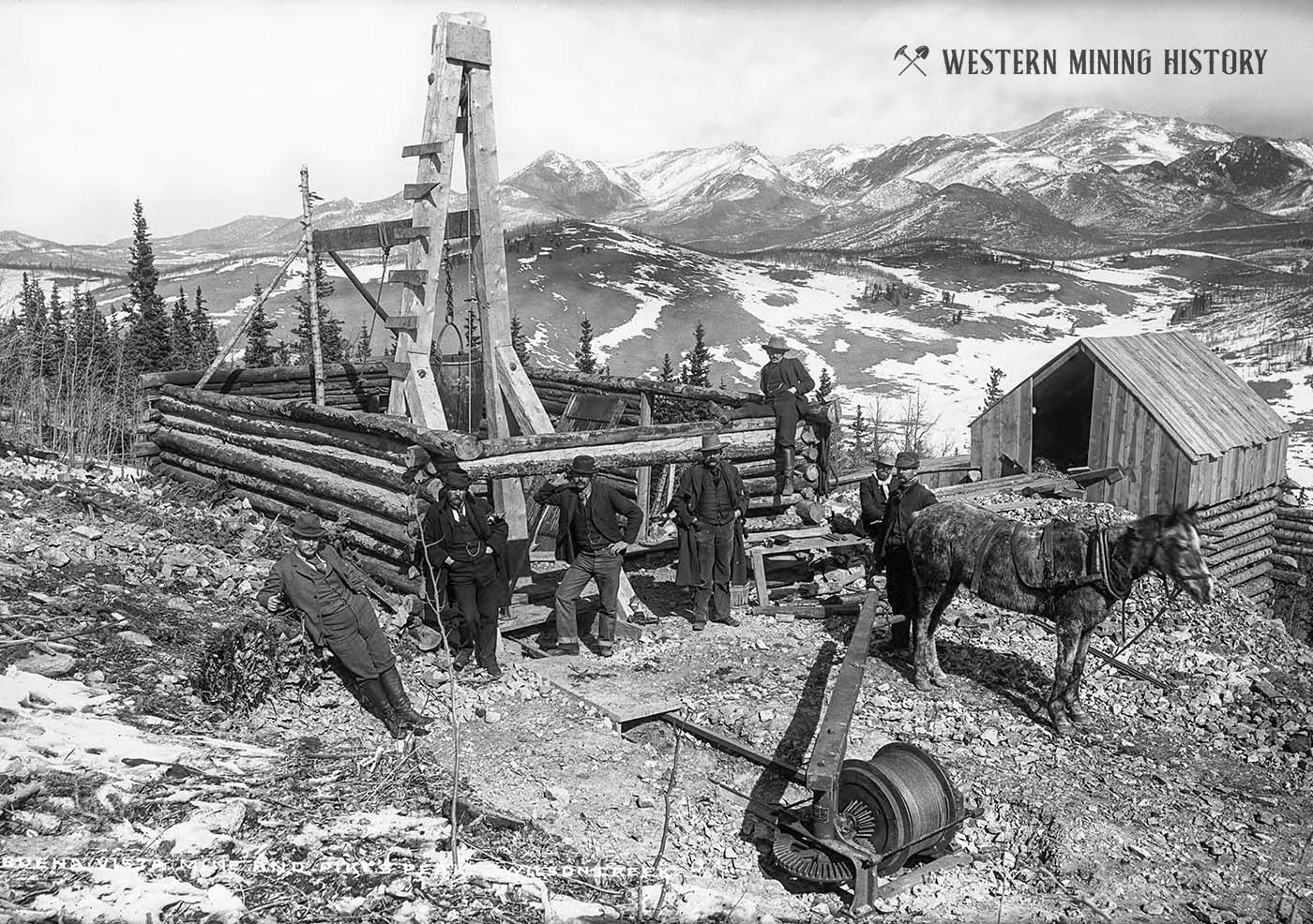
This second view of the Buena Vista mine provides a clear view of Pikes Peak in the background–certainly one of the grandest views captured in any historical mining photo.
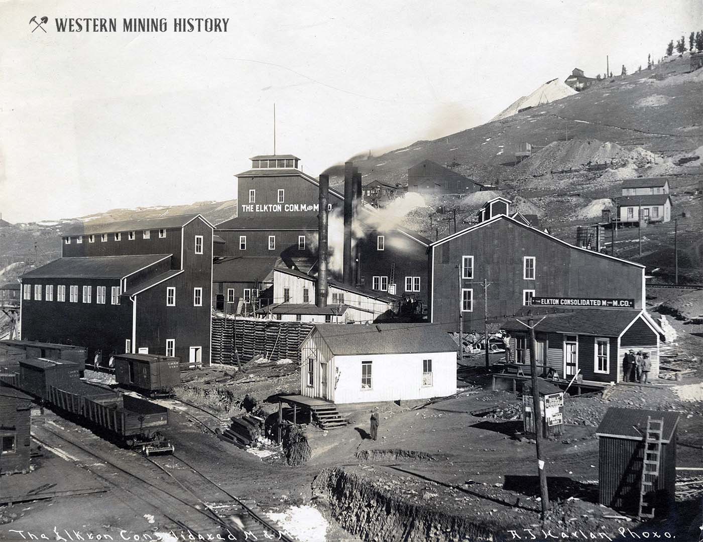
Elkton was the name of one of the district’s top producing mines, and the community that formed near the mine. The town of Elkton, along with nearby settlements, housed miners from many large mines and mills, and had a peak population of over 2,500.
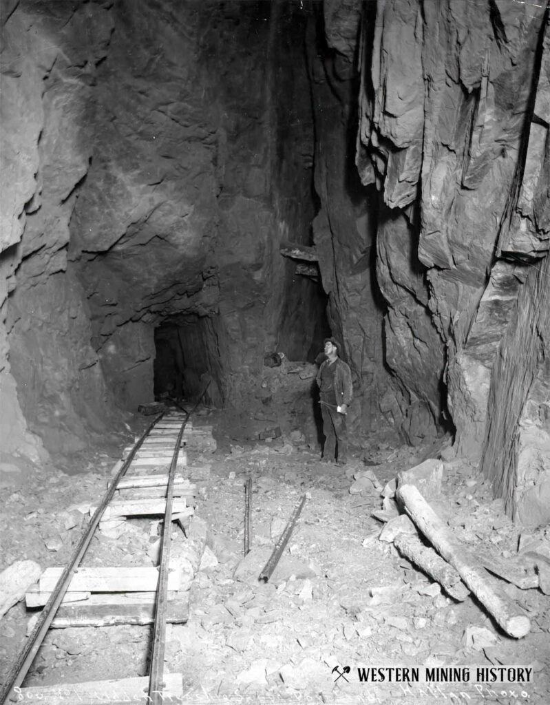
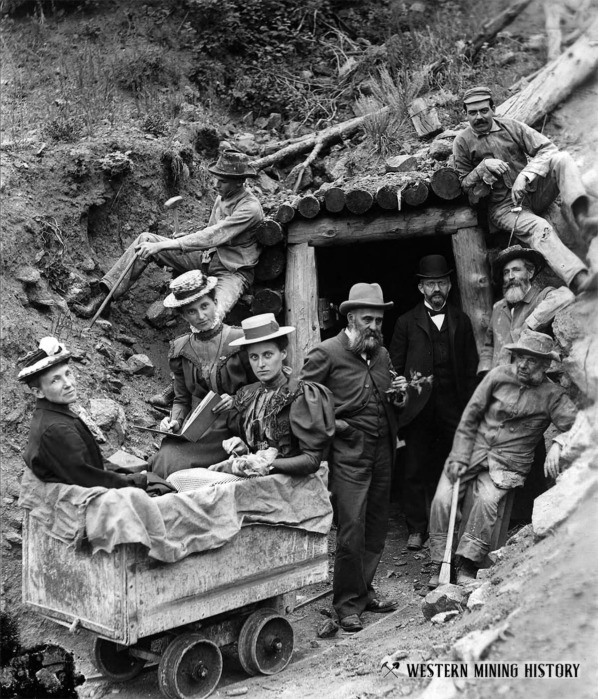
The following photo of an unidentified mine is titled as being “500 feet underground in a Cripple Creek mine.”
Vice-presidential nominee Theodore Roosevelt visited Victor in 1900. Political tensions were high, and Roosevelt was attacked by an angry mob of protesters as he disembarked from the train. Cripple Creek postmaster Danny Sullivan is credited with keeping the crowd at bay with a two by four until Roosevelt was back on the train.
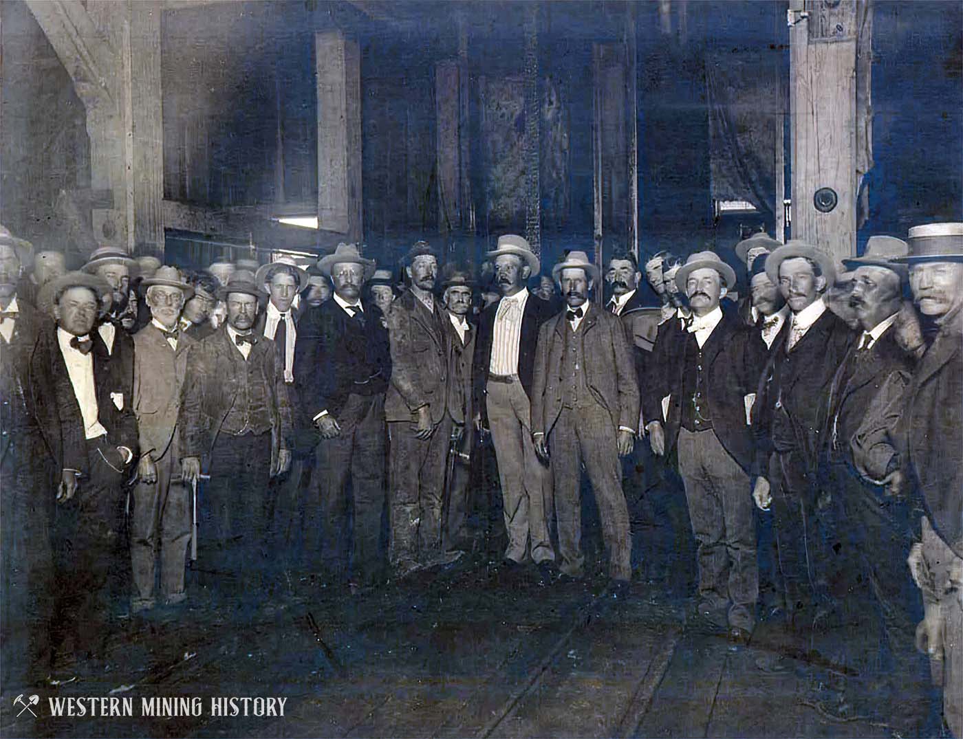
A year later Roosevelt visited again, then as Vice President. This time he was treated with much more respect, and the apologetic city council of Victor kept him entertained for so long that he barely had time to visit Cripple Creek before departing.
Leadville
The silver bonanza at Leadville transformed Colorado into the nations top mining state in the early 1880s. The mines of Leadville were so rich that by 1880 they were producing five times the wealth as Central City, the states leading district until that time.
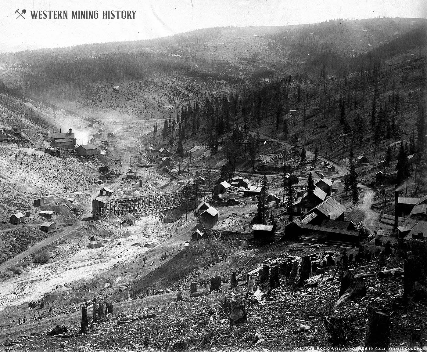
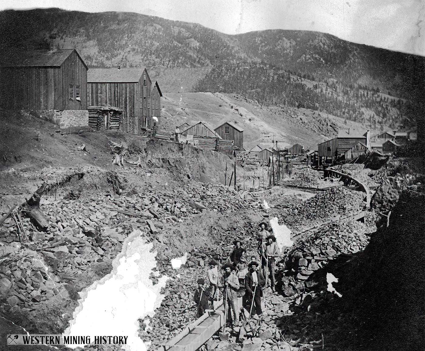
California Gulch was one of the area’s earliest important mining locations. The following photo shows early development in the gulch, around 1880.
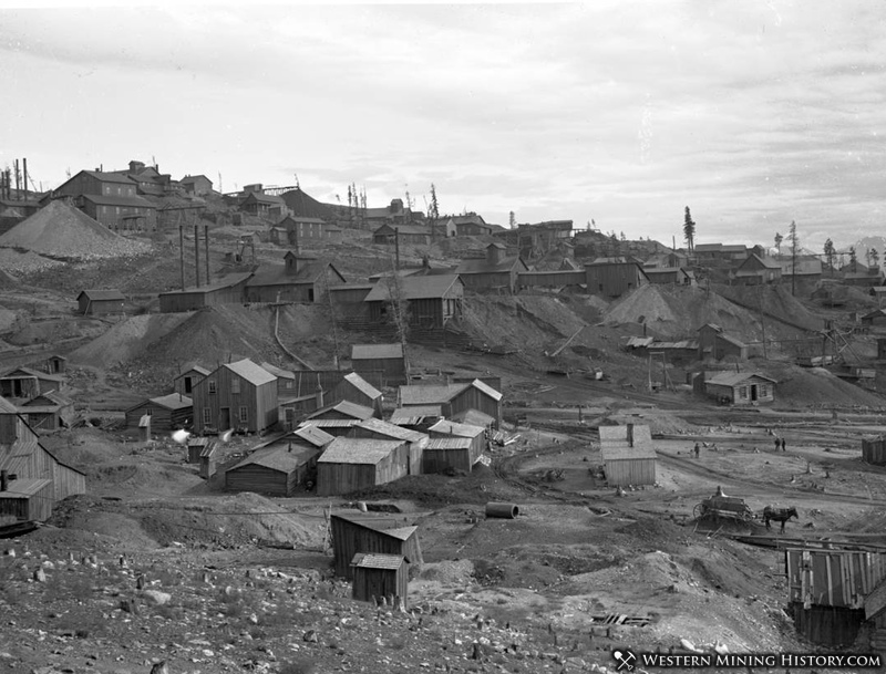
Carbonate Hill was one of Leadville’s bonanza ore producing areas. Many fortunes were taken from these rich mines.
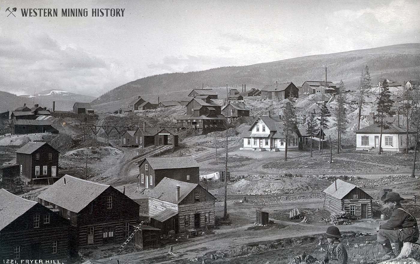
Fryer Hill was initially considered worthless ground, but discoveries there turned it into one of the richest hills in the world. H. A. W. Tabor’s great mining fortune started with the discoveries on this hill.
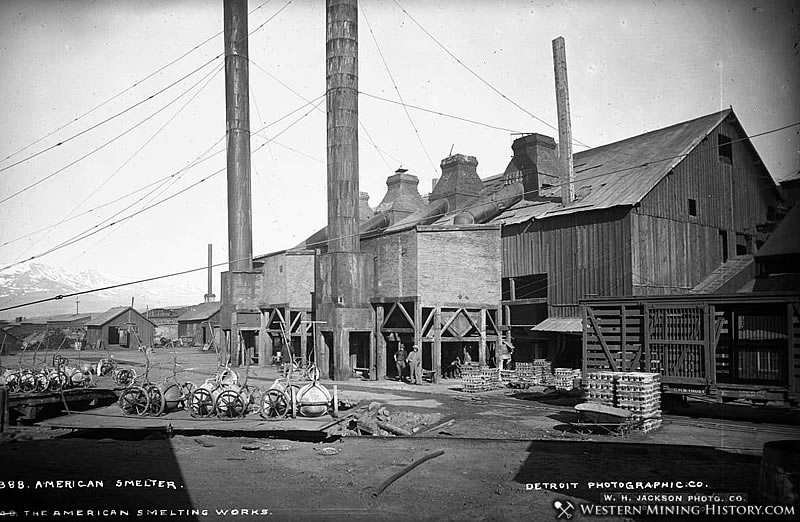
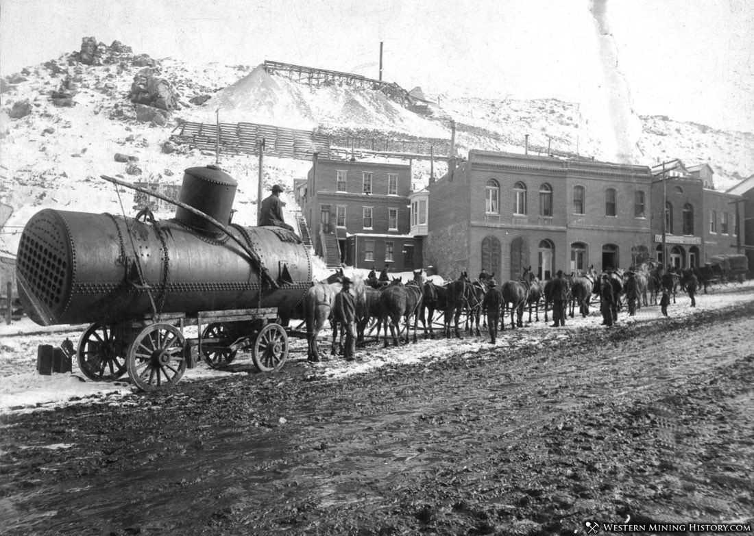
Leadville was an important smelting center for both the local mines, and for surrounding mining districts. Many smelters operated here over the decades.
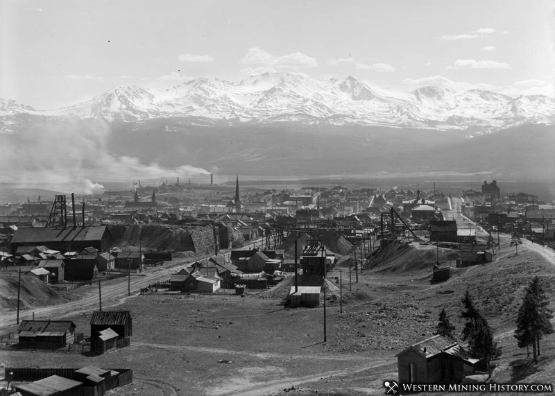
Leadville was a major mining and smelting center for many decades. The following image from 1918 illustrates the scale of both the city and the mining industry here.
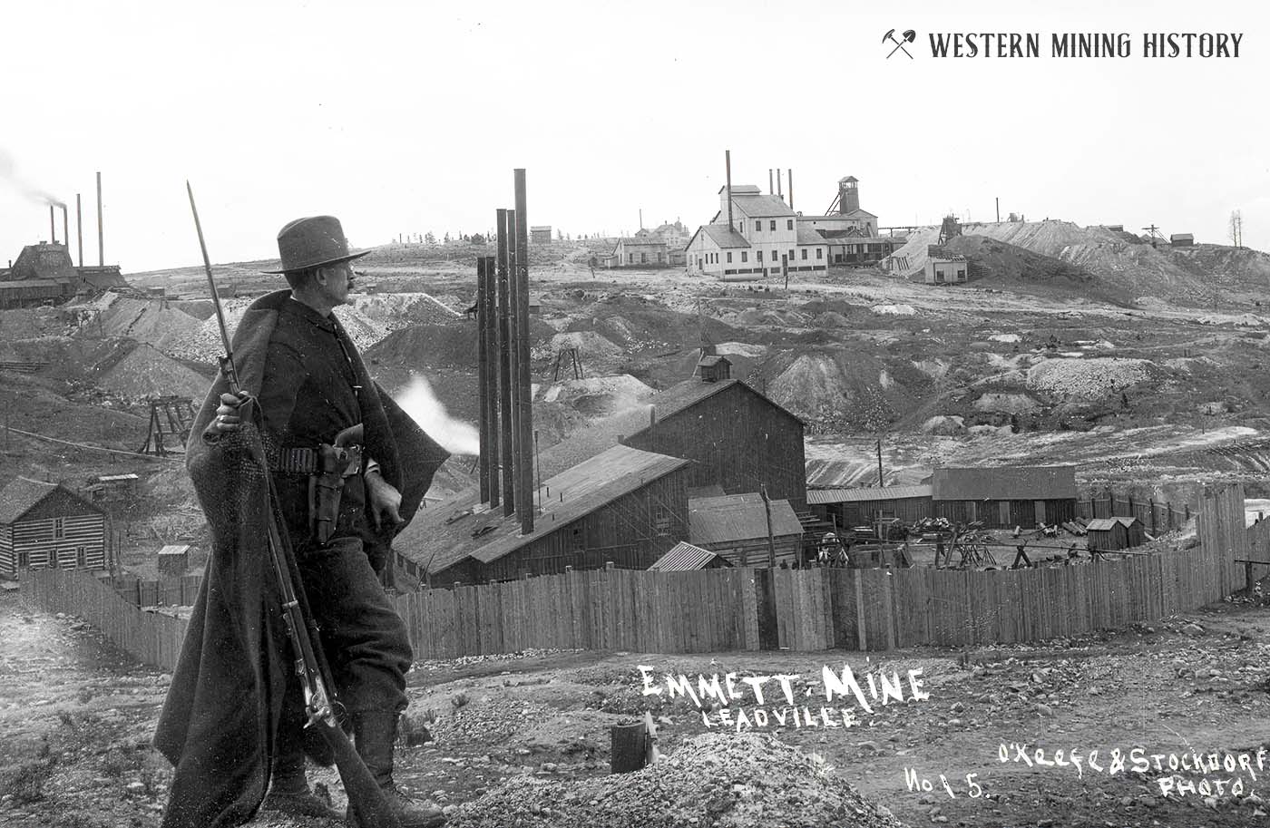
Like many of the West’s great mining centers, Leadville experienced periods of conflict between laborers and mine owners. In September of 1896, strikers advanced on the Emmett mine at Leadville, attacking it with gunfire, dynamite, and even a home-made cannon. The strikers were driven back and lost one of their numbers to gunfire.
The photo below shows a member of the Colorado National Guard watching over the Emmett Mine at Leadville following the attack.
Central City
Gold discoveries at Gregory Gulch were the center of Colorado’s first mining bonanza. Numerous settlements were established here, but “Central” or Central City was the district’s most important city.
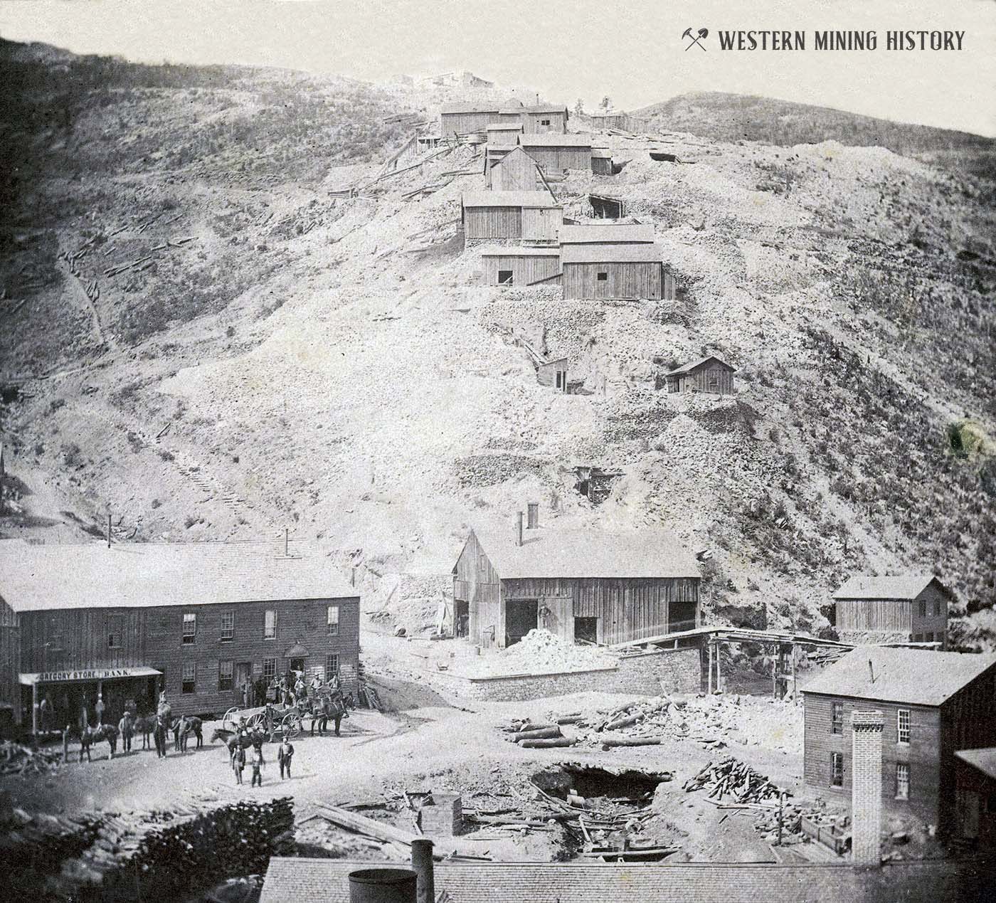
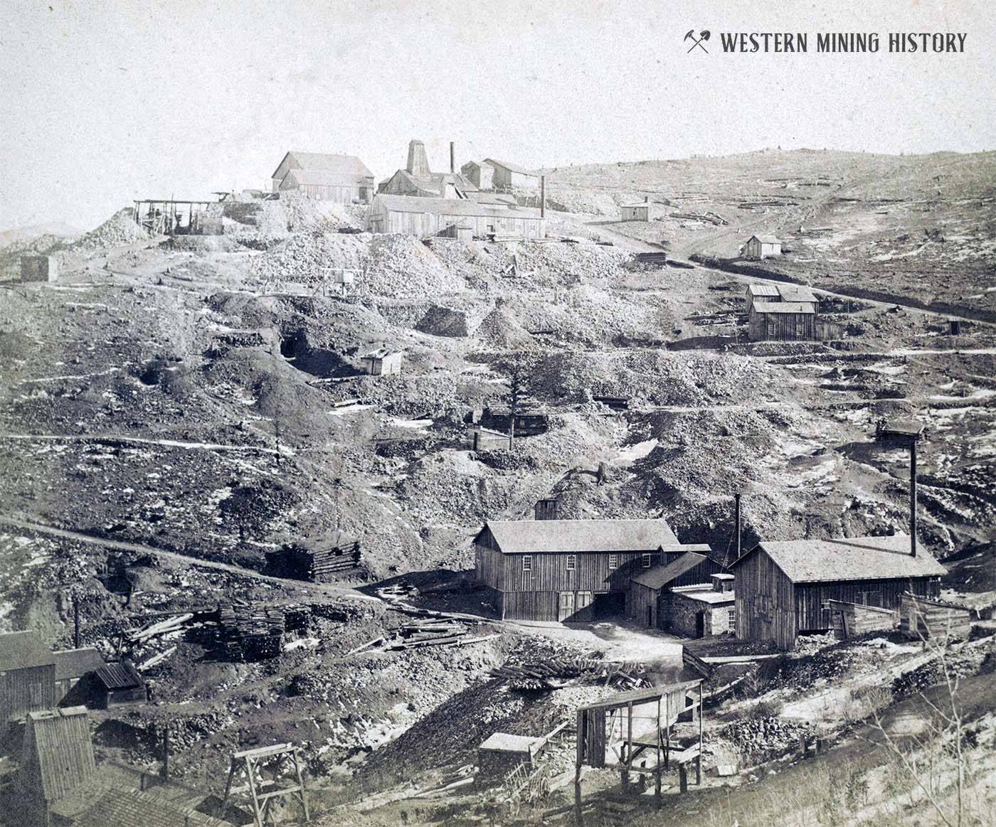
The following image shows the extensive surface workings during the early years of the district.
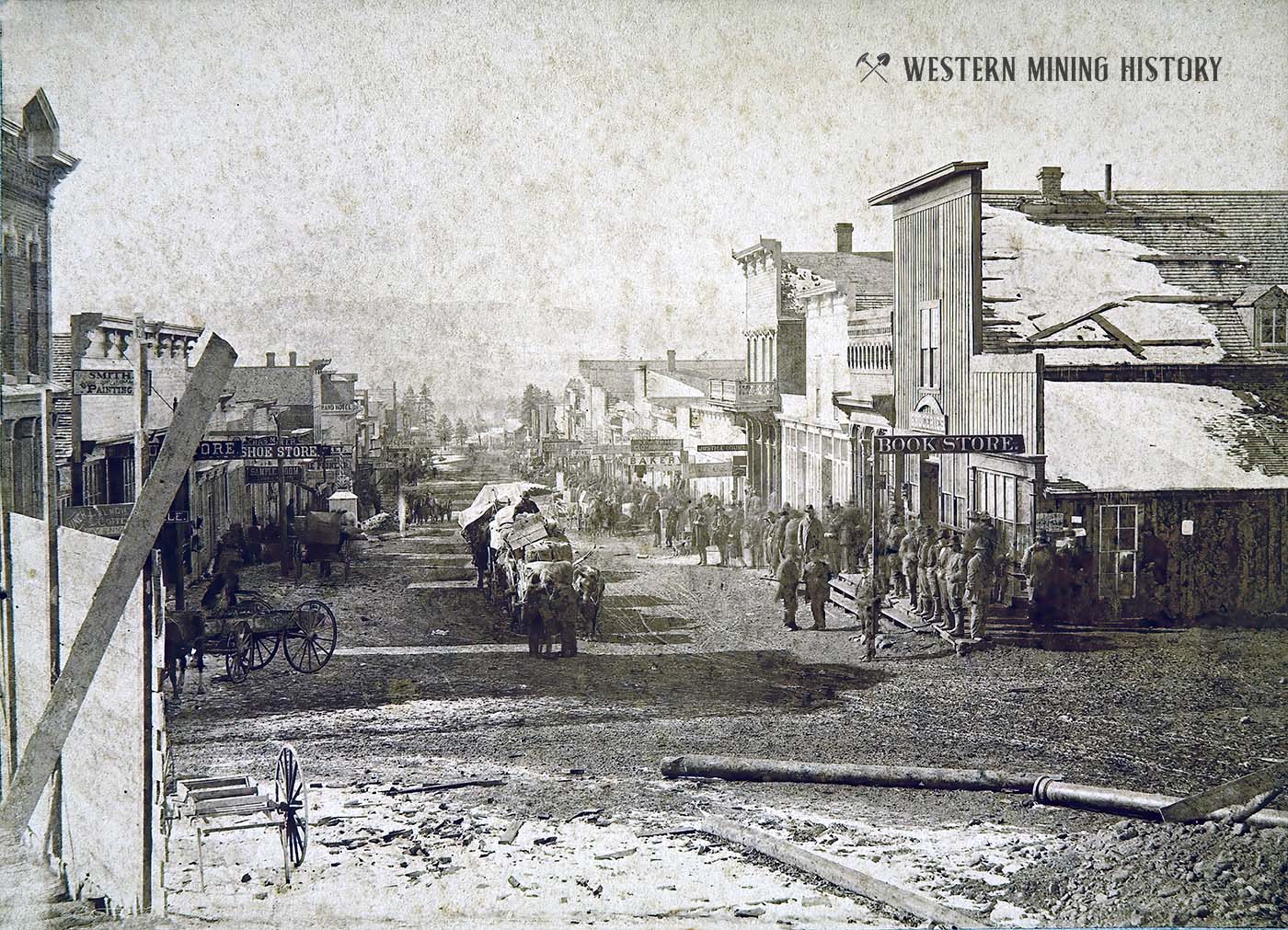
The following ca. 1860 photo is one of the earliest views of the town of Central City. This would soon become Colorado’s most important settlement.
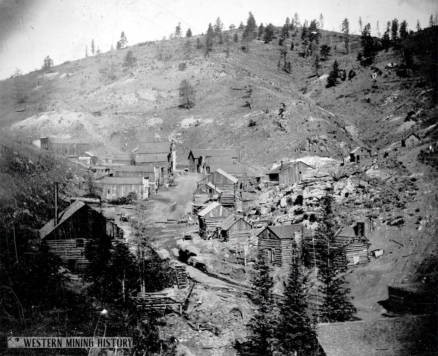
Central City was part of what became known as “The Richest Square Mile on Earth”, and was Colorado’s economic center for nearly two decades.
The following ca. 1880s view depicts the Gregory Lode and what was previously the community of Mountain City. Mountain City was established in 1859 between Black Hawk and Central City, but was later absorbed by Central City.
Note the Gregory quartz vein that has been mined over the surface in the image above. The following image shows what that mining operation looked like in 1861.
In 1869 it was reported that the Gregory lode “…is acknowledged the best worked lode in these mountains, and, under its present management, is understood to be paying well.”
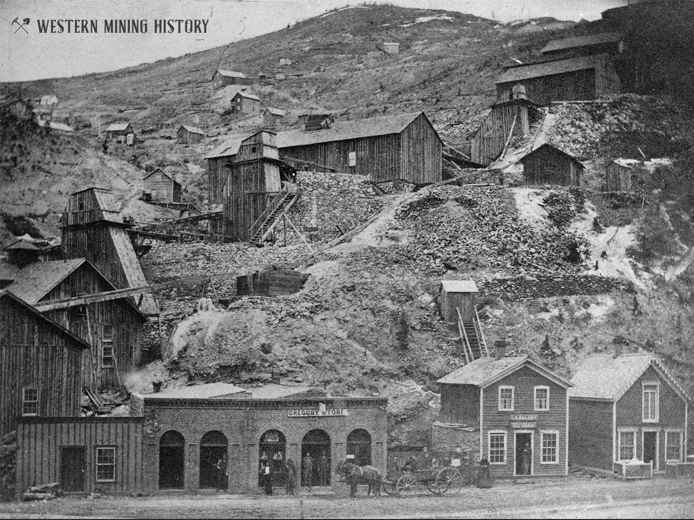
The next photo shows how the surface plants of the Gregory Lode continued to evolve in the 1860s. Note the series of headframes that facilitated deeper mining along the vein.
Colorado was in a depression by the late 1860s as much of the easily-recovered placer gold was played out, and processing the state’s complex ore was proving difficult. Black Hawk became the first smelting center in the state, and the smelters here were instrumental in the transition from placer to lode mining.
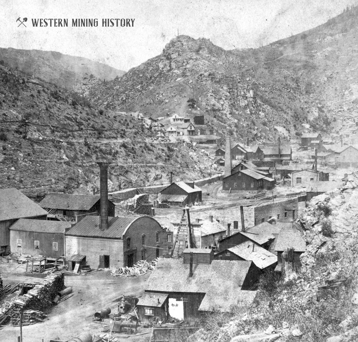
Professor Nathaniel Hill built Colorado’s first successful smelter at Black Hawk. His smelter is credited with turning around the Colorado mining industry, which was experiencing a very difficult period in the mid 1860s as the complex ore from the mines were difficult to process profitably.
The Bobtail Lode, high on a mountain above Black Hawk, was one of the districts top mines. A newspaper article in 1869 reported “This mine has produced, since 1861, fully $2,000,000, and has paid a dividend of one per cent, per month on $1,000,000.”
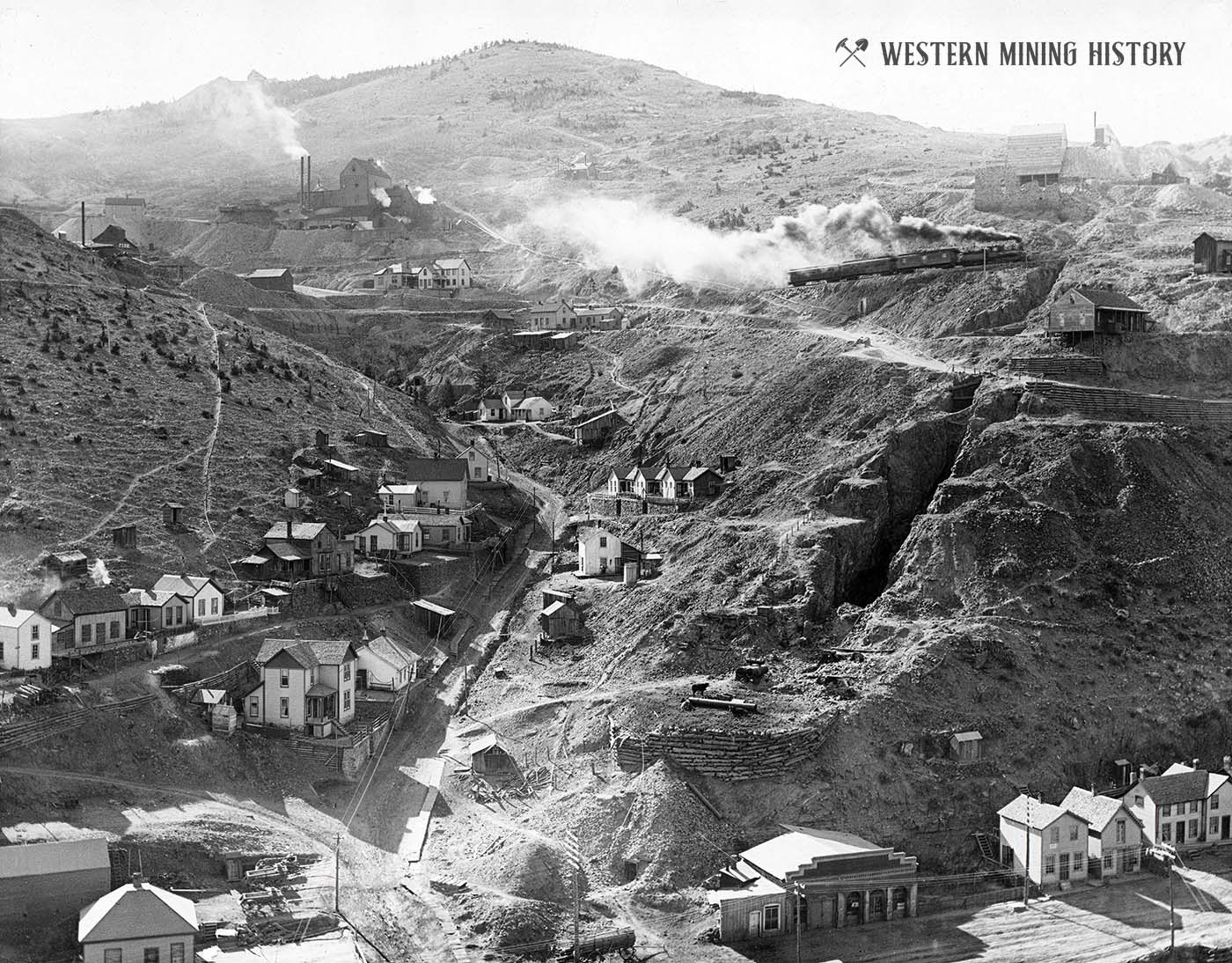
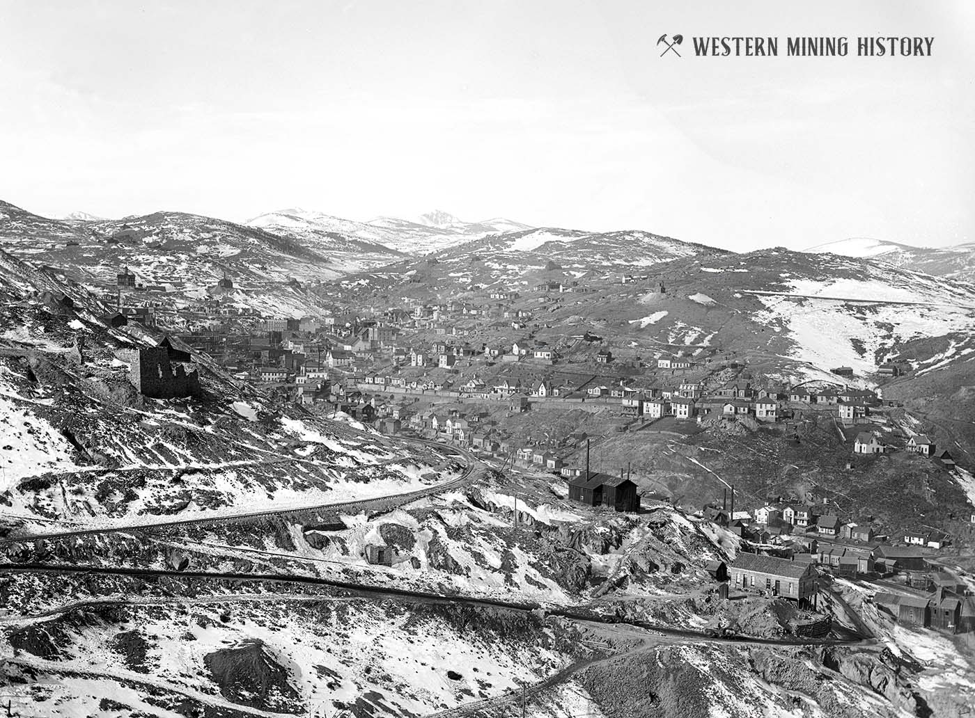
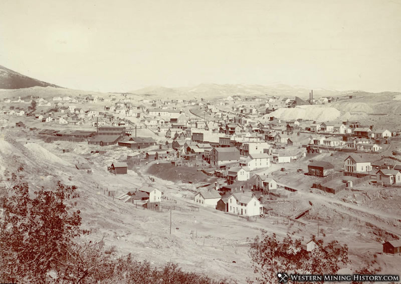
The following photo was taken from Bobtail hill around 1900. On the left side of the view, Central City can be seen, with Black Hawk on the right.
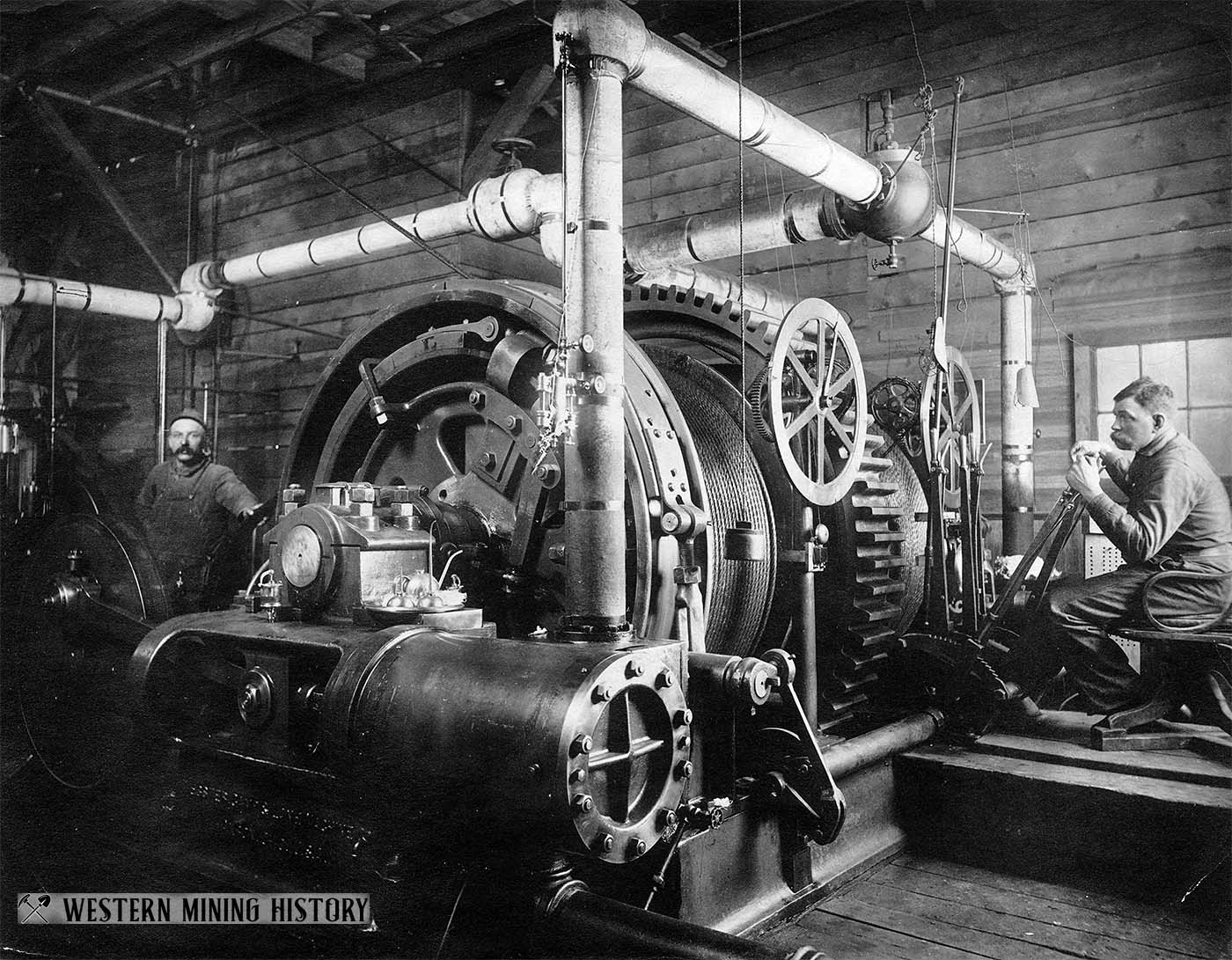
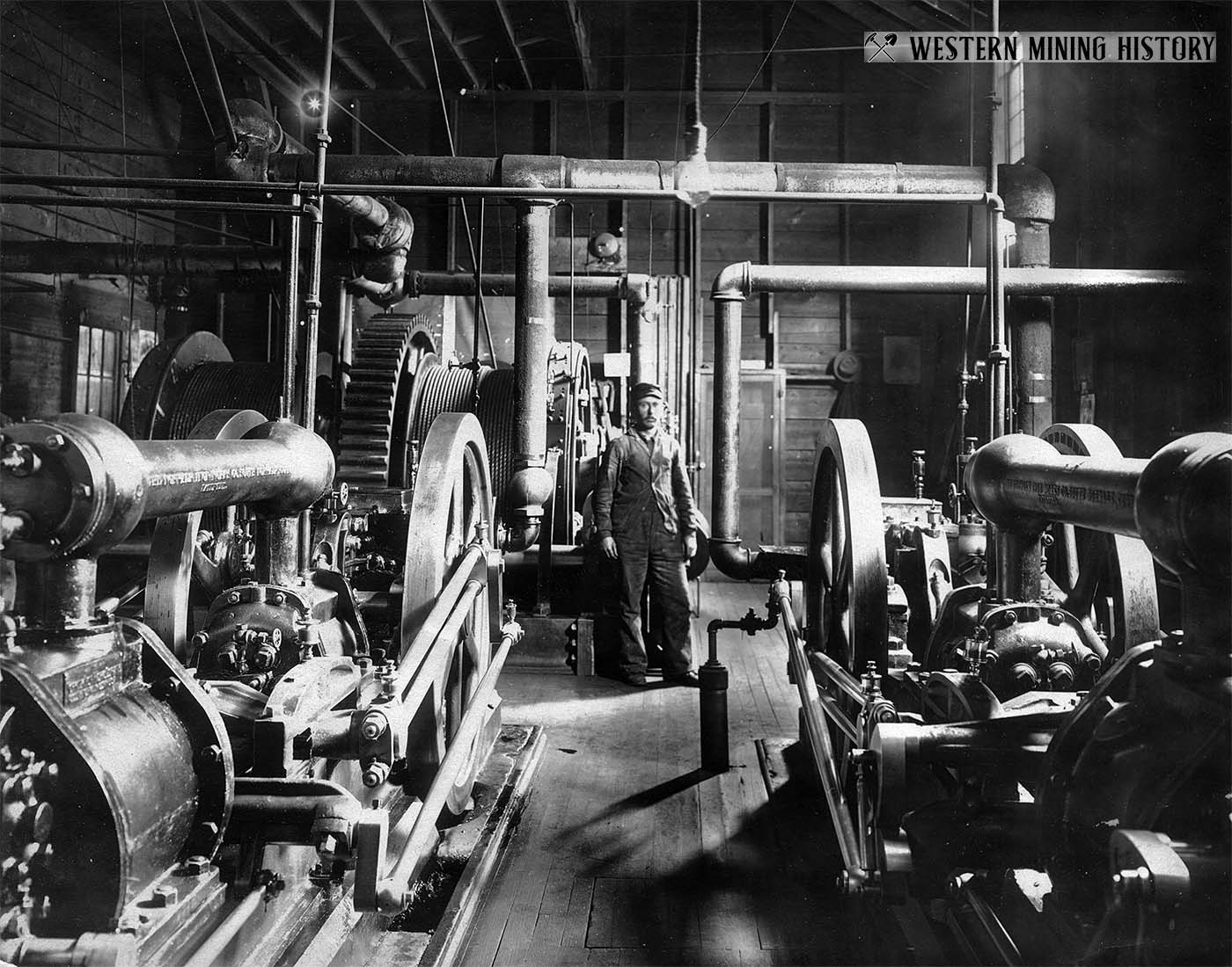
This view depicts the engine room at the Cook shaft house. Two “Norwalk” air compressors are in the foreground.
Nevadaville was another significant town in the Central City district. Built among rich mines, it was a prominent mining town for decades. Today only a handful of historic buildings remain.
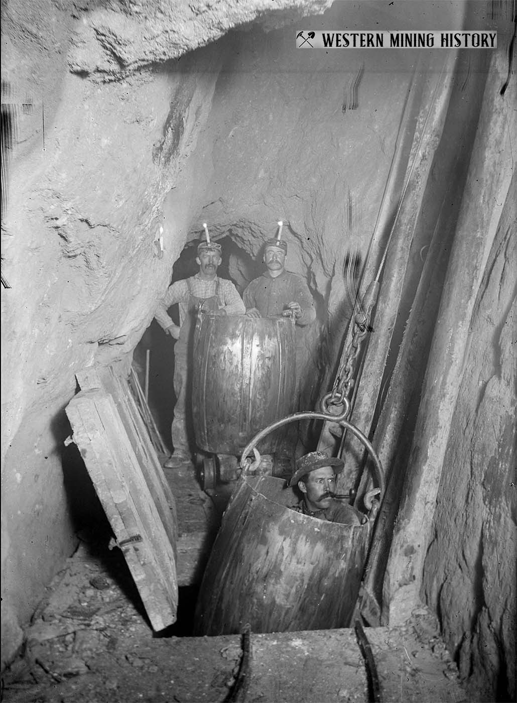
The following image demonstrates how ore, and sometimes men, were transported between levels in ore buckets in a Nevadaville mine.
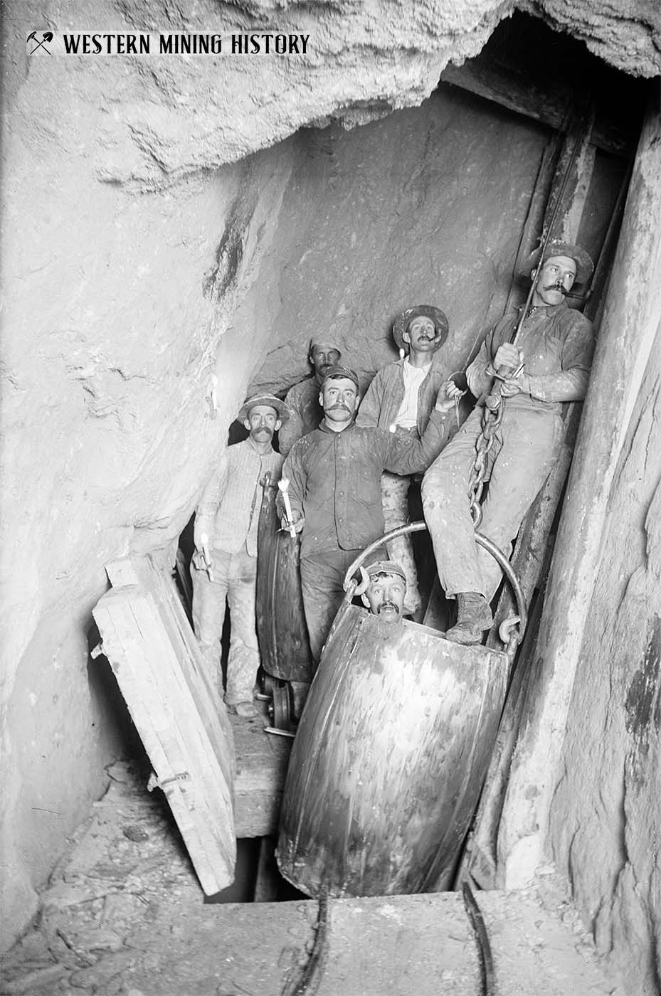
There are two photos in this series, in the second one more miners crowd to get into the scene. Note how the trapdoor is mounted with tracks so that ore cars can pass over it when it is closed.
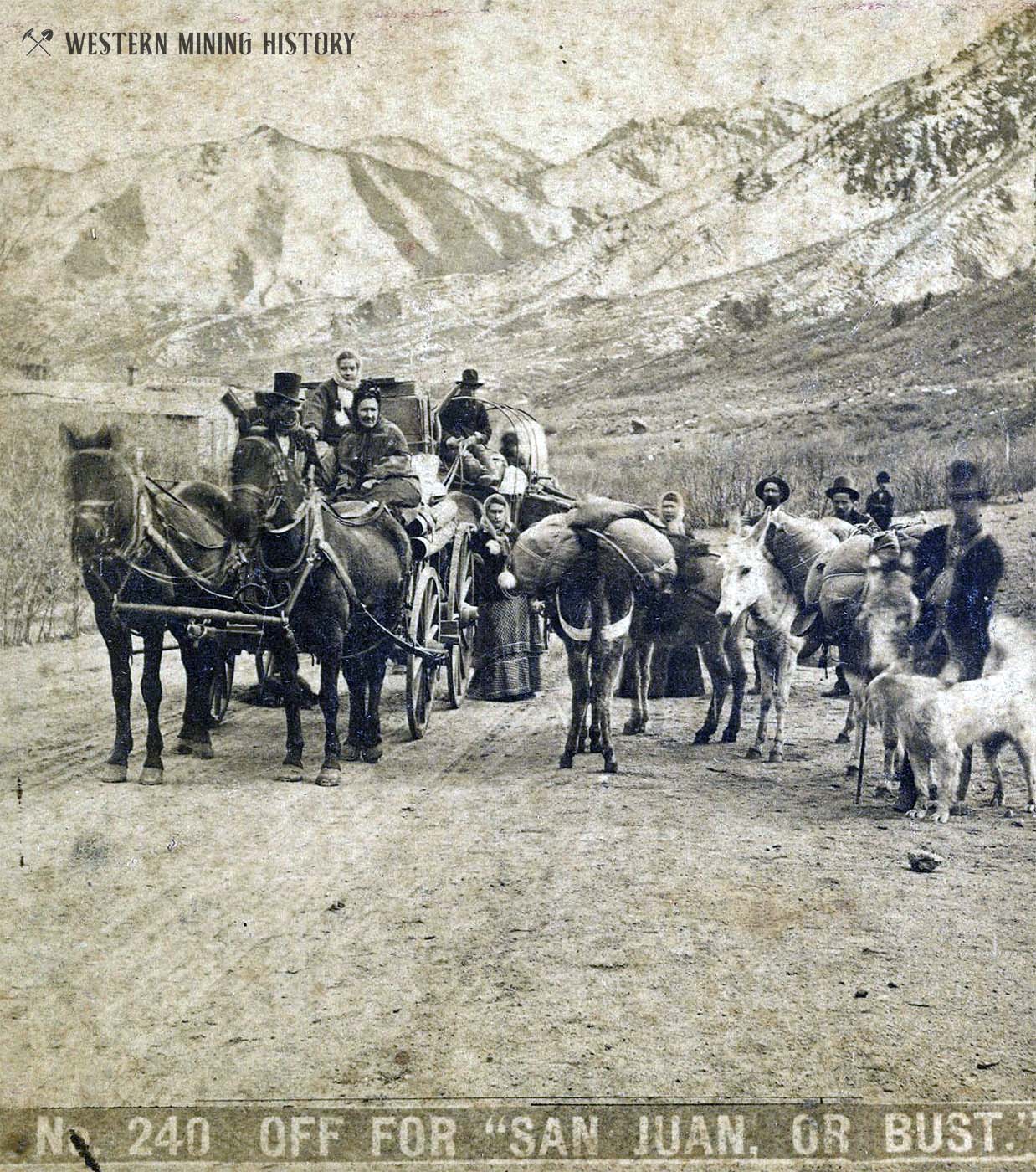
San Juan Mountains
The San Juan Mountain range of southwestern Colorado is the state’s most rugged and inaccessible region. Many of the deposits are at high altitude, in settings so difficult that individual mines became year-round camps where hundreds of miners lived.
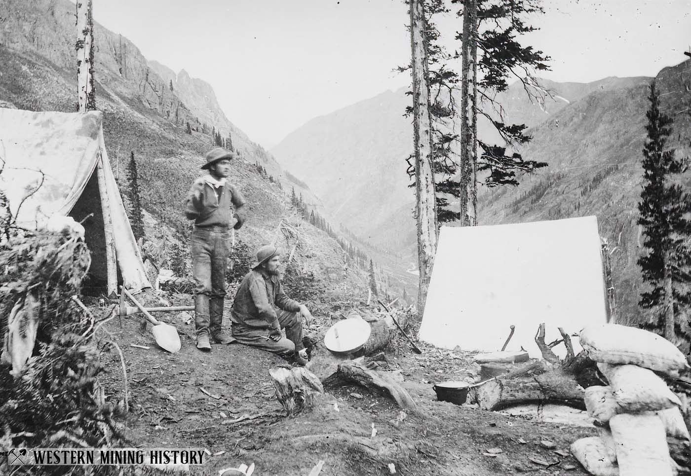
The following 1875 photo depicts the camp of two early pioneers of the San Juan region mines. Despite the hardships, the men that worked these mountains must have been in awe of the incredible scenery.
The Sheridan vein, located in 1875 in Marshall Basin, was the first quartz lead discovered near Telluride. Here the mine is seen around 1890.
The following image depicts the Tomboy Mine, which was situated at 11,500 feet in elevation in the aptly named Savage Basin. Mines like Tomboy became towns of their own, complete with a school, store, stables, and even a tennis court and bowling alley.
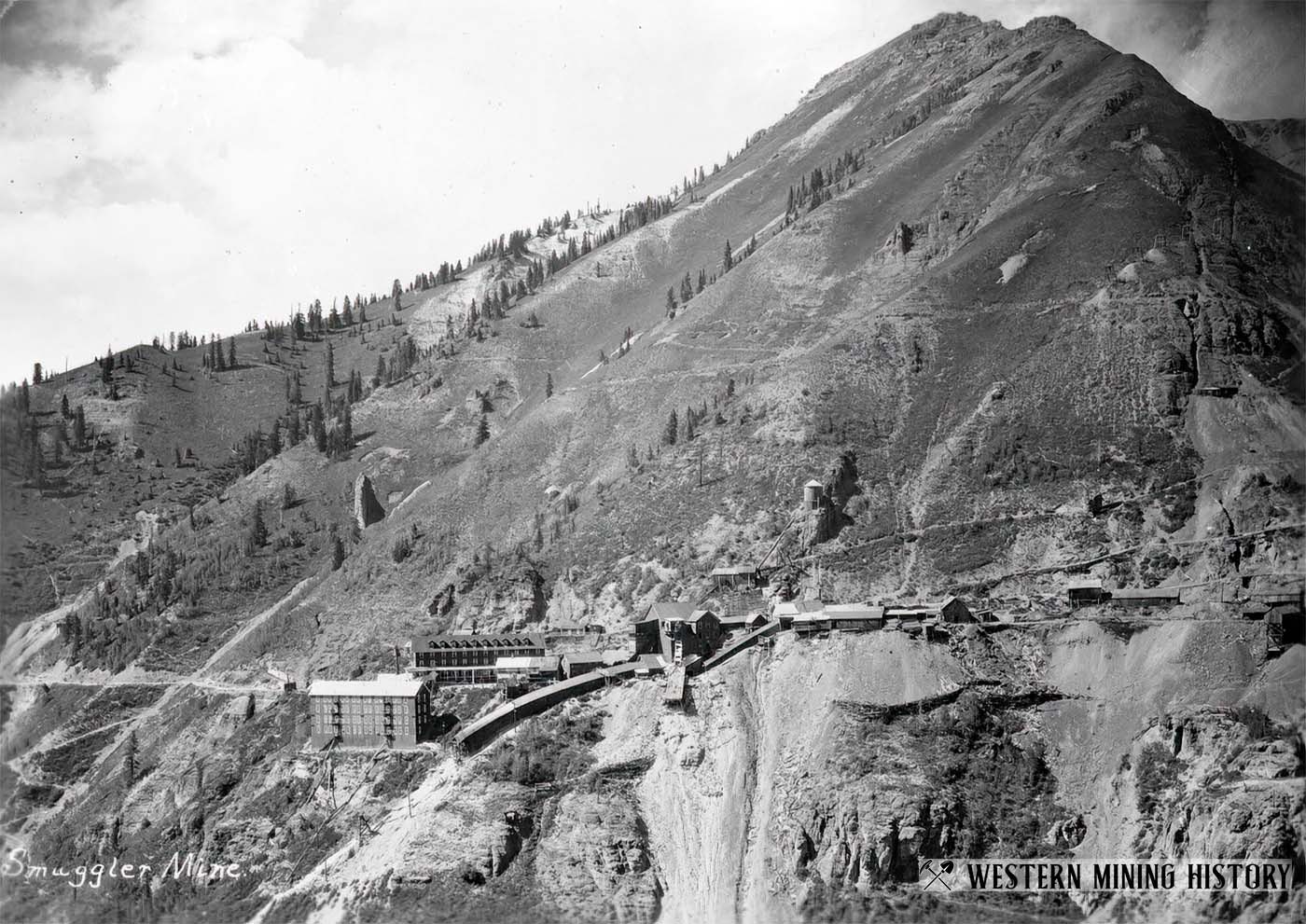
Both the Tomboy and Smuggler mines were located high above the town of Telluride. The following photo depicts the impossible terrain that the Smuggler was built on.
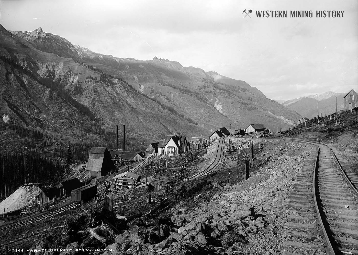
New silver discoveries at Red Mountain during the early 1880s created one of Colorado’s most productive silver districts. The center of the district was at Red Mountain Town, and the Yankee Girl mine was one of the top producing mines.
This view of the Yankee Girl is typical of the mines in Colorado’s rugged and magnificent San Juan Mountains.
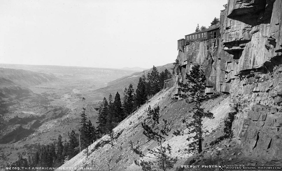
Mines of the San Juan Mountain region were rarely located in gentle terrain. The following view of the American Nettie mine near Ouray reveals that no location was too challenging for the miners of the late 1800s.
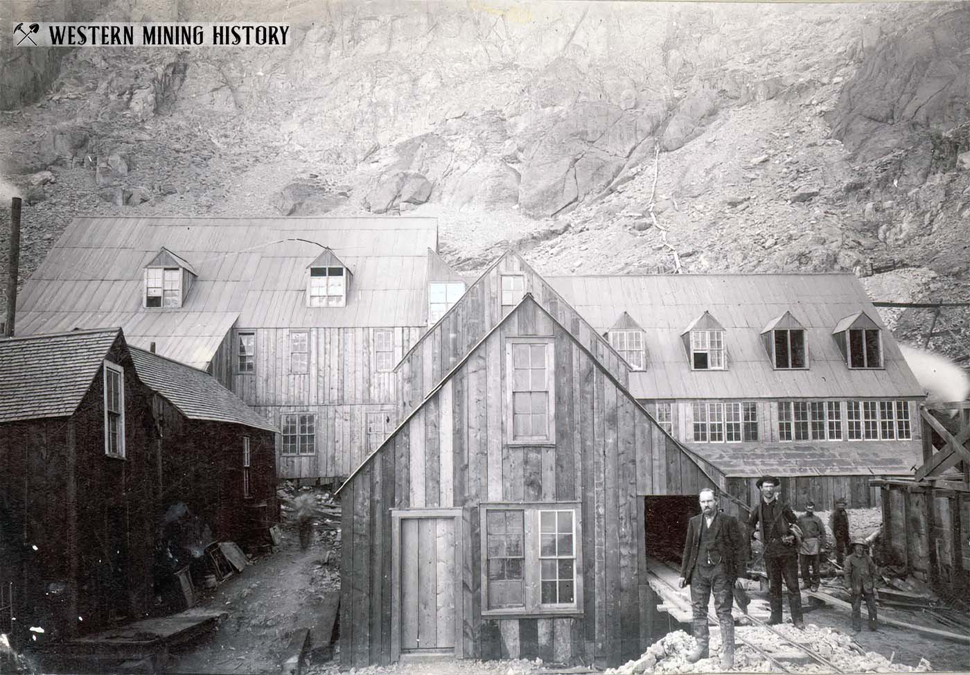
Situated at over 12,000 feet in elevation, the Virginius Mine is located approximately 2,000 feet above the town of Sneffels. The photo below illustrates the kind of terrain that many of Colorado’s top mines were located in.
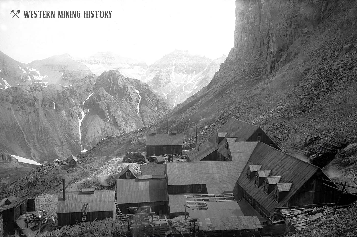
The Virginius mine building is seen from another angle in the following image.
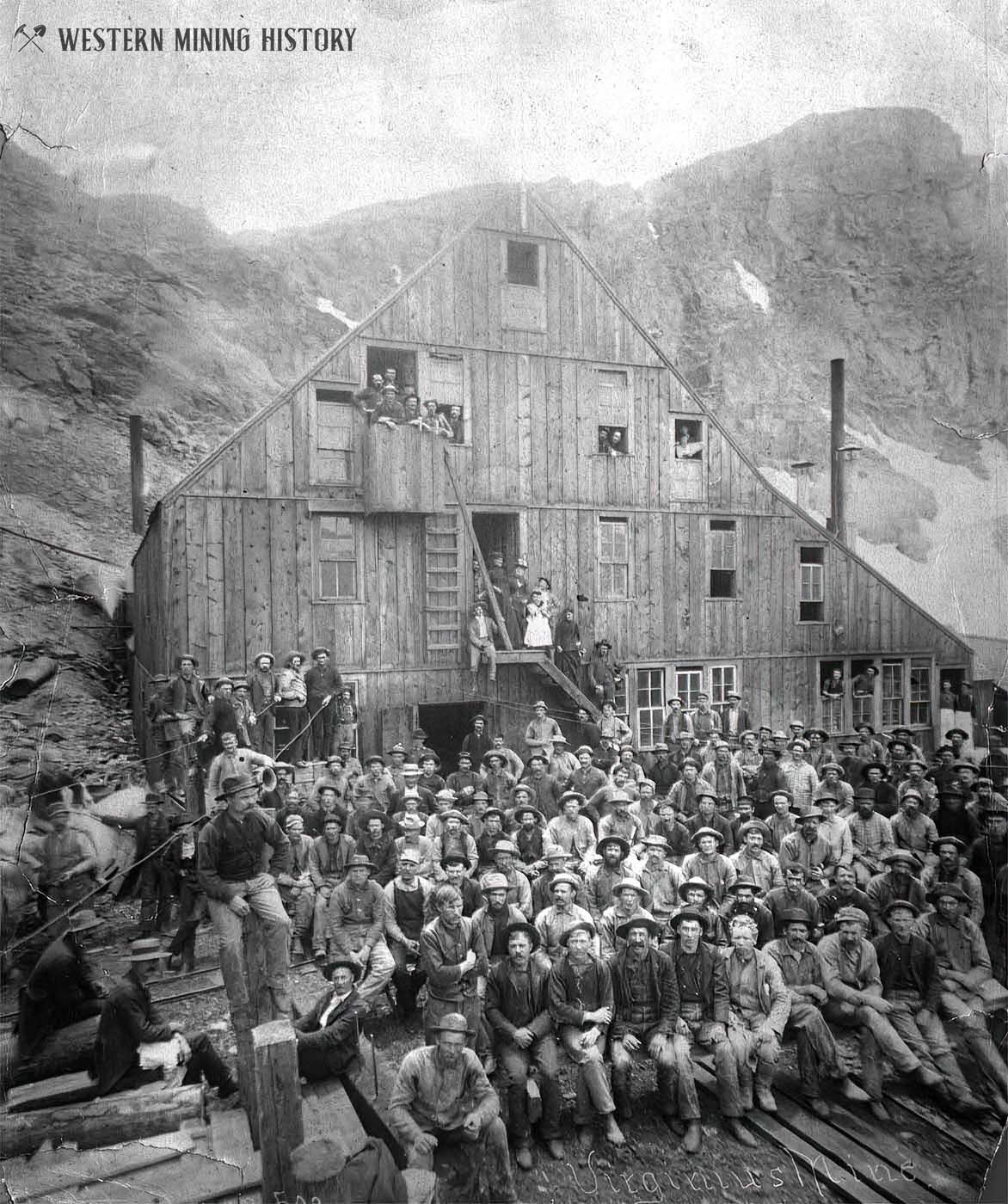
The Virginius mine crew has assembled for this iconic photo.
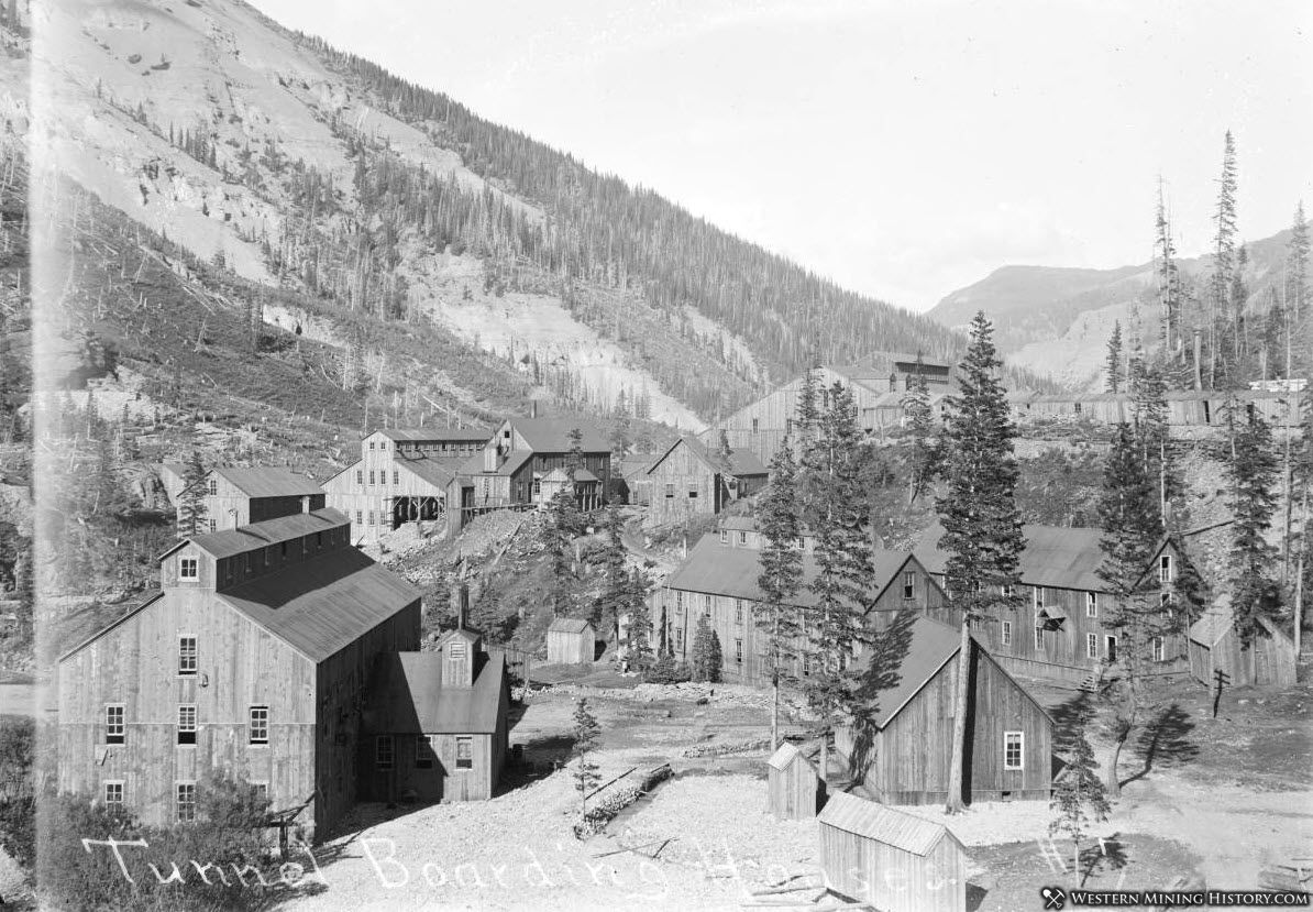
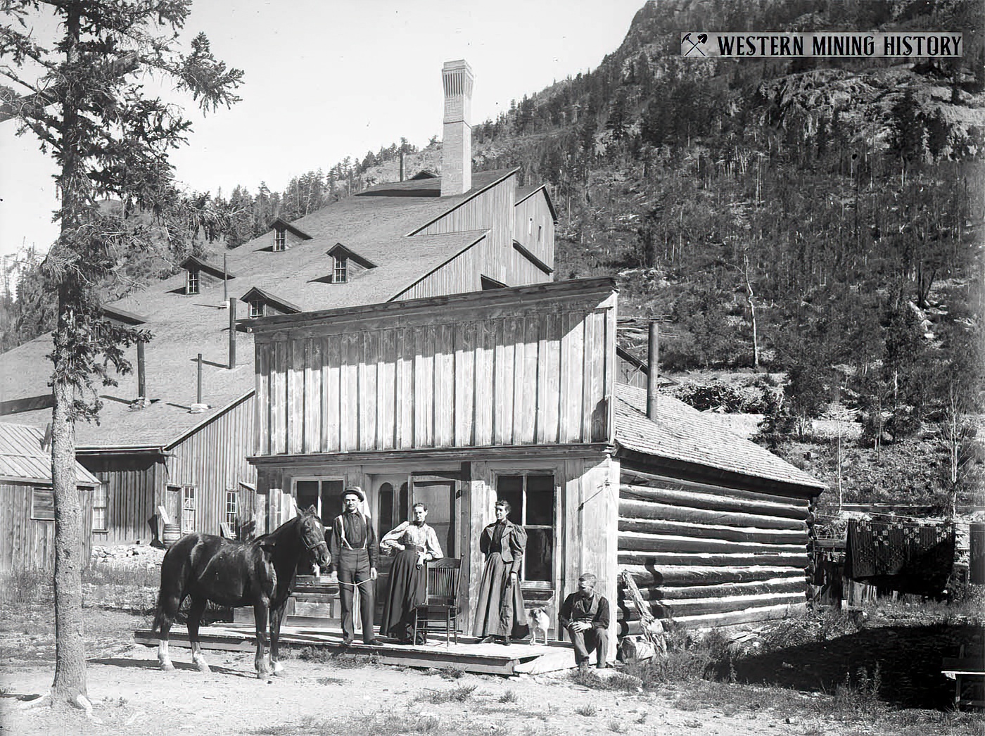
Sneffels was the milling center for the Virginius Mine ore, and it was the location of the Revenue Tunnel which was built to drain the water from the Virginius Mine. The image below shows the boarding houses where the Revenue Tunnel workers lived.
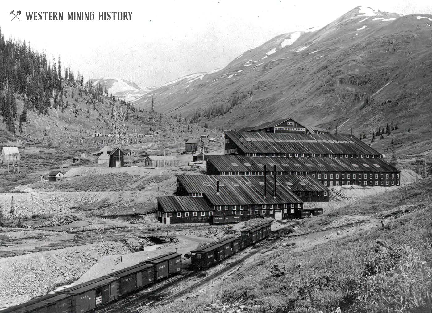
The Camp Bird Mine, located above Ouray, was one of the state’s richest and longest-operating mines. The mine was a vast operation, by the end of 1900 the mine consisted of 103 mining claims on 941 acres, and had twelve mills in operation. The boarding house seen in the photo below was described in an 1899 newspaper article:
A boarding house capable of accommodating 400 men has been built and equipped with modern conveniences as well as the average hotel – electric light, steam heat, hot and cold water, porcelain bath tubs, commodes, sewer connection, fire apparatus, library, reading room, stationary porcelain basins, and all the other etceteras that contribute to the comforts of a home.
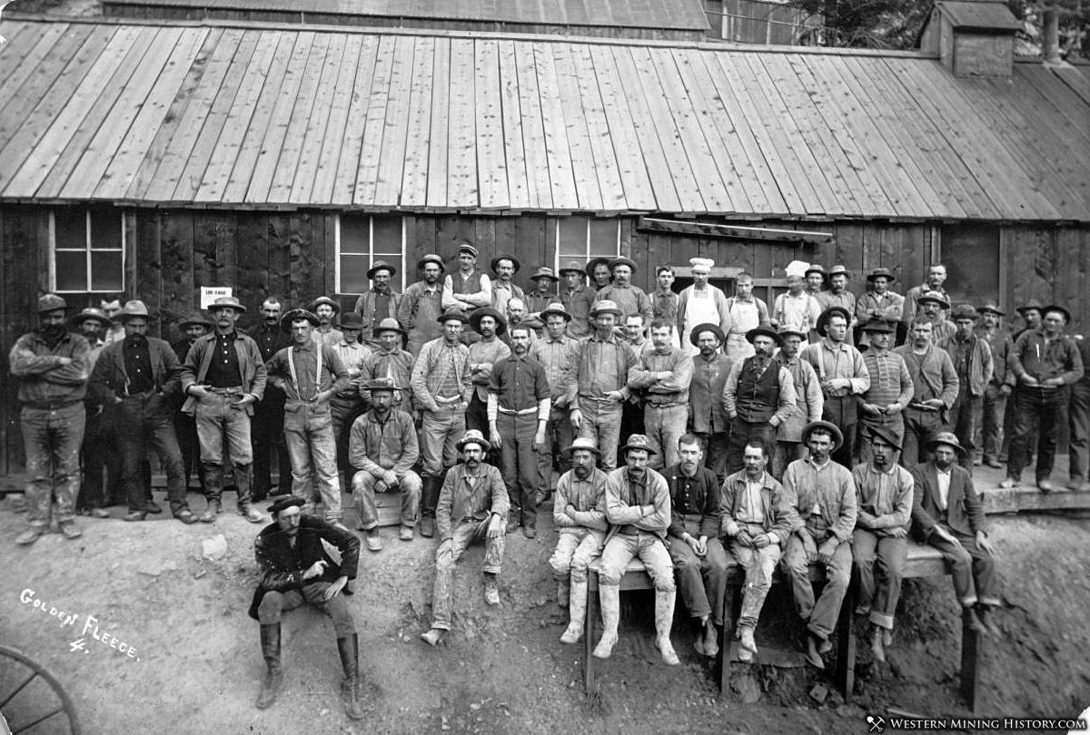
A mine would be nothing without the skilled men that built them. Miners would often live and work at the remote mines, and it was common to photograph the mine crew in front of surface buildings. The following photo shows the crew of the Golden Fleece Mine near Lake City.
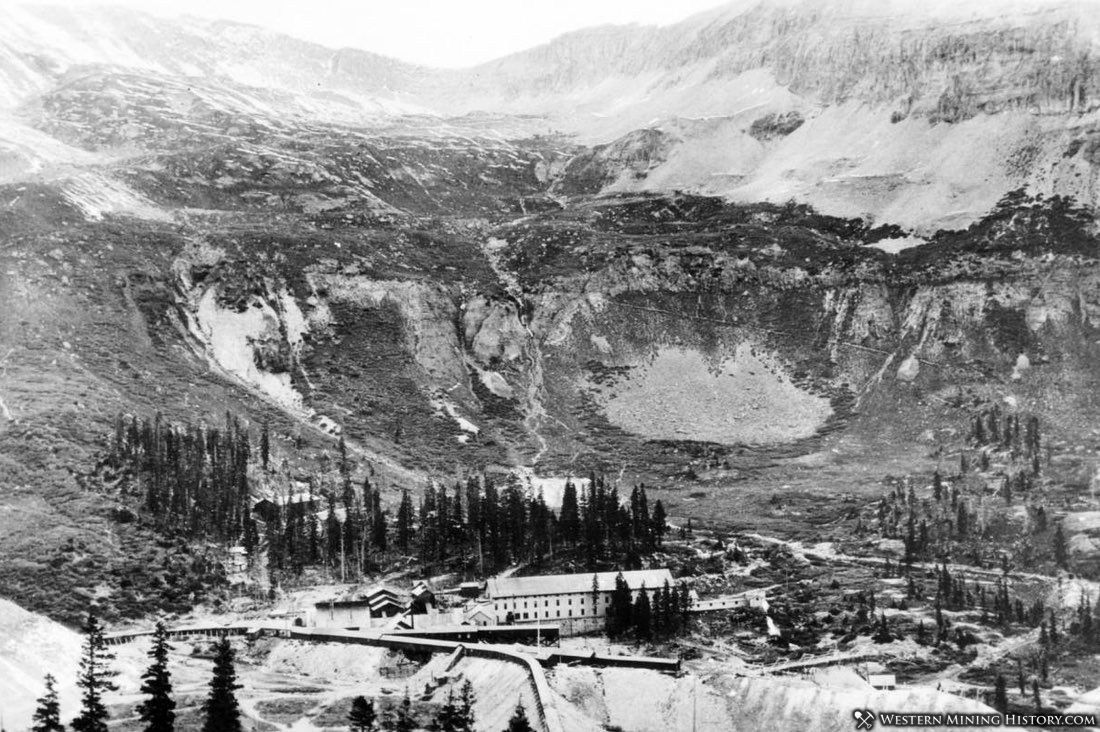
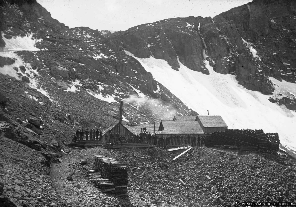
The following photo of the “Old Virginius” mine high above Ouray, Colorado illustrates the difficult terrain and remote locations that men lived in worked in while employed at the mines.
Many mines of the rugged San Juan Mountains were only accessible by foot or by mule. Pack trains supplied all the necessary equipment and supplies to keep the mines running. Miners usually walked into and out of the mines, often at great distances and through harsh weather.
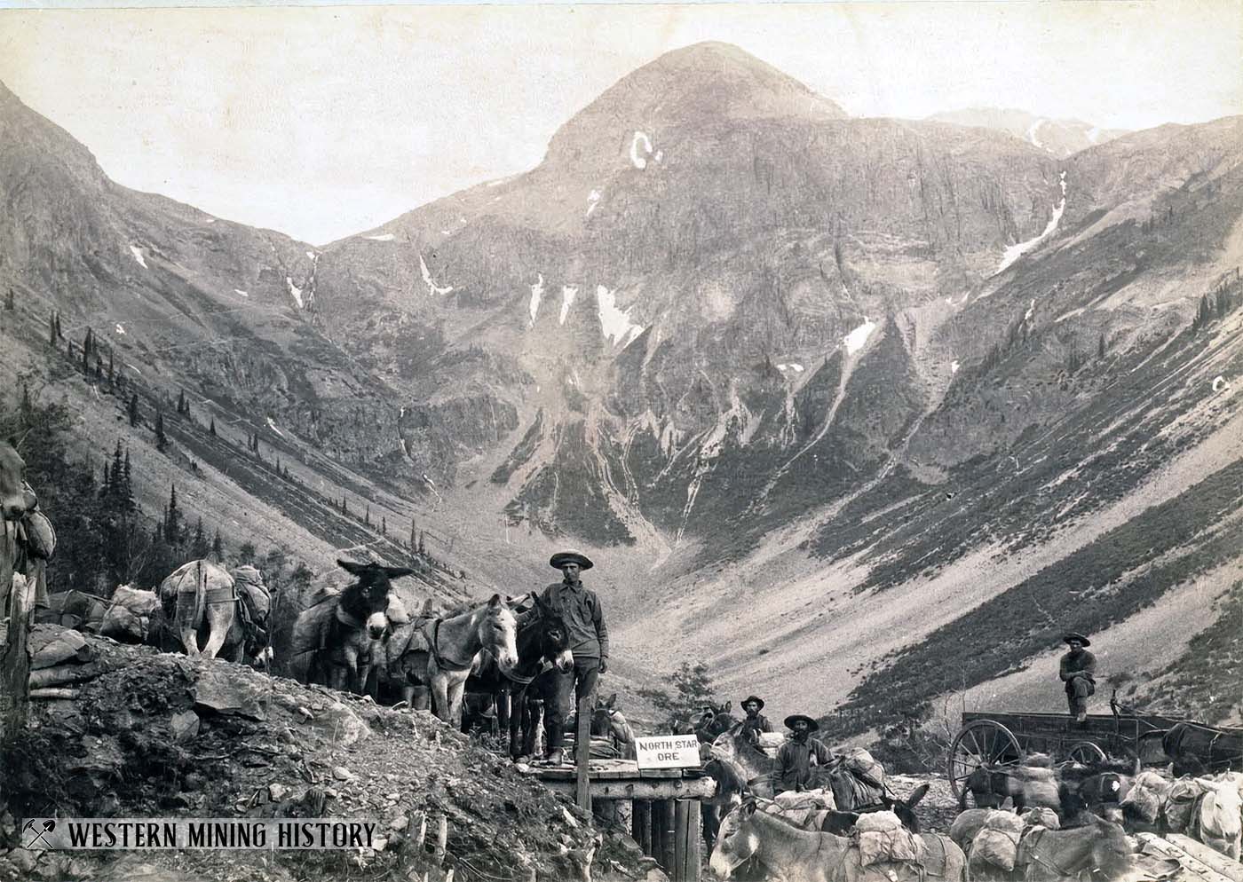
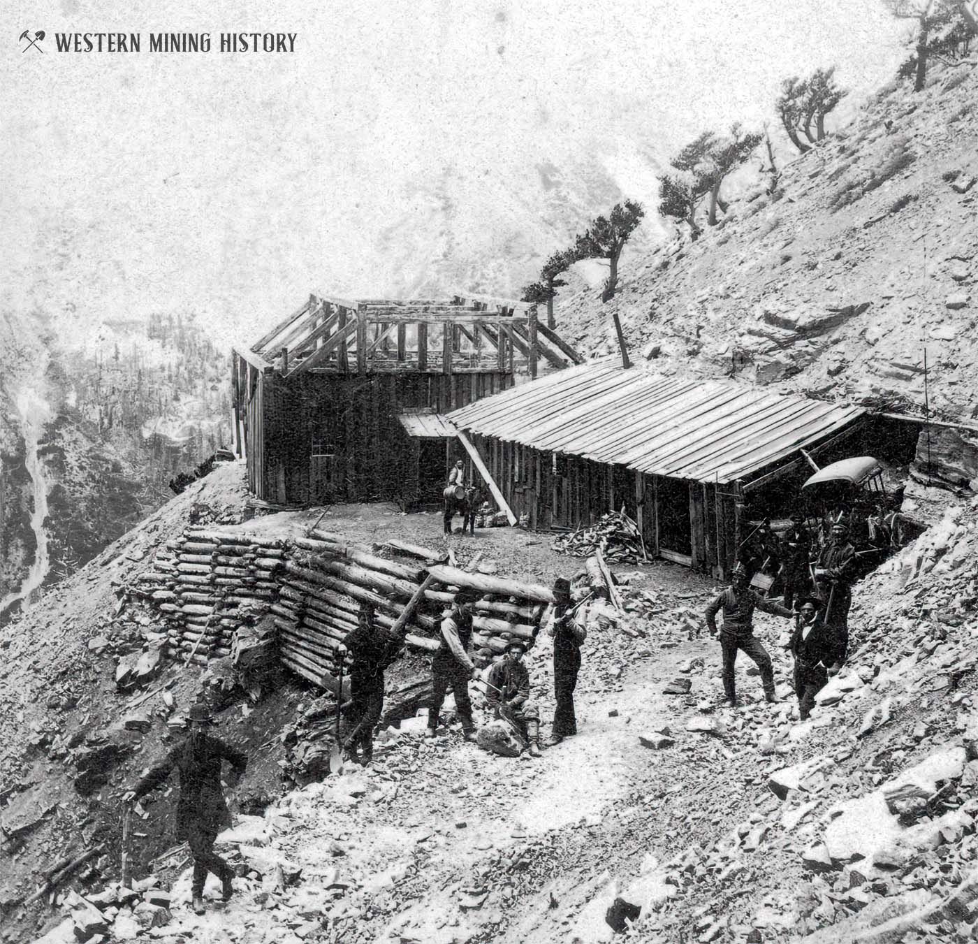
The following image of the North Star Mine of San Juan County depicts the men and mules that opened the mines in impossible terrain.
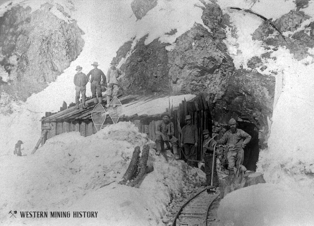
This unidentified mine from Ouray County, Colorado illustrates the difficulties miners had to overcome to work their mines in extremely rugged terrain. Note the snowshoes leaning against the building.
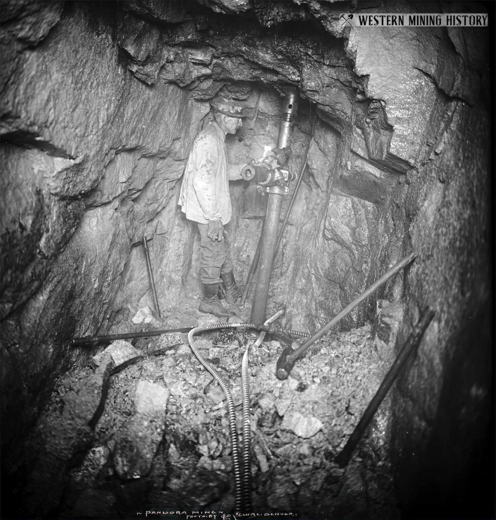
In the following scene a miner is setting up a pneumatic drill in the Pandora mine located in the San Miguel County.
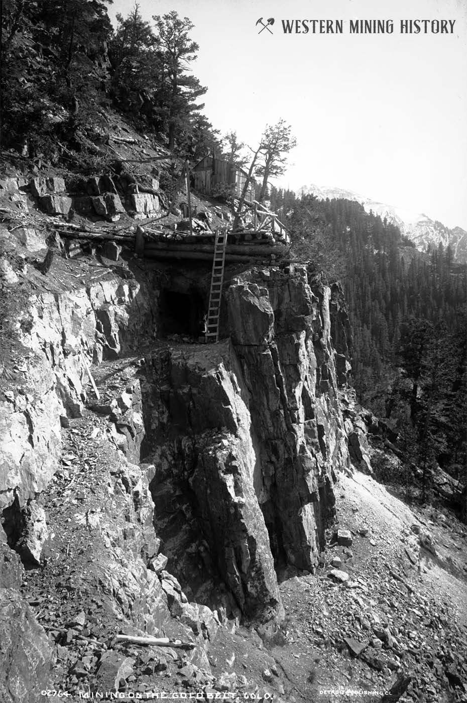
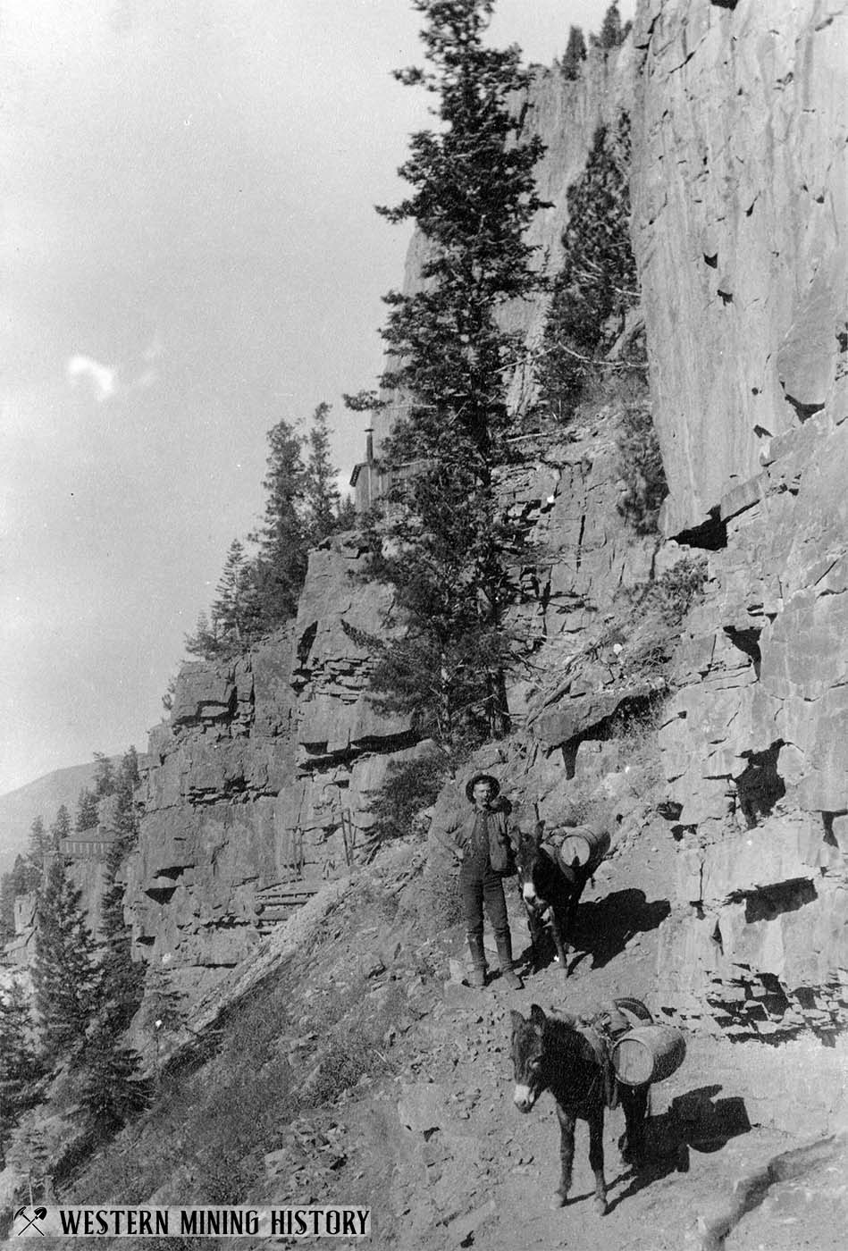
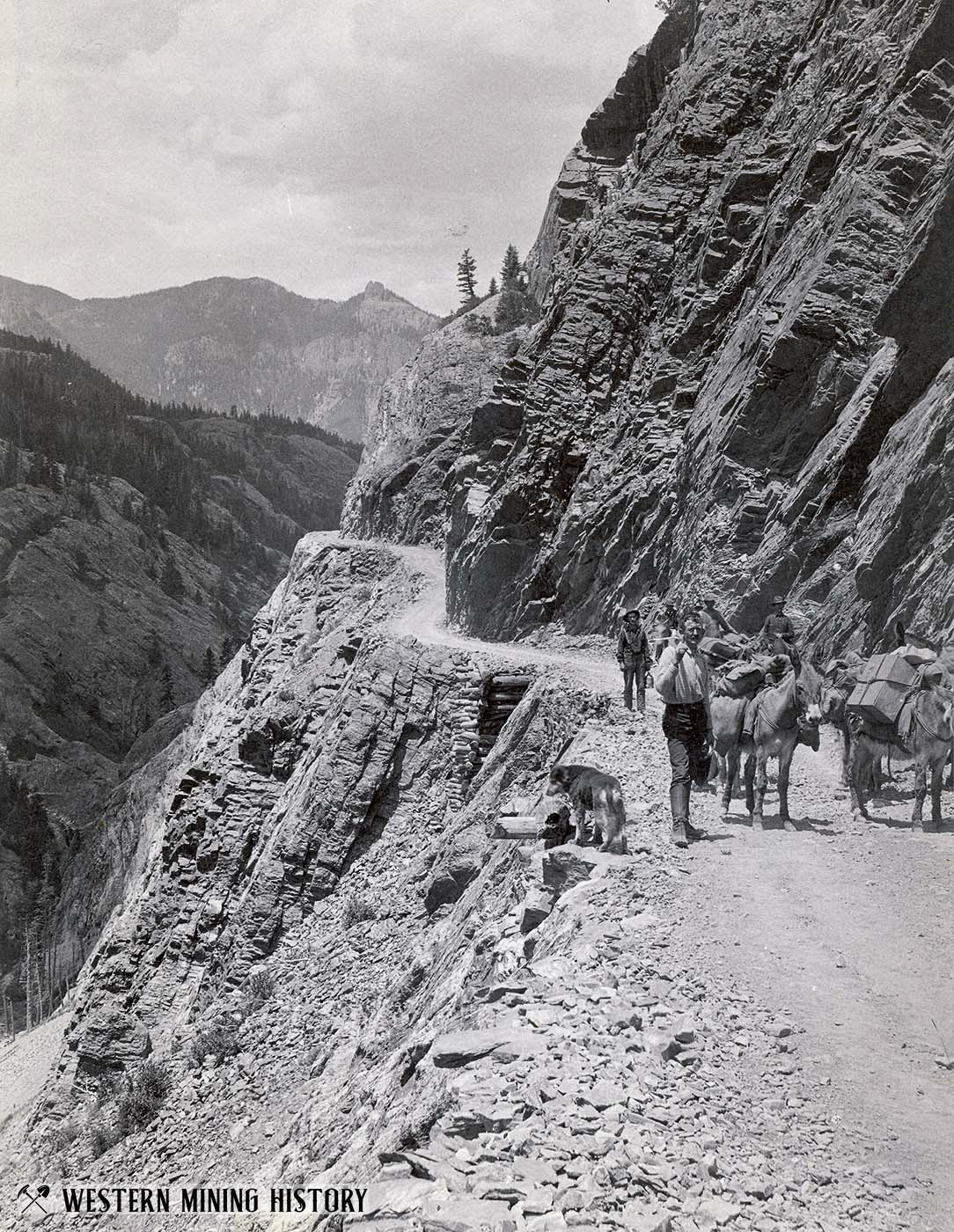
The two photos below, taken before 1900 by William Henry Jackson, were taken on the “Gold Belt Trail” near the town of Ouray. It is hard to imagine the obstacles that independent miners had to overcome to start mines like this.
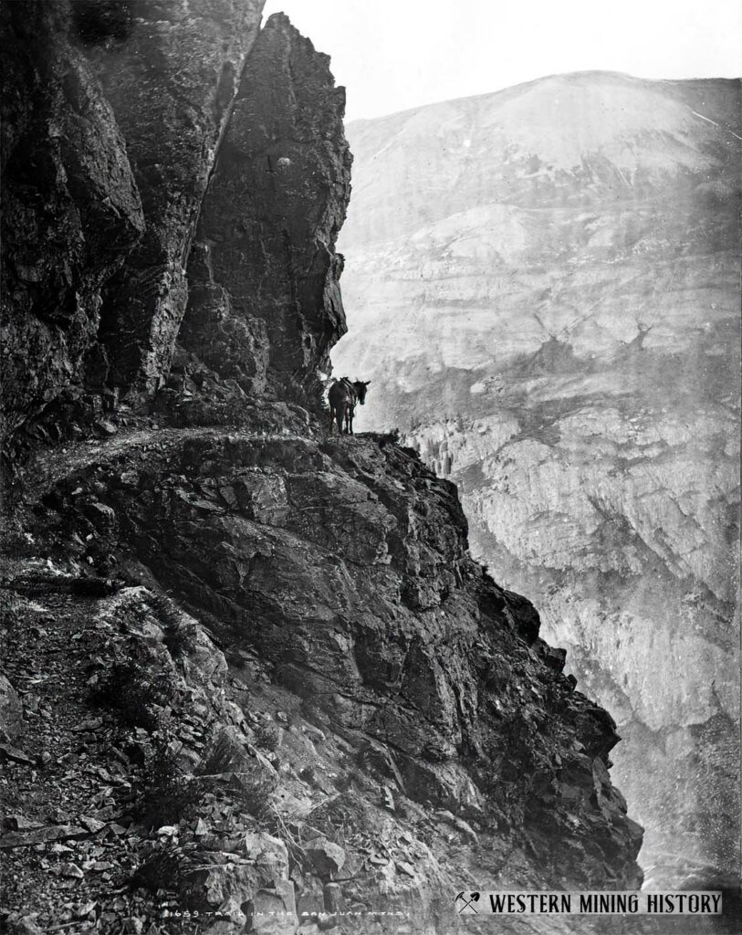
The photos above certainly paint a picture of just how rugged the mountain terrain of Colorado’s San Juan mountain range is. Imagine being a miner or prospector in this area in the late 1800s, navigating terrain like what is depicted in the next photo. A user from the Facebook page identified this trail as being above Highland Mary in Cunningham Gulch.
Travel in the region was greatly improved by the mid-1880s with the completion of the Otto Mears Toll Road which linked Ouray with the mines of Red Mountain and then on to Silverton. In the next photo, miners travel with their pack animals on the new road.
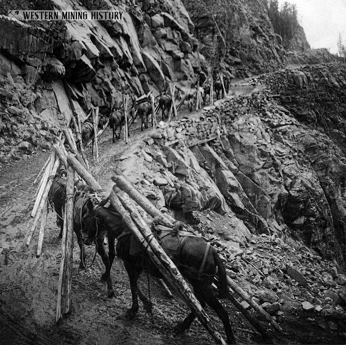
Enormous quantities of equipment and supplies had to be continuously freighted to difficult mountain locations. In the following photo, a pack train trails timbers to the Tomboy mine above Telluride.
The Excelsior mine, near Capitol City, was located at over 10,000 feet in elevation. The harsh weather at this spot is revealed by the sparse wind-blown trees visible in the photo below.
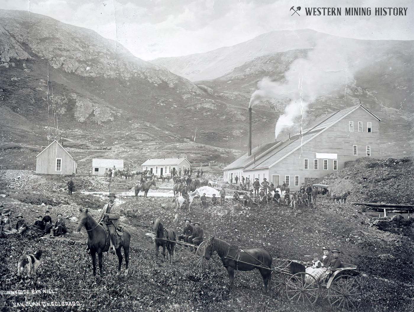
The Sunnyside Extension mill, located in Placer Gulch above the town of Animas Forks, was built in 1889. A newspaper article from 1890 reported “The Sunnyside Extension is netting some thousands of dollars a day for its owner, Rasmus Hanson. A wagon road is being built from the mine to the mill, and large dam below the mill to catch the tailings in larger quantities. Rasmus Hanson is also putting up a private telephone line between Eureka and this point.”
Although the San Juan region is known for its lode mines, there were some placer mines in operation. The following image of miners working a placer claim is identified as being in the Telluride area, and is probably down the canyon a ways near the town of Placerville.
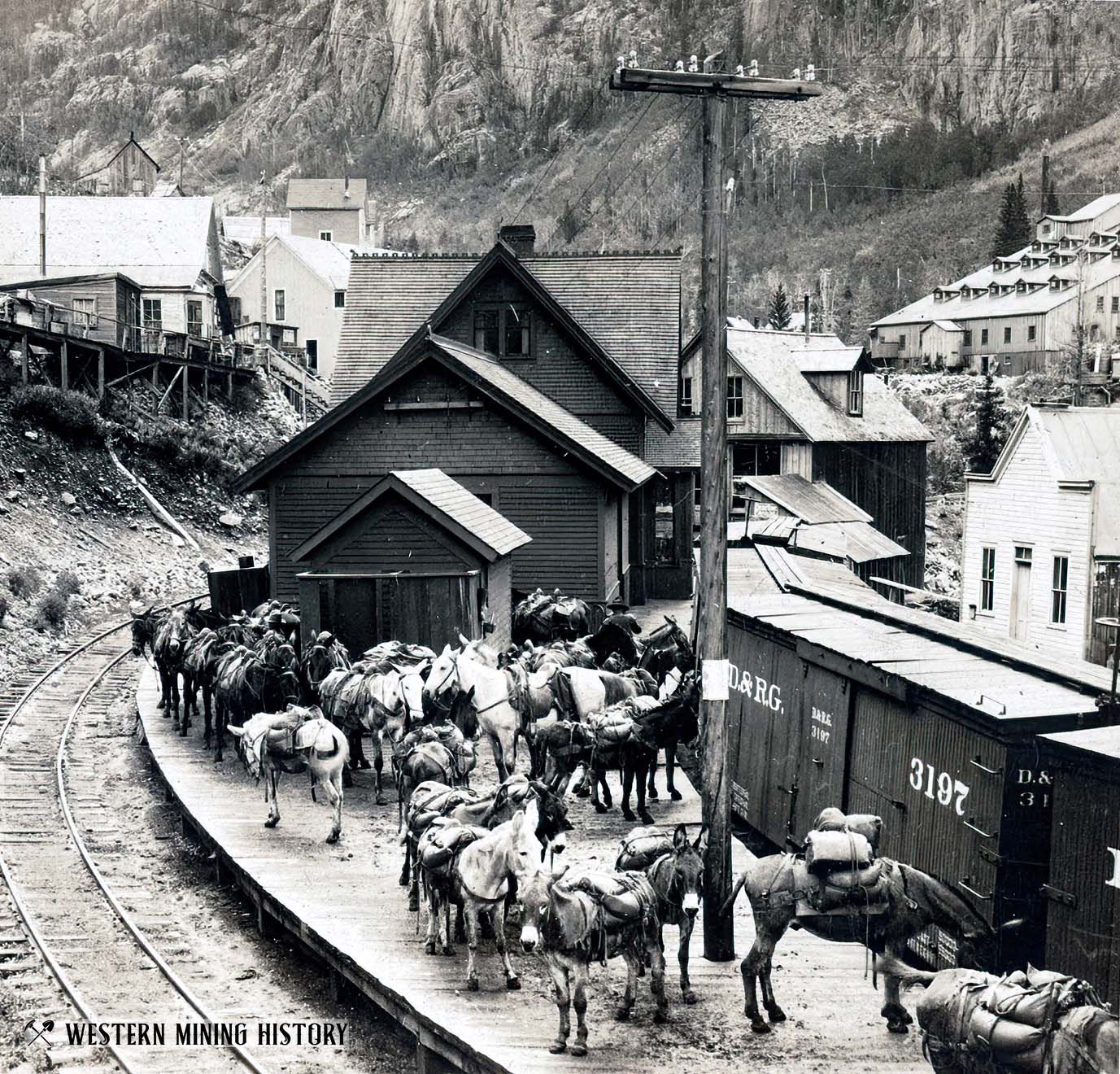
Although the arrival of the railroad transformed Colorado’s mining districts, they still relied on mule teams to traverse the very difficult mountain trails to many of the mines. In this image, mules loaded with ore concentrates are ready to unload at the Ophir railroad depot.
Yule Marble Quarry
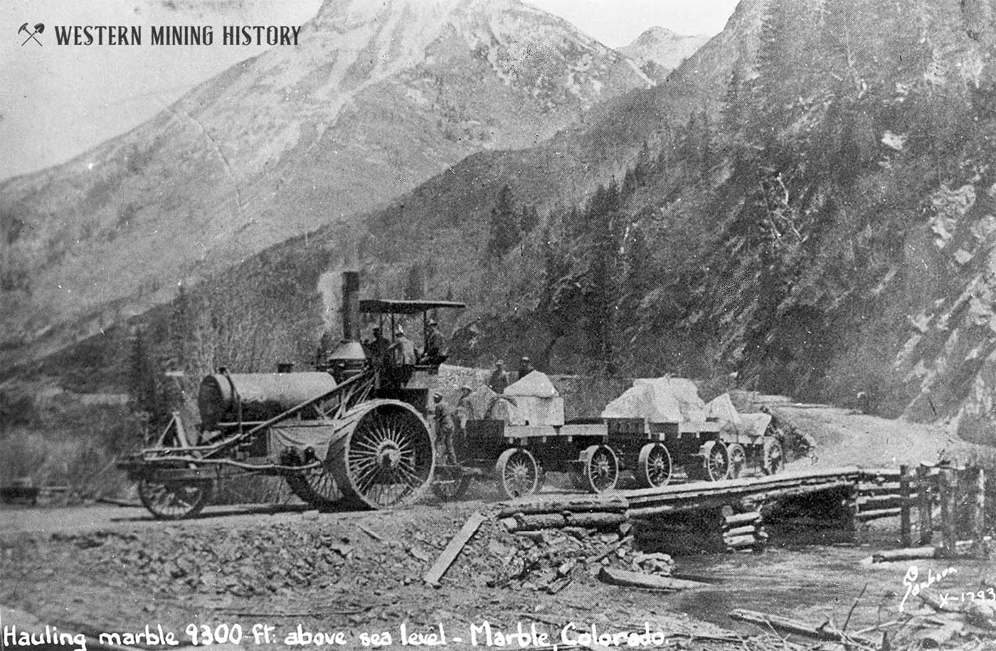
Not all riches taken from Colorado mines were gold and silver. At the aptly named town of Marble, a world-class marble deposit was developed at the Yule Quarry.
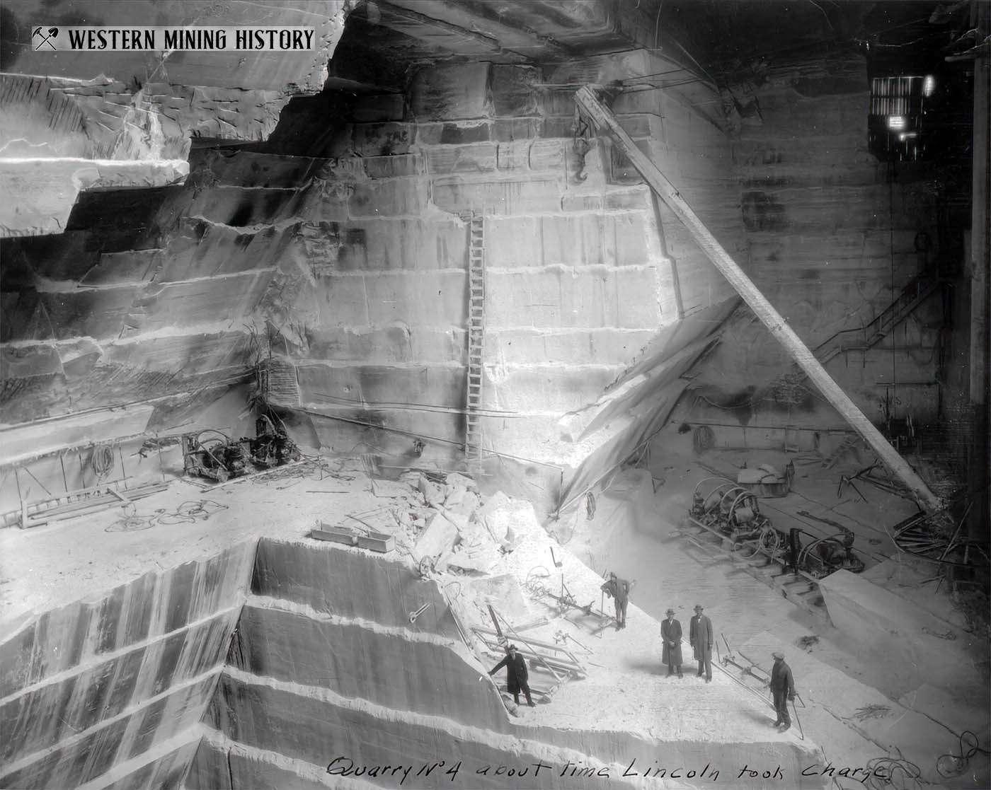
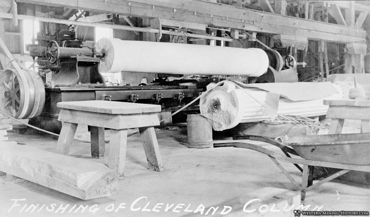
Yule Marble has been used in many famous buildings and monuments in the United States and around the world, including the Lincoln Memorial, Washington Monument, Hearst Castle, Tomb of the Unknown Soldier, and numerous capital buildings, banks, and hotels.
The enormous slabs of marble had to be hauled down the mountain to the mill where they were processed. The following image illustrates an early method of transporting the blocks – by steam tractor.
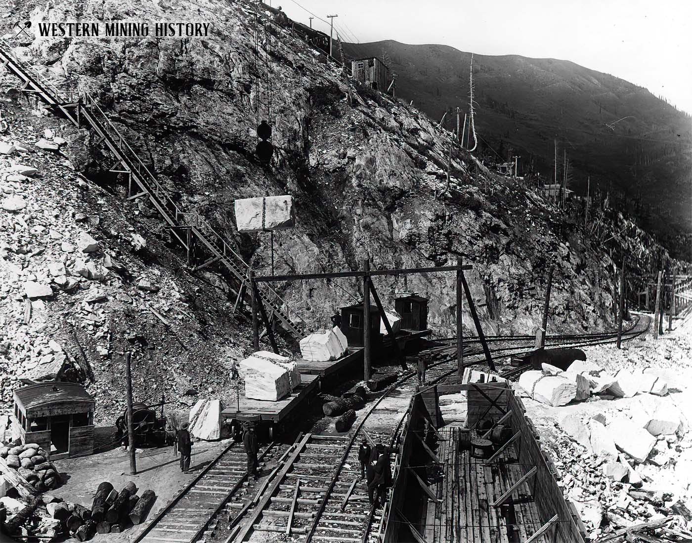
The next image shows slabs being loaded onto an electric railway, certainly an improvement over the steam tractor shown above.
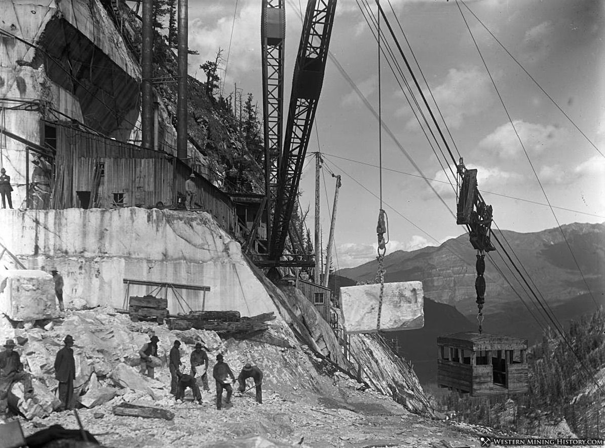
The Yule Quarry is the site of a world-class marble deposit, but it is also in a very difficult location, high on the side of a mountain. The following image illustrates the elaborate methods used to transport supplies and equipment to the quarry, and to move marble blocks to the railway.
Colorado Ore Reduction Mills
Just a few years after the discovery of gold in Colorado in 1858, the state found itself in an economic depression. The placer gold was largely mined out, and the ore from the early hard-rock mines was difficult to process with available equipment and technology.
By the late 1860s, new technology and increased investment in ore reduction mills lifted Colorado out of its depression and kicked off an era of mining that would make Colorado the leading mining state for decades to come.
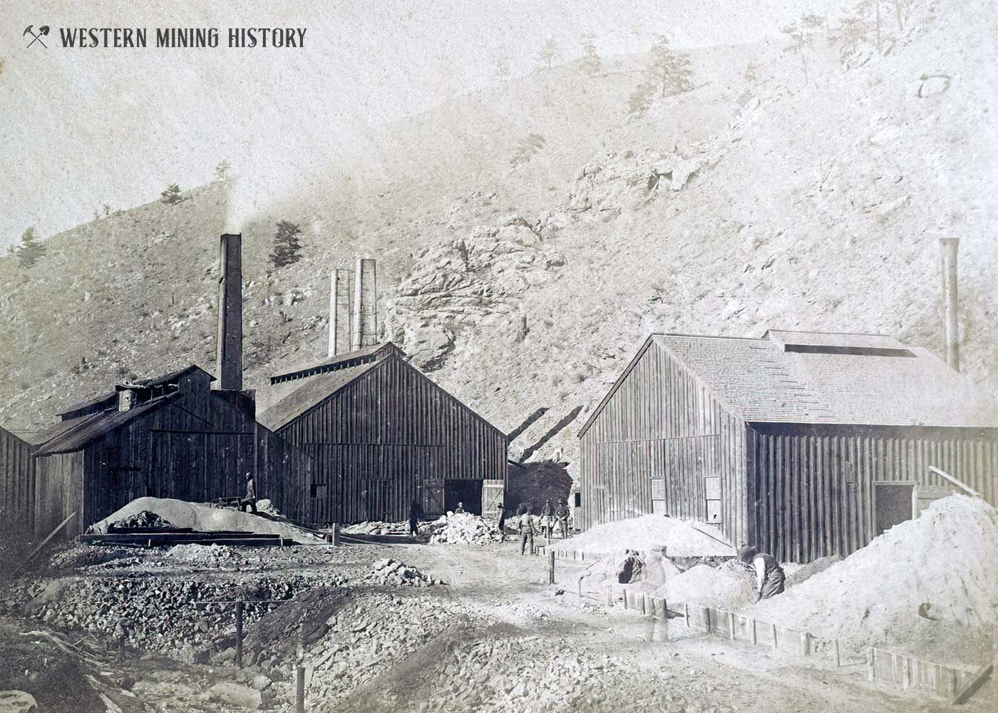
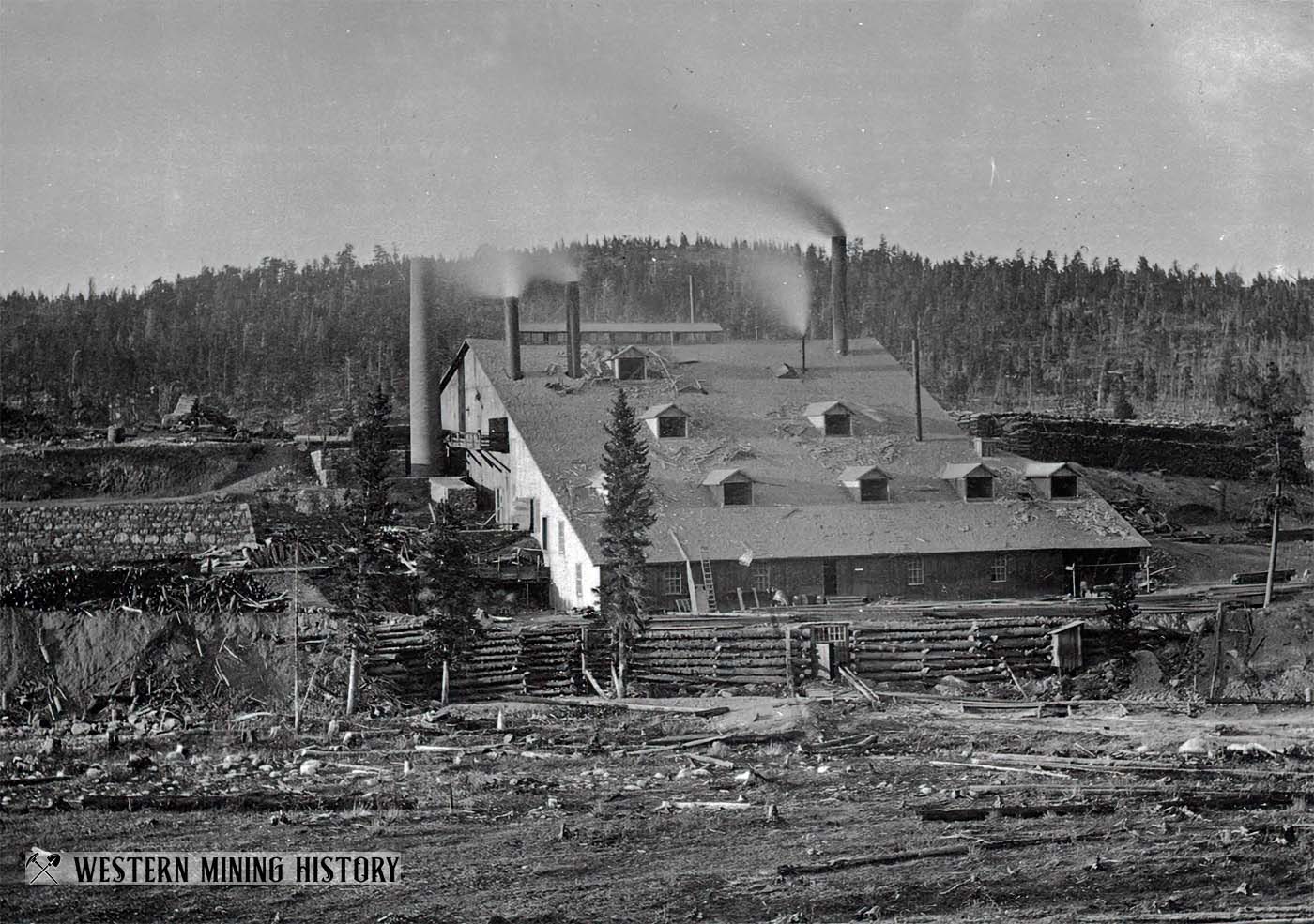
One of the earliest successful mills was the Caribou Mill at Nederland. This mill was built to process the rich silver ores at Caribou, location of Colorado’s first silver rush.
During the late 1800s and early 1900s, many new ore reduction techniques were implemented at Colorado mills in attempts to improve efficiency and profitability. Enormous sums were spent on some mills that did not live up to expectations, and they only operated for a short time. One such mill was the enormous chlorination mill of the Wallstreet Gold Extraction Company, at Wallstreet, Colorado.
The following image of the Emma Mill near Dunton, Colorado has many interesting details. The building in the foreground in the boarding house for mill workers, complete with chef standing out front. The Emma mill in the background consists of the original mill on the right, with a large expansion on the left.

Stamp mills were extremely loud and often operated round the clock. Despite the deafening noise, these mills were often located within town limits, often right next to homes or businesses. The following image shows the Black Wonder mill in the town of Sherman towering over a commercial storefront.
The Gold Prince Mill was an enormous facility located at the town of Animas Forks. The mill foundation is still a prominent feature at Animas Forks ghost town, a popular tourist destination.
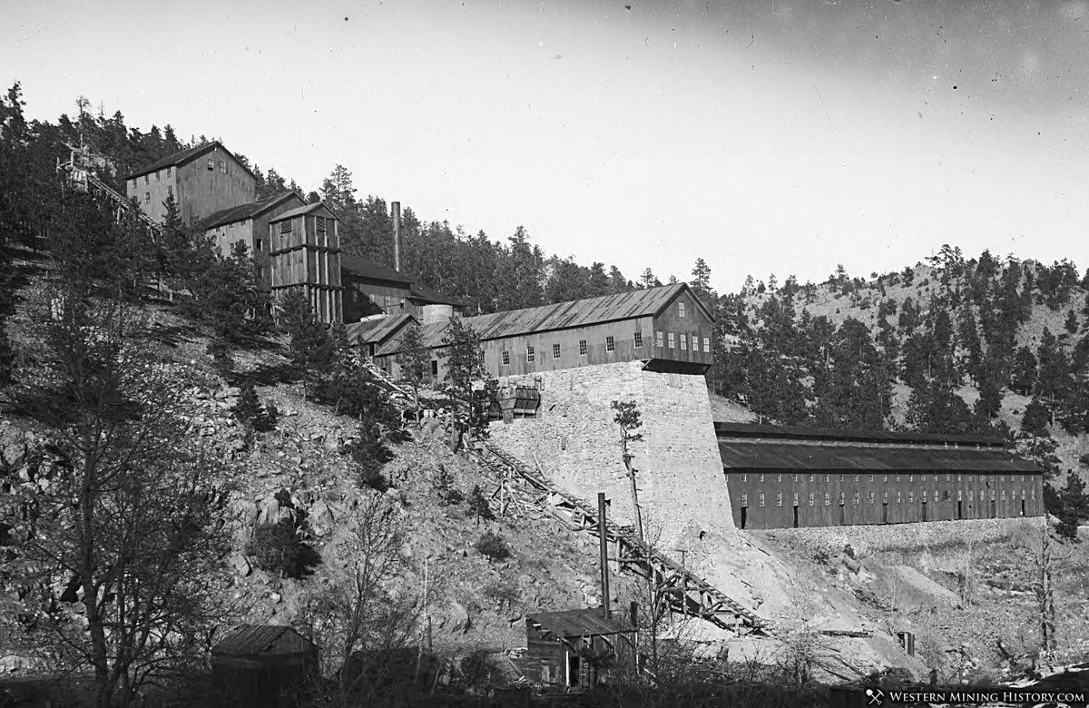
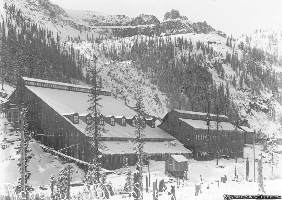
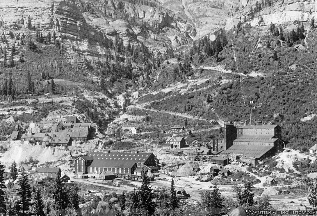
The Revenue Mill at Sneffels was an enormous operation that processed ores from the Virginius and other mines in the area. The Revenue complex employed around 600 men at its peak.
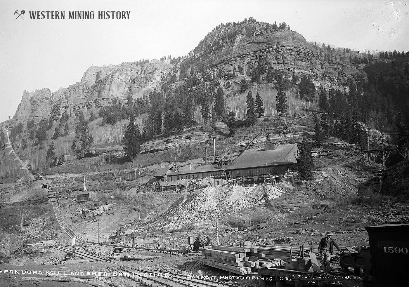
By the first decade of the 1900s, the Telluride district had become one of the state’s leading mining centers. The town of Pandora was established as a milling center for the area’s numerous mines.
The following image shows the Pandora Mill and the Sheridan Incline that was used to transport ore thousands of feet down the steep mountainside. In December of 1892 the Telluride Republican reported on an accident on the incline:
There was an accident on the Sheridan incline Wednesday which might have resulted seriously. Three cars loaded with ore broke away just below the tunnel at the middle station, caused by the grip chain on one of the cars being defective and breaking in two. On breaking loose these cars shot down like lightning and did not leave the track until they reached the spot where the old foundry and blacksmith shop were located. Fortunately no one was hurt, although there were a score or more of workingmen on and along the track at the time.
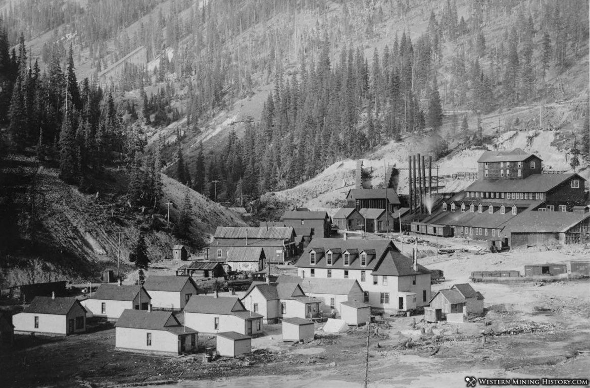
The Gold King Mill at Gladstone processed ores from the Gold King mine, one of the state’s leading gold producers. The following image of the mill and company housing is from around 1900.
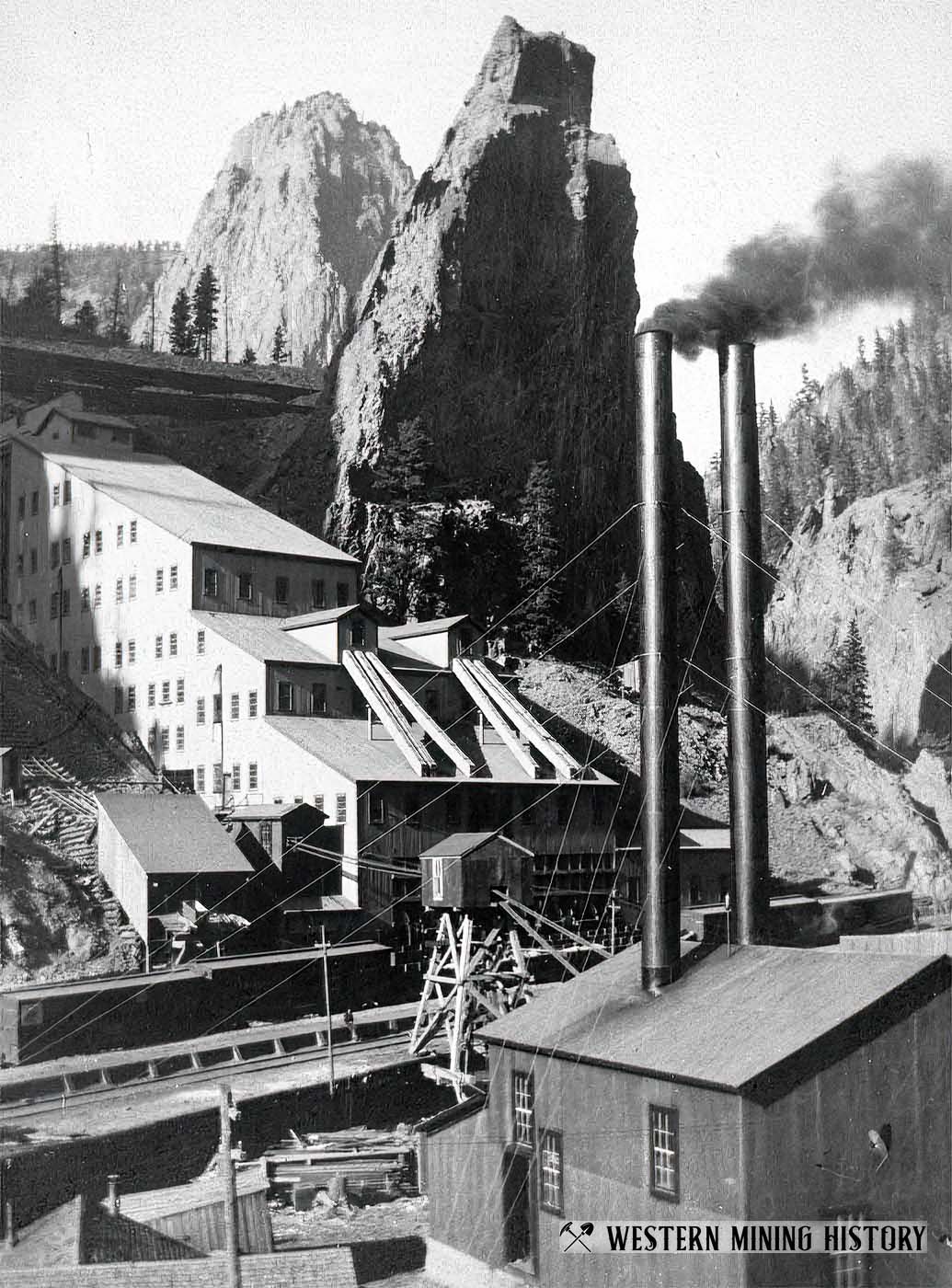
Colorado mines were often in spectacular locations, as the mill of the Humphreys Mine at Creede, pictured below, illustrates.
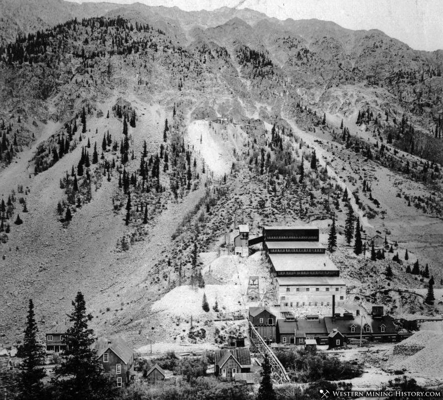
The Old Hundred Mine is famous for the impossibly positioned boarding house building that still survives today. The photo below shows the mill complex of the Old Hundred as it was around 1910. The settlement at the mill was known as Niegoldstown.
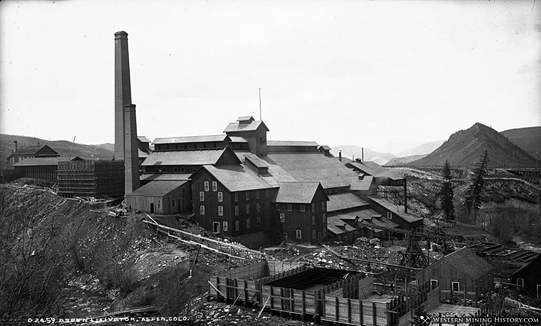
The Holden Lixiavation Works, an enormous ore reduction mill built at Aspen in 1891, is pictured below. In the early 1890s Aspen was experiencing an enormous silver boom, and had become one of the state’s premier mining centers.
More Colorado Mining Scenes
Colorado has hundreds of historic mining districts, some that were extremely rich and lasted for decades, and others that never amounted to much. The following images depict some of the best photos taken at various mining centers.
Coal was another commodity that built prominent mining towns in the state of Colorado. Colorado coal mines were uniquely positioned to supply the fuel needed for the state’s enormous mining industry.
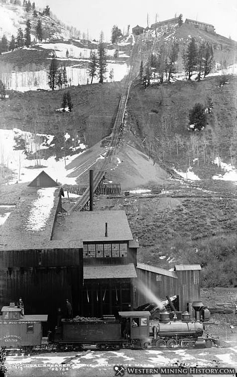
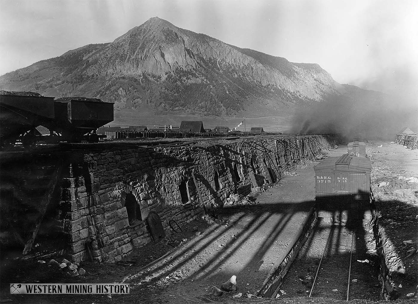
Although Crested Butte was initially founded as a gold and silver town, it was the coal mines that would be the town’s economic foundation for many decades. The following image details the Colorado Fuel and Iron Coke Ovens ca. 1910.
Silver Cliff was founded in the late 1870s as a silver and gold mining town. The following image from the Silver Cliff area show an unusual scene at the Racine Boy Mine. Many miners are loading ore cars from what must have been a rich deposit of ore right at the surface.
Breckenridge was one of the first settlements in the entire state. While most gold placer mines were exhausted within a couple years of discovery, Breckenridge manged to thrive for many decades by successfully adopting hydraulic mining methods, and later dredging.
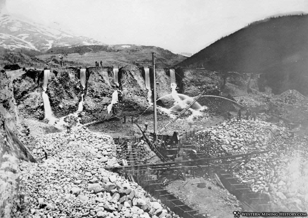
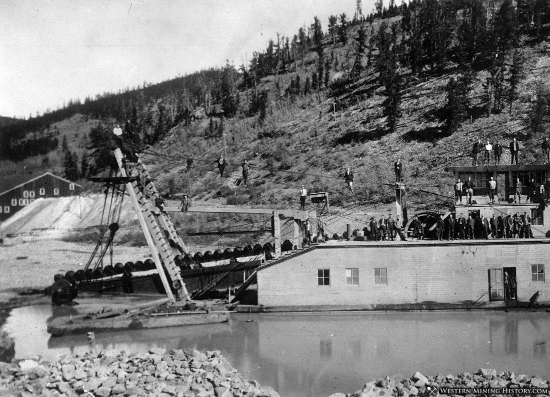
Gold dredging got its start in Montana just prior to 1900. By 1910 gold dredging had become big business in many western gold districts. The following image shows the Colorado Reliance dredge near Breckenridge ca. 1910.
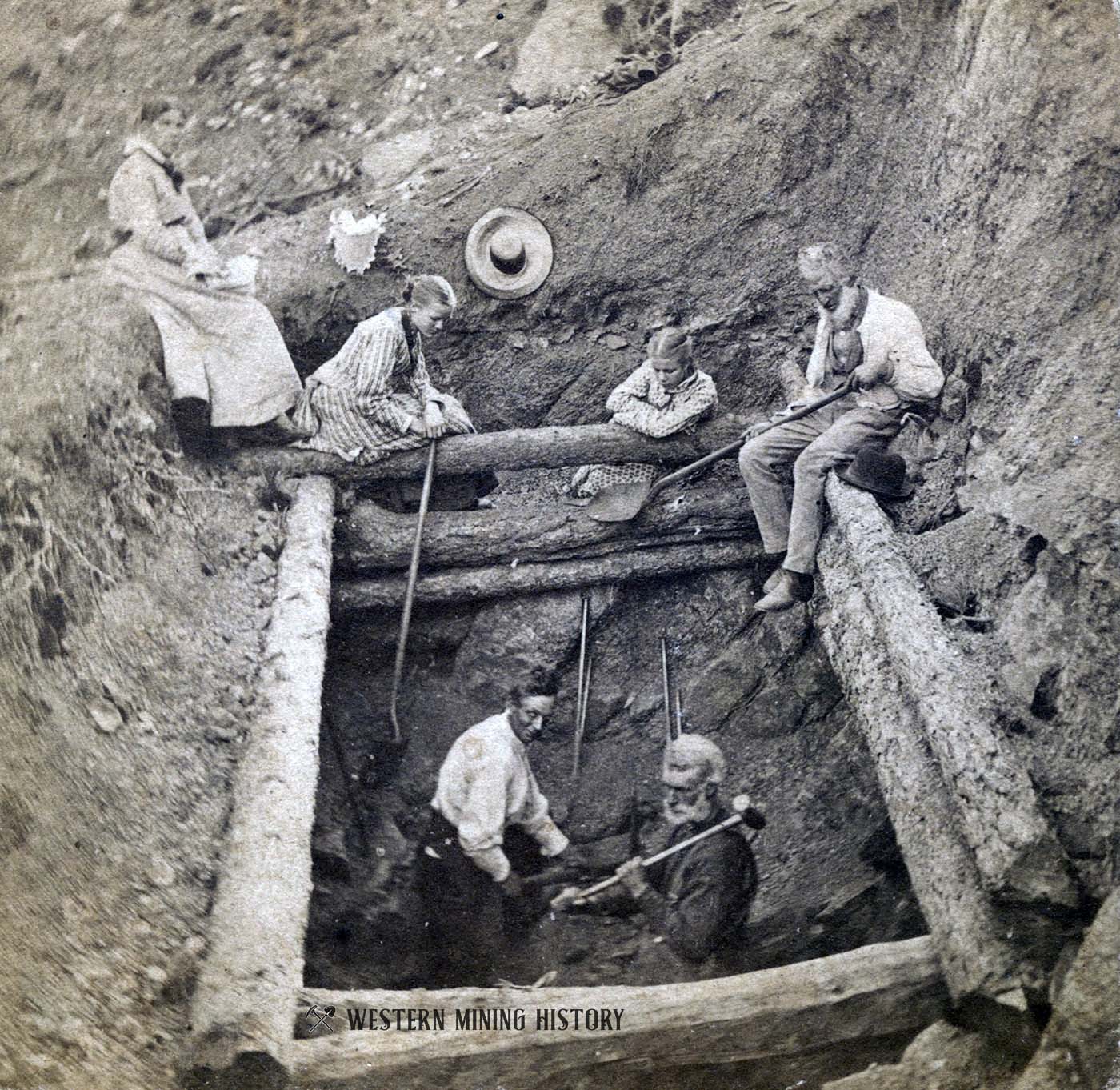
The following photo depicts miners, with family members present, working starting a prospect shaft in El Paso County, Colorado (early 1870s).
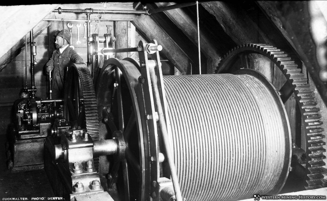
Often the best is saved for last, and the following photo certainly fits the bill. This stunning 1893 photo illustrates an underground hoist and operator at the Della S Mine at Aspen. The year this photo was taken marks both the year that Aspen took the crown as largest silver producer in the United States.
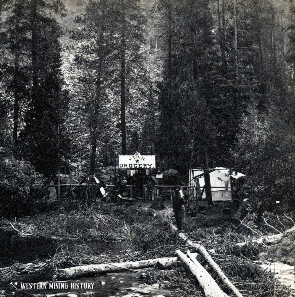
The following image of the Star Grocery in Eagle River country (in the vicinity of the town of Red Cliff) provides a very unique glimpse of a true frontier merchant operating right in the middle of the wilderness. Undoubtedly this establishment was a welcome point of trade and companionship for the miners and prospectors that were working in the area.
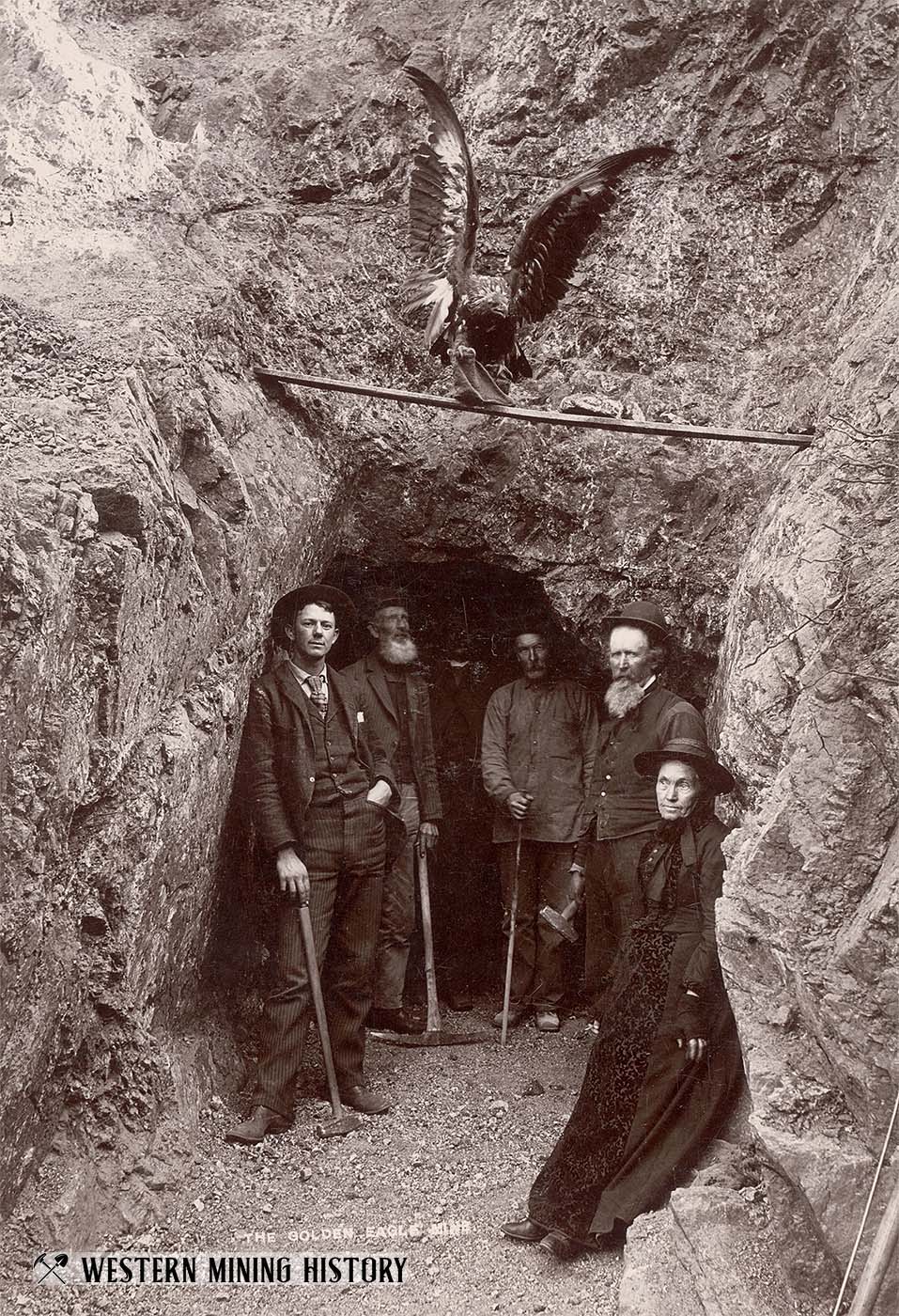
Mine photos were often for the purpose of promoting a mine. In the photo below, the mine owners have added a stuffed eagle to the entrance of the Golden Eagle mine, possibly located in Clear Creek County.
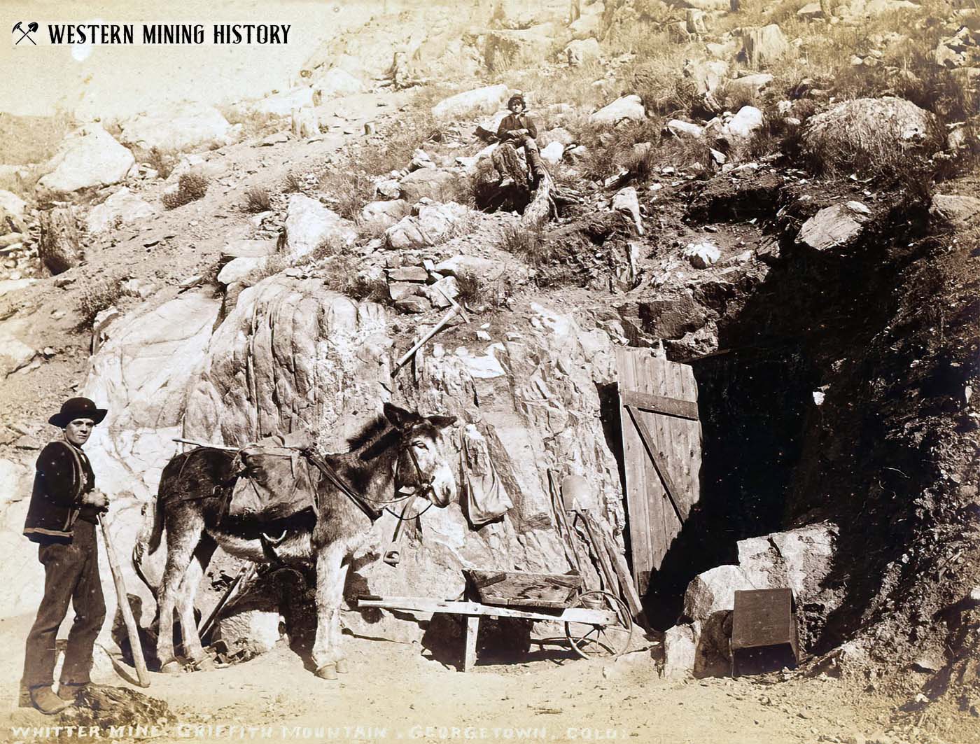
The Whitter mine was located on Griffith Mountain near Georgetown, Colorado. In 1896 it was reported “The Whitter mine has opened up a large vein of mineral, five feet wide, that runs well in gold. From 150 to 180 tons or ore will be shipped to the mill.” The vein must have narrowed significantly with further development though as the mine made little news going forward.
The following image depicts a mine well above treeline near Alma, Colorado. Mines like these were accessed only by trail, relying entirely on pack trains for supplies and equipment. Miners hiked in and out, even in the dead of winter, and would stay weeks at a time rarely emerging from the buildings where they lived.
The Alma Lincoln mine, seen here ca. 1890s, was just west of Idaho Springs. The scene below is now dominated by Interstate 70.
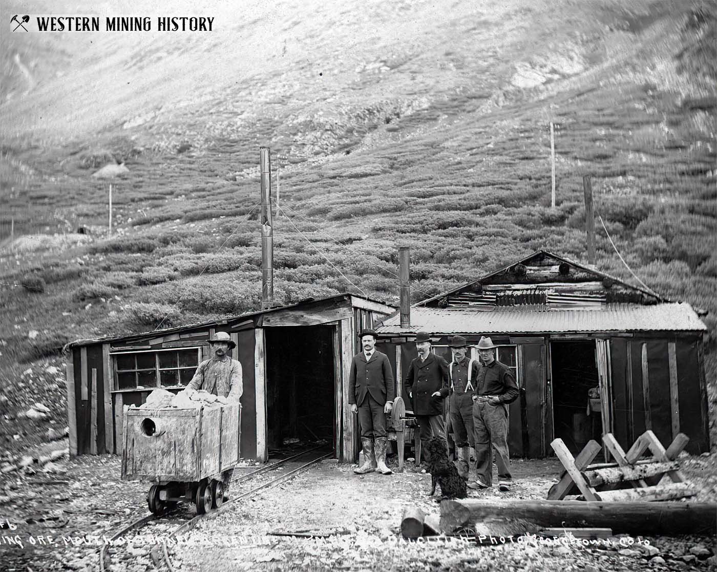
The Argentine mine, seen below, is part of the Argentine mining district, located southwest of Georgetown. Discovered in 1865, this was one of the oldest lode mines in the state.
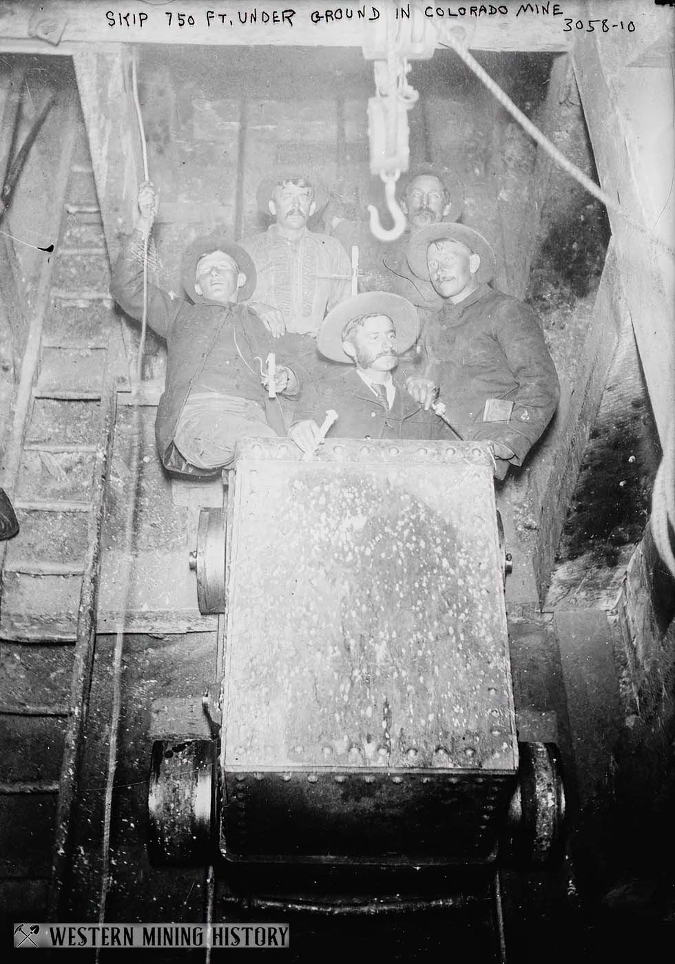
In the following photo, men are posing on an a skip 750 feet underground in an unidentified Colorado mine.
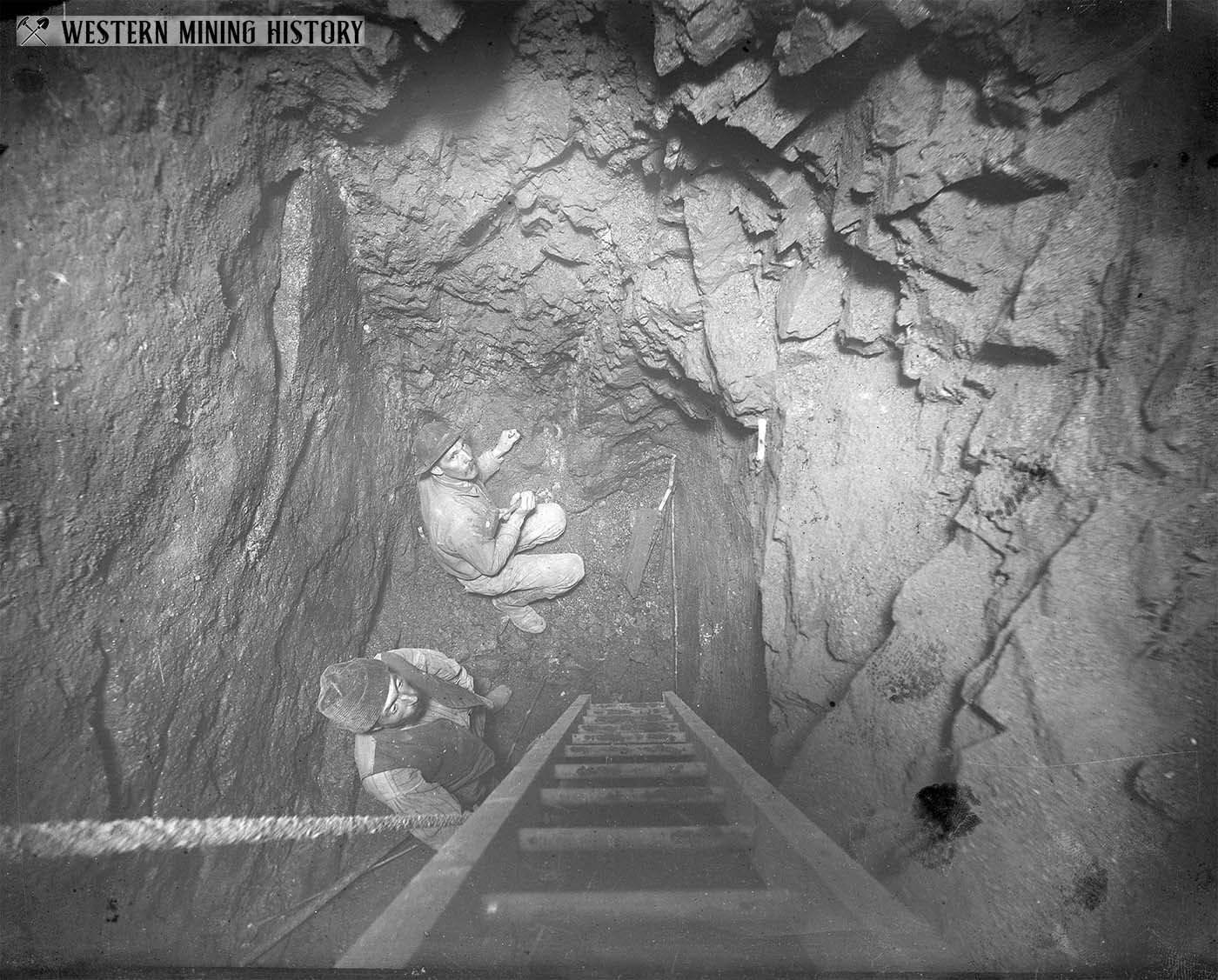
The following photo from an unidentified mine depicts two miners sinking a shaft by candlelight. One man is hand-drilling a hole that will be filled with dynamite.
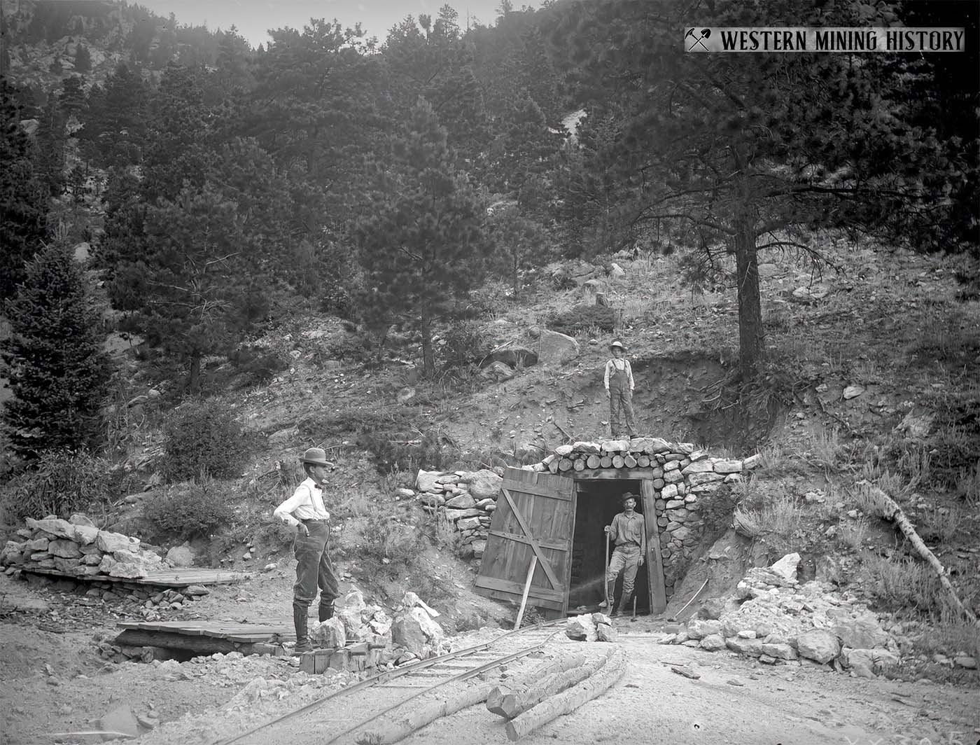
The following ca. 1890s photo was taken by photgrapher Lachlan McLean. The mine is likely located in Clear Creek, Gilpin, or Boulder counties. Pictures is an interesting shaft house made of logs.
The Running Lode mine in Gilpin County is first mentioned in newspapers in the 1860s. The mine had a couple decades of modest production until good ore was struck at depth in the 1890s and again in the first decade of the 1900s.
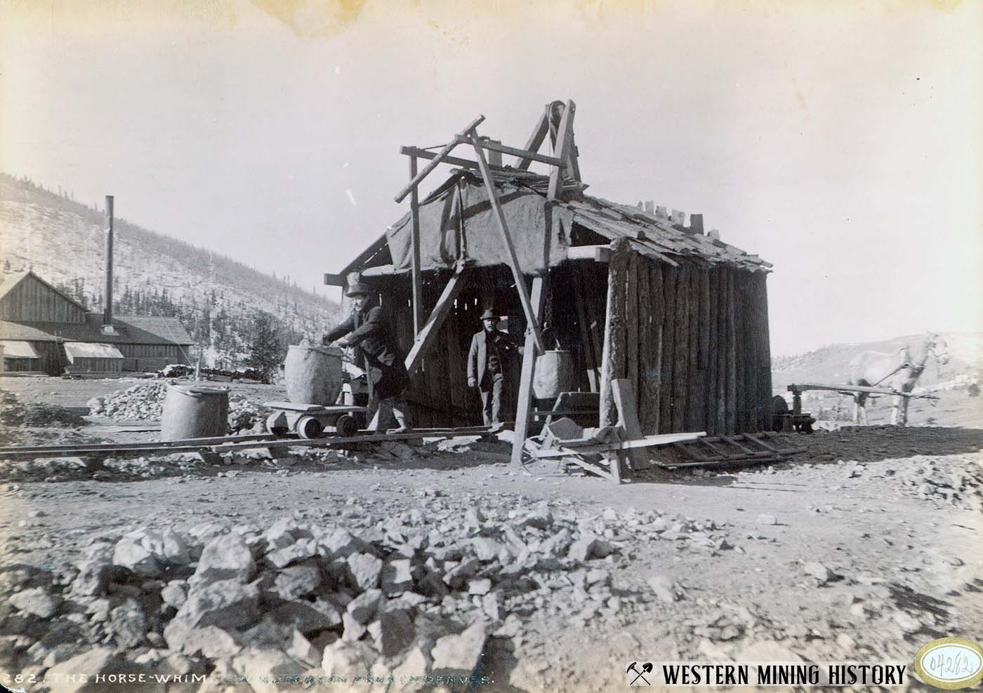
This ca. 1890 photo from William Henry Jackson depicts a small mining operation that is using a horse whim for hoisting ore buckets out of a shaft. Note the crude shaft house built of logs.
Boulder County
Boulder County isn’t as well known for its mines as other counties in Colorado. While this region did not have the world-class mines found in famous districts like Cripple Creek and Leadville, it did have hundreds of smaller mines that produced consistently for many decades.
Boulder County’s proximity to the state’s largest population centers meant that the mines here generated much interest with the public, and professional photographers captured many scenes from the mines and mining camps here.
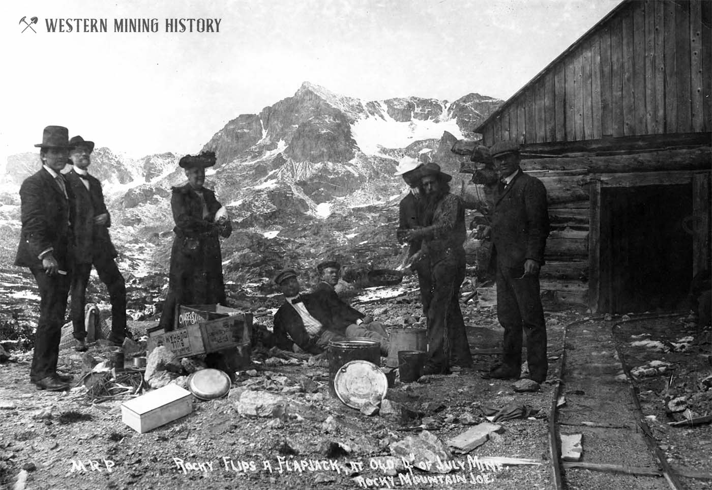
This ca. 1890s photo is titled “Rocky flips a flapjack at old Fourth of July Mine”. The man holding the pan may look like a typical mountain prospector, but he is actually Joseph Bevier Sturtevant, AKA “Rocky Mountain Joe”, one of Colorado’s most notable frontier photographers. The Fourth of July Mine was located near the mining town of Eldora (Boulder County), at an elevation of over 8,000 feet.
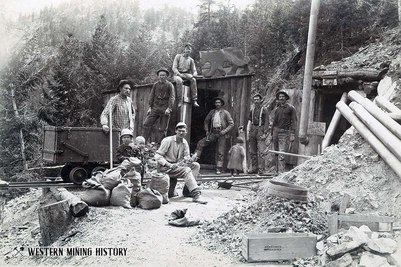
These miners in Boulder County had no trouble finding daycare for their little ones. Note the wooden sign in the shape of a black bear–this was a crew that took pride in their operation.
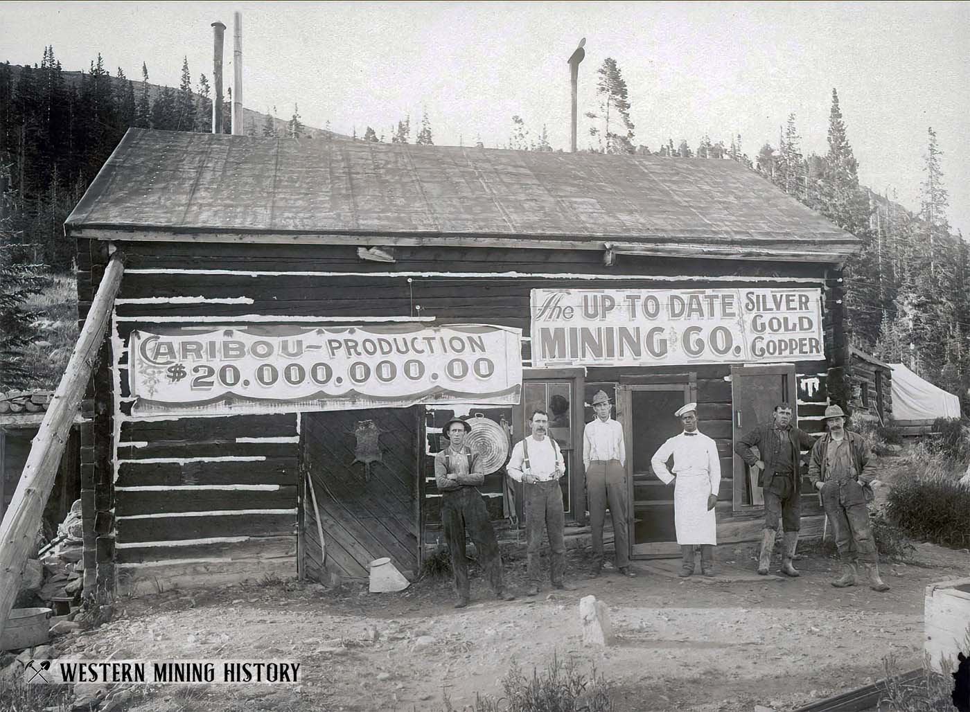
Mines in the early stages of development often sought to raise capital to finance the operation. Sometimes the owners of mines were more interested in mining the pockets of investors than doing any actual mining. Whether the Up To Date mine at Caribou was an honest enterprise is something we will never know, but the USGS notes that the mine was “largely exploratory” and had little production.
The Belle mine near Salina was a gold mine that had its best years during the first decade of the 1900s. An article from June of 1904 describes a rich strike here:
A ten inch streak of gold ore running $100 to the pound has been opened up in the Belle mine at Salina, Colorado, a discovery which has aroused great interest in that portion of the state.
Miners pose with the mine owners and their family members at the Logan Mine – Crisman, Colorado (Boulder County) ca. 1890s.
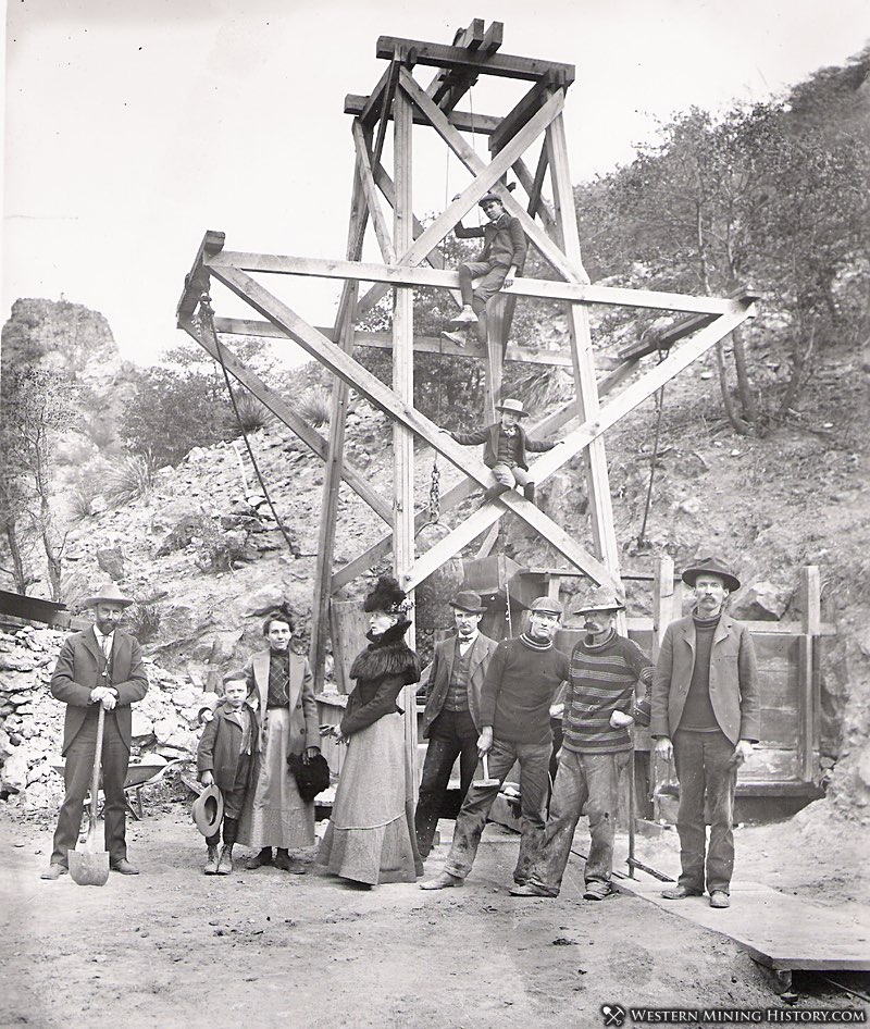
The following image shows two miners posing at their prospect in either Boulder County or Clear Creek County ca. 1900. Visible are a horse whim, headframe, ore bucket, and what appears to be a crude oven or forge.
The Schiller mine was located near the mining town called Sunshine. It is only mentioned briefly by newspapers in 1895 and 1897 and there is no USGS MRDS record for it.
An article from 1897 indicates that the owner of the mine, Frank Wiest, attempted to sell the mine to the Wynadotte Mining company, but the representative of the company determined that the mine was salted to inflate its value. Wiest denied these claims and said he would work the mine himself after the deal fell through. Since the mine is never again mentioned in papers, it is likely that the salting allegations were true.

The Frontier Photography of William Henry Jackson
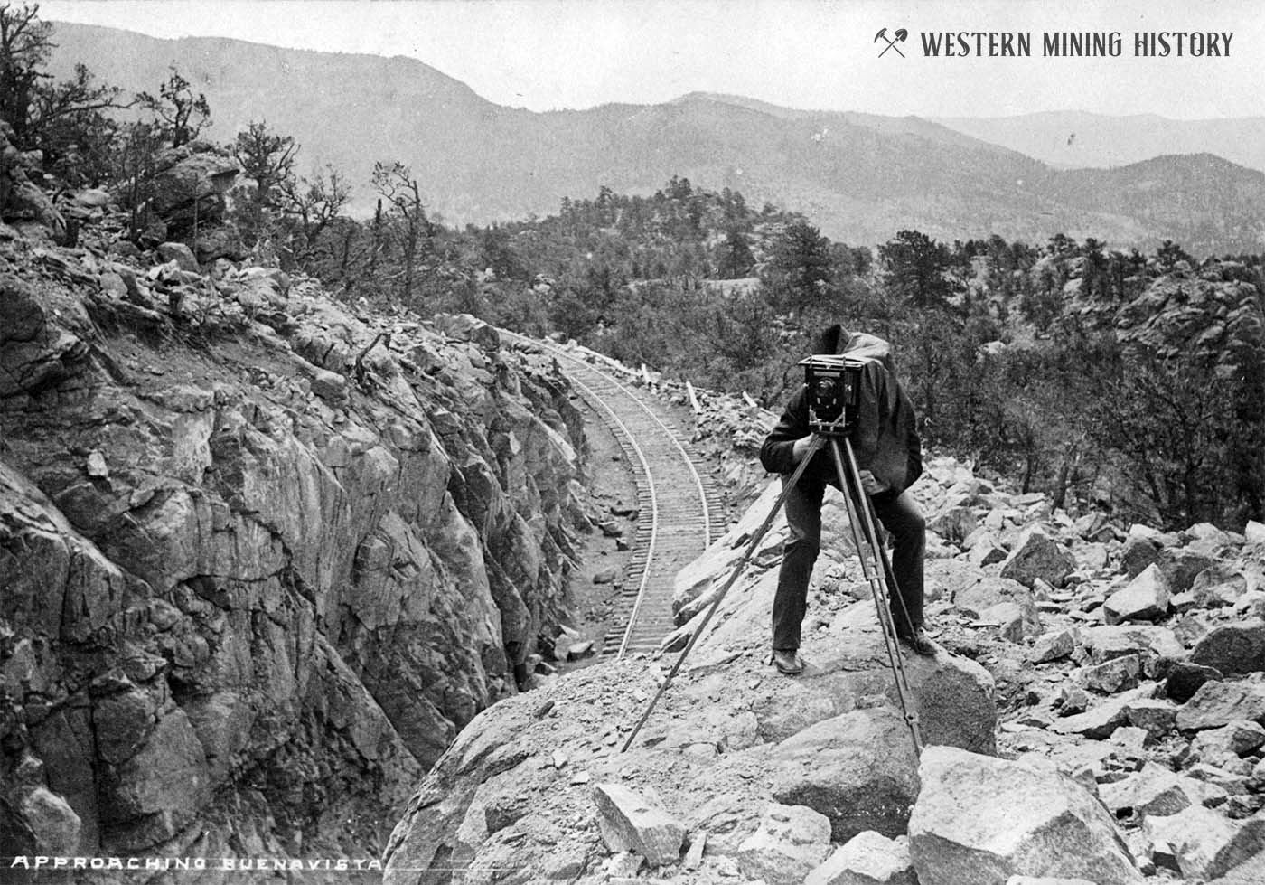
Many of the photos in this collection were taken by famous frontier photographer William Henry Jackson. In this rare photo, the photographer himself is captured at work near Buena Vista circa 1890s.
More Photo Collections from Western Mining History
The following collections capture more of the West’s amazing mining history.
A Collection of Arizona Mining Photos
A Collection of Arizona Mining Photos highlights some of the best historic scenes from various Arizona districts during the peak mining years between the 1870s and the 1920s.
Best Historical Photos: Colorized Mining Scenes
This collection images highlights some of the best colorized photos of historic western mining scenes. Included are mines, miners, historic mining towns, and related scenes: Best Historical Photos: Colorized Mining Scenes
The Comstock Lode: Nevada’s Big Bonanza
The Comstock Lode was the West’s first great silver mining district. Photos of the towns, mines, and mills are available at The Comstock Lode: Nevada’s Big Bonanza
A Collection of Nevada Mining Photos
The first mines in Nevada were discovered in the 1850s, and by the 1860s new districts were being discovered throughout the state. Nevada would first be known as the “Silver State” but would eventually become the largest gold producing state in the Nation. These are some of the best historical photos from Nevada’s notable mining districts: A Collection of Nevada Mining Photos