The Rough and Ready Laterite is a nickel mine located in Josephine county, Oregon at an elevation of 1,601 feet.
About the MRDS Data:
All mine locations were obtained from the USGS Mineral Resources Data System. The locations and other information in this database have not been verified for accuracy. It should be assumed that all mines are on private property.
Mine Info
Elevation: 1,601 Feet (488 Meters)
Commodity: Nickel
Lat, Long: 42.0825, -123.74580
Map: View on Google Maps
Rough and Ready Laterite MRDS details
Site Name
Primary: Rough and Ready Laterite
Secondary: Rough and Ready Nickel Group
Commodity
Primary: Nickel
Secondary: Cobalt
Secondary: Chromium
Tertiary: Iron
Location
State: Oregon
County: Josephine
District: Waldo
Land Status
Land ownership: Mixed
Note: the land ownership field only identifies whether the area the mine is in is generally on public lands like Forest Service or BLM land, or if it is in an area that is generally private property. It does not definitively identify property status, nor does it indicate claim status or whether an area is open to prospecting. Always respect private property.
Holdings
Type: Private Lease
Type: Located Claim
Workings
Type: Surface
Ownership
Owner Name: Walt Freeman
Percent: 5.00
Home Office: Oregon
Info Year: 1979
Owner Name: Inspiration Development Co.
Percent: 95.00
Home Office: Arizona
Info Year: 1979
Production
Not available
Deposit
Record Type: Site
Operation Category: Prospect
Operation Type: Surface
Mining Method: Strip-Hillside
Discovery Year: 1953
Years of Production:
Organization:
Significant: Y
Deposit Size: S
Physiography
General Physiographic Area: Pacific Mountain System
Physiographic Province: Pacific Border Province
Physiographic Section: Klamath Mountains
Mineral Deposit Model
Not available
Orebody
Not available
Structure
Not available
Alterations
Not available
Rocks
Not available
Analytical Data
Not available
Materials
Unknown: Kaolinite
Unknown: Enstatite
Unknown: Garnierite
Unknown: Gibbsite
Unknown: Goethite
Unknown: Ilmenite
Unknown: Limonite
Unknown: Magnetite
Unknown: Chalcedony
Unknown: Chromite
Unknown: Montmorillonite
Unknown: Nontronite
Unknown: Serpentine
Unknown: Spinel
Unknown: Talc
Unknown: Chlorite
Unknown: Diaspore
Comments
Comment (Geology): LATERITE SHOULD BE A MINERAL ENTRY; IT IS PROCESSED FOR COMMODITY CONTENT. SAPROLITE SHOULD BE A MINERAL ENTRY; IT IS PROCESSED FOR COMMODITY CONTENT. MAGHEMITE IS NOT IN MINERAL TABLE. RECENT RESEARCH INDICATES MOST OF THE NICKEL (AND PRESUMABLY THE COBALT) IS INCLUDED IN THE GOETHITE LATTICE. NICKEL AND COBALT ARE RELEASED FROM THE PARENT MINERALS AND RECOMBINED IN THE IRON OXIDES. OLIVINE IS THE PROBABLE SOURCE OF NICKEL. SOURCE OF COBALT IS UNKNOWN.
Comment (Production): PROPERTY HAS NOT PRODUCED (1979).
Comment (Reserve-Resource): OWNERS:INSPIR. DEV. CO.>95%,WALT FREEMAN>5%. OTHER NAMES:ROUGH AND READY NI GROUP.
Comment (Deposit): LOCATION IS POINT OF ENTRY TO PROPERTY AT TOE OF ROUGH AND READY RIDGE (MOUTH OF ROUGH AND READY CANYON). NICKEL AND COBALT ARE ENTERED AS COPRODUCTS RECOVERY OF COBALT AND NICKEL IS NECESSARY FOR PRODUCTION AT CURRENT PRICES (1979).
Comment (Geology): THE SHAPE OF THE LATERITE AREAS IS GENERALLY TABULAR, BOTTOM IS HIGHLY IRREGULAR.
Comment (Reserve-Resource): QUANTITY ESTIMATES TAKEN FROM B-BIB Q800-Q805 ASSAY FE- 1977
Comment (Geology): UNSPEC SEDIMENTARY FOR LACK OF AN APPROPRIATE ENTRY FOR LATERITE. LATERITIC SOIL COMPOSED OF HYDROUS FE-OXIDES, CLAY MINERALS, AND POSSIBLE GARNIERITE WITH RESIDUAL SILICA AND CHROMITE. SAPROLITE, THE CLAY-RICH WEATHERED HOST ROCK, IS A SIGNIFICANT, BUT VARIABLE, PERCENTAGE OF THE RESOURCE.
References
Reference (Deposit): OR. DEPT. GEOL. AND MIN. INDUST. BULLETIN 100, 1979, P. 37.
Reference (Deposit): P. 35-36.
Reference (Deposit): OR. DEPT. GEOL. AND MIN. INDUST. MISC. PAPER 20, 1978,
Reference (Reserve-Resource): *CONFIDENTIAL DATA*
Reference (Reserve-Resource): USBM REPORT, JANUARY 1978.
Reference (Reserve-Resource): RALPH C. KIRBY, ASSISTANT DIRECTOR - METALLURGY);
Reference (Reserve-Resource): WESTERN UNITED STATES (A REPORT AND APPRAISAL FOR
Reference (Reserve-Resource): WILLIAMS, J.F. AND LINDSEY, D.S., NICKEL DEPOSITS IN THE
Oregon Gold

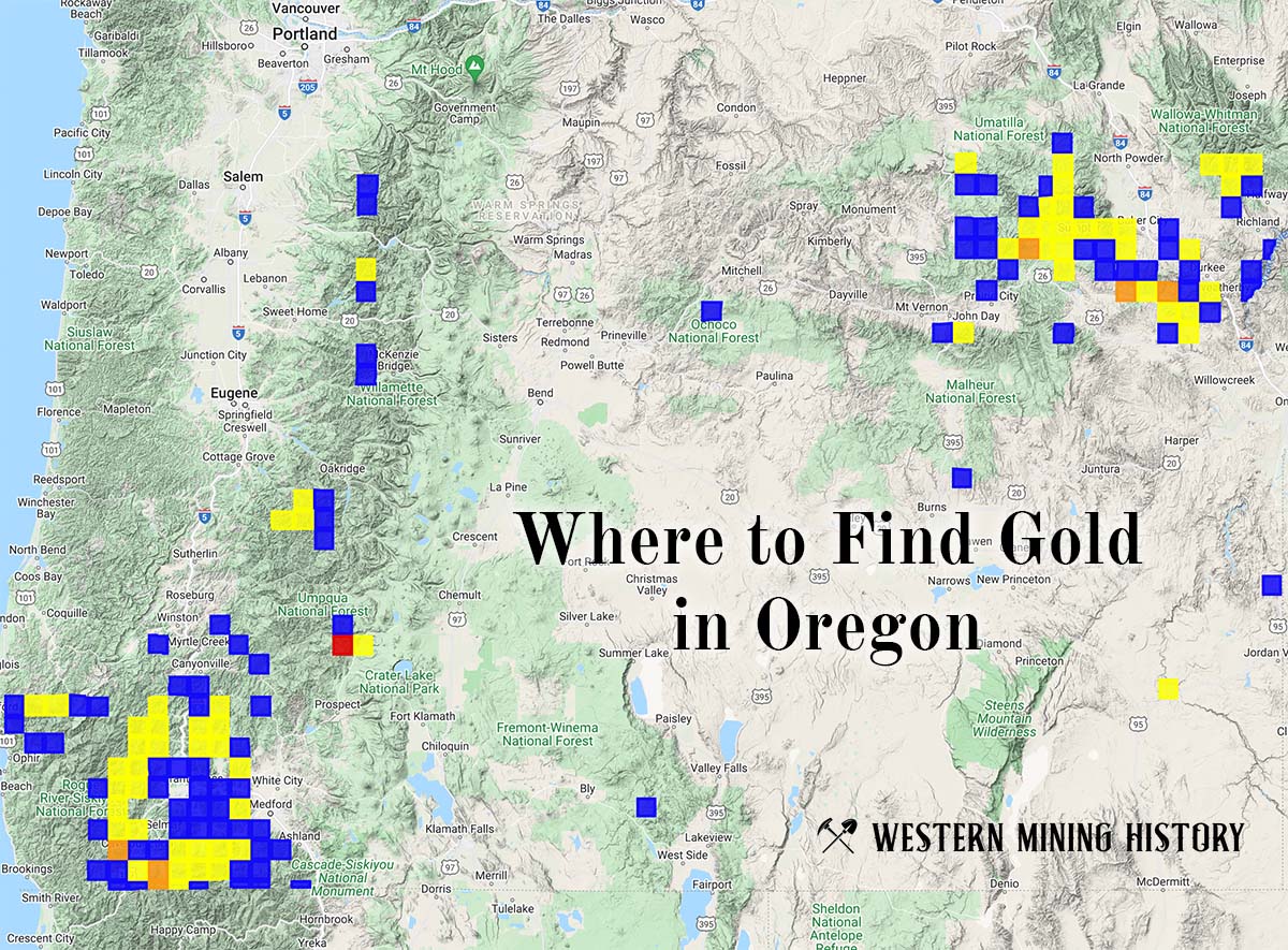
"Where to Find Gold in Oregon" looks at the density of modern placer mining claims along with historical gold mining locations and mining district descriptions to determine areas of high gold discovery potential in Oregon. Read more: Where to Find Gold in Oregon.