The Wind River Mine is a gold mine located in Skamania county, Washington at an elevation of 1,699 feet.
About the MRDS Data:
All mine locations were obtained from the USGS Mineral Resources Data System. The locations and other information in this database have not been verified for accuracy. It should be assumed that all mines are on private property.
Mine Info
Elevation: 1,699 Feet (518 Meters)
Commodity: Gold
Lat, Long: 45.94, -121.94611
Map: View on Google Maps
Satelite View
MRDS mine locations are often very general, and in some cases are incorrect. Some mine remains have been covered or removed by modern industrial activity or by development of things like housing. The satellite view offers a quick glimpse as to whether the MRDS location corresponds to visible mine remains.
Wind River Mine MRDS details
Site Name
Primary: Wind River Mine
Commodity
Primary: Gold
Secondary: Copper
Secondary: Silver
Tertiary: Arsenic
Location
State: Washington
County: Skamania
District: Wind River Area
Land Status
Land ownership: National Forest
Note: the land ownership field only identifies whether the area the mine is in is generally on public lands like Forest Service or BLM land, or if it is in an area that is generally private property. It does not definitively identify property status, nor does it indicate claim status or whether an area is open to prospecting. Always respect private property.
Administrative Organization: In Gifford Pinchot National Forest
Holdings
Not available
Workings
Type: Surface/Underground
Ownership
Owner Name: Delano Wind River Mining Co.
Years: 1992 -
Production
Not available
Deposit
Record Type: Site
Operation Category: Past Producer
Operation Type: Unknown
Discovery Year: 1925
Years of Production:
Organization:
Significant: N
Deposit Size: S
Physiography
General Physiographic Area: Pacific Mountain System
Physiographic Province: Cascade-Sierra Mountains
Physiographic Section: Northern Cascade Mountains
Mineral Deposit Model
Model Name: Epithermal vein, Sado
Orebody
Form: VEINS
Structure
Not available
Alterations
Not available
Rocks
Name: Basalt
Role: Host
Age Type: Host Rock
Age Young: Miocene
Analytical Data
Analytical Data: VALUES FROM SHIPMENTS RANGED FROM 0.12-0.59 OZ/TON AU, 0.36-0.84 OZ/TON AG, UP TO 0.1% CU.
Materials
Ore: Malachite
Ore: Pyrite
Ore: Realgar
Ore: Gold
Gangue: Calcite
Gangue: Limonite
Gangue: Quartz
Comments
Comment (Commodity): REPORT OF REALGAR UNCONFIRMED
Comment (Location): UNSURVEYED. ON MINOR TRIBUTARY TO WIND RIVER NEAR HEADWATERS OF WIND RIVER
Comment (Reserve-Resource): VEINS MIGHT MERIT FURTHER EXPLORATION
Comment (Development): WIND RIVER MINING CO. OPERATED PROPERTY FROM 1956-1963. BAXTER MINING CO. ACQUIRED THE PROPERTY IN 1967. IN 1972 FRED NEISLER LEASED PROPERTY AND SHIPPED ORE IN 1972-1974. IN 1979 PROPERTY WAS BEING DEVELOPED BY FOSTER MINING CO. DELANO WAS DRILLING PROPERTY IN 1992
Comment (Production): ORE SHIPPED FROM MINE REPRESENTED ABOUT 90% TOTAL METAL PRODUCTION OF SOUTHWESTERN WASHINGTON.
Comment (Deposit): 4 QUARTZ VEINS, 6 IN.-6 FT THICK, IN BASALT, WITH NORTH-NORTHWEST STRIKES AND STEEP DIPS. ATTITUDE GIVEN IS FOR MAIN VEIN. WHITE CHALCEDONIC QUARTZ IN VEINS IS COMMONLY BANDED PARALLEL TO VEIN WALLS AND VUGGY; VUGS MAY BE PARTIALLY FILLED WITH LIMONITIC CLAYS AND LINED WITH DRUSY QUARTZ. SOME QUARTZ IS PORCELANIC. PARTS OF SOME VEINS HAVE WELL DEVELOPED BLADE TEXTURE. GOLD IS IN MINUTE GRAINS IN THE VEIN QUARTZ; PYRITE IS ONLY VISIBLE SULFIDE MINERAL; MALACHITE STAINING IS ONLY EVIDENCE OF CU. ASSAYS ARE THE ONLY WAY TO DISTINGUISH ORE FROM BARREN QUARTZ. MINERALIZATION IS IRREGULAR AND CONFINED TO SHOOTS.
Comment (Workings): SEVERAL SHALLOW PROSPECT PITS, ADIT, RAISE TO SURFACE, UNDERHAND STOPE EXTENDING 35 FT DOWN DIP OF VEIN, AND 30 FT WINZE CONNECTING WITH UNDERHAND STOPE.
Comment (Geology): BASALTIC HOST ROCKS INTRUDE EO-OLIGO VOLCANIC ROCKS THAT INCLUDE AGGLOMERATE, TUFF BRECCIA, VOLCANIC SANDSTONE AND SILTSTONE, AND PUMICE
Comment (Deposit): 10 UNPATENTED CLAIMS, 1 MILLSITE. MAP OF MINE WORKINGS AND LOCATION MAP IN MOEN, (1977). ; INFO.SRC : 1 PUB LIT
Comment (Deposit): Discovery Year: EARLY 1900'S
References
Reference (Production): MOEN, 1977.
Reference (Reserve-Resource): MOEN, 1977
Reference (Deposit): DERKEY, R.E., GULICK, C.W., AND LINGLEY, W.S., JR., 1993, WASHINGTON'S MINERAL INDUSTRY - 1992: WASHINGTON GEOLOGY, V. 21, NO. 1, P. 3-25.
Reference (Deposit): MCFARLAND, C.R., MCLUCAS, G.B., RIGBY, J.R., STOFFEL, K.L., 1980, DIRECTORY OF WASHINGTON MINING OPERATIONS, 1979: WASHINGTON DIVISION OF GEOLOGY AND EARTH RESOURCES INFORMATION CIRCULAR 69, P. 10.
Reference (Deposit): MOEN, W.S., 1977, ST. HELENS AND WASHOUGAL MINING DISTRICTS OF THE SOUTHERN CASCADES OF WASHINGTON: WASHINGTON DIVISION OF GEOLOGY AND EARTH RESOURCES INFORMATION CIRCULAR 60, P. 59-62.
Washington Gold

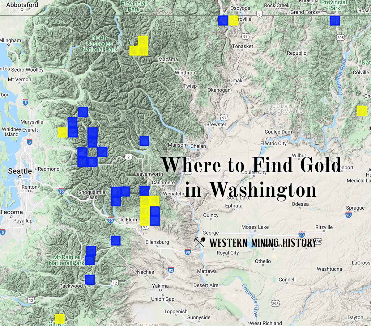
"Where to Find Gold in Washington" looks at the density of modern placer mining claims along with historical gold mining locations and mining district descriptions to determine areas of high gold discovery potential in Arizona. Read more: Where to Find Gold in Washington.