Photo Description
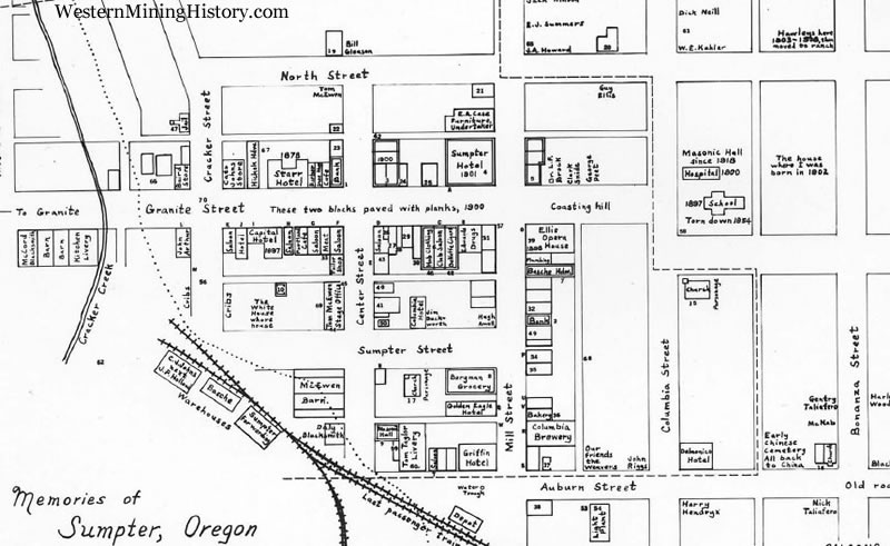
Drawn and annotated by Brooks Hawley. The map is an invaluable aid in locating buildings that existed in Sumpter before the fire of August 13, 1917, that destroyed most of the business district. There are two maps attached to this record. Image 1 is the whole annotated map. Image 2 is just the downtown area without annotations.
Text Courtesy of Baker County Library website