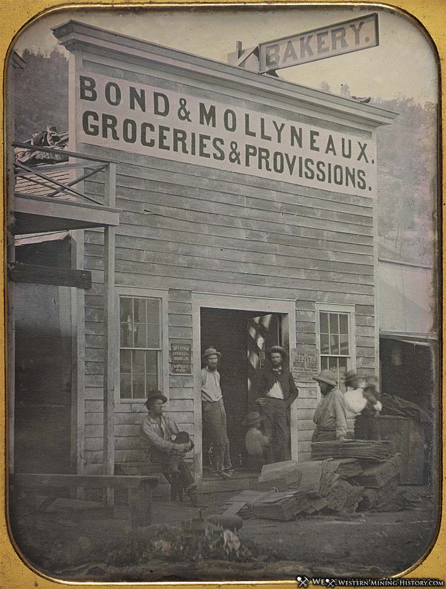
For anyone familiar with California in modern times, it is difficult to imagine what the state must have been like during the California Gold Rush. The famous gold discovery at Sutter’s Mill happened in 1848, but it wasn’t until 1849 that news of the discovery reached the East Coast and the rest of the world. That news transformed the nation, and the great rush to California was on.
The 1851 map “A New Map of the Gold Region in California” illustrates what California looked like just two years after the start of the 1849 gold rush.
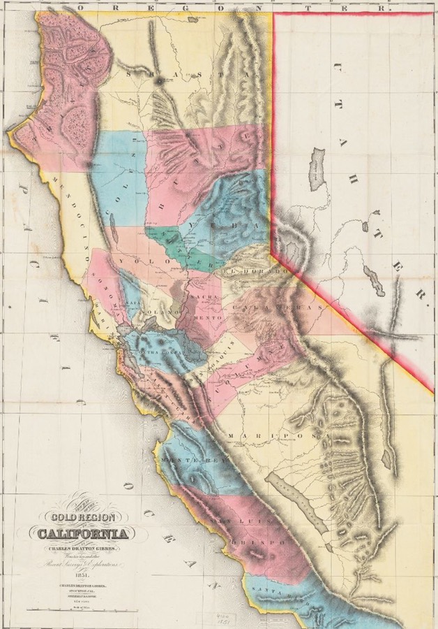
The map is hardly complete, and many towns that were established prior to 1851 that would later become famous are not on the map. However, the map does illustrate what towns were creating a buzz at the time, many of which have become obscure ghost towns that little is known about.
California became a state in September of 1850. The state covered a vast area, relatively few people lived there at the time, so the original counties were much fewer, and much larger than the current counties that divide California.
In 1851, the majority of mining and prospecting was happening in the central and southern “Sierra Nevada Goldfields”, which included Yuba, El Dorado, Calaveras, and Tuolumne counties. Most of these counties have since been divided into smaller counties so today’s map looks much different.
Yuba County
Formed in 1850, Yuba County was one of the original counties of California. By 1852, the county had been subdivided into Yuba, Placer, Nevada, and Sierra Counties.
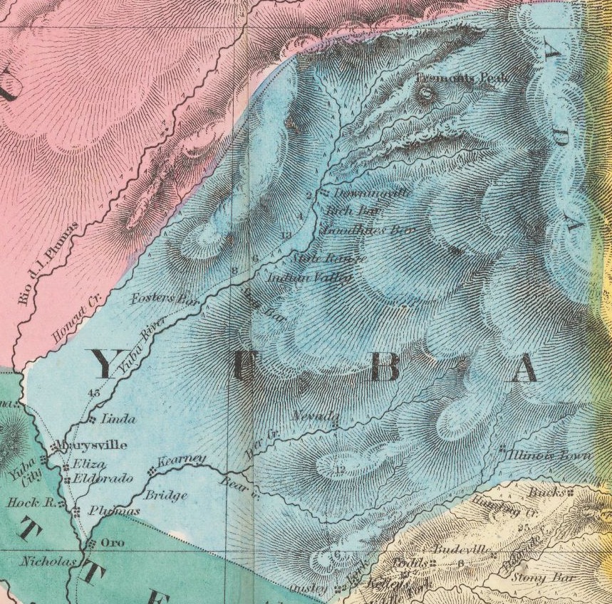
The Yuba county portion of the map shows a few familiar names: Downieville, Nevada City, and Marysville are all active towns today and are well known to anyone interested in the Gold Rush or California in general. But what about some of the other towns on the map, do they still exist, and if not, what happened to them?
Rich Bar
Gold was first discovered at Rich Bar on the Feather River in the summer of 1850. By 1853 the town had over 1,000 residents. The boom in Rich Bar was over by 1854, but mining in the area maintained the town until after 1910. Today Rich Bar is has mostly been reclaimed by nature and nothing but a cemetery remains.
Goodyear’s Bar
Gold was discovered at this spot on the Yuba River by Miles and Andrew Goodyear in 1849. The area grew quickly and the town of Goodyear’s Bar became a bustling community by 1851. Almost 1,000 residents would call the town home, and Goodyear’s Bar had many amenities to offer residents and local miners including saloons, stores, hotels, restaurants and churches.
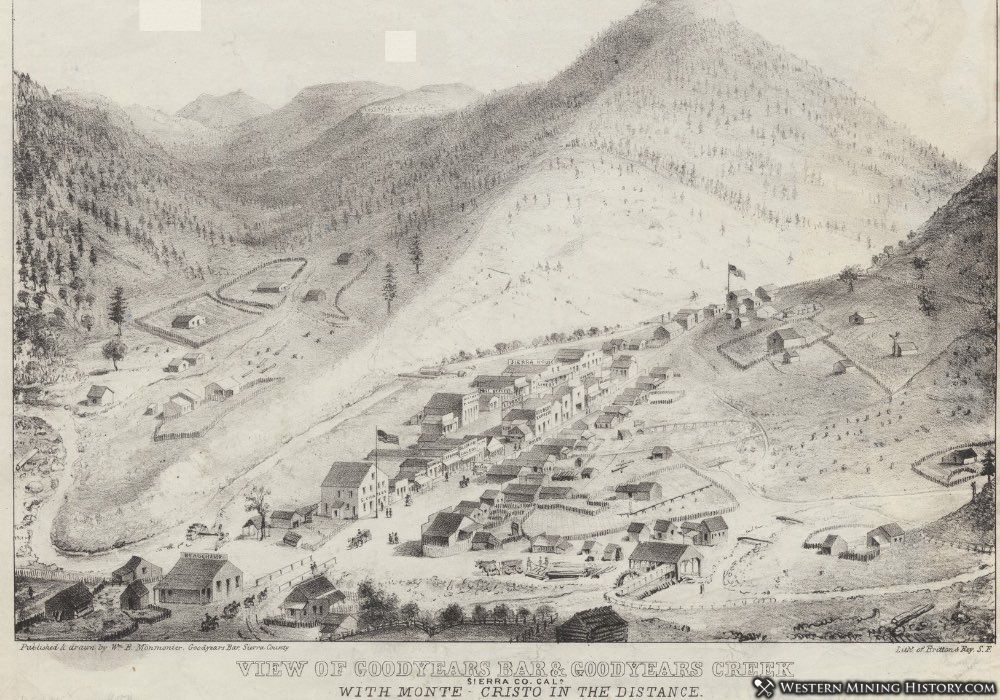
Goodyear’s Bar continues to be a small rural community, but little remains of the town’s gold mining origins.
El Dorado County
El Dorado County was the site of the initial 1848 gold discovery at Sutter’s Mill that started the great rush to California.
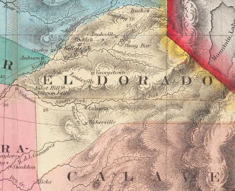
Bucks, Budeville, Kelley, Todds
Interestingly, it seems that almost nothing is known about the communites of Budeville, Bucks, Kelley or Todds other than they appeared on this map. These locations were likely new diggings named after their discoverers, but were abandoned in a few months or years as the placers ran out.
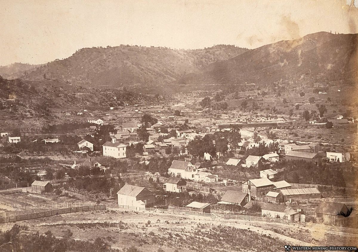
Coloma
Sutter’s Mill is located in the community of Coloma, which is still an active town and many of the town’s historic structures have been preserved as the Marshall Gold Discovery State Historic Park.
Weberville
Charles M. Weber was prospecting this area in 1848, well before the main part of the gold rush started in 1849. Weber, having the advantage of being the first in the area, was said to have taken an enormous amount of gold from the diggings.
The 1850 government census lists 906 residents of Weberville in 1850. Not much is known of the later history of Weberville, and nothing remains of the town today.
Calaveras County
Calaveras county was the site of a lot of early prospecting in 1848, before the California Gold Rush got into full swing in 1849. Interestingly, the map leaves off famous towns like Angel’s Camp, which was established in 1848.
Perhaps Angel’s Camp was not well known at the time, or perhaps the map maker was just not aware of every booming camp. In all of Calaveras County, the map only shows the town of Double Springs.
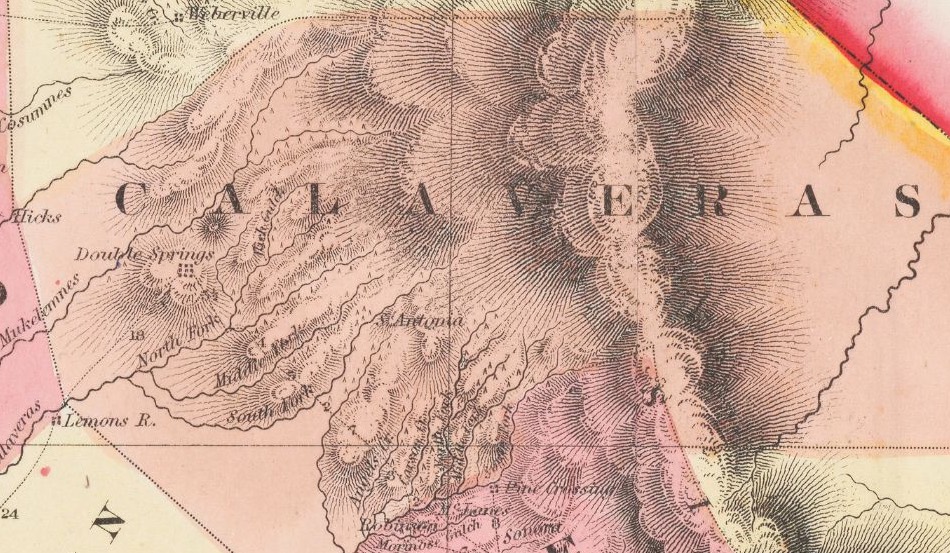
Double Springs
If you are wondering why you have not heard of Double Springs, a town seemingly so important that it is the only one that made it into the 1851 map of Calaveras county, you are not alone. Double Springs is the perfect example of a town that was important at the time the map was made, but quickly vanished as other towns rose to prominence.
Double Springs was made the county seat in 1850 and by 1853 it was a bustling community. However, other towns in the area were becoming more prominent in the 1850’s and they all coveted the role of county seat. The seat was moved to Mokelumne Hill in the early 1850’s, and by 1860 Double Springs was all but abandoned.
Tuolumne County
Tuolumne County was a hotbed of activity in 1851, with notable towns already making the map like Sonora, and Jamestown, towns that would be some of the most prominent in the region, and still exist today. However, like the other counties in this list, there are a few towns that most people probably have not heard of.
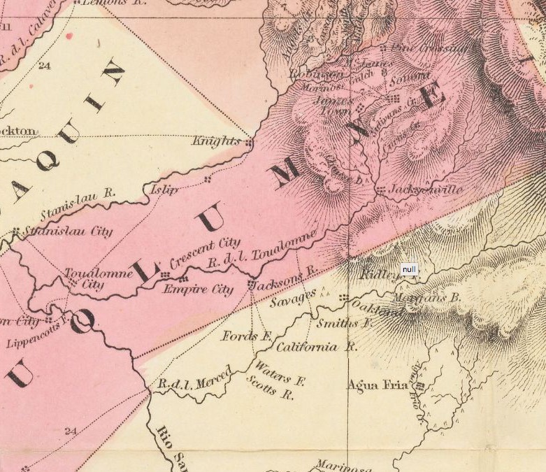
Jacksonville
Jacksonville was once one of the largest towns in the California gold belt with a population in the thousands. The town endured for over 100 years until it was submerged by the Don Pedro Reservoir in the 1960’s.
Pine Crossing
Not much is known about Pine Crossing, but historical newspaper articles mention the town as early as 1850.
************
Unfortunately not much is known about most of these early gold camps. One can imagine how remote and wild this wilderness was in the early 1850’s and many temporary settlements were likely never documented. Luckily maps like this 1852 map serve as a record of where some of these historic camps were located.
It All Started With The Gold Rush
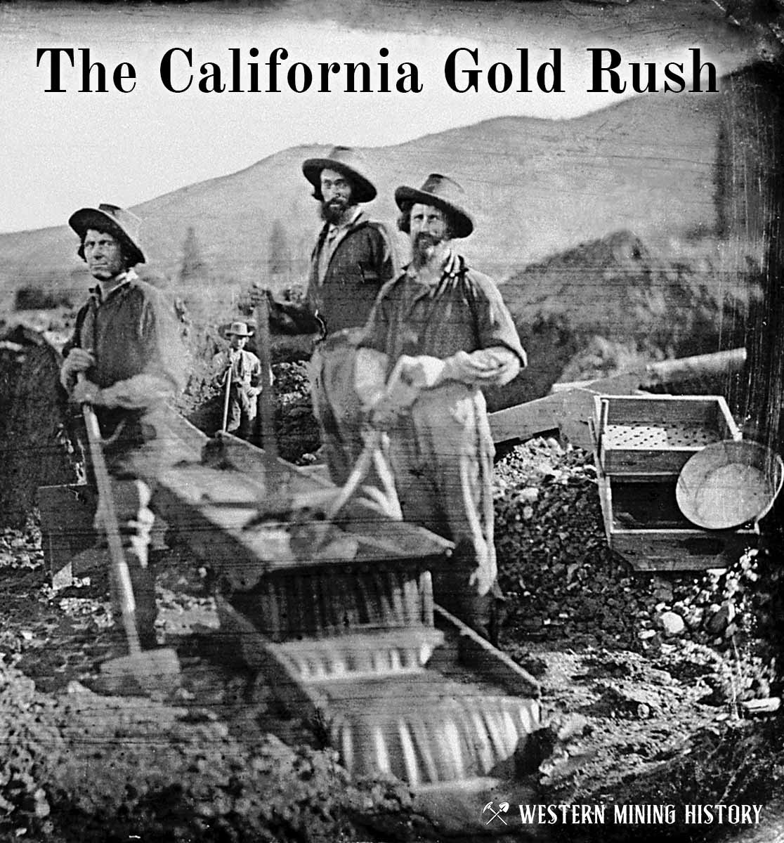
The great California Gold Rush kicked off the entire saga of western mining. Read about it at The California Gold Rush.