Mill Locations of the Comstock Lode
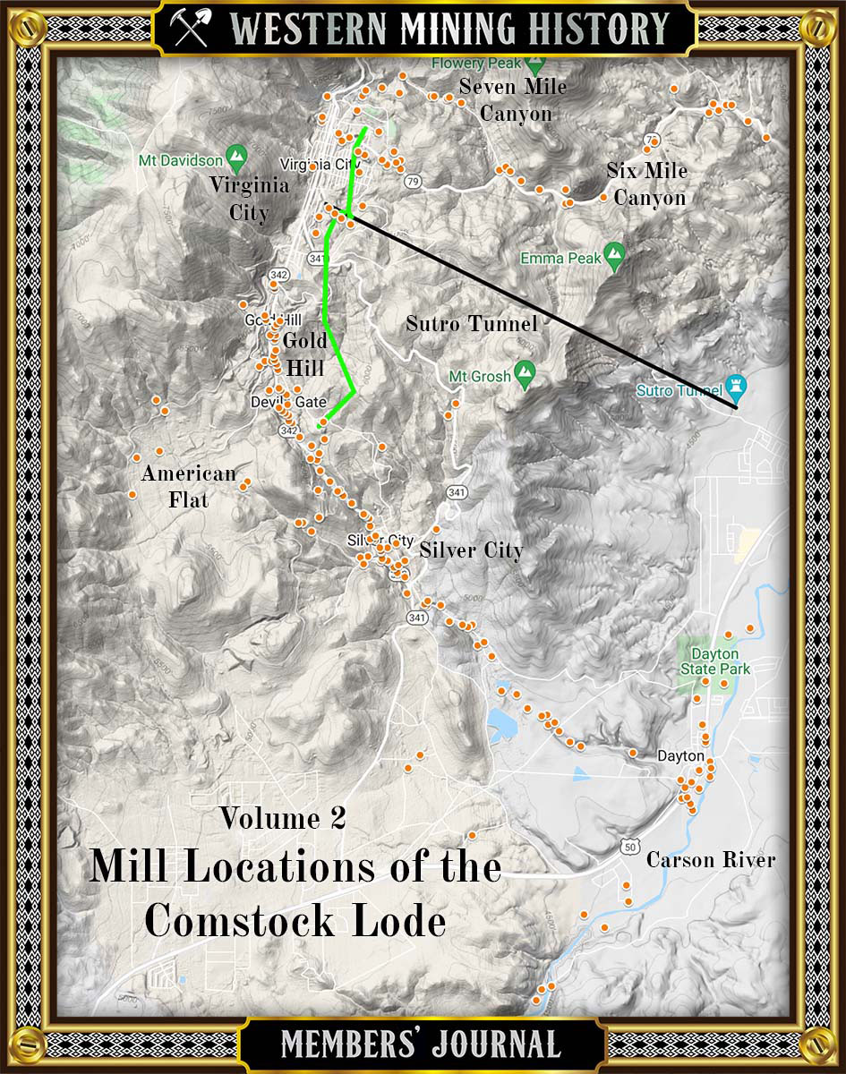
The Comstock Lode of Nevada was one of the richest deposits of precious metals ever discovered, and the mining bonanza that occurred there is one of America’s most significant historical events. This article looks at the distribution of the over 200 mills that were constructed to process the Comstock ore.