Mining in Oregon started in the early 1850s after gold was discovered in the southwest part of the state. Gold was discovered a decade later in the northeast corner of the state, in the Blue Mountains. These two regions are the location of the vast majority of Oregon’s mines.
Although there are mines scattered throughout other parts of the state, the only major outlier is the Bohemia district southeast of Cottage Grove.
Gold is Oregon’s primary mined commodity, and the gold mining industry thrived in the state for many decades. This is a collection of noteworthy mining photos from the state.
Northeast Oregon
The mining districts of Northeast Oregon are primarily located in the Blue Mountains. Initially discovered in the 1860s, this area became the primary lode mining area in the state, and the largest producer of gold. Numerous gold districts were established in this region.
Cable Cove District
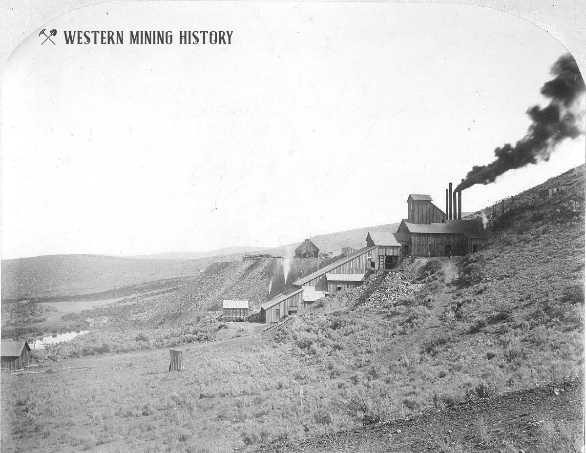
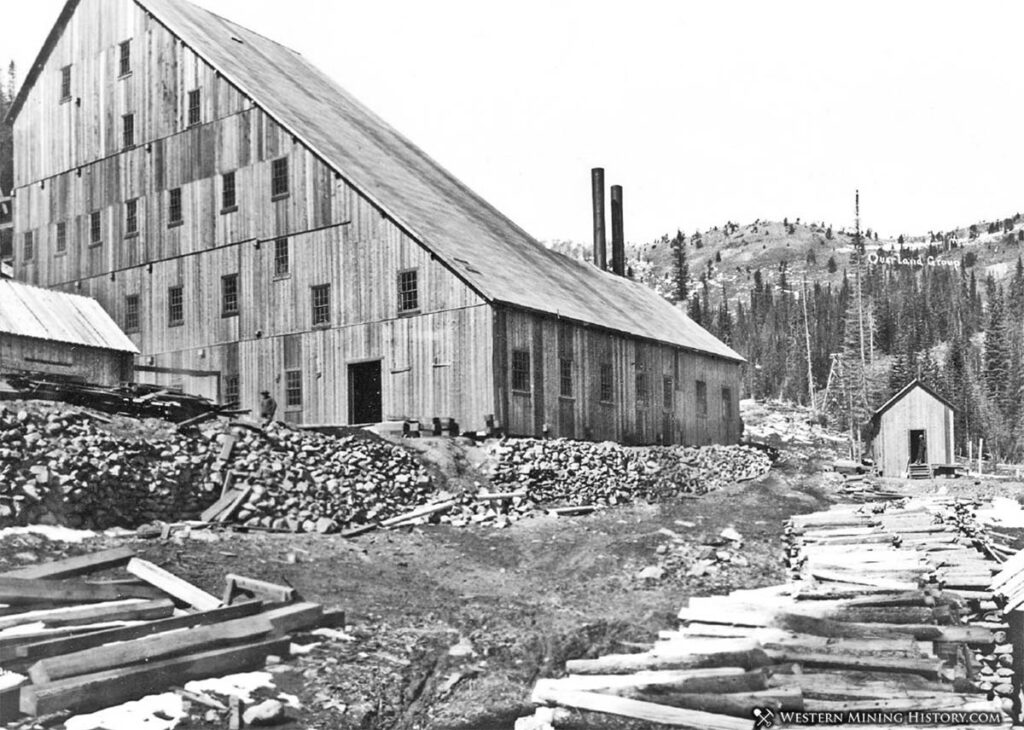
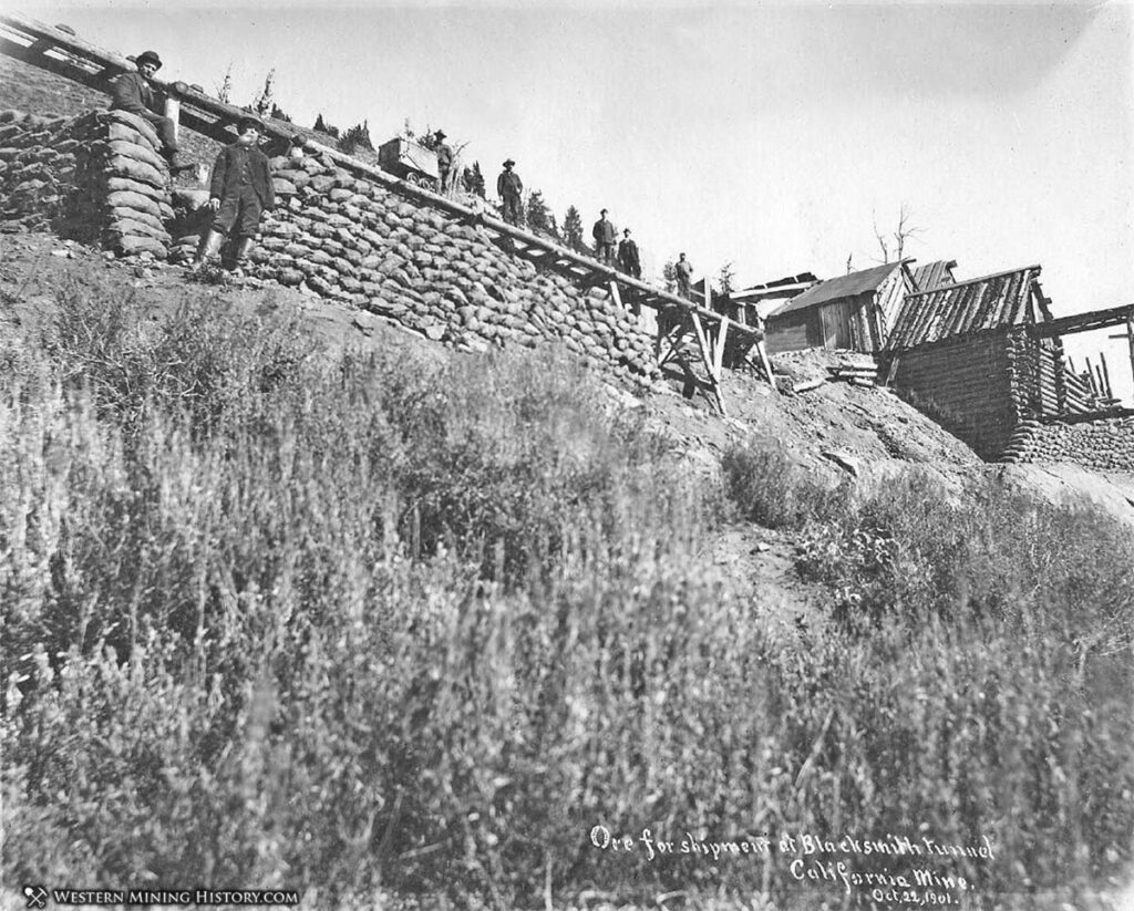
A 1901 USGS report gave a brief history of the California Mine, located in the Cable Cove district:
“The California claim is 1,200 feet to the northwest of the Eagle vein, and is one of the oldest mines in eastern Oregon. It was located in 1873, and in 1876 the upper tunnels were begun. At that time there were only two other quartz mines in operation, the Monumental and the Virtue. In 1878 half a ton of ore, assaying $500 per ton, was packed on horseback to Umatilla and thence shipped to San Francisco. In 1896 a shipment of 54 tons is reported to have yielded $105 per ton. Further shipments were made in 1893 and 1894 of ore assaying $60 to $80 per ton, and in 1897 several carloads were produced.”
“In 1897 a 10-stamp concentrating mill was built and run with unsatisfactory results for a short time. It is claimed that the whole width of the vein was milled, thus reducing the grade of the ore too much. During 1900 five cars, or 100 tons, are reported to have been shipped. The total production is not known, but probably does not exceed $10,000.”
“The developments consist of 2,000 feet of drifts and crosscuts divided among six tunnels. The lowest working tunnel from which ore was extracted in 1900 is located on the steep slope 100 feet below the croppings. Its elevation is about 7,200 feet, its length 635 feet. A new crosscut, to be 900 feet long, is now in progress 100 feet lower down, 1,300 feet below the summit of California Mountain and 800 feet below the croppings.”
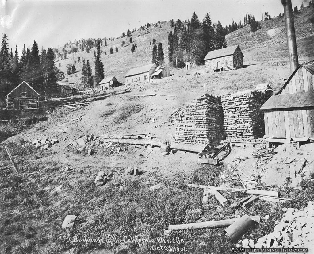
The photos in this series represent a new period of activity at the mine that started around 1901. A September, 1901 edition of The Sumpter Miner describes the developments at the mine:
“The Tumagain Arm Gold Mining company, of Minneapolis, is the first concern to go into tho district and carry on operations on an extensive scale. Sometime ago they purchased the California mine and since then Cable Cove has been the most active of all our rich mining districts. A large force of men has been continuously at work on this property, under able and efficient management, since they have taken charge of it.”
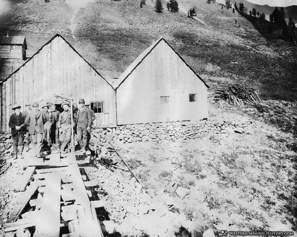
“A number of now buildings have been erected, consisting of bunk and boarding houses, general merchandise store, laboratory and office, to accommodate the largely increased demands. Roads have been graded along the mountain side to the different tunnels; the county roads have been greatly improved; water flumes have been constructed and now and large timber sheds built.”
“Application has been made for a new post office, which will be called Cable Cove. The Inland Telephone company is setting poles and stringing wires for a telephone exchange, and connections will be made this week. Thomas McEwen, manager of tho Sumpter Transfer & Livery company, will soon establish a stage line from Sumpter to the mine.”
The post office at Cable Cove (also known as Cableville) operated during the years 1901-1909.
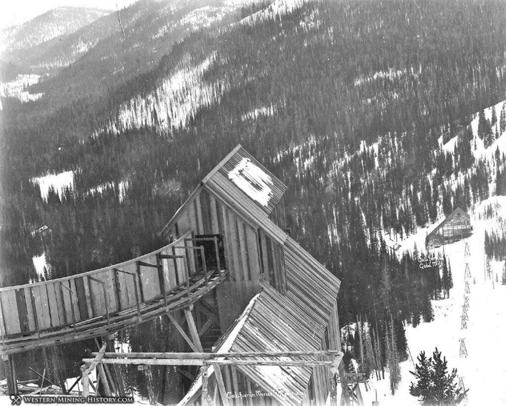
Cornucopia District
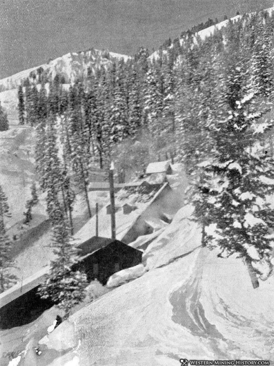
Cornucopia is unique among Oregon districts in that it sits in a rugged mountain valley that resembles some of the alpine districts of the Rocky Mountains. The steep terrain necessitated the use of an elaborate aerial tram at one mine, much like the trams common in Colorado.
Cornucopia endured extremely harsh winters with deep snows. Millions of dollars in gold was mined in the district starting in 1885 and ending during World War II.
Although there were many gold mines in the Cornucopia district, the primary producers were the Union-Companion and Last Chance mines.
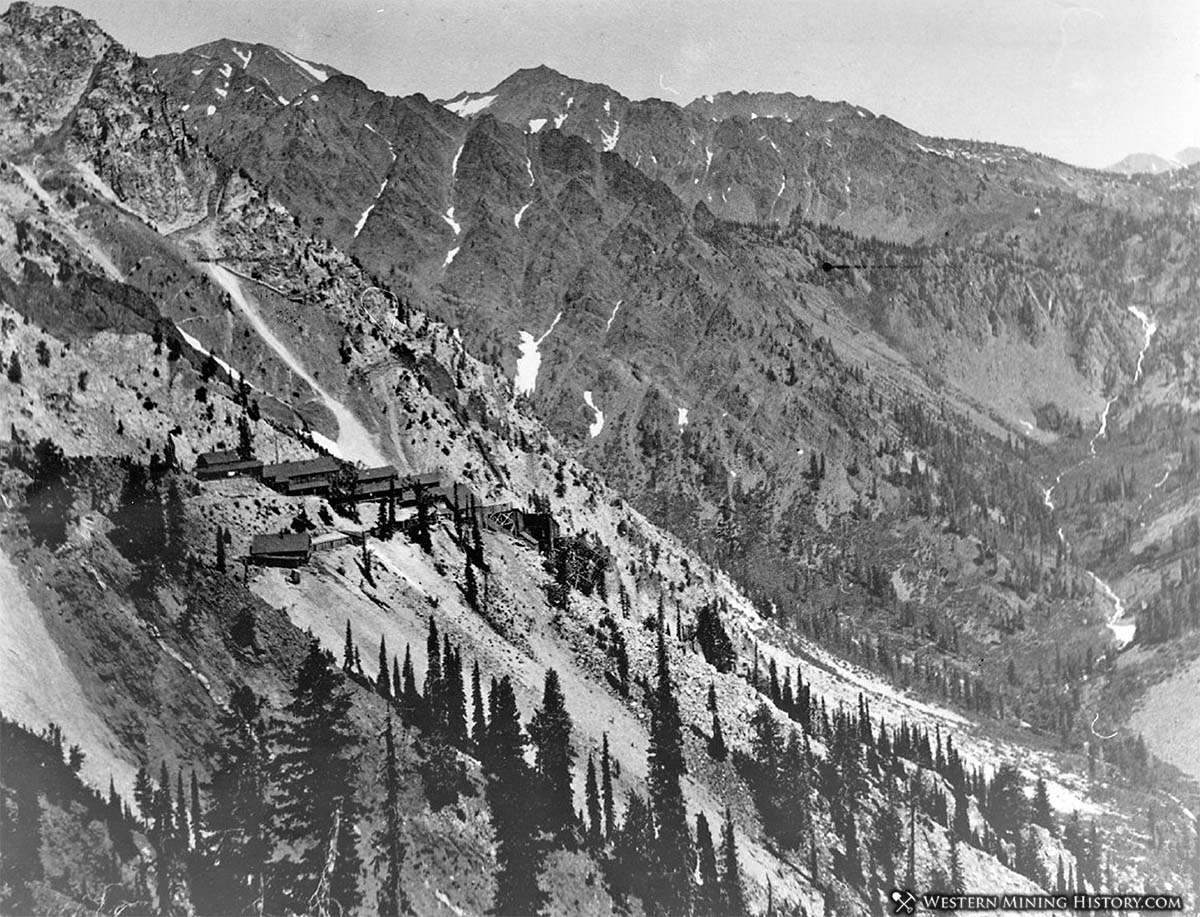
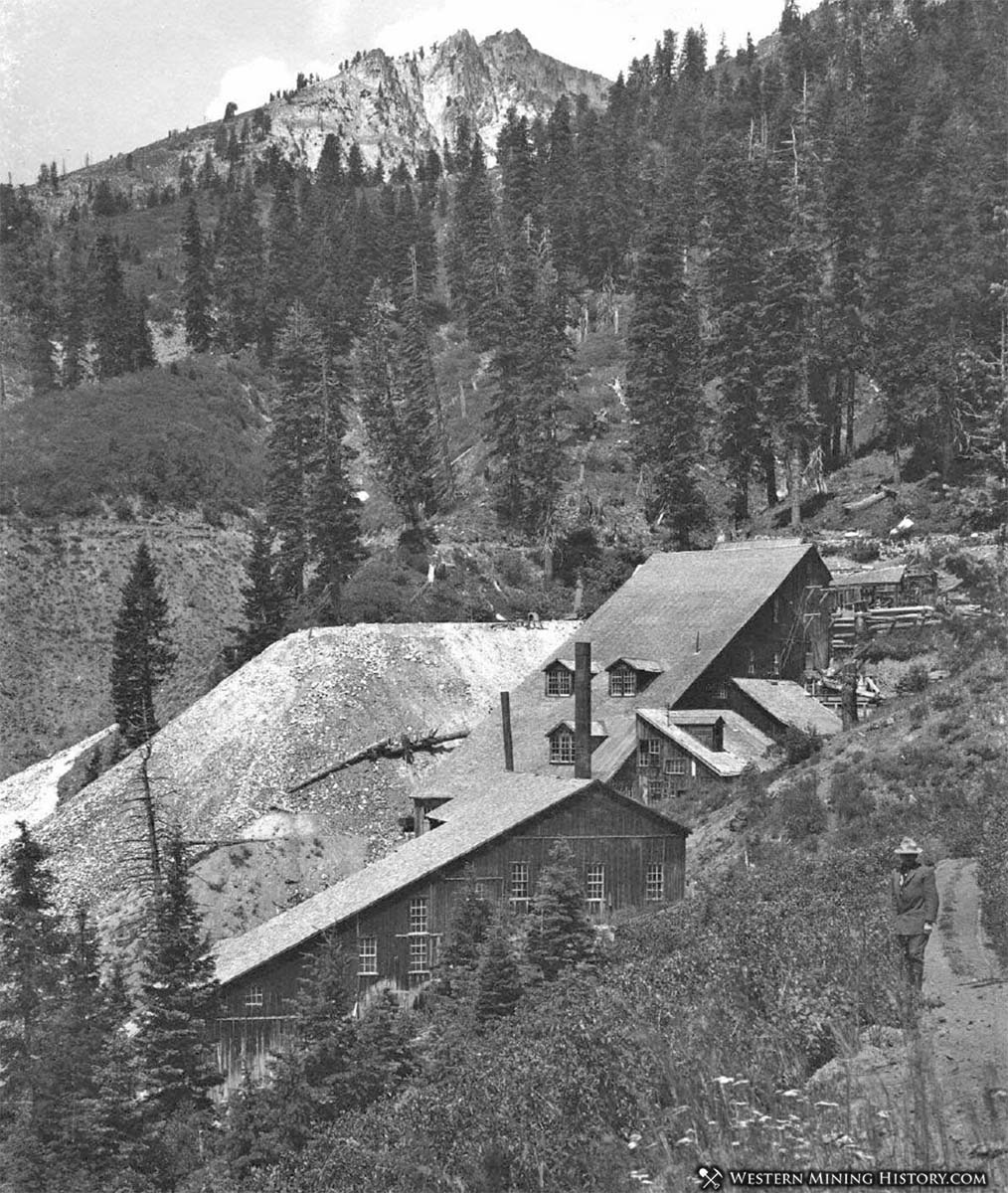
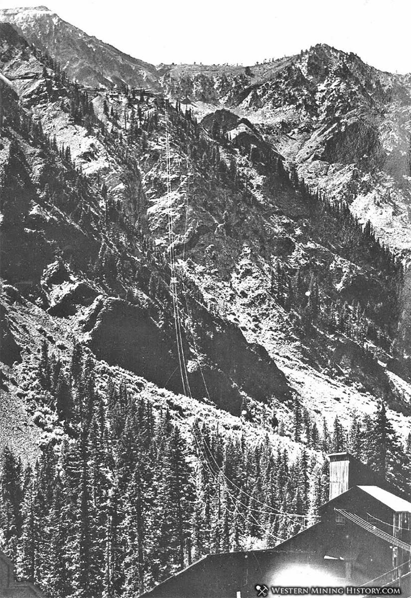
The Last Chance mine was located high on the side of a very steep mountain. In 1914 a spectacular aerial tram was completed between the mine and the mill almost 1,700 feet below.
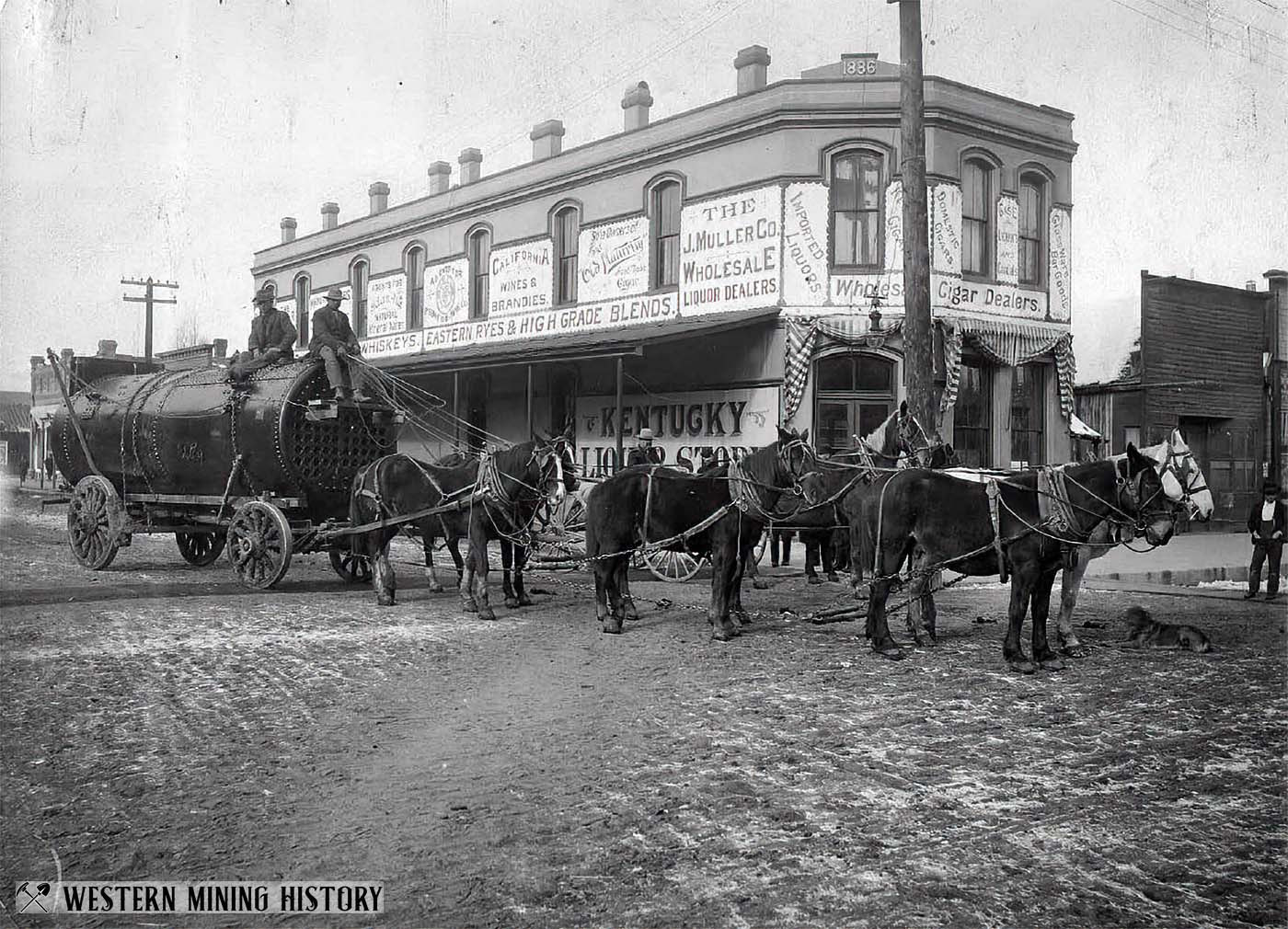
Baker City was an important supply center for mines throughout the northeastern corner of Oregon. In the following ca. 1890s photo, a freight team from Baker City readies to haul a boiler to the Cornucopia mines.
Greenhorn District
The Greenhorn district is is in a remote section of the Blue Mountains, straddling the Grant and Baker county line. The historic mining town of Greenhorn City is the center of the district.
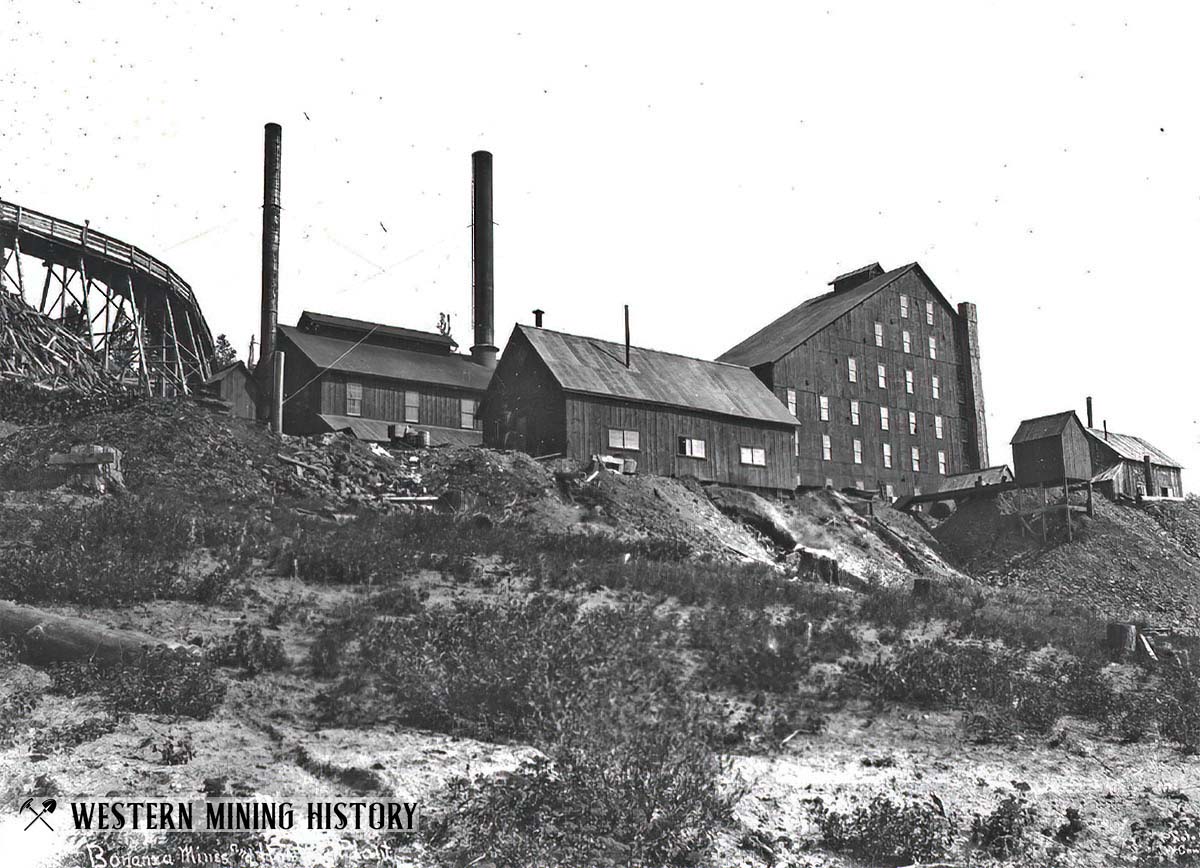
The Bonanza Mine was one of the district’s largest producers. The company town of Geiser was built at the mine site, named after the Geiser family that purchased the mine in 1891.
A newspaper article from 1898 describes the mine during it’s most prosperous period: “In 1891 the Geiser Estate purchased it, re-opened the old works and have had the mine and mill in continuous operation since, and it is to-day the heaviest producer in the state.”
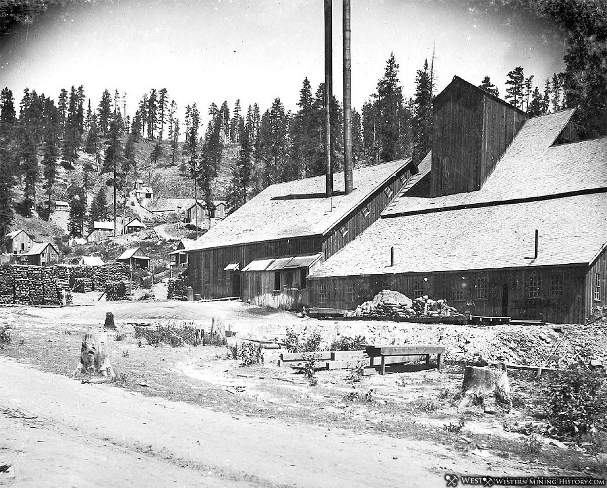
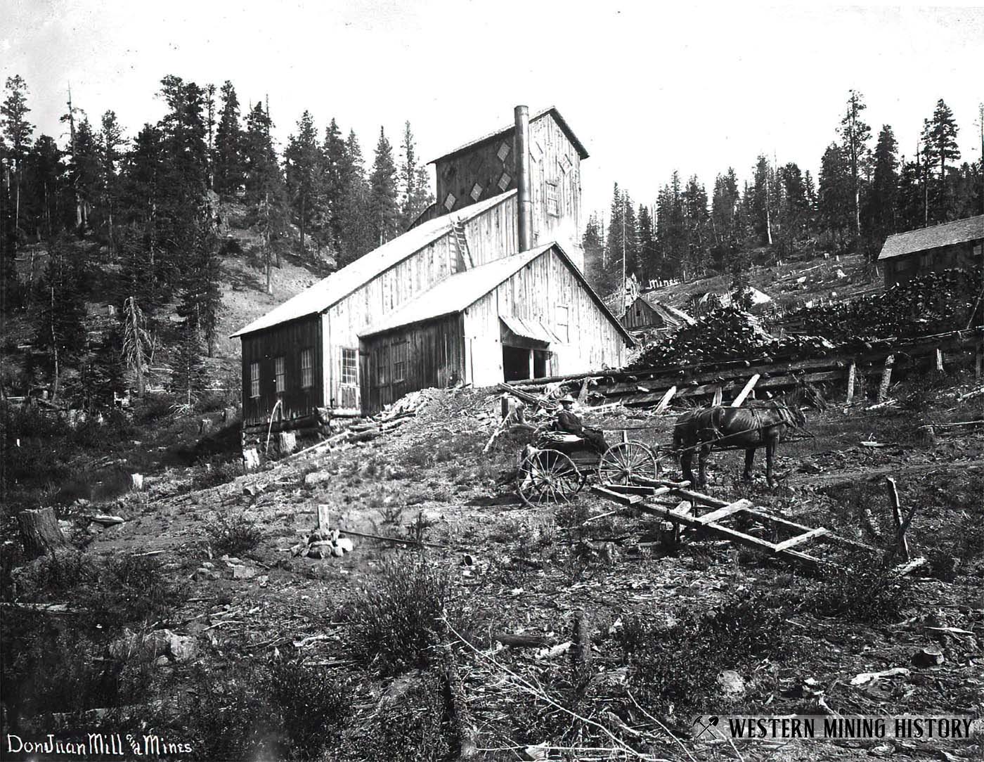
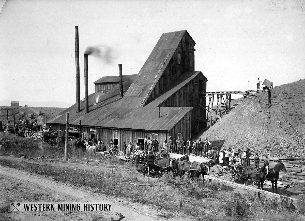
The Don Juan mine was located about a mile from Greenhorn City. An August, 1897 article notes that eastern interests had recently purchased the mine, and a ten stamp mill was under construction which is seen below.
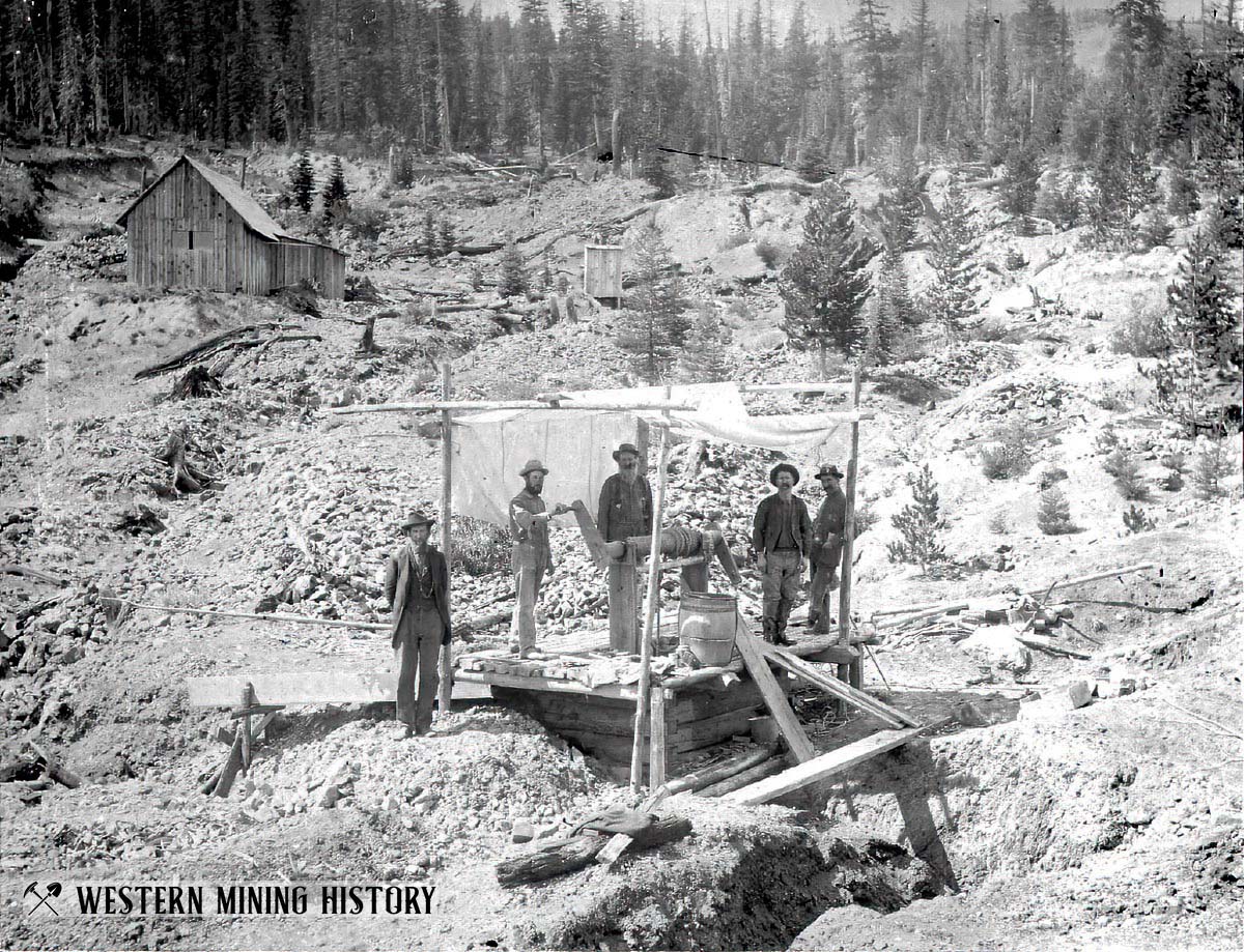
The following image shows early work at the West Side mine near Greenhorn City.
Sumpter District
While the city of Sumpter was the center of northeast Oregon’s lode mining empire, the mines close to town consisted primarily of placer gold mines.
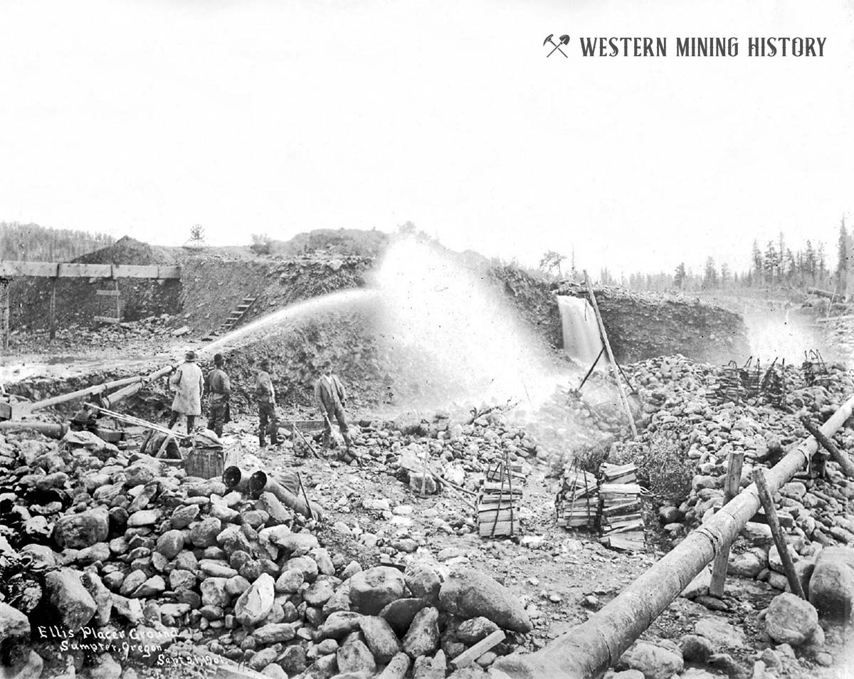
The Ellis Placer Mine was located just northwest of Sumpter. Owner Arthur W. Ellis arrived in the Sumpter area in 1894, and using proceeds from earlier successful mining ventures, bought significant parcels of land for placer mining and timber harvesting.
Sumpter was also the location of a series of gold dredges starting in 1912. This was the location of largest dredge field in the state.
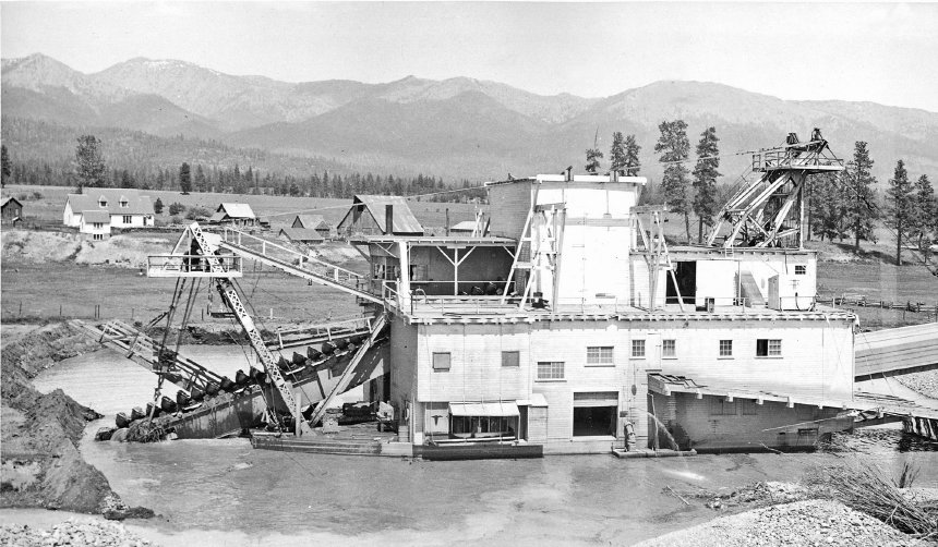
Click here for additional photos and information on the Sumpter gold dredges.
Virtue District
The Virtue District was located approximately 9 miles southeast of Baker City.
The White Swan Mine was a gold producer that started production in the 1870s.
Bonanza (Geiser) District
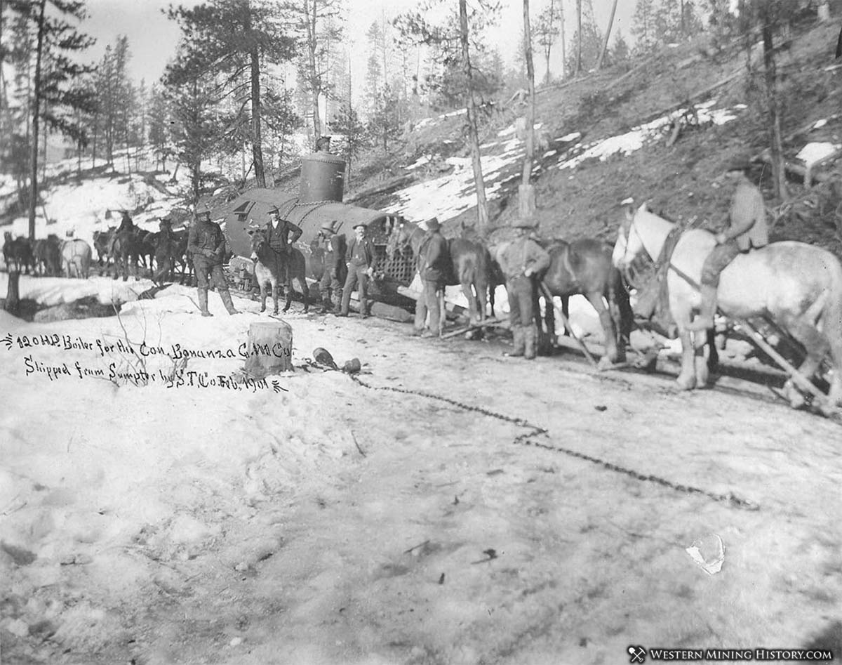
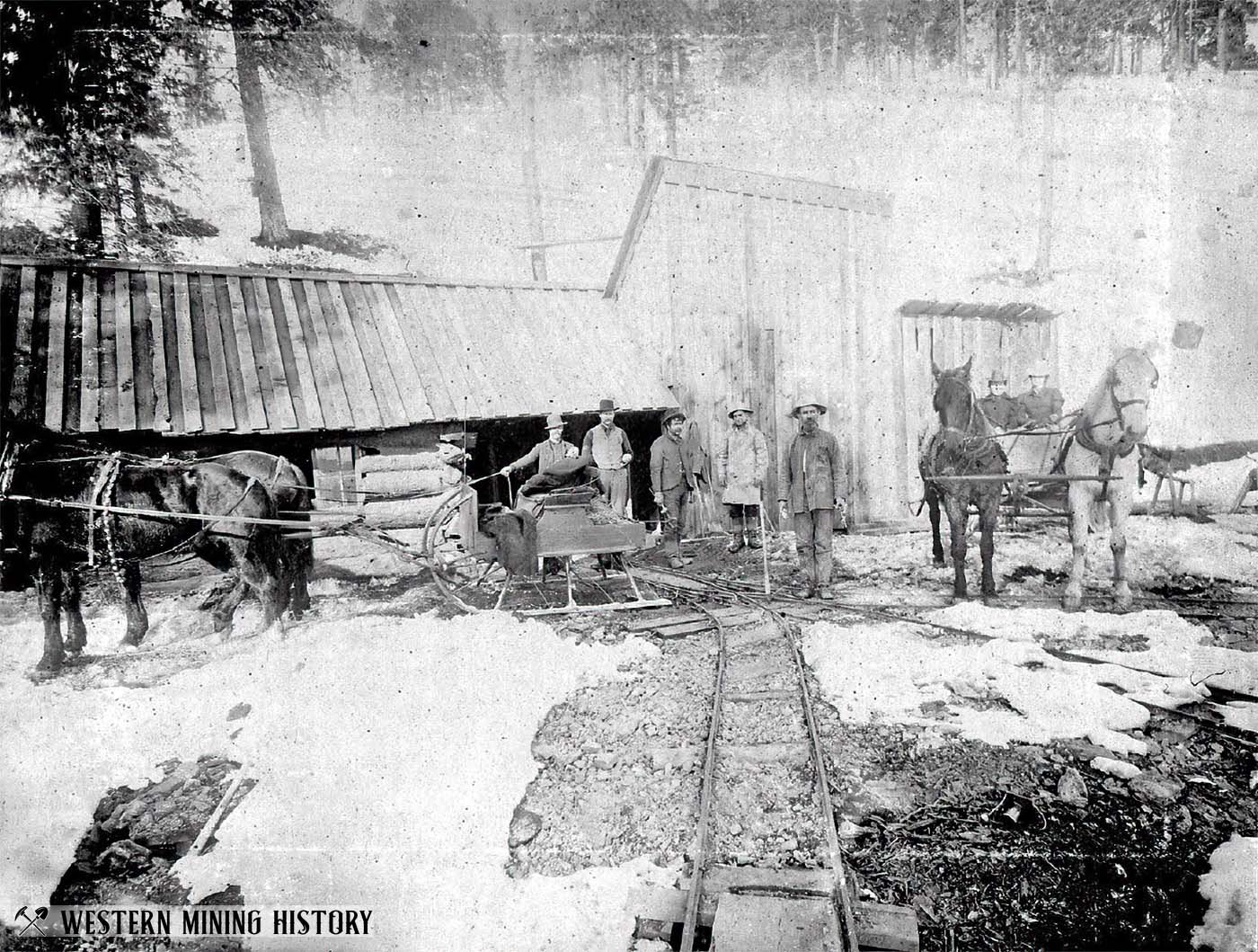
The following 1901 photo depicts two horse-drawn sleighs at the Keystone-Belle mine in northeast Oregon. This mine was in the Bonanza (Geiser) district in Baker County. The Keystone, Belle, and Gold Boy Consolidated Mining Company was incorporated with capital stock of $2,000,000 in 1901. The president of the company was Albert Geiser, owner of the Bonanza gold mine and one of Oregon’s most prominent businessmen at the time.
Southwest Oregon
The gold fields of southwest Oregon, discovered in 1852, are the state’s oldest mining areas.
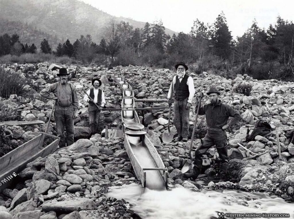
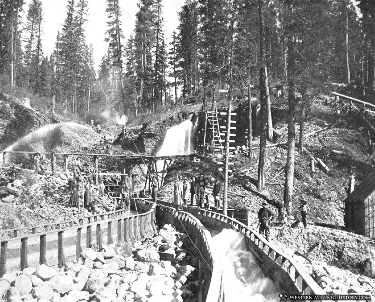
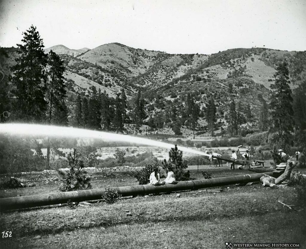
Hydraulic mining methods were utilized to get the gold out of the deeper deposits. It is not uncommon to find photos of citizens visiting the mines as in the photo below – apparently the hydraulic mines were of some interest to the locals.
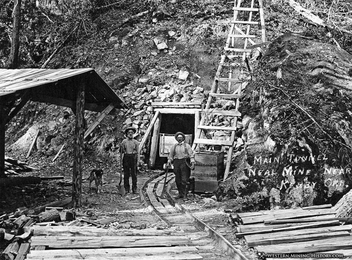
Initially rich placer mines were the primary producers of gold, but as the placers ran out miners transitioned to lode mining. The following image depicts two miners and their dog at a Kerby area mine.
Other Oregon Mining Areas
Although the vast majority of mining in Oregon occurred in the northwest and southwest corners of the state, there are a few exceptions.
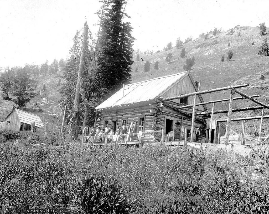
Bohemia
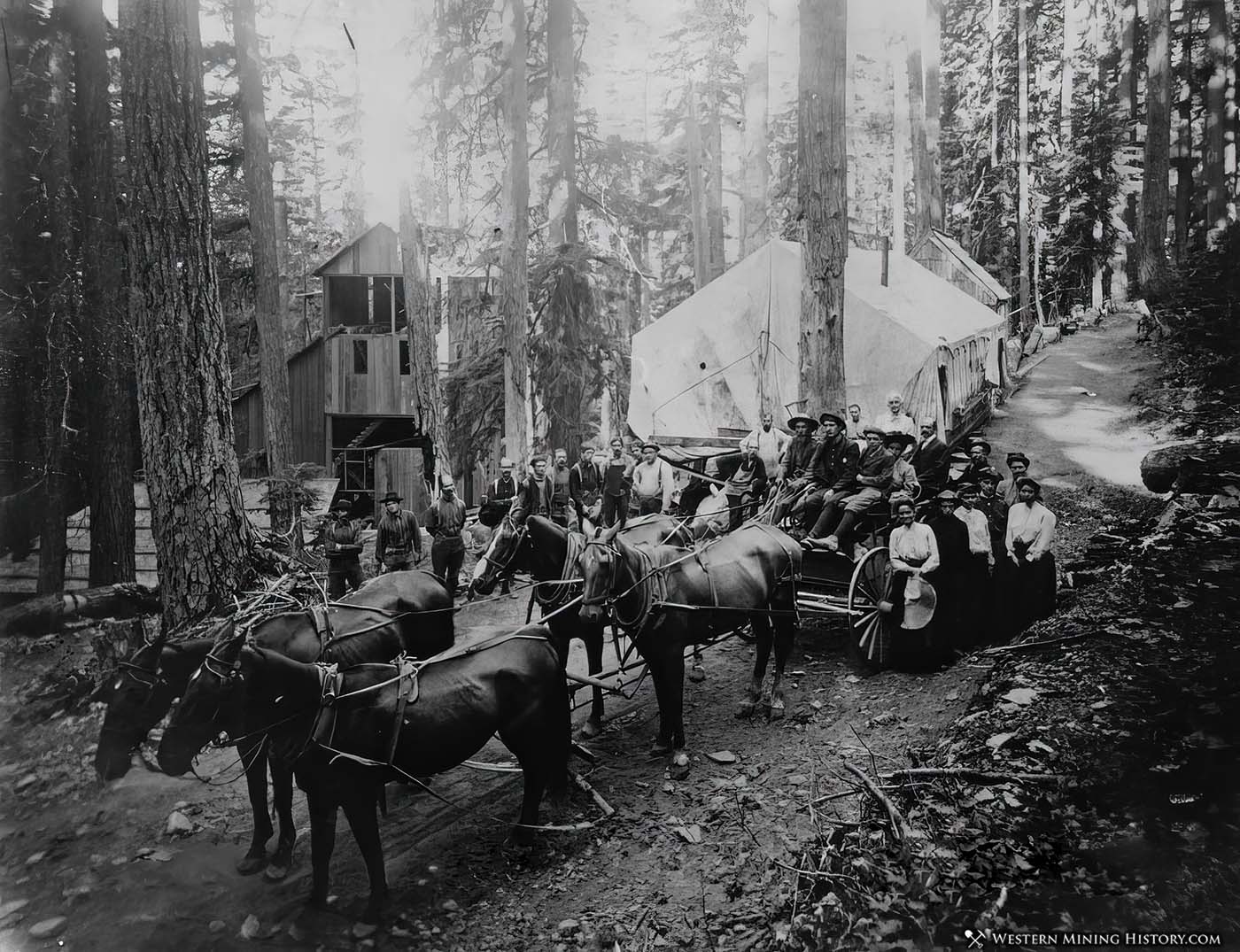
The Bohemia mining district is located about 25 miles southeast of Cottage Grove, Oregon. The district is approximately nine miles square, in a very rugged mountainous and heavily forested area. Discovered in 1858, the mines here had an initial period of activity from the mid 1860s until 1877, then was mostly abandoned. By the mid 1880s enough development and exploration had been conducted to bring attention back to the district, and by the mid 1890s Bohemia was experiencing a resurgence.
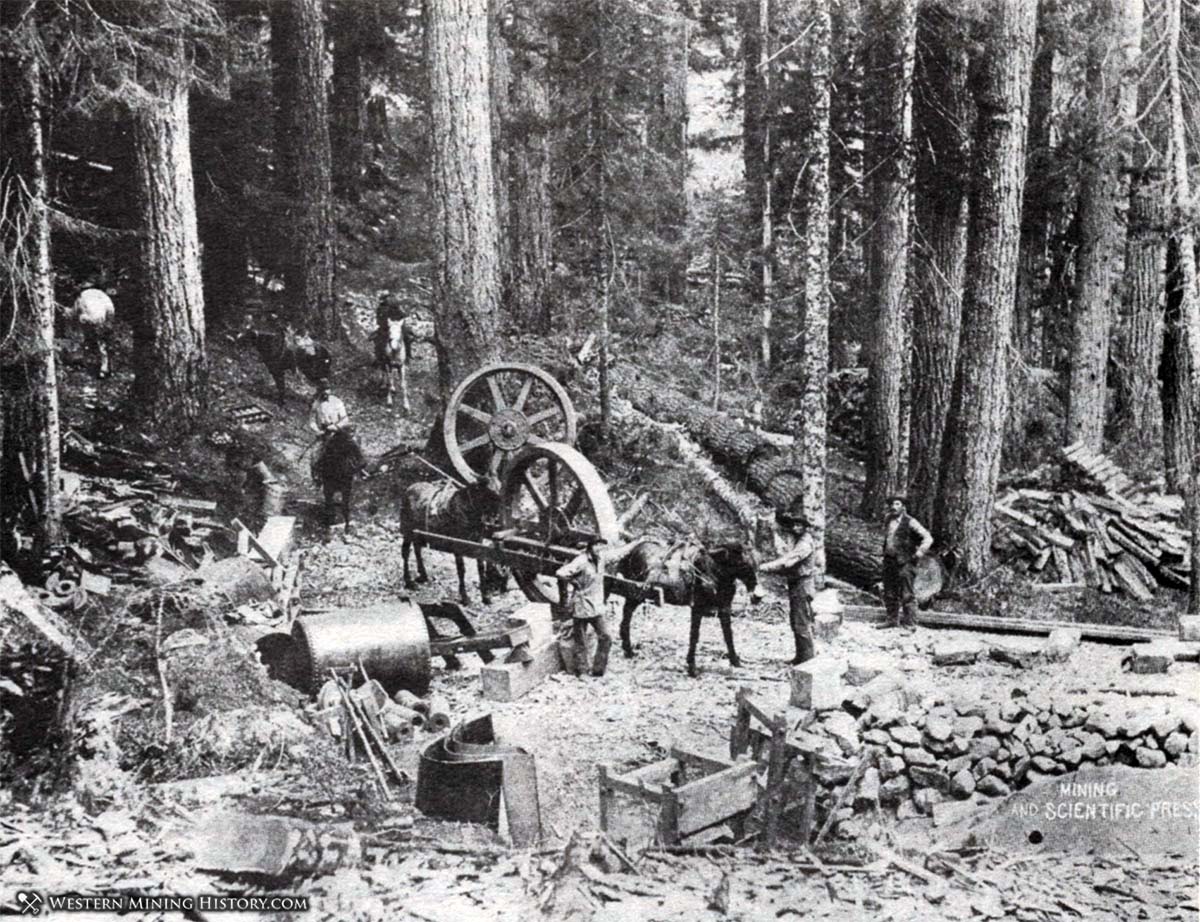
Bohemia is located in a mountainous and densely forested wilderness, and transportation in the district was restricted primarily to trails for the first few decades. The photo above depicts men moving heavy machinery on a Bohemia trail.
The Knott Mill was the districts first stamp mill. In the 1893 photo above it has been moved to the Annie Mine. In early 1893 the mine owners found the mill completely covered in snow – the following account describes how they got it running:
Locating the boiler room by means of the smokestack, which protruded some three feet out of the snow, they dug down, found the door and proceeded to overhaul the machinery by lantern light. The rest of the crew arriving, they were put to work by Supt. McGee on the job of cutting off the tops of trees, hauling them across the snowbanks and throwing them down the hole for use as wood for the fire under the steam boiler.
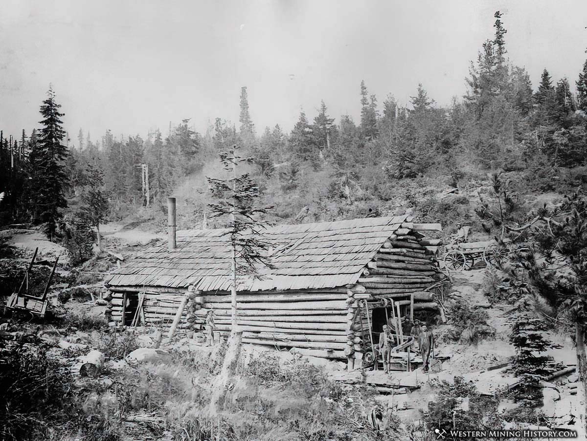
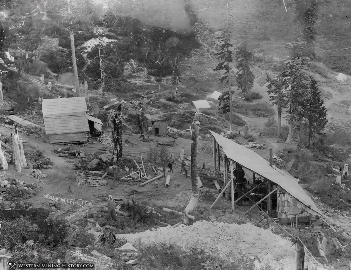
The photo above, which likely dates to the late 1890s, shows one of the few roads that had been built by that date. Also visible is a stamp mill (possibly under construction), and a tent that was likely serving as a boarding house.
The Musick Mine was one of the districts largest producers, but for nearly a decade after it’s discovery in 1891, it relied on trails to haul in equipment. The photo above shows the rudimentary nature of the first stamp mill at the mine.
Ashwood
Ashwood was the site of a very minor mining excitement in Jefferson County in 1901. Although the excitement was largely overblown, the Oregon King Mine did have many alternating periods of production for decades.
Oregon Gold

“Where to Find Gold in Oregon” looks at the density of modern placer mining claims along with historical gold mining locations and mining district descriptions to determine areas of high gold discovery potential in Oregon. Read more at Where to Find Gold in Oregon.