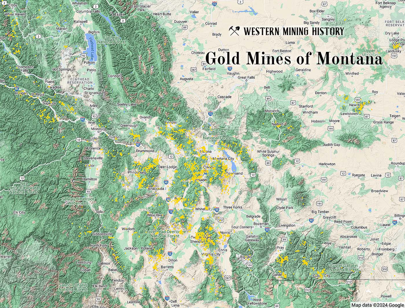
The information in this article is based on data compiled in the 1965 USGS publication Principal Gold Producing Districts of the United States.
The USGS credits Montana with lode and placer gold totaling 17,752,000 ounces from 1862 through 1965. The majority of the gold was mined before 1900 when records were poorly kept, therefore much of the historical production has been estimated.
Historical Overview
Gold was first discovered in 1852 in gravels along Gold Creek in Powell County. However, it was not until the 1862 discovery of gold at Grasshopper Creek (Bannack) that the first gold rush occurred in Montana Territory.
As prospectors entered the territory by the thousands starting in 1862, new placer and lode discoveries were made with increasing frequency. In May of 1863, the rich deposits along Alder Gulch near Virginia City were discovered, which soon proved to be the most extensive and productive placers in Montana.
During the summer of 1864, important placer gold discoveries were made at Last Chance Gulch (Helena) and in the Butte district. Placer mining flourished in the territory well into the 1870s as numerous new discoveries were made.
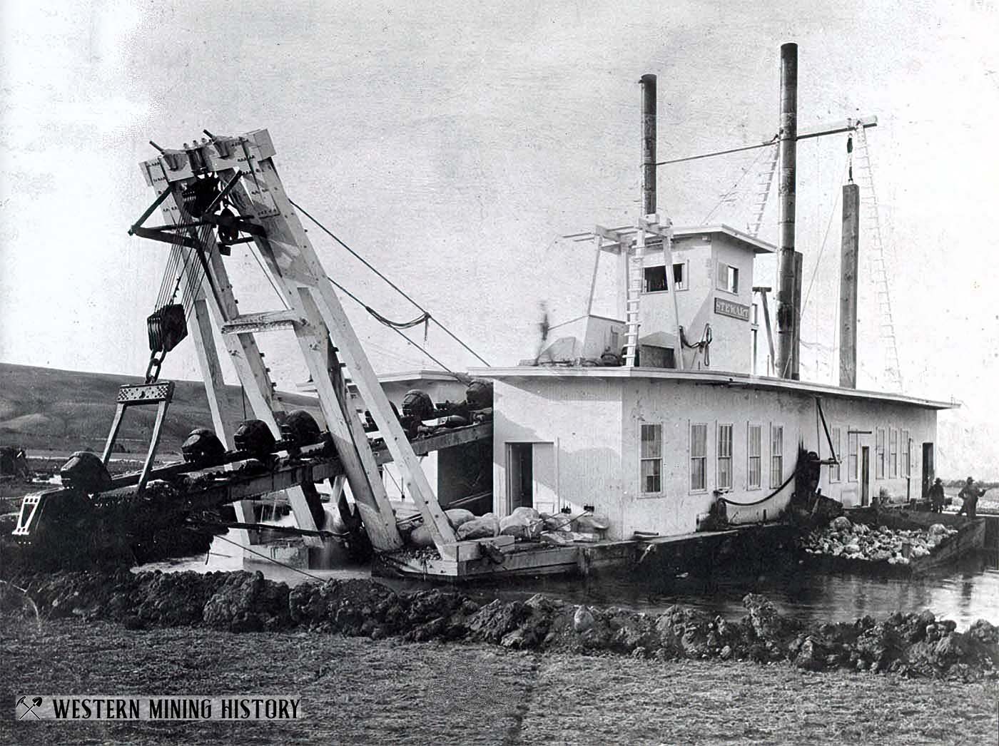
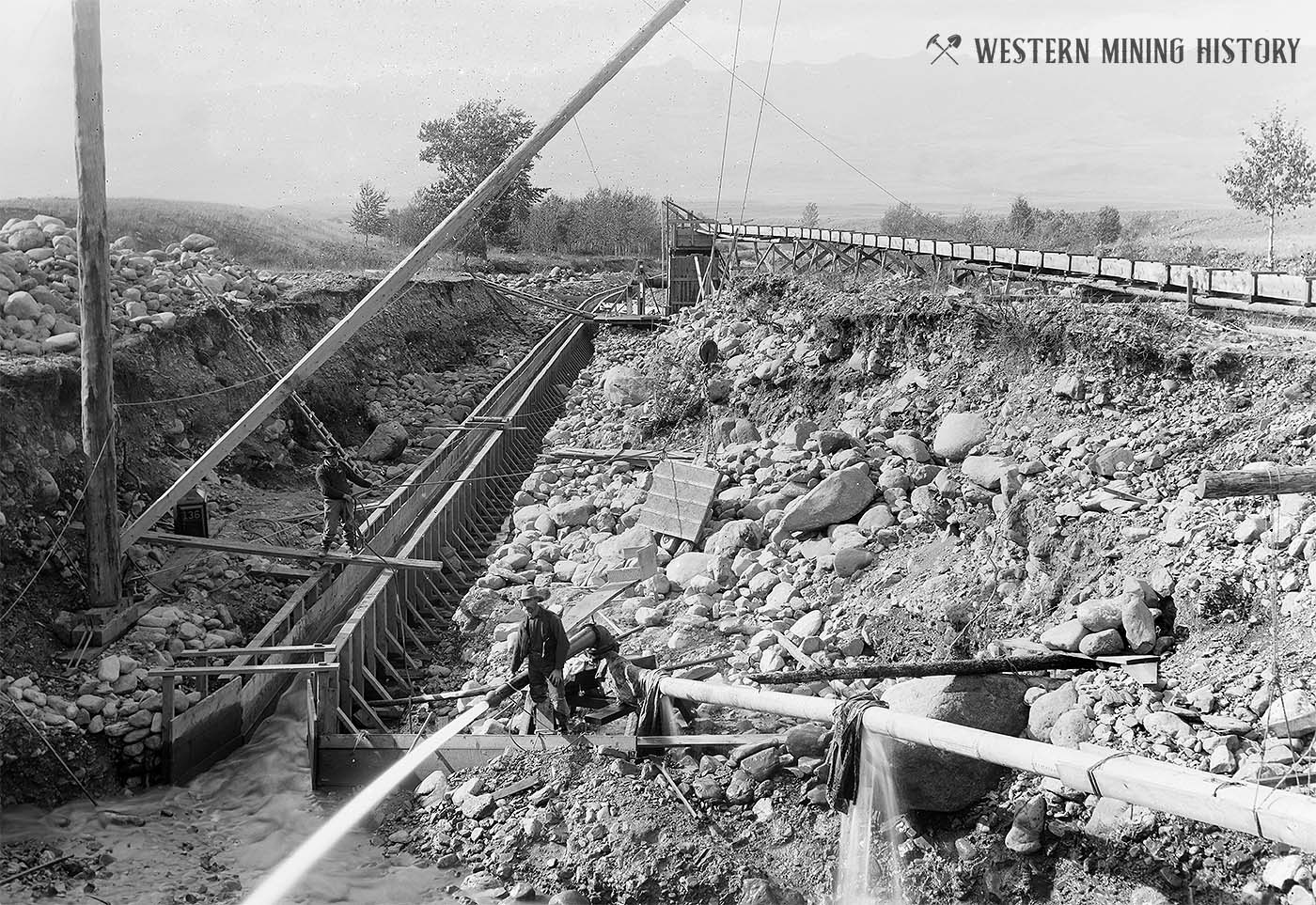
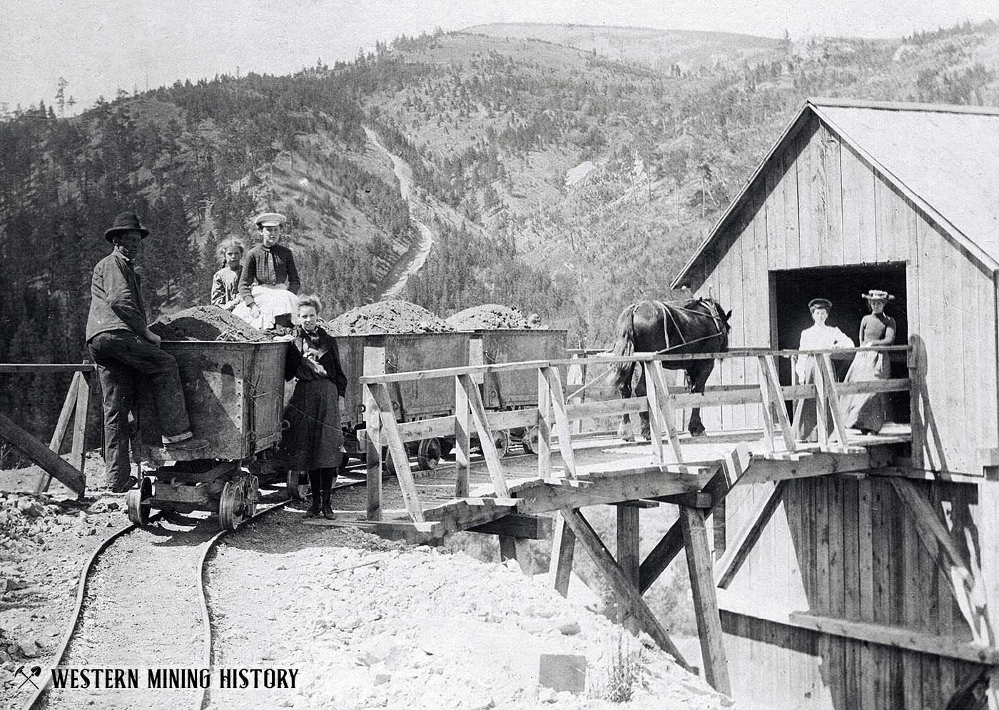
Although many of the important placer mines were worked out relatively quickly, improvements in technology and infrastructure extended the life of many of the mines by decades. The introduction of dredges starting in the 1890s once again renewed the lifespan of the placer mines.
Although important lode discoveries were made in the 1860s, gold production from lode mines did not become significant until the 1870s. Development of the mines was slowed by lack of transportation infrastructure, but the arrival of the railroad starting in 1882 greatly enhanced the state’s mining industry.
Dredging extended the life of the state’s placer mines and significant lode gold continued to be produced well into the 1900s, particularly as a byproduct of the copper mines at Butte.
By 1965 Montana had produced almost 18 million ounces of gold, making it the seventh largest gold producing state in the United States.
Principal Gold Districts
In Montana, 54 mining districts have each have produced more than 10,000 ounces of gold. The largest producers are Butte, Helena, Marysville, and Virginia City, each having produced more than one million ounces. Twenty seven other districts are each credited with between 100,000 and one million ounces of gold production.

Beaverhead County
Beaverhead County had gold production of about 370,000 ounces through 1959, but early production records are incomplete and the totals may be much larger. The three principal gold districts in the county are Argenta, Bannack, and Bryant (Hecla).
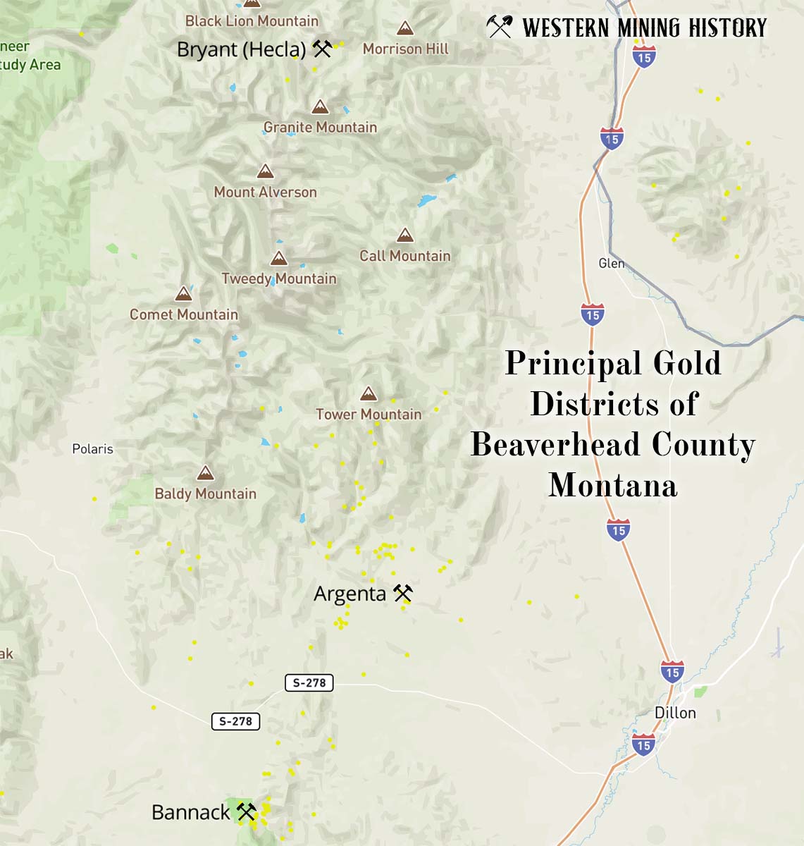
Argenta District
The Argenta district is located approximately 12 miles west of Dillon.
Small amounts of placer gold were discovered here in the early 1860s, and the first lode mines, producers of gold, silver, and lead, were discovered in 1865. Lode mining occurred here for the next decade, although records of production are sparse. The district was mostly abandoned by 1875.
In 1926 the district was revitalized with the discovery of the Ermont group of mines, which became the largest gold producers in the district. From 1904 through 1957 the Argenta district produced around 65,350 ounces of gold.
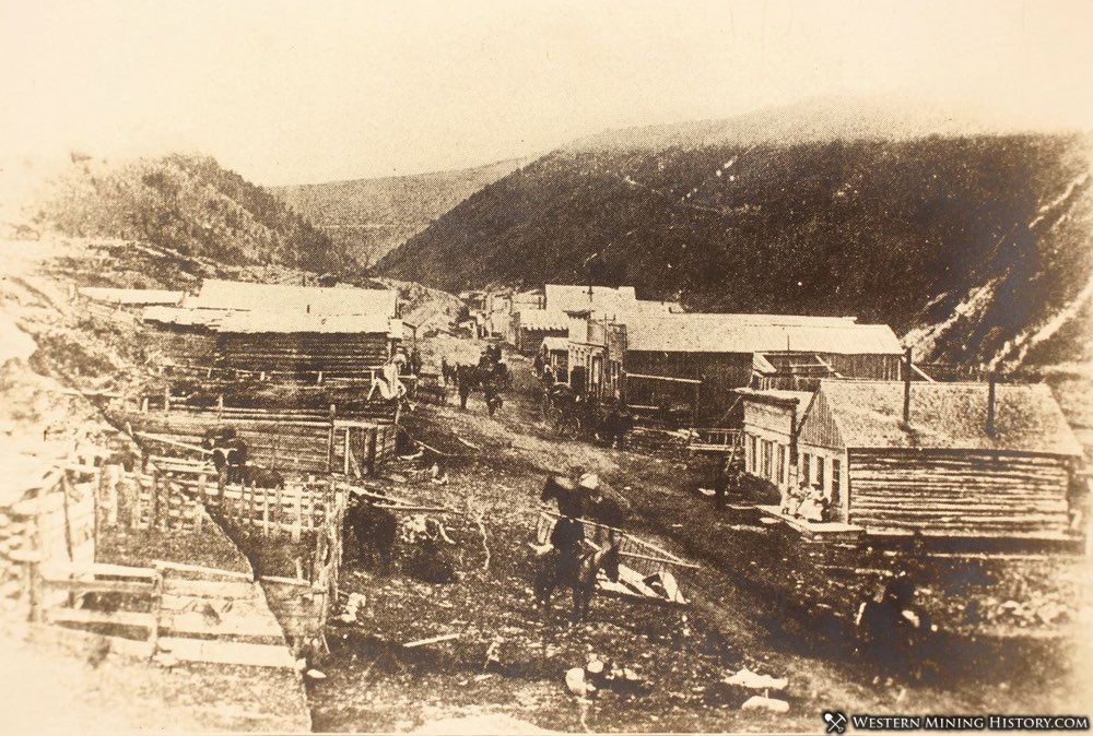
Bannack District
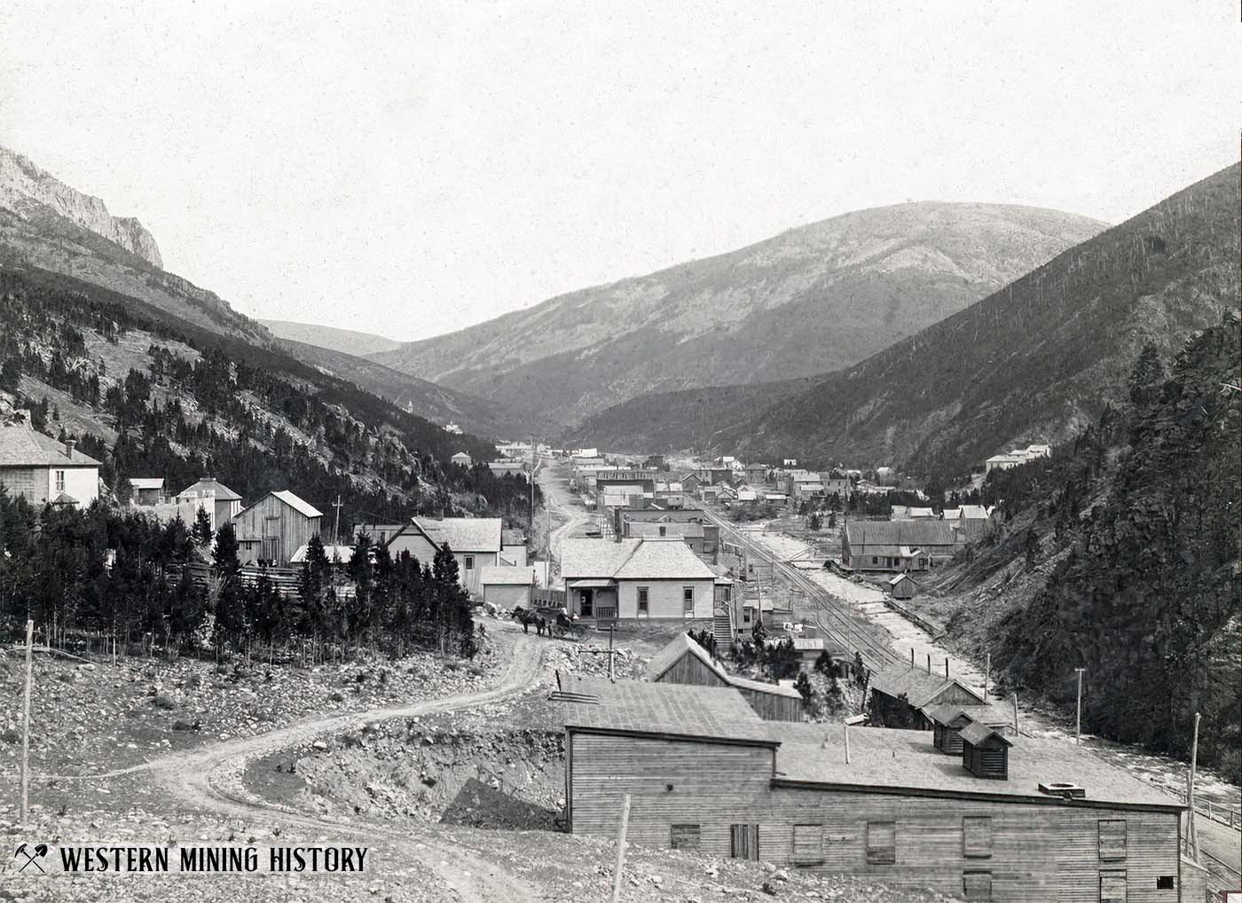
The Bannack district is located approximately 22 miles west-southwest of Dillon. The town of Bannack was the original territorial capital of Montana, and the ghost town is preserved as a state park.
Rich placer deposits were discovered at Bannack along Grasshopper Creek in 1862. These deposits were the first significant gold discoveries in Montana and started the first rush of prospectors to the territory. Among other firsts for this district is the first lode mine discovered in Montana (1862), and the first successful bucket-lift gold dredge operating in the United States (1894).
Total gold production for the district through 1959 was at least 240,400 ounces – 132,000 ounces from placers and 108,400 ounces from lodes.
Bryant (Hecla) District
The Bryant (Hecla) district is located approximately 12 miles west of Melrose. This was a lode mining district.
The Bryant district was primarily a producer of silver and lead, with relatively minor amounts of gold. Despite this being a silver-lead district, it is still credited with 11,744 ounces of gold production by the USGS, although other sources put it at over 18,000 ounces. Copper and zinc were also mined here.
Lode mining started here in 1873 and continued at fairly large scale until 1893 when the silver panic shuttered mines across the country. The district’s mines operated intermittently in subsequent decades, finally closing for good in 1949.
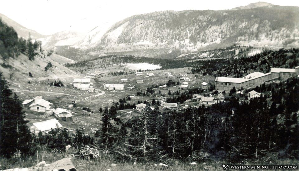
Broadwater County
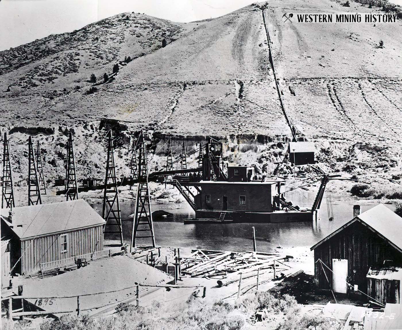
Broadwater County is known for having some of the most productive placer mines in Montana. Few records of placer gold production were kept before 1900, but substantial amounts of gold were recovered here. Confederate Gulch alone is thought to have produced over 580,000 ounces.
Gold production for the county from 1901 through 1959 was around 362,000 ounces – approximately 327,500 ounces from lode mines and 34,500 ounces from placers. Total production, including the period prior to 1904, likely exceeded one million ounces.
The principal gold districts of Broadwater County are Confederate Gulch, Park, Radersburg, White Creek, and Winston (Beaver Creek).
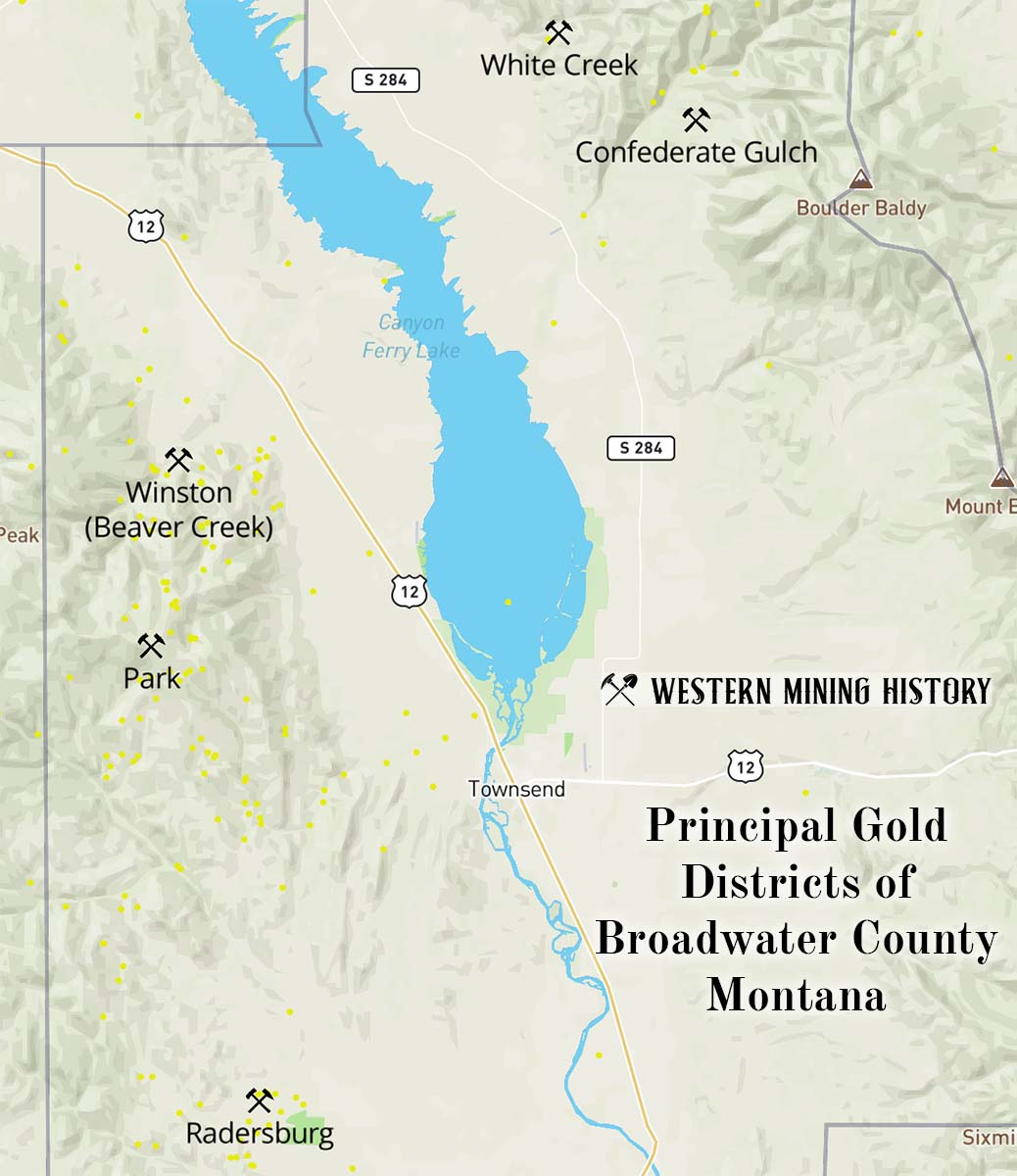
Confederate Gulch District
The Confederate Gulch district is located approximately 11 miles north of Townsend. This was primarily a placer mining district.
The gold placers at Confederate Gulch were discovered in 1864 and were some of the richest ever discovered in Montana. The placers here higher in grade than even the well-known deposits at Virginia City (Alder Gulch) and Helena (Last Chance Gulch), although overall lower in tonnage than those famous districts.
By 1870 the placer mines were in rapid decline, and by 1880 the district was mostly abandoned. From 1908 through 1951 lode mines were worked on a small scale, except during World War II. The total gold production of the district through 1959 was around 580,000 ounces – only about 10,000 ounces of that total was from lode mines.
Park District
The Park district is located on the east side of the Elkhorn Mountains between Winston and Radersburg. The mines of this district were producers of gold and silver, with minor quantities of zinc and lead.
Placer gold was first discovered here in 1860 at Indian Creek. Lode mining also occurred here, but very little was recorded for either lode or placer mine production prior to 1900. The placer mines were again active in 1911-15, 1933-43, and again in 1945-49. The USGS provides the following estimates for production from this district:
M. R. Klepper (written commun., 1962) summarized gold production as follows: 1864-1904, $850,000; 1905-28, $50,000; 1929-56, $1,250,000. Production from 1864 to 1904 was mainly from placers and from some lode mines in the Hassel area. From 1929 to 1956, production was mainly lode gold from the Marietta mine. Total production for all three periods was about 80,300 ounces of gold valued at $2,150,000.
Radersburg District
The Radersburg district is located on the east side of the Elkhorn Mountains, approximately 10 miles southwest of Townsend. This was the largest producer of lode gold in Broadwater County.
Both placer and lode deposits were discovered in 1866. By the late 1870s the easily worked gold ores were exhausted, and the district was idle. In 1883 railroad connections were made with smelters at Butte and Helena that facilitated the treatment of ores at low cost. The mines at Radersburg went back into production and operated through 1956.
Placer deposits are found for several miles along Crow Creek and Johnny Gulch near Radersburg. Old residents of the district estimated the placer production from 1866 to 1904 at 25,000 to 50,000 ounces. The total gold production of the district was about 325,000 ounces.
White Creek District
The White Creek district, located in the northern part of the county northwest of Confederate Gulch, includes the basins of White Creek, Avalanche Creek, and upper Magpie Gulch. This was primarily a gold placer district.
Gold was discovered at White Creek in 1865. The placers along the upper part of White Creek and Johnny Gulch were mined for about 20 years, and although the deposits were described as being rich, production records are not available. The USGS provides estimates as to the district’s production (based on the 1969 price of gold of about $41):
Based on the amount of gravel moved, the estimated the yield is about $1 to $1.5 million worth of gold. The Avalanche Creek placers yielded at least $100,000 and Magpie Gulch yielded about $330,000 in gold. Most of the production was before 1904; only a few ounces was reported in the 1920’s and 1930’s from desultory diggings along White Creek and Magpie Gulch. Total gold production through 1959 was between 68,000 and 92,000 ounces.
Winston District
The Winston district is located approximately 13 miles northwest of Townsend, in the drainage basin of Beaver Creek. This was primarily a lode mining district, although some placer production was recorded.
The first lode mine was discovered in 1867, although no significant mining occurred for at least a decade after the discovery. The USGS estimates that around 106,000 ounces of gold were mined here, with about two-thirds of that total produced prior to 1908.
Cascade County
Most gold production from Cascade County is from the lode mines of the Montana (Neihart) district.
Montana (Neihart) District
The Montana district (located around the town of Neihart) is primarily a lead-silver district, but enough gold was produced as a byproduct to make this list.
Rich silver deposits were discovered here in 1881. The district is credited with about 67,000 ounces of gold for the period from the 1880s through 1959.
Deer Lodge County
Deer Lodge County is know for its production of both lode and placer gold. The two principal gold districts in the county are the French Creek and Georgetown districts.
Placer production is said to be significant in the 1860s and 1870s, but like most districts during this period, records are sparse. Estimates prior to 1904 put both lode and placer production between 170,000 and 400,000 ounces.
From 1904 through 1952, the county produced approximately 300,000 ounces of lode gold and only 2,243 ounces of placer gold. The total gold production through 1959 was around 470,000 ounces.
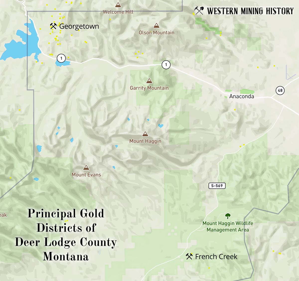
French Creek District
The French Creek district is located about 12 miles south of Anaconda, near the headwaters of French Creek. Placer gold deposits were discovered here in 1864.
It is estimated that at least 50,000 ounces of gold was recovered here in the 1860s, although the amount could have been considerably larger. From 1900 to 1902, a dredge and several hydraulic mines operated in the district, but there were no records of production for that period.
Georgetown District
The Georgetown district is located approximately 10 to 15 miles northwest of Anaconda and about 10 miles southeast of Philipsburg.
Placers were mined in the early 1870s, producing at least 10,000 ounces from the Cable and Georgetown placers. The Cable mine was the largest lode mine in the district. Total production for the district was at least 460,000 ounces, most of it from lode mines.
Fergus County
From 1886 through 1950 the total gold production of Fergus County was approximately 653,000 ounces, all but around 1,000 ounces was from lode mines. The periods of greatest production were 1901-22 and 1936-42.
The two principal gold districts in the county are the North Moccasin and Warm Springs districts.
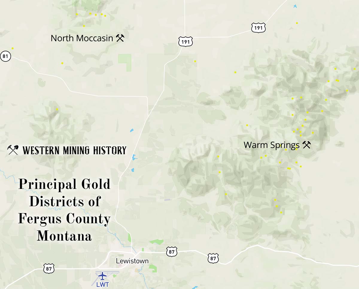
North Moccasin District
The North Moccasin district is around 15 miles north of Lewistown, and is the location of the mining town of Kendall. Gold was discovered here in 1893, but production did not start until around 1900. In 1903 and 1904 this was one of the top gold producing districts in Montana.
This district is credited with approximately 450,000 ounces of gold production, all of it from lode mines, with the North Moccasin mine being the most productive.
Warm Springs District
The Warm Springs district is located in the Judith Mountains about 10 miles northeast of Lewistown. This is the location of the mining towns of Maiden and Gilt Edge. The first ore discoveries in Fergus County were placer gravels in the Judith Mountains, discovered in 1879 or 1880. Gold-silver lodes were found soon after.
The lode mines of the district produced approximately 45,000 ounces before 1900. Mining continued after 1900 with the most prosperous period being 1901-1921. Total gold production for the district was around 200,000 ounces.
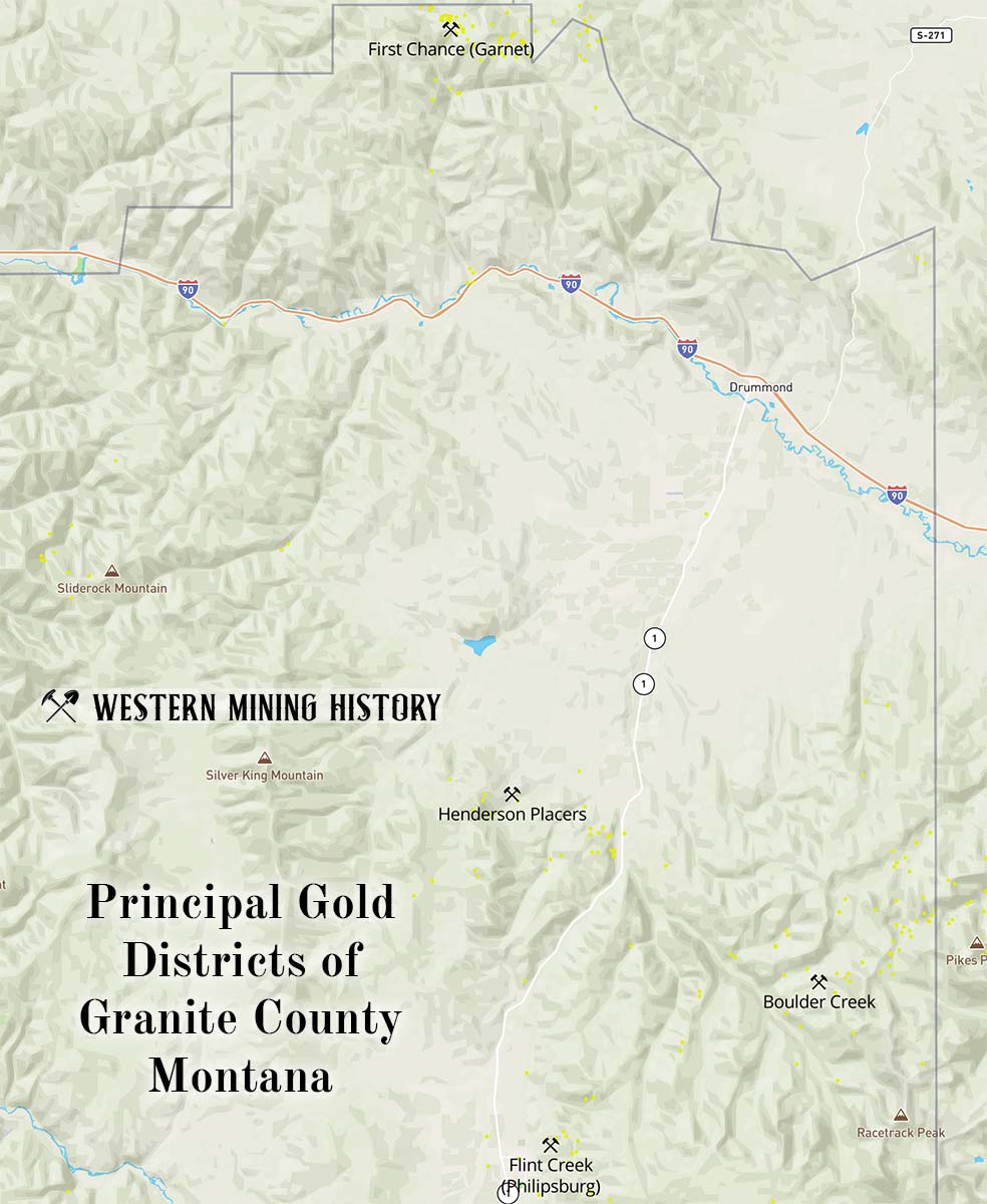
Granite County
Granite county has produced over 700,000 ounces of gold, roughly in equal parts from placer and lode mines. The majority of the lode gold was mined as a byproduct of silver ores.
Boulder Creek District
The Boulder Creek district is approximately 8 miles northeast of Philipsburg. There were placer operations along Boulder Creek, but this was primarily a lode district.
The first discoveries here were made in the 1860s, but mining of any importance did not start until new discoveries were made around 1885. The royal mine, credited with almost 50,000 ounces of gold, was the district’s leading mine.
First Chance (Garnet) District
The First Chance district is located in the drainage basin of Bear Creek, and is the site of the historic town of Garnet. Both placer and lode mines were important here.
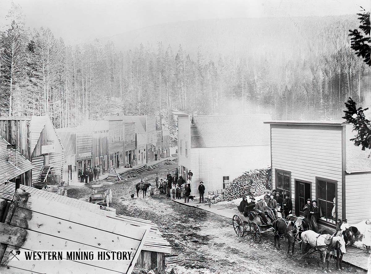
Placer gold was first mined here in 1865, and production through 1917 is estimated to be 240,000 to 340,000 ounces. Lode mining became important starting in 1896 and continued intermittently until World War II. Total lode production of gold was around 90,000 ounces.
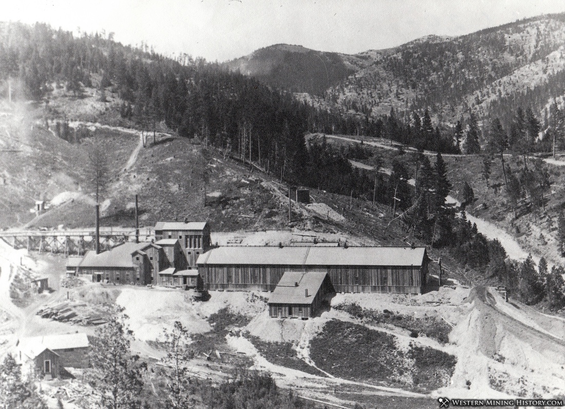
Flint Creek District
The Flint Creek district is located just east of Philipsburg. The lode mines here are some of Montana’s richest producers of silver, and although gold is only a minor commodity in comparison, this is still the county’s largest gold producer.
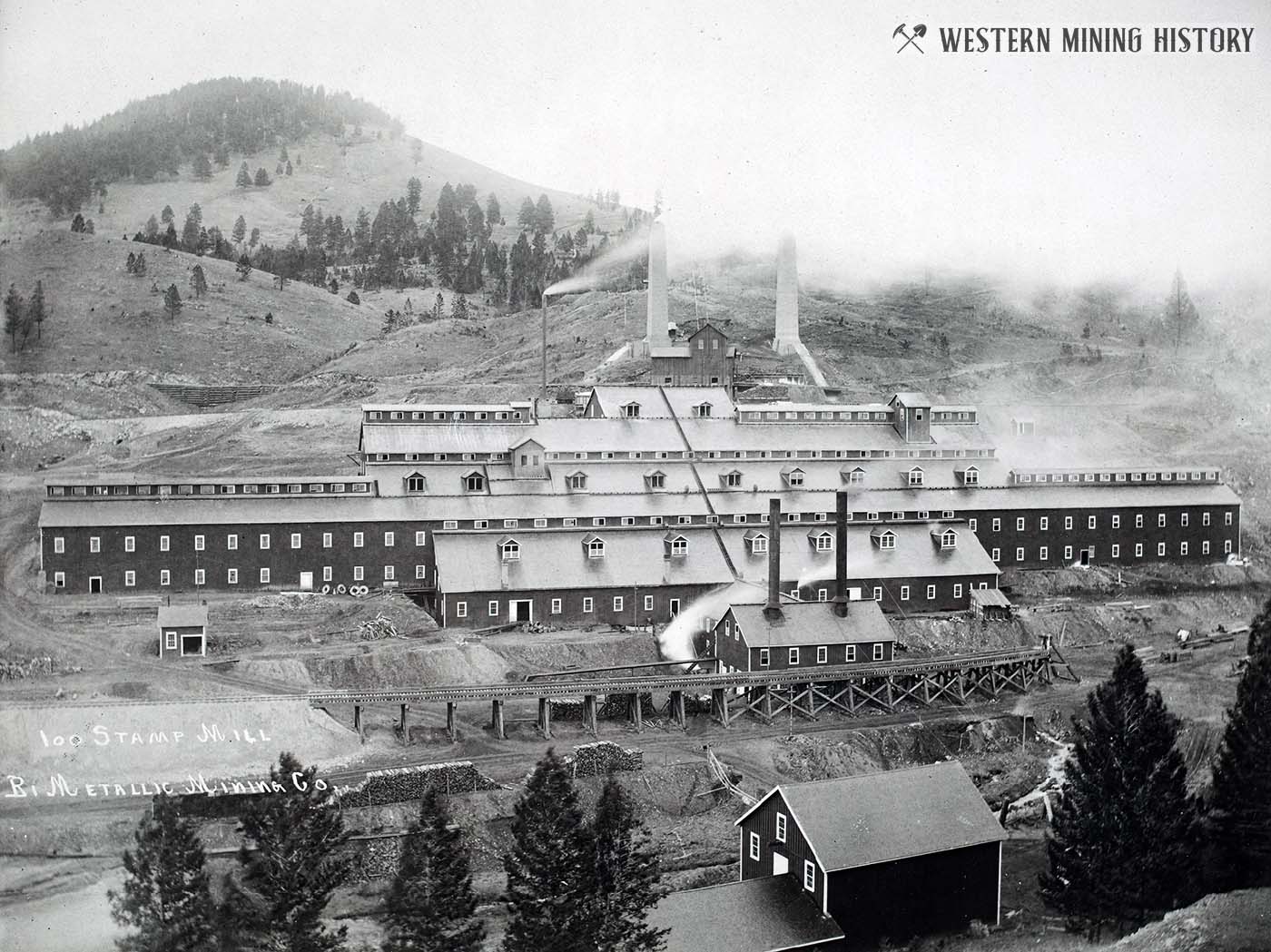
The Granite Mountain mine produced over $20 million in silver during its peak years from 1875 to 1892, and at one time was the largest silver producer in the nation. The mines here were hit hard by the silver panic of 1893, but consolidation of the district’s largest mines allowed for large-scale production to resume later that decade. The mines here were significant producers through 1945.
Although gold was only around ten percent of the value of the ore mined here, the district is still credited with approximately 260,000 ounces of gold production.
Henderson Placers
The Henderson placer mines are located around 11 miles north of Philipsburg. This was one of the numerous Montana placer districts that were discovered in the 1860s. Approximately 50,000 ounces of gold were recovered here between 1866 and 1913.
Jefferson County
From 1864 through 1959 Jefferson County produced more than 700,000 ounces of gold. Approximately 575,000 ounces were produced from lode mines and around 125,000 ounces from placer mines.
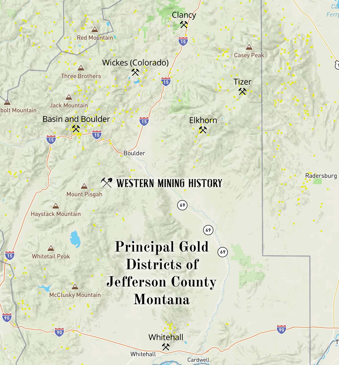
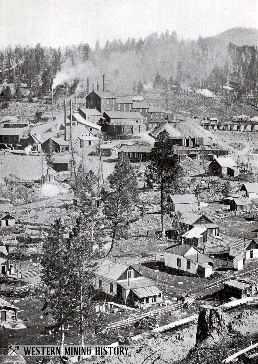
Basin and Boulder District
The Basin and Boulder district is located near the town of Basin and includes Basin Creek, Cataract Creek, Lowland Creek, and the upper Boulder River. This was primarily a lode mining district, but placer mines contributed to total production.
Lode mines were discovered here in 1870, but mining was sporadic until after 1900. The USGS credits the district with 188,200 ounces of gold production, 12,000 ounces of which came from placer mines.
Clancy District
The Clancy district is located about 10 miles south of Helena. This was primarily a placer district, but gold was also recovered as a byproduct of silver ores.
Placer mining along Prickly Pear Creek commenced in 1865 and continued intermittently until about 1910. In 1933 a dredge began operating here, and additional large scale operations in the late 1930s contributed significantly to the district’s gold output.
Total gold production was approximately 100,000 ounces, with just around 2,000 of that total coming from lode mines.
Elkhorn District
The Elkhorn district is approximately 9 miles west of Granite, in the Elkhorn mountains. This was primarily a silver lode mining district that produced gold as a byproduct.
The Elkhorn mine was discovered in 1875, and the town of the same name was founded that year at the mine site. This was one of the state’s richest mines, which operated for decades and produced over 9 million ounces of silver. In addition to silver, the lode mines of the district have produced around 70,000 ounces of gold.
Tizer District
The Tizer district is about 20 miles southeast of Helena. This was a minor lode mining district with a small amount of placer production from deposits on Wilson and Crow Creeks. Total gold production for the district is around 10,000 ounces, less than 10 percent of which was from placer mines.
Whitehall District
The Whitehall district is located just east of the town of Whitehall. Most of the gold in this district came from one lode mine–the Golden Sunlight. Total gold production for the district is over 1 million ounces through 1959, at least three quarters of which came from the Golden Sunlight.
This district is one of the rare examples for the state of Montana where significant gold production occurred after the 1960s when the USGS report was published.
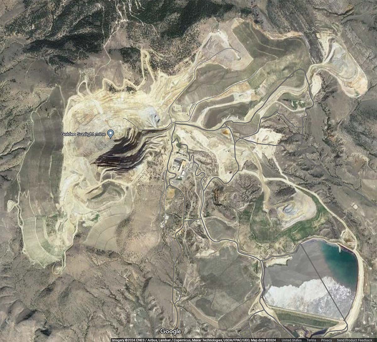
The Golden Sunlight mine operated from 1890 and 1957, presumably entirely underground during that period. Starting in 1975, an open pit mine was developed on the property which operated until 2015, with additional underground operations extending the length of the mine’s life until 2019 when it shut down permanently.
During this period of open-pit mining, the mine is credited with over 3 million ounces of gold production. As of 2023, the mine is active again with a large scale project to process the tailings at the site underway.
Wickes District
In the Wickes (Colorado) district is located about 20 miles south of Helena. This was primarily a lode mining district and gold has been a byproduct of rich silver-lead ores.
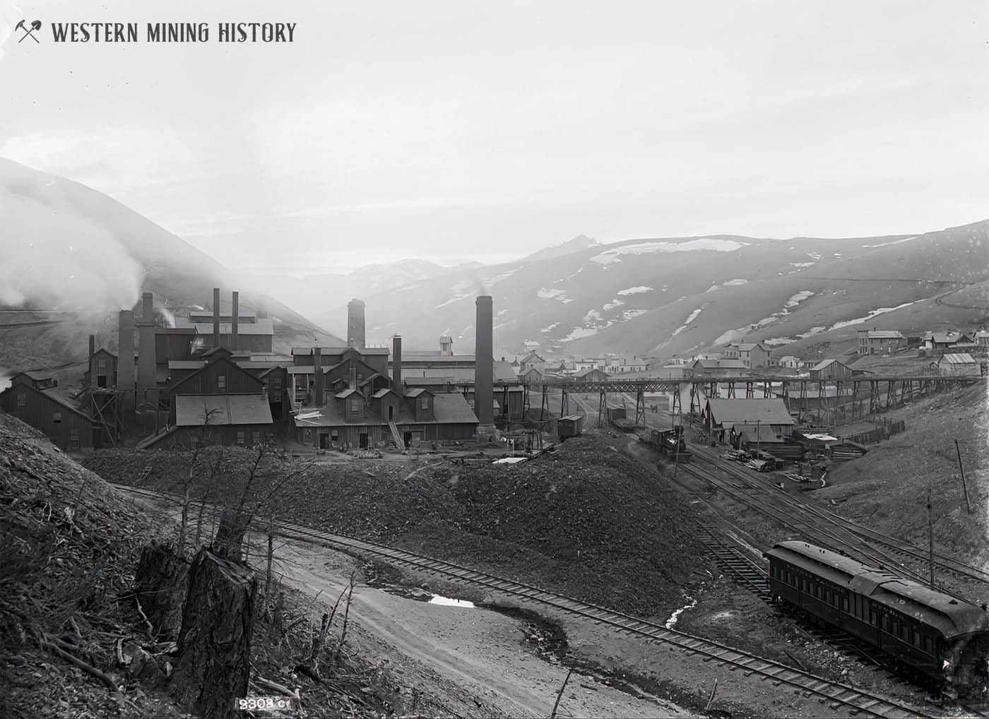
Lode mining began here in 1864 after the discovery of the Gregory mine. The Gregory, Alta, Comet, and Minah are the primary mines of in the district. The most active period of mining was from 1880 to 1893, but the district was active almost continuously through 1959.
Total gold production for the district was around 264,000 ounces from lodes and 2,200 ounces from placers.
Lewis and Clark County
Lewis and Clark County is one of only four counties in Montana that exceeded one million ounces of gold production prior to data compiled in the 1960s. Gold production for the county is estimated to be four to five million ounces, with lode and placer mines being about equal in their contributions to the total.
The Helena-Last Chance and Marysville-Silver Creek districts have each produced more than one million ounces.
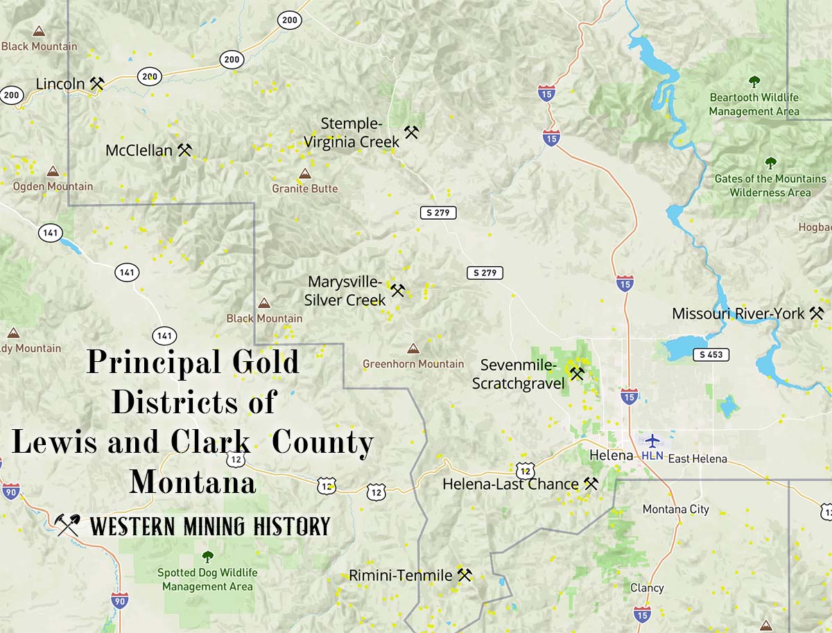
Helena-Last Chance District
The Helena-Last Chance district is located in and around the city of Helena. Discovered in 1864, the placer deposits of Last Chance Gulch were some of the richest ever mined in the state.
While placer mines were the most productive in this district, lode mines, particularly the Whitlatch-Union mine, still produced significant amounts of gold. The district is credited with over 345,000 ounces of lode gold and around 940,000 ounces of placer gold.
Lincoln District
The Lincoln district is located in western Lewis and Clark County near the town of Lincoln. Gold placers were discovered in Lincoln Gulch in 1865, but the district was largely abandoned a decade later. The USGS report summarizes the placer activity of the area:
Pardee and Schrader (1933) estimated that during the early years a stretch of the gulch 7,400 feet long yielded about $7 million (338,653 ounces) in gold. The placers were worked intermittently from 1904 through about 1955 and yielded at least 2,700 ounces of gold. The total placer production through 1959 was about 342,000 ounces.
McClellan District
The McClellan district is located about 8 miles south of Lincoln. This was exclusively a placer mining district.
Placer mining commenced here after gold discoveries in 1864. Over the following decade, and estimated 340,000 ounces of gold was recovered. These very rich placer deposits were repeatedly reworked in subsequent decades, although the amount of gold recovered after 1875 is not known.
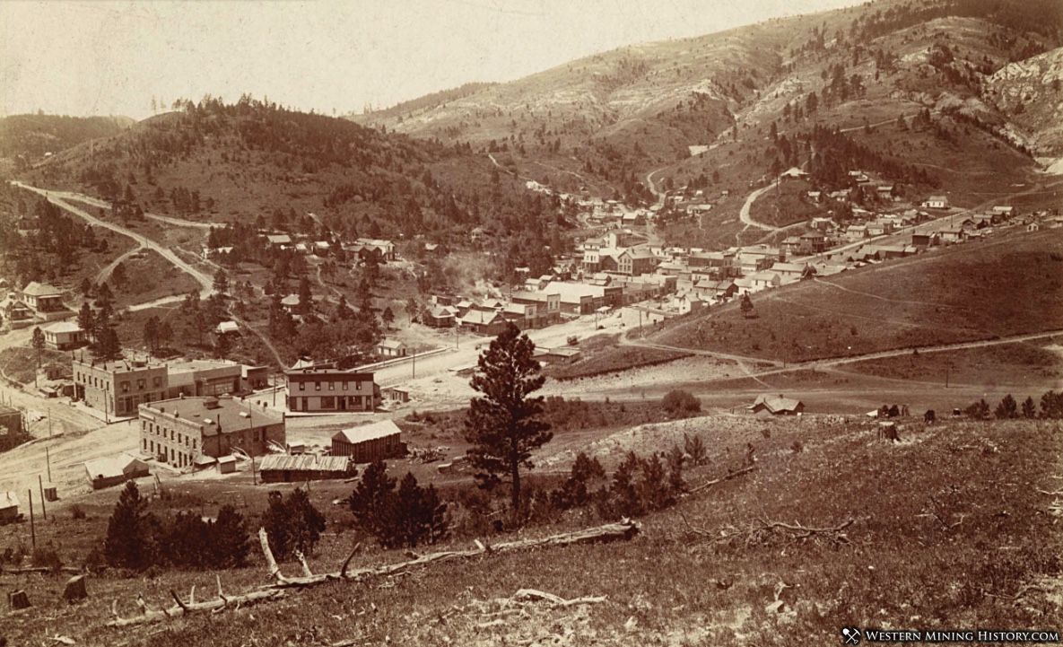
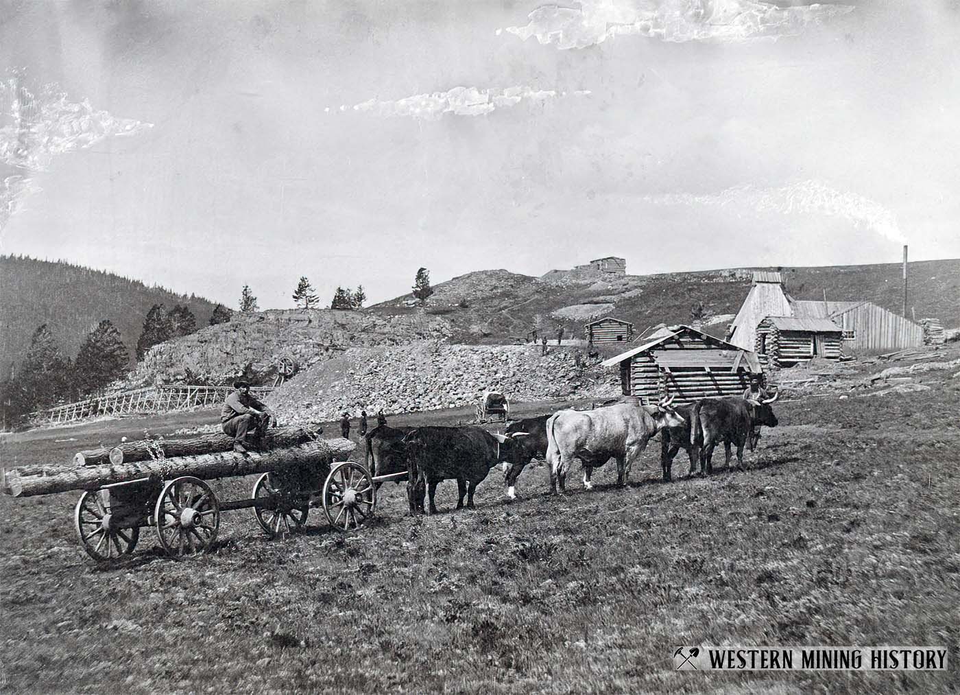
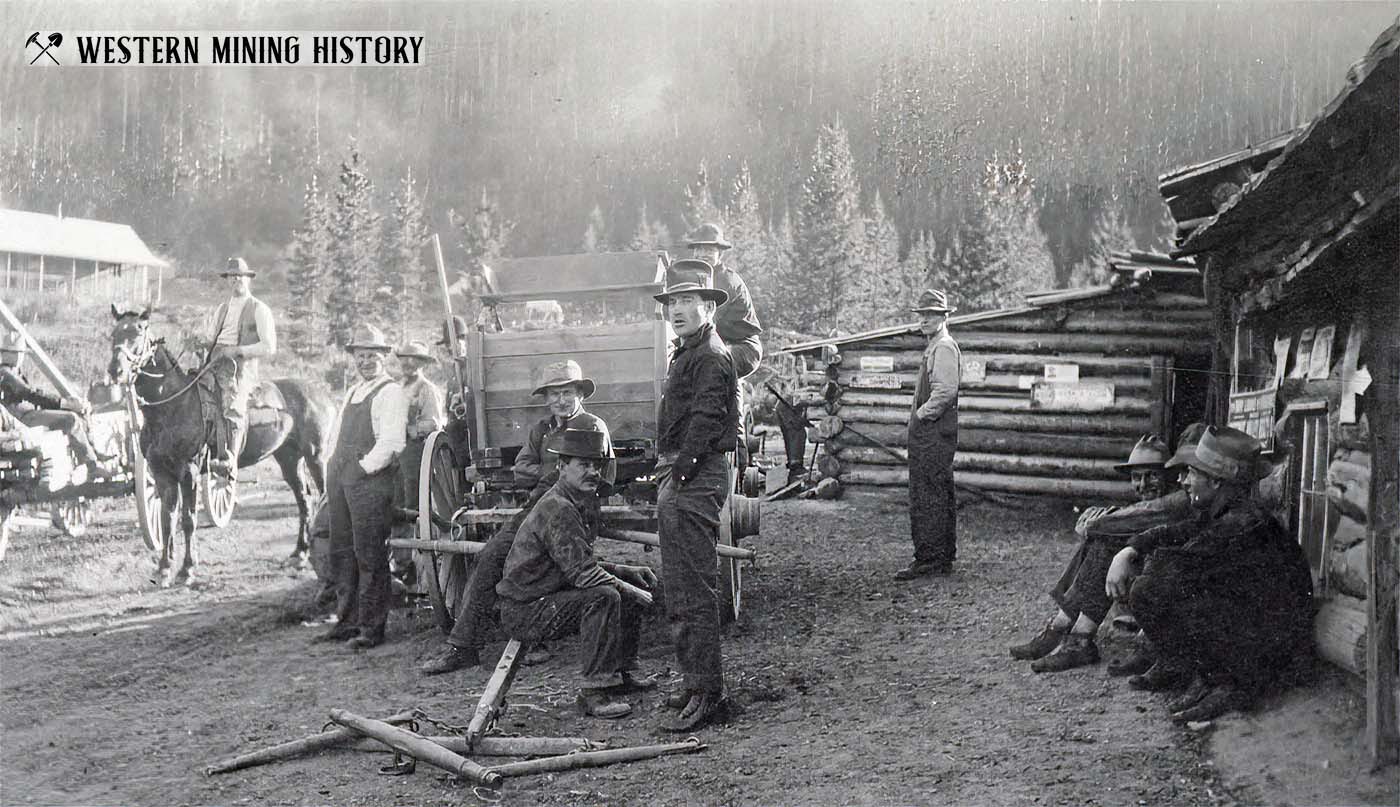
Marysville-Silver Creek District
The Marysville-Silver Creek district is located approximately 18 miles northwest of Helena. This is known as one of the state’s leading lode gold districts, however, placer production during the early years resulted in significant gold production.
Placer mining commenced on Silver Creek deposits in 1864, which were mined out by the 1870s. It is estimated that over 150,000 ounces of gold were recovered during this early period.
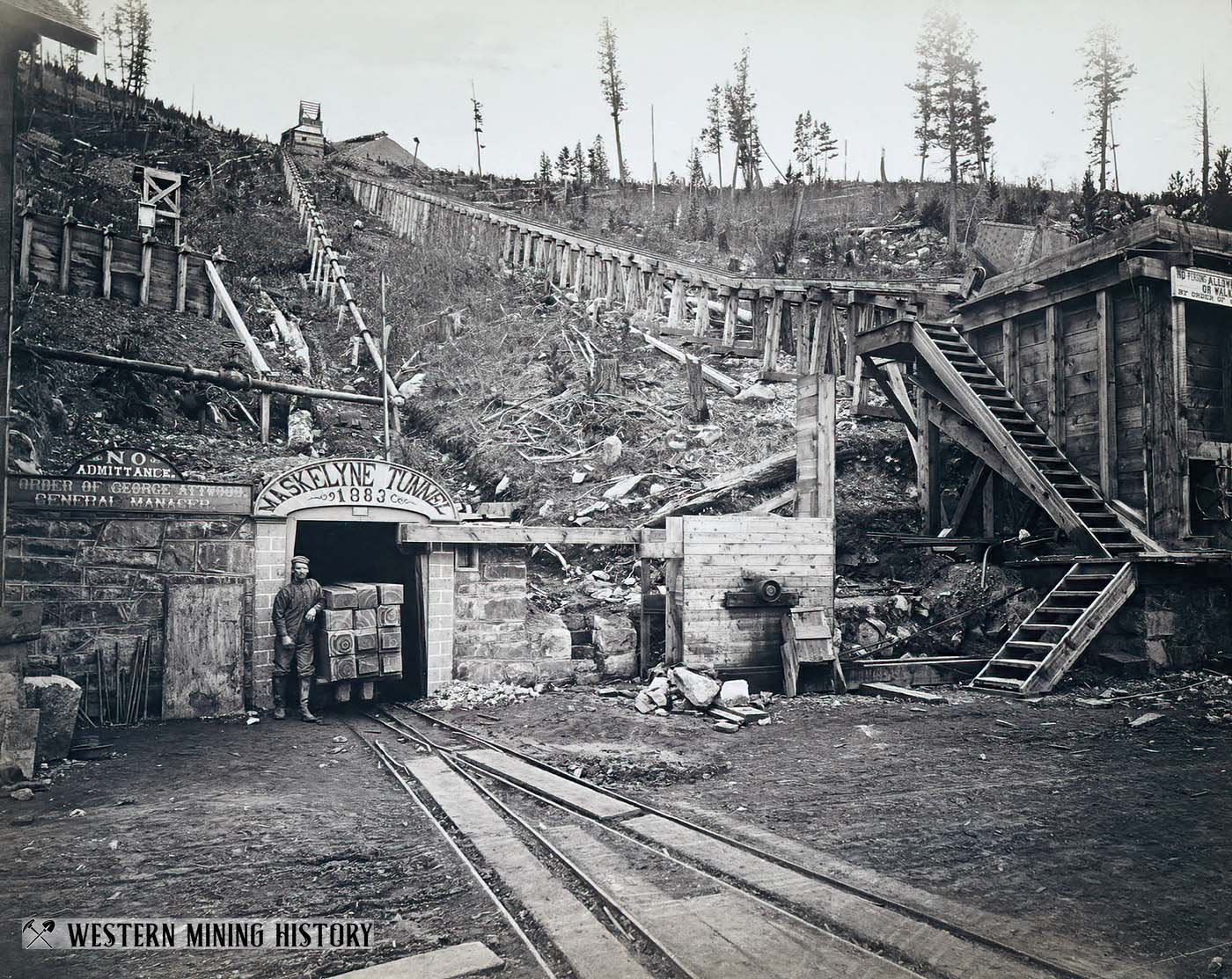
In 1876 the Drumlummon lode was discovered, which became the district’s leading mine and one of Montana’s best producers for many years. Lode production for the entire district up to 1903 was around $30 million, with approximately half of that coming from the Drumlummon mine. Up to 60 percent of this total was from gold, with the rest from silver.
It is estimated that combined placer and lode gold production from the Marysville-Silver Creek district through 1959 was over 1,300,000 ounces.
Missouri River-York District
The Missouri River-York district is located approximately 16 miles northeast of Helena. The district is named for the settlement of York, and the various creeks and gulches of the district are all tributaries of the Missouri River.
Placer gold was discovered at York Gulch in 1864, with numerous other discoveries being made on tributary streams and gulches over the next couple years. The rich placer mines were worked out within a few years. After 1900 some of the ground was worked with dredges.
The USGS report estimates that a minimum of 265,000 ounces of placer gold was recovered here. Lode mines also contributed, with the Golden Messenger mine, which operated from 1899 to 1942, being the largest producer. Total placer and lode production for the district is estimated at around 335,000 ounces.
Rimini-Tenmile District
The Rimini-Tenmile district is located approximately 14 miles southwest of Helena. This was primarily a lode mining district that produced gold, silver, and lead. Most of the production from the district occurred prior to 1907. Total gold production is estimated at 194,000 ounces of lode gold and 4,000 ounces of placer gold.
Sevenmile-Scratchgravel District
The Sevenmile-Scratchgravel district is located 4 miles northwest of Helena. Placer gold was discovered in Iowa Gulch in 1864, shortly before the famous deposits were discovered at nearby Last Chance Gulch (Helena).
Placer production from the 1860s is not known, but the USGS approximates total placer production through 1930 to be around 60,000 ounces. Lode mines contributed an estimated 50,000 ounces, putting the district total at approximately 110,000 ounces of gold through 1959.
Stemple-Virginia Creek District
The Stemple-Virginia Creek district is located around about 30 miles northwest of Helena. This was primarily a lode district but some placer gold was recovered here.
The primary mine of the district is the Jay Gould. Lode mines produced around 216,000 ounces through 1959. The gravels of Virginia Creek produced an estimated 30,000 ounces of placer gold.
Lincoln County
Gold is a minor commodity on Lincoln county, with just two districts recording the amount of gold production required to make this list.
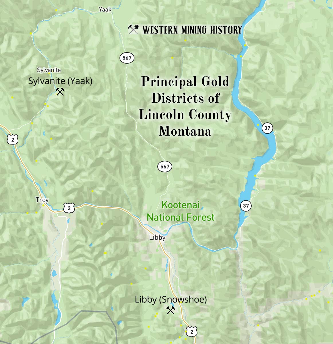
Libby District
The Libby district is located south of the town of Libby. This is a district of lesser importance relative to other locations in Montana.
Placer gold was discovered in the Libby Creek drainage basin in 1867, but no significant mining occurred until the 1880s. In the 1890s lode mines were opened but none were significant producers. Total production for the district was about 20,000 ounces.
Sylvanite District
This is a very minor district, barely recording the 10,000 ounces of production required to make this list. A small amount of lode gold was produced prior to 1930, but the bulk of the district’s gold production came from lode mines in the 1930s.
Madison County
Madison County is one of only four counties in Montana that exceeded one million ounces of gold production by the 1960s. Gold production for the county is estimated to be at least 3,746,000 ounces, with placer mines producing around 65% of the total.
The Virginia City-Alder Gulch district is the county’s largest gold producer.
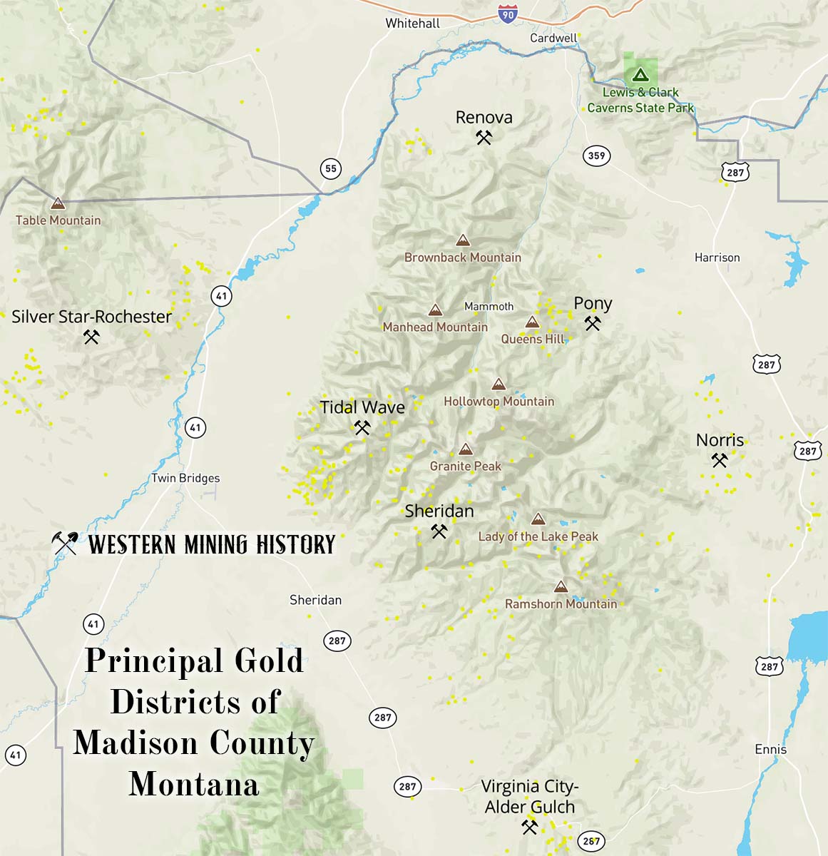
Norris District
The Norris district is located approximately nine miles south of Harrison. This was both a lode and placer district, although lode mining produced the greater portion of the gold.
Placer deposits were discovered at Norwegian Gulch and South Meadow Creek in 1864, with Norwegian Gulch producing $150,000 in gold by 1874. By 1902 the district’s placer deposits had produced at least 14,500 ounces of gold. Large scale placer mining occurred again between 1936 and 1942. Total placer production through 1958 is estimated at 30,000 ounces.
Lode mines were also discovered here in 1864 and were put into production much quicker than in other areas of the state. By 1870 at least eight ore mills were operating here. The lode mines here operated almost continually until 1959, with total production being around 235,000 ounces.
Pony District
The Pony district is located in the northeastern part of Madison County at the historic mining town of Pony. This was primarily a lode mining district.
Lode deposits were discovered here in the early 1870s and actively mined during the 1880s and 1890s, which were the peak decades for the district. Mining continued through 1918, and again between 1928 and 1944. Total gold production through 1959 is estimated at 346,000 ounces.
Renova District
The Renova district is located roughly seven miles southeast of Whitehall, at the north end of the Tobacco Root Mountains. This was primarily a lode mining district. Most mining occurred after 1896, with the Mayflower mine being the district’s primary gold producer. Approximately 162,000 ounces of gold was produced here through 1953.
Sheridan District
The Sheridan district is located roughly 10 miles northeast of Virginia City. Mining of gold, primarily in lode deposits, started here in the 1860s. The district is credited with 33,500 ounces of gold, with approximately 2,000 ounces of that total being from placers.
Silver Star-Rochester District
The Silver Star-Rochester district is located roughly nine miles northwest of Twin Bridges. Lode mining started here in the 1860s, but the peak production years were 1935-1942. The Watseca, Green Campbell, Iron Rod, and Broadway were the primary mines of the district.
Tidal Wave District
The the Tidal Wave district is located roughly nine miles east of Twin Bridges. This was a lode district that produced silver, and lead in addition to gold. Gold mining commenced in the 1860s, but the bulk of the district’s production occurred after 1900. Just over 33,000 ounces of gold was mined here through 1959.
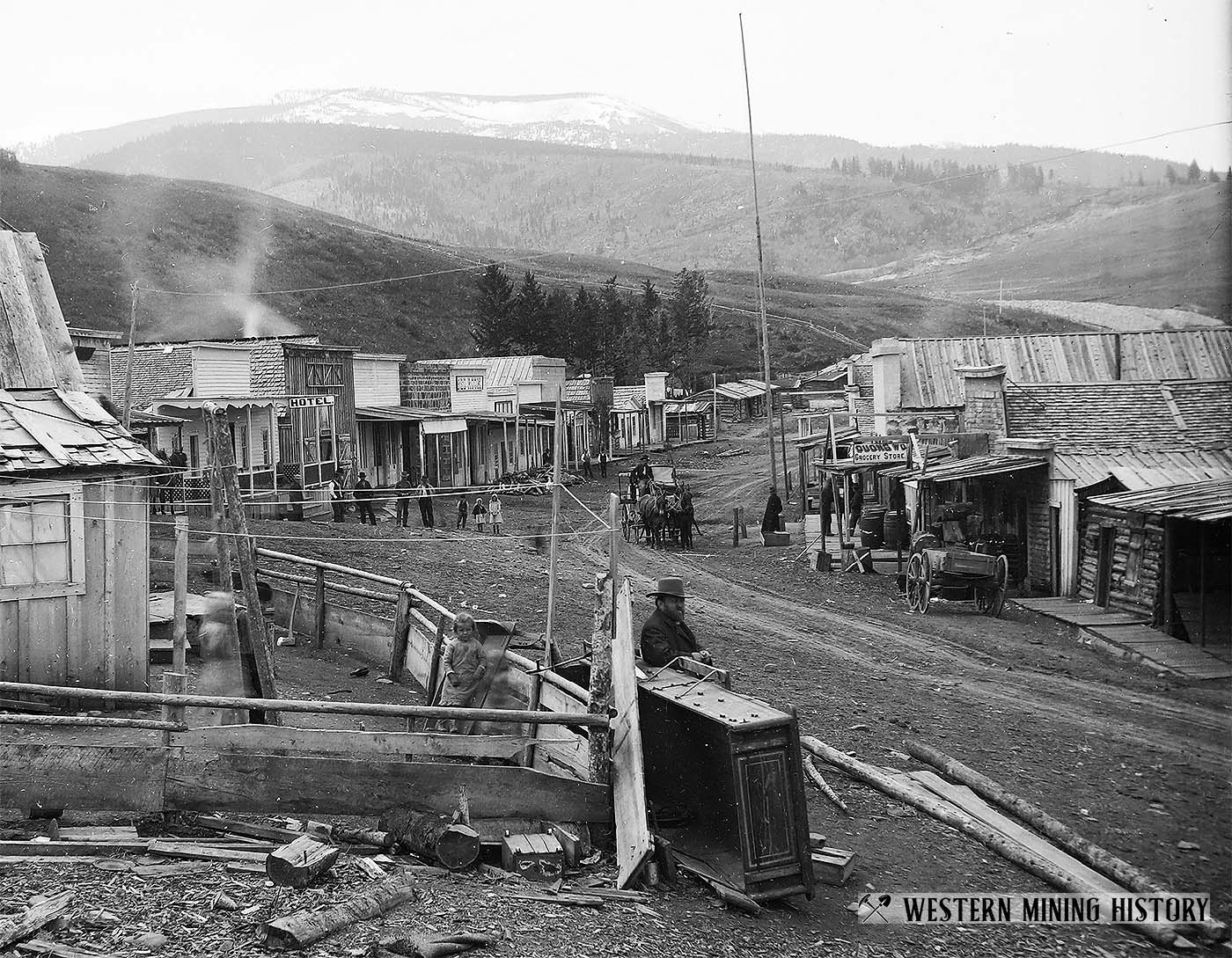
Virginia City-Alder Gulch District
The Virginia City-Alder Gulch district is located at the south end of the Tobacco Root Mountains, at the famous mining town of Virginia City. This district is the top producer of placer gold in Montana, and has also produced small amounts of lode gold.
The spectacular gold deposit discovered in Alder Gulch on May 26, 1863 marked one of the state’s most important historical events. A frenzied rush of gold seekers swelled the local population to 10,000 by the summer of 1864, and in 1865 the territorial capital was moved here from Bannack.
The Alder Creek placers, which were mined for a distance of roughly 20 miles, were the most productive ever discovered in Montana. From 1863 until 1899 the gravels were worked by sluice boxes, pans, and rockers. Dredging began in 1899 and lasted until 1922.
It is difficult to put an accurate number on the massive quantity of placer gold that was mined here in the 1800s, but the USGS puts the total amount for the district through 1959 at a minimum of 2,475,000 ounces. An additional 142,000 ounces is credited to lode mines.
Mineral County
Mineral County was formed in 1914 by partition of Missoula County. All gold mined before 1914 from the area now included in Mineral County is credited to Missoula County.
Cedar Creek-Trout Creek District
The placers on Cedar and Trout creeks are the only significant source of gold in Mineral County. The deposits were first discovered in 1869, and it is estimated that over 120,000 ounces of gold were recovered here prior to 1904. Another 32,175 ounces was produced between 1904 and 1956.
Missoula County
Most of the gold in Missoula County came from the Elk Creek-Coloma and Ninemile Creek districts. There is very little information on the placer mining prior to 1900 when most of the gold here was recovered, but it is thought that the county produced over 200,000 ounces of gold.
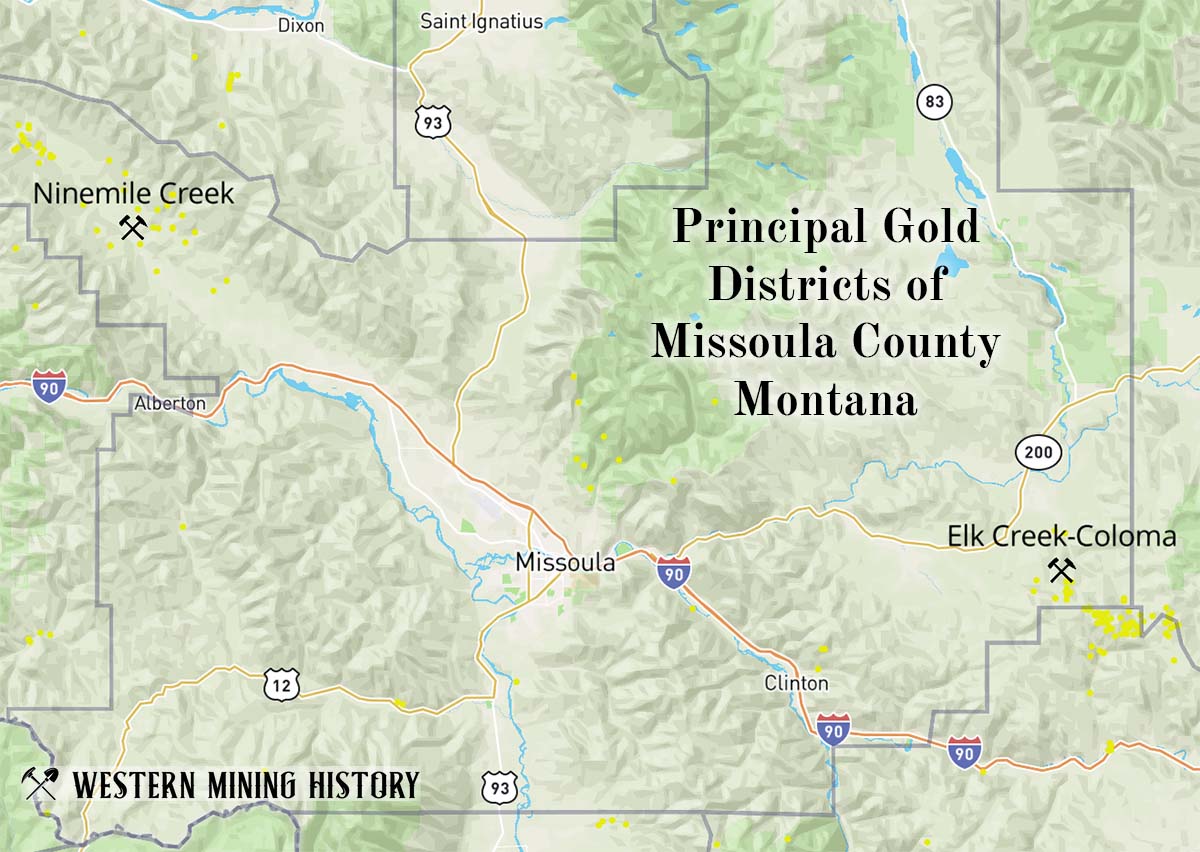
Elk Creek-Coloma District
The Elk Creek-Coloma district is locate roughly 30 miles east of Missoula. This was both a lode and placer gold district.
Rich placer deposits were mined here in the 1860s, and although records are not available, it is estimated that up to 100,000 ounces of placer gold was mined here. Lode gold, primarily from the Comet and Mammoth mines, accounted for another 10,000 to 20,000 ounces.
Ninemile Creek District
The Ninemile Creek district is located roughly 30 miles northwest of Missoula. This was primarily a placer district.
Gold was first discovered in 1874 and several miles of deposit were worked during this early period. Mining continued intermittently after 1900. Although total production can only be estimated, it is estimated to be at least 100,000 ounces.
Park County
Park County is credited with approximately 300,000 ounces of gold, primarily from lode mines in the Jardine and Cooke City districts.
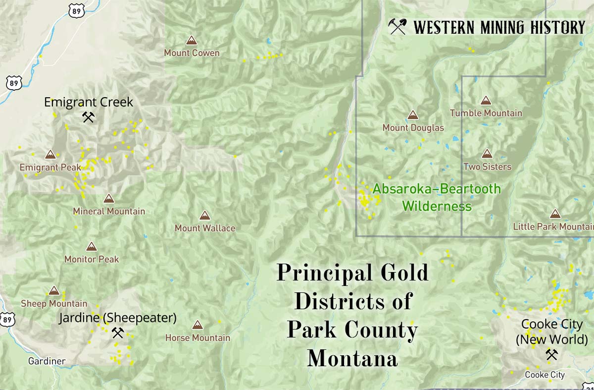
Emigrant Creek District
The Emigrant Creek district is located roughly 20 miles south of Livingston. Only about 15,000 ounces of gold were recovered here, the vast majority of it from placer mines.
Jardine (Sheepeater) District
The Jardine (Sheepeater) district is located 6 miles east of Gardiner. Placer deposits were discovered here in the 1860s and the first lode deposit in 1870.
Little is known about placer production prior to 1900. The bulk of the gold produced in this district came from lode mines after 1902. The district is credited with about 200,000 ounces of gold.
Cooke City District
The Cooke City district is located just north of the town of Cooke City. This district primarily produced silver, copper and lead from lode mines, with gold as a byproduct.
Only intermittent mining occurred in the late 1800s as high freight costs made the primarily low-grade ores difficult to mine profitably. Most metal production in the district occurred between 1933 and 1953. The district is credited with a minimum of 66,000 ounces of gold production.
Phillips County
Gold production in Phillips county almost all came from lode mines in the Little Rocky Mountains district.
Little Rocky Mountains District
The Little Rocky Mountains district is located at the mining town of Zortman. The majority of mining here occurred after 1906. Total gold production through 1959, primarily from lode mines, was around 380,000 ounces.
Powell County
Most of the gold production in Powell County was from placer deposits in the southern part of the county. The county is credited with 517,000 ounces of placer gold and around 50,000 ounces of lode gold.
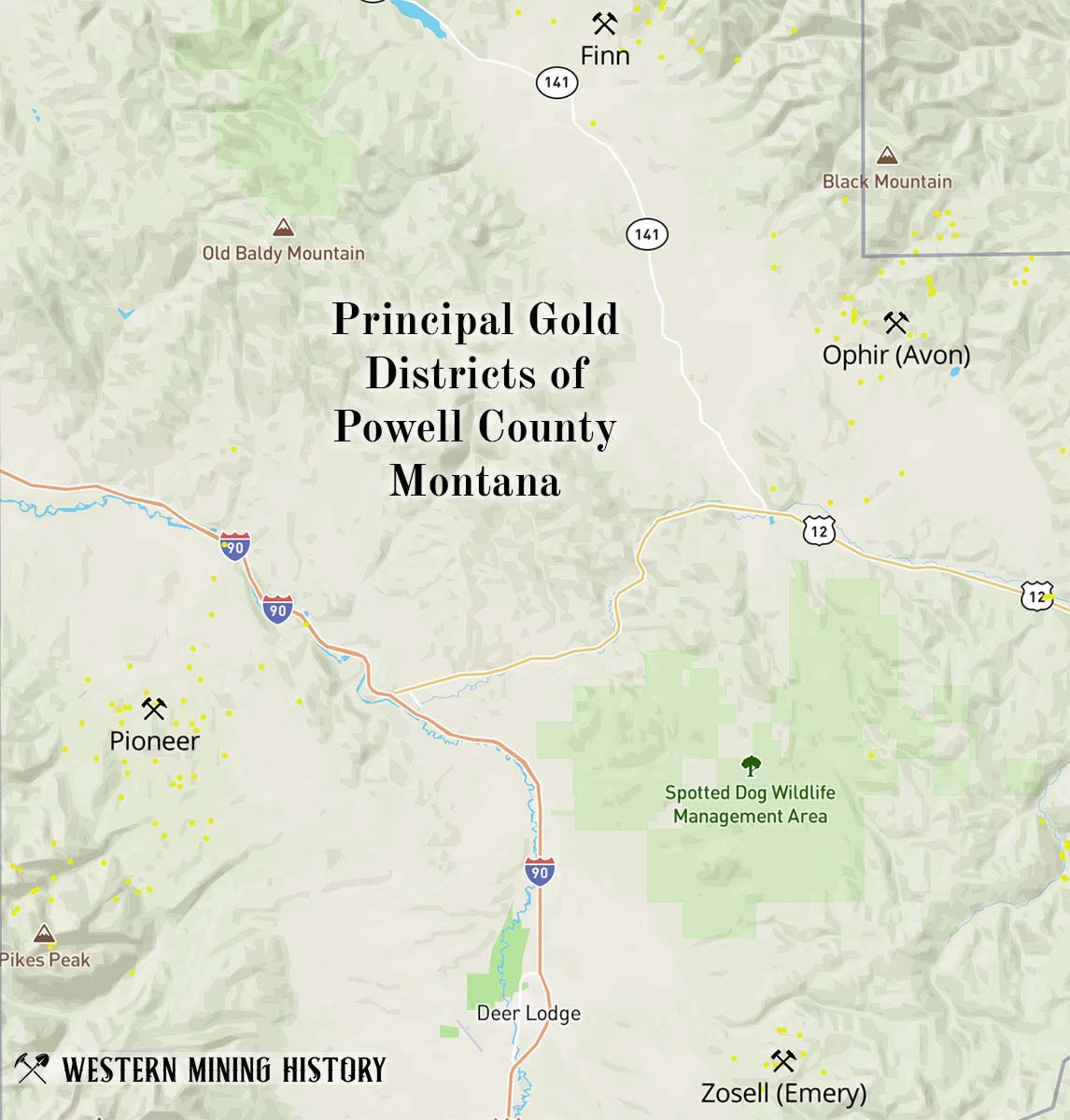
Finn District
The Finn district, located approximately 15 miles north of Avon, includes Washington, Jefferson, and Buffalo Gulches. This was primarily a placer district, but a small amount of lode production was recorded.
Prior to 1890, the streams of this district produced moderate amounts of placer gold. The most productive mines in the district were located along Washington Creek. The total placer production of the district through 1959 was about 81,000 ounces, while over 600 ounces of lode gold was produced between 1933 and 1959.
Ophir District
The Ophir (Avon) district is located roughly 8 miles northeast of Avon. This was primarily a placer district, although some lode gold was produced.
Placers were discovered here in 1865 and subsequently the mining camp of Blackfoot City was established at the mines. The placer deposits at Ophir Creek and its tributaries were the most productive, however after 1875 they were mostly exhausted and were worked in subsequent years by the Chinese.
Total placer production for the district was at least 180,000 ounces, while lode gold production was less than 10,000 ounces.
Pioneer District
The Pioneer district is located about 13 miles northwest of Deer Lodge. This was primarily a placer district.
Placer gold was first discovered here in the 1850s, making this the site of Montana’s first gold discovery. The early discoveries were not significant and not much mining was done until 1868-69 when a ditch 16 miles long was completed to deliver water to mine the high terraces along Pikes Peak Creek.
By 1871 eight hydraulic giants were operating in the district. Most of the good ground was mined out by 1920, but from 1933 to 1944 dredging in Pioneer Gulch recovered significant gold. There are few records of gold recovery here in the 1800s, but it is estimated that the district produced approximately 246,200 ounces through 1959.
Zosell District
The Zosell district is located roughly six miles east of Deer Lodge. This was primarily a lode district but some placer production was recorded prior to 1900.
Gold placers were first mined here in the 1870s and total production was around 3,500 ounces. The lode mines of the district, which were also producers of silver and lead, are credited with around 40,000 ounces of gold.
Ravalli County
Most gold produced in Ravalli County came from placer deposits on Hughes Creek. Although only about 10,000 ounces are credited to this district, early records are sparse and the USGS states:
The Hughes Creek placers were known since the early days of mining and that claims had been staked out for a distance of 15 miles from the mouth to the divide. It is therefore highly probable that the Hughes Creek district had a total output of more than 10,000 ounces of gold.
Silver Bow County
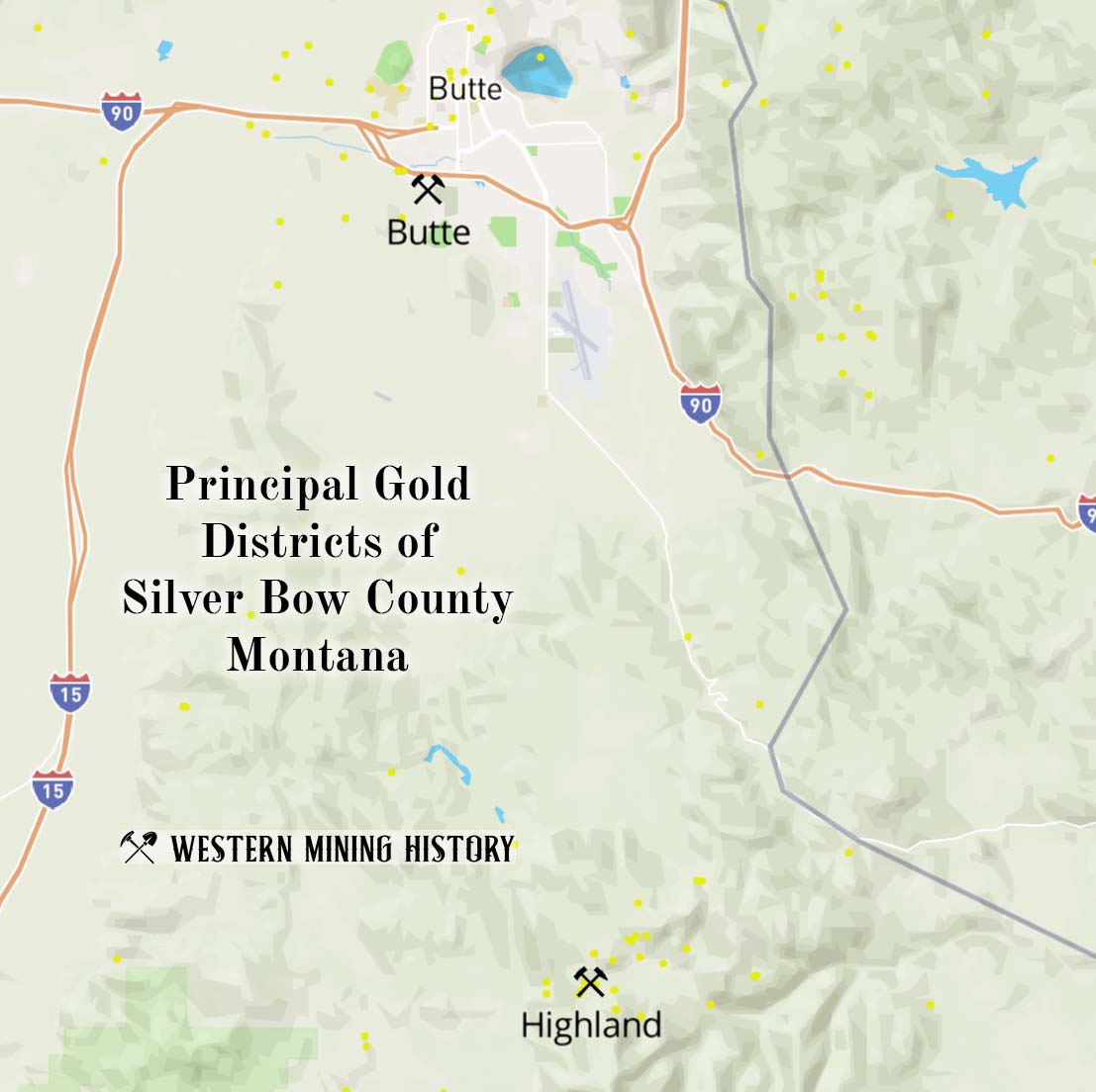
Butte District
Most people don’t realize that Butte, the world’s greatest copper city, actually started as a gold placer district:
The first mineral discoveries were the gold-bearing gravels found in 1864 in Missoula Gulch, at a point now within the Butte city limits. Later that same year placers were found along Silver Bow Creek and in German Gulch. These deposits were fairly profitable in the 1860’s and 1870’s.
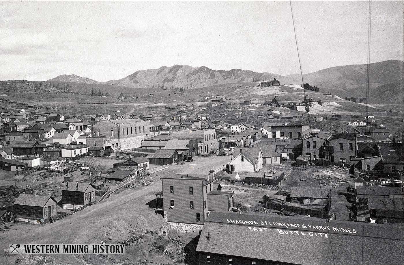
The gold placers only produced around 50,000 ounces before they were exhausted and attention turned to silver deposits in the 1870s. The USGS report does not mention subsequent gold production as a byproduct of silver and copper ores, but it must have been significant as the county is credited with approximately 2,800,000 ounces.
Highland District
The Highland district is located about 15 miles south of Butte. Placer gold was discovered along Fish Creek in 1866, but the mines were exhausted within a decade. Lode mining occurred at small scale in the 1800s, then again from 1931 to 1944. Total gold production for the district was at least 50,000 ounces, with roughly 80% being from placers.
Related Articles
Principal Gold Districts of Utah